


Topography software
Topography
Released: November 07, 2014
|
Added: November 19, 2014 | Visits: 814
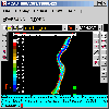
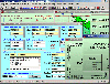
 Importation/Exportation: Import/export trails to gpx file. Unlimited number of trails, and TrackPoints. Export to gpx, Excel, PDF, XPS and KML/KMZ.
Data table: Very flexible data table that allows sorting by columns, with inheritance of data, attributes, etc.
Presentation on map: View...
Importation/Exportation: Import/export trails to gpx file. Unlimited number of trails, and TrackPoints. Export to gpx, Excel, PDF, XPS and KML/KMZ.
Data table: Very flexible data table that allows sorting by columns, with inheritance of data, attributes, etc.
Presentation on map: View...
Platforms: Windows, Windows 8, Windows 7, Windows Server
| License: Freeware | Size: 27.05 MB | Download (611): ediTrail Download |
Released: September 26, 2012
|
Added: September 26, 2012 | Visits: 534
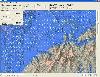
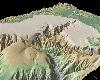 GeoMapApp is an earth science exploration and visualization application that is continually being expanded as part of the Marine Geoscience Data System (MGDS) at the Lamont-Doherty Earth Observatory of Columbia University.
The application provides direct access to the Global Multi-Resolution...
GeoMapApp is an earth science exploration and visualization application that is continually being expanded as part of the Marine Geoscience Data System (MGDS) at the Lamont-Doherty Earth Observatory of Columbia University.
The application provides direct access to the Global Multi-Resolution...
Platforms: Windows
| License: Freeware | Size: 9 MB | Download (446): GeoMapApp Download |
Released: July 14, 2012
|
Added: July 14, 2012 | Visits: 532
 GEOPoint is an easy to use satellite antenna pointing calculator, for geostationary communications satellites. It calculates the azimuth and elevation pointing angles from a given location on the earth towards a specified geostationary satellite. The program also calculates polarisation tilt...
Platforms: Windows
| License: Freeware | Size: 2.1 MB | Download (402): GEOPoint Download |
Released: July 19, 2012
|
Added: July 19, 2012 | Visits: 497
 Apply amazing and beautiful effects very easily like Droste effect (recursive picture), kaleidoscope, mandala, conformal map (topography, projection), cartoon, painting, anaglyph, textures ... You can make endless zoom movies ! You can also enhance your photos with a large choice of tools:...
Platforms: Mac
| License: Freeware | Size: 108 MB | Download (391): SeamlessMaker for Mac OS Download |
Released: April 25, 2017
|
Added: April 27, 2017 | Visits: 4.803
 Simple, powerful and inexpensive CAD software for surveying. You can do triangulation, isolines, color-filled contour maps, sections, intersections, volume and much more. You can process hundreds of thousands of points or triangles, even on less powerful PCs.
Through its own CAD system (called...
Simple, powerful and inexpensive CAD software for surveying. You can do triangulation, isolines, color-filled contour maps, sections, intersections, volume and much more. You can process hundreds of thousands of points or triangles, even on less powerful PCs.
Through its own CAD system (called...
Platforms: Windows, Windows 8, Windows 7, Windows Server
| License: Shareware | Cost: $84.00 USD | Size: 1.04 MB | Download (359): RTOPO Download |
Released: December 30, 2019
|
Added: January 08, 2020 | Visits: 3.179
 TOPOWIN is a state-wide register of the German Topographic Cartographies, the German Basic Cartography and of localities with geo references in different coordinate systems. It is also a topographic information system. In the division of planning and execution of economical and scientific...
Platforms: Windows, Windows 8, Windows 7, Windows Server
| License: Shareware | Cost: $125.00 USD | Size: 4.56 MB | Download (271): TOPOWIN Download |
Released: October 05, 2005
|
Added: June 25, 2006 | Visits: 4.210
 A volume of data with map names, map numbers, corner coordinates and completing data of all official topographic maps of the Federal Republic of Germany. TK25: Data base table with data of the maps on a scale 1:25000. TK50: Table with data of the maps on a scale 1:50000. TK100: Table with data of...
Platforms: DOS, OS/2, BeOS, Palm OS, Windows, Mac, *nix, Windows CE
| License: Shareware | Cost: $30.00 USD | Size: 254 KB | Download (256): Amtliche Topografische Karten Deutschland Download |
Released: January 05, 2011
|
Added: January 15, 2011 | Visits: 1.006
 TopoLT is an indispensable tool for topography, meeting all the requirements of the field and office work. The program is available in multiple languages and can be translated in any language by the user, and the functions can be configured for a wide range of situations.
Main features of...
TopoLT is an indispensable tool for topography, meeting all the requirements of the field and office work. The program is available in multiple languages and can be translated in any language by the user, and the functions can be configured for a wide range of situations.
Main features of...
Platforms: Windows
| License: Demo | Cost: $500.00 USD | Size: 13.74 MB | Download (210): TopoLT Download |
Released: April 11, 2017
|
Added: April 22, 2017 | Visits: 1.416
 An add-on for AUTOCAD 2002-2018, which makes the triangulation of a set of POINT entities, the intersection curves (isolines) between a set of 3DFACE entities and a set of equidistance plans, horizontally or vertically and the volume and center of gravity of a set of bodies or between surfaces...
Platforms: Windows, Windows 8, Windows 7
| License: Shareware | Cost: $84.00 USD | Size: 648 KB | Download (156): TRIANGULATION for AutoCAD Download |
Added: September 04, 2010 | Visits: 824
FTimes is a system baselining and evidence collection tool. FTimess primary purpose is to gather and/or develop information about specified directories and files in a manner conducive to intrusion analysis. FTimes is a lightweight tool in the sense that it doesnt need to be "installed" on a...
Platforms: *nix
| License: Freeware | Size: 419.84 KB | Download (95): FTimes Download |
Released: September 01, 2012
|
Added: July 21, 2013 | Visits: 836
 TRIANGULATION, ISOLINES, VOLUME, LOADING of XYZ points files, 3DINTERSECTION, cross sections and a longitudinal profile, color-filled contour map; 7 functions for IntelliCAD versions which can load SDS applications (dll).
TRIANGULATION performs the triangulation of a set of 3D points with...
TRIANGULATION, ISOLINES, VOLUME, LOADING of XYZ points files, 3DINTERSECTION, cross sections and a longitudinal profile, color-filled contour map; 7 functions for IntelliCAD versions which can load SDS applications (dll).
TRIANGULATION performs the triangulation of a set of 3D points with...
Platforms: Windows
| License: Shareware | Cost: $36.00 USD | Size: 587 KB | Download (94): TRIANGULATION for IntelliCAD Download |
Released: November 03, 2015
|
Added: December 23, 2015 | Visits: 1.190
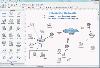 10-Strike Network Diagram is a powerful network diagrammer and mapper for the quick creation of visual local-area network maps and diagrams, and exporting them to Microsoft Visio, or saving as charts, vector, or raster images.
The program will scan your managed switches via SNMP and discover the...
10-Strike Network Diagram is a powerful network diagrammer and mapper for the quick creation of visual local-area network maps and diagrams, and exporting them to Microsoft Visio, or saving as charts, vector, or raster images.
The program will scan your managed switches via SNMP and discover the...
Platforms: Windows, Windows 8, Windows 7, Windows Server
| License: Shareware | Cost: $149.95 USD | Size: 5.33 MB | Download (94): 10-Strike Network Diagram Download |
Added: July 15, 2010 | Visits: 795
nefu (network fidelity utility) is a Unix daemon that monitors services over the network. Natively-monitored protocols include ICMP echo (ping), SSH, IPP, DNS, HTTP, POP, NTP, IMAP, SMTP, and LDAP, as well as having facilities to execute external programs. Status pages are available via finger or...
Platforms: *nix
| License: Freeware | Size: 307.2 KB | Download (90): nefu Download |
Added: May 10, 2013 | Visits: 815
World Wind lets you zoom from satellite altitude into any place on Earth. Leveraging Landsat satellite imagery and Shuttle Radar Topography Mission data, World Wind lets you experience Earth terrain in visually rich 3D, just as if you were really there. Virtually visit any place in the world....
Platforms: Windows, C/C++,
| License: Freeware | Download (74): World Wind Download |
Added: May 10, 2013 | Visits: 497
Some of the indicators calculated are GRS80 free air anomalies, EIGEN-CG03C (an remaining topography reduction), normal gravity GRS67 and GRS80.The place of the study that was the base of the research is a region of Canada (lat:56 to 60 deg,long:-120 to -114 deg). Requirements: - MATLAB 7.6 or...
Platforms: Windows, Mac, *nix, Matlab, BSD Solaris
| License: Freeware | Download (59): The Gravity Field of the Earth Download |
Added: September 05, 2013 | Visits: 500
function alt_km=ITU_P1511(lat,long)computes altitude of a site at given lat,long coordinatesby means of bicubic interpolation using itu topo 0.5 degrees resolutionmatrix.refer to ITU-R Recommendation P 1511.INPUTSlat: latitude + = North, -=southlong: longitude, positive degrees East.Required...
Platforms: Matlab
| License: Freeware | Size: 10 KB | Download (54): Altitude in Km above sea level for a given pair of coordinates (lat,long) Download |
Released: October 20, 2012
|
Added: October 20, 2012 | Visits: 470
 WindStation is a software tool for the simulation of wind flow over complex topography. This is diagnostic simulator that solves the full 3D Navier-Stokes equations using a boundary-fitted coordinate system. The software is a Windows application based on a user-friendly graphical interface....
Platforms: Windows
| License: Shareware | Cost: $181.00 USD | Size: 6.3 MB | Download (52): WindStation Download |
Released: December 21, 2012
|
Added: December 21, 2012 | Visits: 504
The Matlab SRTM Library is designed to be an easy-to-use interface for importing and manipulating NASA's Shuttle Radar Topography Mission (SRTM) Digital Elevation Model (DEM) dataset.
Platforms: Windows, Mac, Linux
| License: Freeware | Size: 175.61 KB | Download (52): Matlab SRTM Library Download |
Released: July 03, 2012
|
Added: July 03, 2012 | Visits: 601
 A volume of data with map names, map numbers, corner coordinates and completing data of all official topographic maps of the Federal Republic of Germany. TK25: Data base table with data of the maps on a scale 1:25000. TK50: Table with data of the maps on a scale 1:50000. TK100: Table with data of...
Platforms: All
| License: Freeware | Size: 51.2 KB | Download (51): Geodaten German Topo Download |
Added: June 15, 2013 | Visits: 746
This script can read AFM image data directly from files stored with Nanoscope 6 software(download openNANO5.m to read Nanoscope 5 files). This version can only read two channels and assumes that the first channel is the topography image and the second channel the error/vertical deflection or...
Platforms: Matlab
| License: Freeware | Size: 10 KB | Download (49): Open Nanoscope 6 AFM images Download |