


Topography software
Topography
Added: August 07, 2013 | Visits: 400
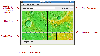
 Intended for 3D geological/geophysical visualisation of layered data and will eventually form part of a geophysical visualisation package.Run ThreedDemo to get an idea of how to use. INPUTS: LayerN: The number of the layer to be plotted R: a m*n*k matrix of colour/resistivity data for each layer...
Platforms: Matlab
| License: Freeware | Size: 10 KB | Download (49): Surf3D Download |
Released: July 17, 2012
|
Added: July 17, 2012 | Visits: 482
 JMARS is an acronym that stands for Java Mission-planning and Analysis for Remote Sensing. It is a geospatial information system (GIS) developed by ASU's Mars Space Flight Facility to provide mission planning and data-analysis tools to NASA's orbiters, instrument team members, students of all...
Platforms: Windows, Mac, Linux
| License: Freeware | Size: 52.2 MB | Download (48): JMARS Download |
Added: July 11, 2013 | Visits: 294
function map=mkpj(n,scheme)% MKPJ Returns a perceptually improved Jet colormap% MKPJ (N,SCHEME) returns an Nx3 colormap.% usage: map=mkpj(n,scheme);%% JUSTIFICATION: rainbow, or spectrum color schemes are considered a poor% choice for scientific data display by many in the scientific community%...
Platforms: Matlab
| License: Shareware | Cost: $0.00 USD | Size: 2.78 MB | Download (48): MKPJ - perceptually improved Jet colormap Download |
Added: June 23, 2013 | Visits: 542
is program computes a map of visibility from a selected point on a topography. It has been written to help the search for radio relay best location. Because it considers only direct line of sight, it gives a good estimation for possible radio link for short distances only (less than 10 km),...
Platforms: Matlab
| License: Freeware | Size: 430.08 KB | Download (44): Radio link coverage map Download |
Added: June 22, 2013 | Visits: 240
In image analysis, such as in the field of AFM topography, a standard problem is to fit polynomials of given ORDer to many columns of data, considered as different functions of the same independent variable. POLYFIC solves this problem in a vectorized way (without using loops). In addition to...
Platforms: Matlab
| License: Shareware | Cost: $0.00 USD | Size: 10 KB | Download (44): polyfic Download |
Added: September 13, 2013 | Visits: 484
This is set of functions that allow opening of Molecular Imaging atomic force microscope files into Matlab matrix. Unzip the files in one directory and type in Matlab command prompt:y=ReadSTP('pathfilename.stp',buffer number).Matrix y will contain z values of measured surface. Comments will show...
Platforms: Matlab
| License: Freeware | Size: 10 KB | Download (43): ReadSTP Download |
Added: April 24, 2013 | Visits: 323
IMSHADE will plot a matrix representing topography as a 3-component color image, with intensity proportional to the magnitude of the topographic slope of each pixel. Optionally, it can take an argument for lighting angle to use the directional slope.The current colormap will be used, but future...
Platforms: Matlab
| License: Freeware | Size: 10 KB | Download (43): imshade Download |
Added: June 27, 2013 | Visits: 357
Model II regression should be used when the two variables in the regression equation are random and subject to error, i.e. not controlled by the researcher. Model I regression using ordinary least squares underestimates the slope of the linear relationship between the variables when they both...
Platforms: Matlab
| License: Shareware | Cost: $0.00 USD | Size: 10 KB | Download (43): maregress Download |
Added: April 10, 2013 | Visits: 340
slice.m does not allow non-monotonic matrices or NaN values.However, a 3D volume may often meet these limitations. For example, a 3D grid may be constructed first by 2D interpolations of scattered Z values to xy grids (such as topography at different depths), and then a 3D interpolation of data...
Platforms: Matlab
| License: Shareware | Cost: $0.00 USD | Size: 10 KB | Download (43): smartSlice and iGSlice Download |
Added: May 16, 2013 | Visits: 729
This script can read AFM image data directly from files stored with Nanoscope 5 software(download openNANO6.m to read Nanoscope 6 files). This version can only read two channels and assumes that the first channel is the topography image and the second channel the error/vertical deflection or...
Platforms: PHP
| License: Freeware | Size: 10 KB | Download (41): Open Nanoscope 5 AFM images Download |
Added: August 30, 2013 | Visits: 263
ploting Climentine lunar topography data(topogrd2.dat)
Platforms: Matlab
| License: Freeware | Size: 10 KB | Download (40): Climentine topo data Download |
Added: October 30, 2013 | Visits: 418
USBView is a GTK program that displays the topography of the devices that are plugged into the USB bus on a Linux machine. It also displays information on each of the devices. This can be useful to determine if a device is working properly or not.
Platforms: *nix
| License: Freeware | Size: 348.16 KB | Download (40): USBView Download |
Added: August 10, 2013 | Visits: 453
Do you plot Earth-orbiting trajectories? Would you like to know how your orbit compares to the size of the Earth? If so, EARTH_SPHERE will help get you there.This function is a modification of the built-in MATLAB command SPHERE. Rather than producing a sphere with a radius of 1, the radius of the...
Platforms: Matlab
| License: Freeware | Size: 10 KB | Download (39): Earth-sized Sphere with Topography Download |
Added: August 13, 2013 | Visits: 412
This file includes two m-files. The ASWERS12345 calculates GRS80 free air anomalies,Eigen-CG03C and model of remaining topography reduction,empirical and analytic covariance functions,normal gravity (GRS67,GRS80) using Somigliana formula. The other one fftstokes.m is a geoid computation using...
Platforms: Matlab
| License: Freeware | Size: 2.04 MB | Download (39): Intoduction to the gravity field of earth Download |
Added: July 01, 2013 | Visits: 383
HEALPix is an acronym for Hierarchical Equal Area isoLatitude Pixelization of a sphere. As suggested in the name, this pixelization produces a subdivision of a spherical surface in which each pixel covers the same surface area as every other pixel. The figure below shows the partitioning of a...
Platforms: Mac
| License: Freeware | Size: 27.7 MB | Download (35): HEALPix Download |
Released: January 06, 2024
|
Added: January 16, 2024 | Visits: 133
 AutoLISP source code can be run on AutoCAD or IntelliCAD (Bricscad, ProgeCAD, Cadopia, etc.), on any number of computers. They are:
- "Triangulation" will generate triangular 3DFACE entities, on the convex hull of the set of points,
- "Load XYZ and 4D files"; file types: x y z color, x y z...
AutoLISP source code can be run on AutoCAD or IntelliCAD (Bricscad, ProgeCAD, Cadopia, etc.), on any number of computers. They are:
- "Triangulation" will generate triangular 3DFACE entities, on the convex hull of the set of points,
- "Load XYZ and 4D files"; file types: x y z color, x y z...
Platforms: Windows, Windows 8, Windows 7, Windows Server
| License: Shareware | Cost: $100.00 USD | Size: 1.12 MB | Download (33): AutoLisp Source Download |
Released: July 09, 2023
|
Added: August 06, 2023 | Visits: 171
 Simple, powerful and inexpensive CAD software for surveying. You can do triangulation, isolines, color-filled contour maps, sections, intersections, volume and much more. You can process hundreds of thousands of points or triangles, even on less powerful PCs.
Through its own CAD system...
Simple, powerful and inexpensive CAD software for surveying. You can do triangulation, isolines, color-filled contour maps, sections, intersections, volume and much more. You can process hundreds of thousands of points or triangles, even on less powerful PCs.
Through its own CAD system...
Platforms: Windows, Windows 8, Windows 7, Windows Server
| License: Shareware | Cost: $125.00 USD | Size: 2.48 MB | Download (21): RTOPO Hydrology Download |