


Topography freeware
Topography
Added: August 10, 2013 | Visits: 449
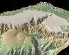
 Do you plot Earth-orbiting trajectories? Would you like to know how your orbit compares to the size of the Earth? If so, EARTH_SPHERE will help get you there.This function is a modification of the built-in MATLAB command SPHERE. Rather than producing a sphere with a radius of 1, the radius of the...
Platforms: Matlab
| License: Freeware | Size: 10 KB | Download (39): Earth-sized Sphere with Topography Download |
Added: August 30, 2013 | Visits: 261
ploting Climentine lunar topography data(topogrd2.dat)
Platforms: Matlab
| License: Freeware | Size: 10 KB | Download (40): Climentine topo data Download |
Added: October 30, 2013 | Visits: 415
USBView is a GTK program that displays the topography of the devices that are plugged into the USB bus on a Linux machine. It also displays information on each of the devices. This can be useful to determine if a device is working properly or not.
Platforms: *nix
| License: Freeware | Size: 348.16 KB | Download (40): USBView Download |
Released: July 19, 2012
|
Added: July 19, 2012 | Visits: 497
Apply amazing and beautiful effects very easily like Droste effect (recursive picture), kaleidoscope, mandala, conformal map (topography, projection), cartoon, painting, anaglyph, textures ... You can make endless zoom movies ! You can also enhance your photos with a large choice of tools:...
Platforms: Mac
| License: Freeware | Size: 108 MB | Download (391): SeamlessMaker for Mac OS Download |
Released: December 21, 2012
|
Added: December 21, 2012 | Visits: 504
The Matlab SRTM Library is designed to be an easy-to-use interface for importing and manipulating NASA's Shuttle Radar Topography Mission (SRTM) Digital Elevation Model (DEM) dataset.
Platforms: Windows, Mac, Linux
| License: Freeware | Size: 175.61 KB | Download (52): Matlab SRTM Library Download |
Added: May 10, 2013 | Visits: 497
Some of the indicators calculated are GRS80 free air anomalies, EIGEN-CG03C (an remaining topography reduction), normal gravity GRS67 and GRS80.The place of the study that was the base of the research is a region of Canada (lat:56 to 60 deg,long:-120 to -114 deg). Requirements: - MATLAB 7.6 or...
Platforms: Windows, Mac, *nix, Matlab, BSD Solaris
| License: Freeware | Download (63): The Gravity Field of the Earth Download |
Added: June 23, 2013 | Visits: 537
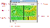
is program computes a map of visibility from a selected point on a topography. It has been written to help the search for radio relay best location. Because it considers only direct line of sight, it gives a good estimation for possible radio link for short distances only (less than 10 km),...
Platforms: Matlab
| License: Freeware | Size: 430.08 KB | Download (40): Radio link coverage map Download |
Added: September 13, 2013 | Visits: 480
This is set of functions that allow opening of Molecular Imaging atomic force microscope files into Matlab matrix. Unzip the files in one directory and type in Matlab command prompt:y=ReadSTP('pathfilename.stp',buffer number).Matrix y will contain z values of measured surface. Comments will show...
Platforms: Matlab
| License: Freeware | Size: 10 KB | Download (43): ReadSTP Download |
Added: April 24, 2013 | Visits: 320
IMSHADE will plot a matrix representing topography as a 3-component color image, with intensity proportional to the magnitude of the topographic slope of each pixel. Optionally, it can take an argument for lighting angle to use the directional slope.The current colormap will be used, but future...
Platforms: Matlab
| License: Freeware | Size: 10 KB | Download (43): imshade Download |
Added: July 15, 2010 | Visits: 795
nefu (network fidelity utility) is a Unix daemon that monitors services over the network. Natively-monitored protocols include ICMP echo (ping), SSH, IPP, DNS, HTTP, POP, NTP, IMAP, SMTP, and LDAP, as well as having facilities to execute external programs. Status pages are available via finger or...
Platforms: *nix
| License: Freeware | Size: 307.2 KB | Download (96): nefu Download |
Added: September 04, 2010 | Visits: 825
FTimes is a system baselining and evidence collection tool. FTimess primary purpose is to gather and/or develop information about specified directories and files in a manner conducive to intrusion analysis. FTimes is a lightweight tool in the sense that it doesnt need to be "installed" on a...
Platforms: *nix
| License: Freeware | Size: 419.84 KB | Download (95): FTimes Download |
Released: September 26, 2012
|
Added: September 26, 2012 | Visits: 534
 GeoMapApp is an earth science exploration and visualization application that is continually being expanded as part of the Marine Geoscience Data System (MGDS) at the Lamont-Doherty Earth Observatory of Columbia University.
The application provides direct access to the Global Multi-Resolution...
GeoMapApp is an earth science exploration and visualization application that is continually being expanded as part of the Marine Geoscience Data System (MGDS) at the Lamont-Doherty Earth Observatory of Columbia University.
The application provides direct access to the Global Multi-Resolution...
Platforms: Windows
| License: Freeware | Size: 9 MB | Download (446): GeoMapApp Download |
Released: July 14, 2012
|
Added: July 14, 2012 | Visits: 534
 GEOPoint is an easy to use satellite antenna pointing calculator, for geostationary communications satellites. It calculates the azimuth and elevation pointing angles from a given location on the earth towards a specified geostationary satellite. The program also calculates polarisation tilt...
Platforms: Windows
| License: Freeware | Size: 2.1 MB | Download (402): GEOPoint Download |
Released: July 03, 2012
|
Added: July 03, 2012 | Visits: 602
 A volume of data with map names, map numbers, corner coordinates and completing data of all official topographic maps of the Federal Republic of Germany. TK25: Data base table with data of the maps on a scale 1:25000. TK50: Table with data of the maps on a scale 1:50000. TK100: Table with data of...
Platforms: All
| License: Freeware | Size: 51.2 KB | Download (51): Geodaten German Topo Download |
Released: July 17, 2012
|
Added: July 17, 2012 | Visits: 480
 JMARS is an acronym that stands for Java Mission-planning and Analysis for Remote Sensing. It is a geospatial information system (GIS) developed by ASU's Mars Space Flight Facility to provide mission planning and data-analysis tools to NASA's orbiters, instrument team members, students of all...
Platforms: Windows, Mac, Linux
| License: Freeware | Size: 52.2 MB | Download (48): JMARS Download |
Added: May 10, 2013 | Visits: 817
World Wind lets you zoom from satellite altitude into any place on Earth. Leveraging Landsat satellite imagery and Shuttle Radar Topography Mission data, World Wind lets you experience Earth terrain in visually rich 3D, just as if you were really there. Virtually visit any place in the world....
Platforms: Windows, C/C++,
| License: Freeware | Download (74): World Wind Download |
Added: June 15, 2013 | Visits: 747
This script can read AFM image data directly from files stored with Nanoscope 6 software(download openNANO5.m to read Nanoscope 5 files). This version can only read two channels and assumes that the first channel is the topography image and the second channel the error/vertical deflection or...
Platforms: Matlab
| License: Freeware | Size: 10 KB | Download (49): Open Nanoscope 6 AFM images Download |
Added: August 07, 2013 | Visits: 398
Intended for 3D geological/geophysical visualisation of layered data and will eventually form part of a geophysical visualisation package.Run ThreedDemo to get an idea of how to use. INPUTS: LayerN: The number of the layer to be plotted R: a m*n*k matrix of colour/resistivity data for each layer...
Platforms: Matlab
| License: Freeware | Size: 10 KB | Download (49): Surf3D Download |
Added: September 05, 2013 | Visits: 501
function alt_km=ITU_P1511(lat,long)computes altitude of a site at given lat,long coordinatesby means of bicubic interpolation using itu topo 0.5 degrees resolutionmatrix.refer to ITU-R Recommendation P 1511.INPUTSlat: latitude + = North, -=southlong: longitude, positive degrees East.Required...
Platforms: Matlab
| License: Freeware | Size: 10 KB | Download (54): Altitude in Km above sea level for a given pair of coordinates (lat,long) Download |
Added: August 13, 2013 | Visits: 407
This file includes two m-files. The ASWERS12345 calculates GRS80 free air anomalies,Eigen-CG03C and model of remaining topography reduction,empirical and analytic covariance functions,normal gravity (GRS67,GRS80) using Somigliana formula. The other one fftstokes.m is a geoid computation using...
Platforms: Matlab
| License: Freeware | Size: 2.04 MB | Download (39): Intoduction to the gravity field of earth Download |