


Motorcycle Route Maps software
Motorcycle Route Maps
Added: February 03, 2006 | Visits: 14.752
 Watch as an artists hand draws a classic Harley Davidson motorcycle. This is one of over 150 drawings that the screen saver can draw. It draws animals, people, holiday themes, fine art and more. You can also create your own drawings for the hand to draw with the ArtStudio add-on. You can actually...
Platforms: Windows
| License: Shareware | Cost: $24.95 USD | Size: 2.12 MB | Download (597): Harley Davidson by Drawing Hand Download |
Released: November 10, 2007
|
Added: November 20, 2007 | Visits: 6.092
 Geocode digital images with latitude, longitude, altitude, and direction information. RoboGEO stamps this information onto the actual photo or writes it to the EXIF headers, allowing you to permanently geotag and link your photos to the GPS coordinates. All writing to the EXIF and IPTC headers...
Platforms: Windows
| License: Demo | Cost: $39.95 USD | Size: 8.28 MB | Download (1179): RoboGEO Download |
Released: June 19, 2004
|
Added: May 19, 2006 | Visits: 3.264
 Complete voyage planning utility for ocean and coastal shipping and yachts,
unlimited number of waypoints, greatcircle or rhumbline. Caculates average weather enroute
as well as estimated vessels performance and optimal speed settings.
Includes hurricane tracking, calculation of CPA and TCPA...
Complete voyage planning utility for ocean and coastal shipping and yachts,
unlimited number of waypoints, greatcircle or rhumbline. Caculates average weather enroute
as well as estimated vessels performance and optimal speed settings.
Includes hurricane tracking, calculation of CPA and TCPA...
Platforms: Windows
| License: Shareware | Cost: $75.00 USD | Size: 1.58 MB | Download (173): NavTools Route Download |
Added: July 16, 2006 | Visits: 4.232
 MindMaster is a powerful visual tool for planning, collaboration and business process management. MindMaster helps business professionals and teams plan, organize and manage information-based activities. Decisions are made much faster, meeting times are decreased and project planning is greatly...
Platforms: Windows
| License: Shareware | Cost: $29.99 USD | Size: 1.06 MB | Download (184): MindMaster Download |
Added: July 11, 2006 | Visits: 2.441
TraceAlarm is a program that continuously watches and monitors any changes of route to the remote host. If the path of IP packets will change or there will be errors, the program will warn, can begin an executable file and will record traceroute event in the TraceHistory. Increasing of path,...
Platforms: Windows
| License: Shareware | Cost: $24.95 USD | Size: 3.41 MB | Download (133): TraceAlarm Download |
Released: October 27, 2008
|
Added: November 28, 2008 | Visits: 4.799
 NetStat Agent is a powerful and extremely useful network tool for monitoring and diagnosing. It includes all useful network tools such as netstat, ping, traceroute, ipconfig, dns query (nslookup), whois, arp, route and http checker, but in a clean graphical interface.
NetStat Agent shows...
NetStat Agent is a powerful and extremely useful network tool for monitoring and diagnosing. It includes all useful network tools such as netstat, ping, traceroute, ipconfig, dns query (nslookup), whois, arp, route and http checker, but in a clean graphical interface.
NetStat Agent shows...
Platforms: Windows
| License: Shareware | Cost: $29.95 USD | Size: 1.89 MB | Download (249): NetStat Agent Download |
Released: May 01, 2011
|
Added: May 21, 2011 | Visits: 2.586
 Anychart is a flexible Flash based-solution, which allows you to easily display any sort of data dealing with geographical locations. It contains United States Maps with Counties, World Map, etc. XML data file and a set of customizable options make AnyChart Maps a universal solution for web...
Platforms: OS/2, Windows, Mac, *nix, Windows CE, Pocket PC, Palm OS 6.0,Not Applicable,Handheld/Mobile Other,Java,MS-DOS,AS/400
| License: Shareware | Cost: $399.00 USD | Size: 10.27 MB | Download (118): AnyChart Flash Map Component Download |
Added: May 27, 2006 | Visits: 3.847
Flash maps US States. With this fully-clickable map you will be able to improve navigation and provide visitors with better and quicker access to information as well as improve the way you present the information. The map can be used "as is" however it is also easily customizable. In just a few...
Platforms: Windows
| License: Demo | Cost: $69.00 USD | Size: 44 KB | Download (484): Zoom Flash Map US States Download |
Released: November 23, 2006
|
Added: November 23, 2006 | Visits: 6.062
 The program StitchMaps simply joins these maps.
The result is a map that is suitable for programs using raster scan.
The maps used as basis for the assembly were either created by scanning templates, or by exports from digitalized maps.
The program is available as standard and as plus...
The program StitchMaps simply joins these maps.
The result is a map that is suitable for programs using raster scan.
The maps used as basis for the assembly were either created by scanning templates, or by exports from digitalized maps.
The program is available as standard and as plus...
Platforms: Windows
| License: Shareware | Cost: $45.00 USD | Size: 554.8 KB | Download (454): StitchMaps Download |
Released: April 20, 2008
|
Added: December 12, 2008 | Visits: 5.637
 Path Analyzer Pro delivers advanced network route-tracing with performance tests, DNS, whois, and network resolution to investigate network issues. By integrating all these powerful features into one simple graphical interface, Path Analyzer Pro has become a must-have tool for any network,...
Platforms: Windows, Mac, *nix
| License: Shareware | Cost: $29.95 USD | Size: 7.8 MB | Download (386): Path Analyzer Pro Download |
Released: January 02, 2007
|
Added: January 06, 2007 | Visits: 2.636
 Imports gridded data into Microsoft MapPoint, to produce attractive data maps that resemble contour maps.
Input data consists of a value that is defined for various (gridded) geographic coordinates. Common text output formats such as CSV are supported.
Can handle imperfect data, holes,...
Imports gridded data into Microsoft MapPoint, to produce attractive data maps that resemble contour maps.
Input data consists of a value that is defined for various (gridded) geographic coordinates. Common text output formats such as CSV are supported.
Can handle imperfect data, holes,...
Platforms: Windows
| License: Shareware | Cost: $75.00 USD | Size: 2.16 MB | Download (907): GridImp Download |
Released: September 07, 2010
|
Added: September 18, 2010 | Visits: 2.859
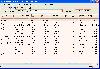
 Calculate Mileage Charts and Tables with Microsoft MapPoint.
Calculate tables for serving customers and suppliers, or to create "road atlas" tables.
Can output route distances, travel times and/or estimated costs to Excel Spreadsheets.
Supports ALL MapPoint routing options including...
Calculate Mileage Charts and Tables with Microsoft MapPoint.
Calculate tables for serving customers and suppliers, or to create "road atlas" tables.
Can output route distances, travel times and/or estimated costs to Excel Spreadsheets.
Supports ALL MapPoint routing options including...
Platforms: Windows
| License: Shareware | Cost: $100.00 USD | Size: 3.65 MB | Download (151): MileCharter Download |
Released: March 15, 2008
|
Added: April 30, 2008 | Visits: 4.644
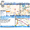 With MobiumGPS , your Windows Mobile device is turned into an advanced Mobile Navigation System with turn-by-turn voice announcements and detailed driving directions. You can search over 15 million point of interests (POIs) - places like hotels, restaurants, shopping malls and other tourist...
Platforms: Windows
| License: Demo | Cost: $9.95 USD | Size: 806.13 KB | Download (1554): Mobium GPS Navigation System Download |
Released: July 31, 2010
|
Added: September 02, 2010 | Visits: 2.896
 CDXZipStream is a complete solution for analyzing address and demographic data into Microsoft Excel. CDXZipStream also has built in features for geocoding, mapping, zip code lists by state or county, reverse look-up, calculating distance or finding the zip codes within a specified radius. No...
Platforms: Windows, Other
| License: Shareware | Cost: $29.95 USD | Size: 7.38 MB | Download (133): CDXZipStream Download |
Released: June 27, 2008
|
Added: July 05, 2008 | Visits: 1.379
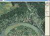
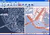 OMapView is a professional map browser. Both satellite imagery and maps online can be viewed through it. With the cache technology, it improve the user experience of viewing map. And more, the map can be viewed even when the computer is offline. It's a multi-window application, different places...
Platforms: Windows
| License: Shareware | Cost: $29.95 USD | Size: 1.75 MB | Download (131): OMapView Download |
Released: September 19, 2007
|
Added: July 17, 2008 | Visits: 1.619
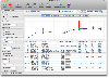
 Versamap draws outline maps on 16 map projections. The program allows users to print publication quality maps; and to export maps in vector graphic (WMF, CGM, DXF, ASCII) and bitmapped (BMP) formats.Versamap is supplied with digital maps from the Versamap Micro World Database, a world map with...
Platforms: Windows
| License: Shareware | Cost: $30.00 USD | Size: 3.98 MB | Download (127): Versamap Download |
Released: March 26, 2010
|
Added: January 08, 2013 | Visits: 16.892
 Bus Driver is a bus driving game for the PC. In Bus Driver, your job is to transport passengers around an attractive and realistic city. You must drive to a timetable on a planned route, whilst obeying traffic rules, and taking care not to upset or injure your passengers. This makes Bus Driver...
Platforms: Windows
| License: Demo | Cost: $12.99 USD | Size: 62.12 MB | Download (5652): Bus Driver Download |
Released: September 19, 2010
|
Added: September 25, 2010 | Visits: 1.964
 Maritime Software Suite is a user-friendly Draft Survey, Lashing Calculations and Route Planning software for Ships Officers and Marine Surveyors. Maritime Software Suite is easily operated using either Keyboard or Mouse. It complies with the latest UN ECE standards and MSC Code of Safe Practice...
Platforms: Windows
| License: Shareware | Cost: $199.95 USD | Size: 2.18 MB | Download (212): Maritime Software Suite Download |
Added: August 08, 2008 | Visits: 1.780
 Production of a passage plan prior to departure is a legal requirement. Route Planner assists in the preparation of passage plans by allowing you to prepare, calculate and print full featured passage plan. A very quick and easy to use program, full of invaluable functions.
Platforms: Windows
| License: Shareware | Cost: $19.95 USD | Size: 35.34 MB | Download (576): XCBA Route Planner Download |
Added: August 19, 2008 | Visits: 3.673
 Fugawi Global Navigator and Fugawi Marine ENC are the ideal PC software tool for route planning, GPS programming, and real-time GPS navigation on land, sea and in the air. With Fugawi Global Navigator you can navigate in real time using the widest variety of digital maps, such as NOAA RNC,...
Platforms: Windows
| License: Demo | Cost: $119.95 USD | Size: 40.05 MB | Download (1120): Fugawi Global Navigator Download |