


Versamap 3.01 |
Date Added: July 17, 2008 | Visits: 1.616 |
|
||||||||||||
|
Versamap draws outline maps on 16 map projections. The program allows users to print publication quality maps; and to export maps in vector graphic (WMF, CGM, DXF, ASCII) and bitmapped (BMP) formats.Versamap is supplied with digital maps from the Versamap Micro World Database, a world map with 220,000 points in 10 geographic features.
|

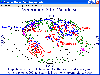
| License: Shareware | Cost: $30.00 USD | Size: 3.98 MB |
USER REVIEWS
VERSAMAP RELATED
|
Science
-
Versamap for Windows 2.07
Versamap draws outline maps on 14 map projections. The program allows users to print publication quality maps on any printer supported by Windows; and to export maps in vector graphic (WMF, CGM, DXF, ASCII) and bitmapped (BMP) formats.... |
896 KB | |
|
Home & Leisure
-
Altimeter Digital GPS + Map Viewer + Cam 1.0
" The most accurate and handly Altimeter is here. It gives you the altitude wherever you are. Simply start the app and altitude will appear in a second, No setup required. You can also adjust Altitude in Feet or Meter as per your requirement.... |
||
|
Games
-
Mapping Maps 1.0.0
In this game there will be some country names and some maps of countries. Your task is to match the country names with the correct maps. You match them by using the mouse to draw a line to connect the dots of the country names and the maps. There... |
262 KB | |
|
Audio Tools
-
G3DGMV 0.60
The g3DGMV program was designed as a free viewer for Digital Elevation Model (DEM ) and Digital Line Graphs (DLG ) maps. Both of these formats are available from various locations on the web. These maps are rendered by g3DGMV as 3D images that can... |
296.96 KB | |
|
Teaching Tools
-
Map Worksheet Factory 2.0.1028
Quickly and easily create professional outline-map worksheets for lessons in geography, history, social studies, and current events. See exactly what your maps will look like as you design them with the WYSIWYG interface. Zoom and pan to select... |
6.28 MB | |
|
Libraries
-
PDL::Transform::Cartography 2.4.3
PDL::Transform::Cartography Perl module contains useful cartographic projections. SYNOPSIS # make a Mercator map of Earth use PDL::Transform::Cartography; $a = earth_coast(); $a = graticule(10,2)->glue(1,$a); $t = t_mercator; $w =... |
2.1 MB | |
|
Geography
-
Versamap 3 for Windows 3.01
Versamap draws outline maps on 16 map projections. The program allows users to print publication quality maps; and to export maps in vector graphic (WMF, CGM, DXF, ASCII) and bitmapped (BMP) formats. Versamap is supplied with digital maps from the... |
4.07 KB | |
|
Multimedia & Graphics
-
Ortelius 1.0.8
A full-featured and affordable vector drawing application especially for cartography. Create custom map graphics and scaled plans for reports, publications, websites, and presentations. Special cartography tools allow you to draw directly with... |
43.2 MB | |
|
Dial-up Networking Tools
-
Offline Map Maker 8.288
Offline Map Maker is a tool that help you to get offline tile images from Google Maps, Openstreetmap, Yandex Maps, Yahoo Maps, Mapquest, Gaode map, Tencent Maps, Baidu Maps, Tianditu, Arcgis Online, OneMap, Whereis, mapy.cz, Mappy, Waze,... |
31.11 MB | |
|
Gaming Utilities
-
MUD Map Designer 1.02
MUD Map Designer is a tool that was developed for MUD programmers that wish to make maps for plotting or simply beneficial reasons. All files can be exported to several different image types. You can create your own setup files and map icons to... |
NEW DOWNLOADS IN EDUCATION, SCIENCE
|
Education
-
Writers Desk 6.03
Writer's Desk is for creative writers, not businesses. Manage your writing projects to write anything faster, better, easier. Work with one file in a project or many. Keep records on people, places, events, notes, and references to have your... |
10.51 MB | |
|
Education
-
KeroSoft FunnyPaint 2.0
KeroSoft FunnyPaint is a simple and fun software program for kids to express themselves by drawing, painting and using the creative elements provided. Provides various drawing and painting tools - KeroSoft FunnyPaint provides comprehensive... |
47.82 MB | |
|
Education
-
FC Compiler 1.510
FC-Compiler (tm) is a Calculus-level Compiler, helps Tweak parameters.. The FortranCalculus (FC) language is for math modeling, simulation, and optimization. FC is based on Automatic Differentiation that simplifies computer code to an absolute... |
11.12 MB | |
|
Education
-
Antiplagiarism 1.2
Antiplagiarism - program will check if your diploma thesis is not a plagiarism. The Antiplagiarism software detects a possibility of commiting plagiarism with the highest efficiency among solutions available on the market. A professional system... |
21.29 MB | |
|
Education
-
PDFMate eBook Converter 1.0.1
PDFMate eBook Converter is a professional eBook Converter specially developed for converting eBook to other popular formats like EPUB, MOBI, PDF, AZW, TXT. Besides, PDFMate eBook Converter is a powerful eBook removal tool which can easily remove... |
80.42 MB | |
|
Science
-
Smart Grid Simulations 8.24
Smart Grid Simulations is a collection of Business Planners in (x/y/t) that allow you to calculate your personal Household Power Supply. With PV Energy, Battery, Wind Turbine, Water Supply, and Public Infastructure, all you need for a Smart Grid... |
7.35 MB | |
|
Science
-
Wind Turbine 8.07
Wind Turbine is an interactive Return on Investment Planner for Renewable Energies. It brings various small Simulations based on the Dynamic Applications Platform of Business Planners. The Simulation Model Wind Turbine - Power Generation is... |
6.44 MB | |
|
Science
-
Model Analyzer Tool 1.0
The Model Analyzer Tool is a compact and user-friendly Windows software specifically crafted for analyzing and evaluating modeling results. Tailored features make it a comprehensive solution for model analysis, providing informative insights.... |
10.9 MB | |
|
Science
-
Thiessen Polygon Tool 1.0
Thiessen Polygons, or Voronoi Polygons, are geometric constructs dividing a plane based on proximity to given points. Named after Alfred Thiessen, each polygon encapsulates points closer to its origin than any other. Formed by connecting midpoints... |
28.67 MB | |
|
Science
-
KNN WG 1.1
The K-nearest neighbors (K-NN) is an analogous approach. This method has its origin as a non-parametric statistical pattern recognition procedure to distinguish between different patterns according to a selection criterion. Through this method,... |
64.25 MB |