RoboGEO 5.2 |
|
|
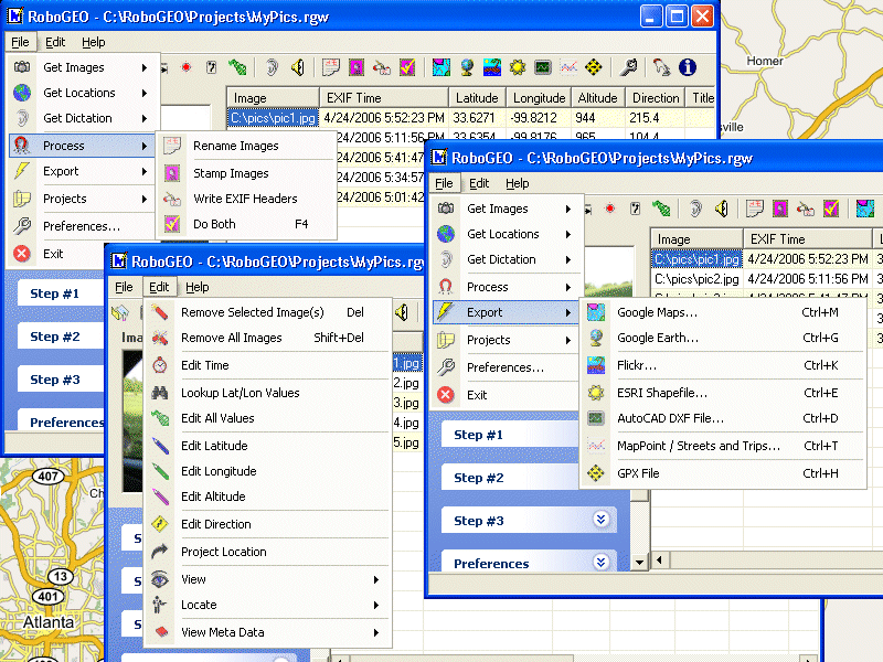
Geocode digital images with latitude, longitude, altitude, and direction information. RoboGEO stamps this information onto the actual photo or writes it to the EXIF headers, allowing you to permanently geotag and link your photos to the GPS coordinates. All writing to the EXIF and IPTC headers is lossless and all of the existing comments (including the MakerNote and the Adobe XMP metadata) are preserved. Includes a Picasa-style geotagger for...
|