


Gis freeware
Gis
Released: October 17, 2012
|
Added: October 17, 2012 | Visits: 860
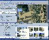
![]() Icons-Land Company advertises exclusive set of icons - Vista Style Points of Interest Icon Set V2. The images are represented in 4 variations of colors (green, blue, red, orange) and 2 variations of backgrounds (plain and circled). Colors variety helps distinguishing the same objects on the map...
Icons-Land Company advertises exclusive set of icons - Vista Style Points of Interest Icon Set V2. The images are represented in 4 variations of colors (green, blue, red, orange) and 2 variations of backgrounds (plain and circled). Colors variety helps distinguishing the same objects on the map...
Platforms: Windows, Mac, Linux, Handheld/Mobile Other, Java
| License: Freeware | Size: 17.49 MB | Download (61): Icons-Land Vista Style POI Icon Set Download |
Added: May 10, 2013 | Visits: 409
 SharpMap is a simple-to-use map renderer that renders GIS data for use in web and desktop applications. The engine is written in C# and based on the .NET 2.0 framework. SharpMap is released under GNU Lesser General Public LicenseFeatures - Embed the engine using any .NET language, including C#,...
Platforms: Windows, ASP.NET,
| License: Freeware | Download (61): SharpMap Download |
Added: December 10, 2013 | Visits: 753
Do you need to see DXF files in Php? This software is for you!You can see DXF files in PHP and execute query inside. It's the best for GIS applications!
Platforms: PHP
| License: Freeware | Size: 409.6 KB | Download (60): Convert DXF to .sql for Scripts Download |
Released: November 19, 2012
|
Added: November 19, 2012 | Visits: 676
 thDIMIN Image Viewer n5 is a free and useful image utility that lets you to view images in countless formats, and apply a variety of effects with this powerful , small and fast application. Dimin Viewer incorporates unique visualization ideas, like Panoramic Photographs Tool and Big Image...
Platforms: Windows
| License: Freeware | Size: 4 MB | Download (58): DIMIN Viewer n5 Download |
Added: May 10, 2013 | Visits: 801
DC Comprehensive Subscriber Survey (DCCSS) is a web-based system for a comprehensive survey of water utility customers. It is a cross-platform application written in PHP that uses a GIS component based on mapserver to visualize the delivery points..
Platforms: Windows, Mac, *nix, PHP, BSD Solaris
| License: Freeware | Download (58): DC Comprehensive Subscriber Survey 0.6.0-1 Download |
Released: June 21, 2012
|
Added: June 21, 2012 | Visits: 907
 Commonly referred to as GRASS, this is a free Geographic Information System (GIS) used for geospatial data management and analysis, image processing, graphics/maps production, spatial modeling, and visualization. GRASS is currently used in academic and commercial settings around the world, as...
Platforms: Mac
| License: Freeware | Size: 59 MB | Download (57): Grass GIS for Mac OS X Download |
Added: May 10, 2013 | Visits: 321
PostGIS adds support for geographic objects to the PostgreSQL object-relational database. In effect, PostGIS "spatially enables" the PostgreSQL server, allowing it to be used as a backend spatial database for geographic information systems (GIS).
Platforms: Windows, Mac, *nix, C/C++, BSD Solaris
| License: Freeware | Download (55): PostGIS Script Download |
Added: May 10, 2013 | Visits: 493
The phpArcIMS project intends to write a set of PHP classes that allow any php developer to develope ArcIMS applications or integrate ArcIMS into any existing application. For those of you that never heard of ArcIMS: ArcIMS is an application server from ESRI that allows users to share GIS...
Platforms: Windows, Mac, *nix, PHP, BSD Solaris
| License: Freeware | Download (55): phpArcIMS Download |
Released: July 17, 2012
|
Added: July 17, 2012 | Visits: 531
 Spatial Knowledge Base is a web based application for storing and searching of archaeological sites information. The software was written to improve access to cultural heritage information though the use of digital archiving, search technology, and GIS.
Platforms: Windows, Mac, Linux
| License: Freeware | Size: 64.03 MB | Download (53): Spatial Knowledge Base Download |
Released: June 15, 2012
|
Added: June 15, 2012 | Visits: 368
Provide the building blocks for a GIS system consistent with the current standards from OGIS
Platforms: Windows, Mac, Linux
| License: Freeware | Size: 9.43 MB | Download (52): Geographical Information System Toolkit Download |
Released: November 13, 2012
|
Added: November 13, 2012 | Visits: 395
A web-based system to register the advertisement panels on the roads. Cross-platform application written in PHP. Uses a GIS component based on mapserver to visualize the panel locations.
Platforms: Windows, Mac, Linux
| License: Freeware | Size: 6.2 MB | Download (51): Road Advertisement Panel Control Download |
Released: October 02, 2012
|
Added: October 02, 2012 | Visits: 573
GeoTools is an open source java GIS toolkit. Used for OGC based projects via GeoAPI interfaces. Includes two great SLD based renderers, raster access and reprojection. Plugns fo Shapefile, ArcGrid, ArcSDE, Postgis, OracleSpatial, MySQL and many more.
Platforms: Windows, Mac, Linux
| License: Freeware | Size: 44.2 MB | Download (50): GeoTools, the java GIS toolkit Download |
Added: May 10, 2013 | Visits: 514
It will calculate the conductor's short circuit current, total cantilever load, short circuit force transmitted to the GIS, heat loss by radiation & convection, equivalent power loss and many other more indicators. Requirements: - MATLAB 7.2 or higher - MATLAB's Symbolic Math Toolbox
Platforms: Windows, Mac, *nix, Matlab, BSD Solaris
| License: Freeware | Download (50): Tubular Copper Conductor Design Verification Download |
Released: December 04, 2012
|
Added: December 04, 2012 | Visits: 314
An attempt to design minimum cost broadband networks with the use of a modified version of the Particle Swarm Optimization method. A GIS subsystem is used for the visualization of data and results.
Platforms: Windows, Mac, Linux
| License: Freeware | Size: 1.02 MB | Download (49): NetDesigner GIS Download |
Released: August 12, 2012
|
Added: August 12, 2012 | Visits: 321
 GeOxygene aims at providing an open framework which implements OGC/ISO specifications for the development and deployment of geographic (GIS) applications. It is a open source contribution of the COGIT lab. at the IGN (the French National Mapping Agency).
Platforms: Windows, Mac, Linux
| License: Freeware | Size: 1.11 MB | Download (49): GeOxygene Download |
Released: October 02, 2012
|
Added: October 02, 2012 | Visits: 414
 Musmap is a web interface to UMN mapserver. It provides users and profiles management, advanced queries and selections, automatic decodification of columns with joins, easy-to-use configuration (colors, ...)... and so on.
Platforms: Windows, Mac, Linux
| License: Freeware | Size: 343.4 KB | Download (49): Musmap - a web GIS software Download |
Released: December 18, 2012
|
Added: December 18, 2012 | Visits: 401
Tools for creating interactive svg maps from GIS data
Platforms: Windows, Mac, Linux
| License: Freeware | Size: 80.86 KB | Download (49): VectorGIS Download |
Released: August 25, 2012
|
Added: August 25, 2012 | Visits: 418
To investigate, describe and develop methods and approaches to generating maps with computers. This is not another GIS project. This one is focused on how to develop programs which make useful end user maps and programs using map backgrounds.
Platforms: Windows, Mac, BSD, Solaris, Linux
| License: Freeware | Size: 16.57 MB | Download (49): Making Maps With Computers Download |
Released: July 17, 2012
|
Added: July 17, 2012 | Visits: 480
 JMARS is an acronym that stands for Java Mission-planning and Analysis for Remote Sensing. It is a geospatial information system (GIS) developed by ASU's Mars Space Flight Facility to provide mission planning and data-analysis tools to NASA's orbiters, instrument team members, students of all...
Platforms: Windows, Mac, Linux
| License: Freeware | Size: 52.2 MB | Download (48): JMARS Download |
Released: August 07, 2012
|
Added: August 07, 2012 | Visits: 423
GIS Facility Managment module for Grass GIS system
Platforms: Windows, Mac, Linux
| License: Freeware | Size: 27.25 KB | Download (48): GIS_FM for Grass Download |