


Gis software
Gis
Added: January 27, 2006 | Visits: 6.811
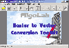 Software development kit for CAD/CAM/ GIS and graphic software developers. Converts from raster to vector and refines architect, mechanical, tech drawing, maps, math graphs, graphics for books and journals and more. ActiveX and Com Component are also available. Refines vector graphics, creates...
Platforms: Windows
| License: Shareware | Cost: $99.00 USD | Size: 2.73 MB | Download (257): Algolab Raster to Vector Conversion CAD/GIS SDK Download |
Released: February 03, 2004
|
Added: March 24, 2006 | Visits: 3.799
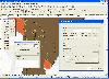 The CANVAS 9 GIS Mapping Edition adds native support for Geographic Information System (GIS) data to Canvas. You can take measurements in geographic coordinates, import industry standard SHAPE and GeoTIFF files into unlimited numbers of automatically aligned overlapping layers and choose among...
Platforms: Windows
| License: Shareware | Cost: $549.99 USD | Size: 53.3 MB | Download (188): Canvas GIS Mapping Edition Download |
Released: July 25, 2007
|
Added: September 26, 2007 | Visits: 3.499
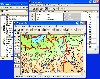
 AvisMap GIS Engine is a comprehensive SDK for the development of custom GIS applications and solutions. This SDK provides several ActiveX (OCX) controls which support Visual Basic, VB.NET, C#, Visual C++ and other ActiveX compatible programming languages, with Microsoft Visual Studio versions 6,...
Platforms: Windows
| License: Shareware | Cost: $199.00 USD | Size: 43.76 MB | Download (157): AvisMap GIS Engine Download |
Added: September 22, 2010 | Visits: 1.571
 GIS::Distance::Polar can do Polar coordinate flat-earth distance calculations. SYNOPSIS my $calc = GIS::Distance::Polar->new(); my $distance = $calc->distance( $lon1, $lat1 => $lon2, $lat2 ); Supposedly this is a formula to better calculate distances at the poles. While implimented, this...
Platforms: *nix
| License: Freeware | Size: 8.19 KB | Download (165): GIS::Distance::Polar Download |
Added: August 24, 2010 | Visits: 1.490
GIS::Distance::Vincenty Perl module contains Thaddeus Vincenty distance calculations. SYNOPSIS my $calc = GIS::Distance::Vincenty->new(); my $distance = $calc->distance( $lon1, $lat1 => $lon2, $lat2 ); For the benefit of the terminally obsessive (as well as the genuinely needy), Thaddeus...
Platforms: *nix
| License: Freeware | Size: 8.19 KB | Download (125): GIS::Distance::Vincenty Download |
Added: August 18, 2010 | Visits: 1.125
GIS-Knoppix is a bootable Linux CD with pre-installed GIS software. It is based on Knoppix..
Platforms: *nix
| License: Freeware | Size: 700 MB | Download (141): GIS Knoppix Download |
Released: June 13, 2012
|
Added: June 13, 2012 | Visits: 896
![]() With the new Icons-Land Vista Style GIS/GPS/Map Icon Set now it is much more comfortable to use local service applications, GPS tracking and GIS applications, and any kind of mapping applications. GIS/GPS/Map Icons are meant to help users to orient oneself when using maps, to facilitate their...
With the new Icons-Land Vista Style GIS/GPS/Map Icon Set now it is much more comfortable to use local service applications, GPS tracking and GIS applications, and any kind of mapping applications. GIS/GPS/Map Icons are meant to help users to orient oneself when using maps, to facilitate their...
Platforms: Windows, Mac, Pocket PC, Java, Handheld/Mobile Other
| License: Demo | Cost: $120.00 USD | Size: 2.53 MB | Download (57): Icons-Land Vista Style GIS/GPS/MAP Icon Set Download |
Released: September 07, 2014
|
Added: September 21, 2014 | Visits: 750
![]() With the new Icons-Land GIS/GPS/Map Vector Icons now it is much more comfortable to use local service applications, GPS tracking and GIS applications, and any kind of mapping applications.
GIS/GPS/Map Icons are meant to help users to orient oneself when using maps, to facilitate their...
With the new Icons-Land GIS/GPS/Map Vector Icons now it is much more comfortable to use local service applications, GPS tracking and GIS applications, and any kind of mapping applications.
GIS/GPS/Map Icons are meant to help users to orient oneself when using maps, to facilitate their...
Platforms: Windows, Mac, Windows 8, Windows 7, iOS
| License: Demo | Cost: $180.00 USD | Size: 5.56 MB | Download (40): Icons-Land GIS/GPS/MAP Vector Icons Download |
Added: August 04, 2008 | Visits: 1.164
 GIS ObjectLand is a universal Geographic Information System for Windows. Key capabilities: vector-raster maps; multiuser data editing; import and export for MIF/MID (MapInfo), SHP (ArcView), DXF (AutoCAD), DBF (dBASE), CSV; setting access permissions to data for different categories of users;...
Platforms: Windows
| License: Shareware | Cost: $99.00 USD | Size: 23.54 MB | Download (537): GIS ObjectLand Download |
Added: August 07, 2008 | Visits: 1.770
Total GIS Converter is an affordable converter of GIZ files. It converts AEP, GRD, ADF, E00, FLT, APR, SHP, DXF, BT, TOC, RT1, DEM, DLG, ECW, IMG, DGF, GML, SID, MIF, TAB, WOR, DNG, DDF, BIL, TIF, JPEG, TTKPS, TTKGP, TTKLS, LFT, PFT, and TFT files. The target formats are TIFF, PNG, JPEG, BMP....
Platforms: Windows
| License: Shareware | Cost: $99.90 USD | Size: 2.66 KB | Download (648): Total GIS Converter Download |
Released: October 24, 2012
|
Added: October 24, 2012 | Visits: 674
 QGIS supports vector, raster, and database formats and lets you browse and create map data on your computer.
Quantum GIS (QGIS) supports many common spatial data formats (e.g. ESRI ShapeFile, geotiff). QGIS supports plugins to do things like display tracks from your GPS.
QGIS aims to be an...
QGIS supports vector, raster, and database formats and lets you browse and create map data on your computer.
Quantum GIS (QGIS) supports many common spatial data formats (e.g. ESRI ShapeFile, geotiff). QGIS supports plugins to do things like display tracks from your GPS.
QGIS aims to be an...
Platforms: Linux
| License: Freeware | Size: 1024 KB | Download (460): Quantum GIS form Linux Download |
Released: July 24, 2012
|
Added: July 24, 2012 | Visits: 782
 QGIS supports vector, raster, and database formats and lets you browse and create map data on your computer.
Quantum GIS (QGIS) supports many common spatial data formats (e.g. ESRI ShapeFile, geotiff). QGIS supports plugins to do things like display tracks from your GPS.
QGIS aims to be an...
QGIS supports vector, raster, and database formats and lets you browse and create map data on your computer.
Quantum GIS (QGIS) supports many common spatial data formats (e.g. ESRI ShapeFile, geotiff). QGIS supports plugins to do things like display tracks from your GPS.
QGIS aims to be an...
Platforms: Mac
| License: Freeware | Size: 1024 KB | Download (440): Quantum GIS form Mac Download |
Released: June 21, 2012
|
Added: June 21, 2012 | Visits: 907
 Commonly referred to as GRASS, this is a free Geographic Information System (GIS) used for geospatial data management and analysis, image processing, graphics/maps production, spatial modeling, and visualization. GRASS is currently used in academic and commercial settings around the world, as...
Platforms: Mac
| License: Freeware | Size: 59 MB | Download (57): Grass GIS for Mac OS X Download |
Released: October 11, 2012
|
Added: October 11, 2012 | Visits: 772
 QGIS supports vector, raster, and database formats and lets you browse and create map data on your computer.
Quantum GIS (QGIS) supports many common spatial data formats (e.g. ESRI ShapeFile, geotiff). QGIS supports plugins to do things like display tracks from your GPS.
QGIS aims to be an...
QGIS supports vector, raster, and database formats and lets you browse and create map data on your computer.
Quantum GIS (QGIS) supports many common spatial data formats (e.g. ESRI ShapeFile, geotiff). QGIS supports plugins to do things like display tracks from your GPS.
QGIS aims to be an...
Platforms: Windows
| License: Freeware | Size: 77.3 MB | Download (453): Quantum GIS Download |
Released: October 02, 2012
|
Added: October 02, 2012 | Visits: 573
GeoTools is an open source java GIS toolkit. Used for OGC based projects via GeoAPI interfaces. Includes two great SLD based renderers, raster access and reprojection. Plugns fo Shapefile, ArcGrid, ArcSDE, Postgis, OracleSpatial, MySQL and many more.
Platforms: Windows, Mac, Linux
| License: Freeware | Size: 44.2 MB | Download (50): GeoTools, the java GIS toolkit Download |
Released: September 14, 2014
|
Added: October 16, 2014 | Visits: 6.485
 Vextractor is a vectorizer program for transforming raster images into vector formats by building centerlines and outlines. This tool could be used for the vectorizing photo, logotypes and other line art images for use in Vector Graphics Design software. You can also vectorize charts, drawings,...
Platforms: Windows, Windows 7
| License: Shareware | Cost: $99.95 USD | Size: 2.97 MB | Download (517): Vextractor Download |
Added: September 05, 2006 | Visits: 3.277
 FlexGraphics - is a set of components for creating vector graphics applications under Borland Delphi. FlexGraphics library can be used for creation of plots, drawings, electrical, concept and mnemonic charts as well as for creation of interactive plans with high level of detail for various...
Platforms: Windows
| License: Shareware | Cost: $149.00 USD | Size: 1.25 MB | Download (172): FlexGraphics Library Download |
Added: March 27, 2006 | Visits: 3.303
EzGIS Components target applications are GIS (Geographic Information System). Although it is new on GIS market, its highlights implemented quality and a lot of features will expand your develops applications.
There are a lot of applications that you can develop with our EzGIS components, like :...
Platforms: Windows
| License: Shareware | Cost: $799.00 USD | Size: 3.61 MB | Download (219): EzGIS Download |
Released: March 04, 2003
|
Added: January 18, 2006 | Visits: 2.711
 ExGIS (OCX Control) target applications are GIS (Geographic Information System). Although it is a new kid on the block on GIS market, its highlights implemented quality and a lot of features.
There are a lot of applications that you can develop with our ExGIS components, like :
Marketing...
ExGIS (OCX Control) target applications are GIS (Geographic Information System). Although it is a new kid on the block on GIS market, its highlights implemented quality and a lot of features.
There are a lot of applications that you can develop with our ExGIS components, like :
Marketing...
Platforms: Windows, Windows CE
| License: Shareware | Cost: $599.00 USD | Size: 36.13 MB | Download (152): ExGIS Download |
Released: April 22, 2008
|
Added: April 26, 2008 | Visits: 9.511
 The free AvisMap Viewer opens most GIS/CAD and raster image file types and most ArcView, ArcExplorer, and MapInfo projects. Besides just opening and viewing files, the Viewer supports an extensive list of features including visual layer properties control, legend control, thematic mapping,...
Platforms: Windows
| License: Freeware | Size: 22.28 MB | Download (1734): AvisMap Free Viewer Download |