


Shapefile software
Shapefile
Added: September 02, 2010 | Visits: 2.488
 Geo::ShapeFile is a Perl extension for handling ESRI GIS Shapefiles. SYNOPSIS use Geo::ShapeFile; my $shapefile = new Geo::ShapeFile("roads"); for(1 .. $shapefile->shapes()) { my $shape = $shapefile->get_shp_record($_); # see Geo::ShapeFile::Shape docs for what to do with $shape my...
Platforms: *nix
| License: Freeware | Size: 276.48 KB | Download (147): Geo::ShapeFile Download |
Released: February 01, 2015
|
Added: February 23, 2015 | Visits: 2.231
 Manco Shapefile Editor is a powerful tool for creating and editing shapefiles, with easy, almost “on the fly”, geometry and data editing and possibility of direct creation of the shapefiles from the image files by image processing algorithms. This product is constantly developing and you will...
Platforms: Windows, Windows 7
| License: Shareware | Cost: $100.00 USD | Size: 6.14 MB | Download (106): Manco Shapefile Editor Download |
Added: April 24, 2013 | Visits: 448
Matlab script to read KML files into a mapstruct structure array and offers the option of writing to a Shapefile. KML files must be of a uniform type: Point, LineString, LinearRing orPolygon. The output contains 5-6 fields, 'Geometry', 'X', 'Y', 'altitude', 'Id' and 'name'. The final field is...
Platforms: Matlab
| License: Freeware | Size: 10 KB | Download (45): KML-Matlab-Shapefile conversion Download |
Added: September 23, 2010 | Visits: 951
BytesFall ShapeFiles is a PHP library that allows reading and editing of an ESRI ShapeFile and all the associated information.. Get BytesFall ShapeFiles at SourceForge.net. Fast, secure and free downloads from the largest Open Source applications and software directory. BytesFall ShapeFiles is a...
Platforms: *nix
| License: Freeware | Size: 58.37 KB | Download (128): BytesFall ShapeFiles Download |
Released: June 25, 2012
|
Added: June 25, 2012 | Visits: 869
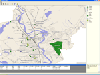
 The free AvisMap Viewer opens most GIS/CAD and raster image file types and most ArcView, ArcExplorer, and MapInfo projects. Besides just opening and viewing files, the Viewer supports an extensive list of features including visual layer properties control, legend control, thematic mapping,...
Platforms: Windows
| License: Freeware | Size: 23.17 MB | Download (449): Free Shapefile Viewer Download |
Added: May 10, 2013 | Visits: 416
BytesFall ShapeFiles is a PHP library that allows reading and editing of an ESRI ShapeFile and all the associated information.
Platforms: Windows, Mac, *nix, PHP, BSD Solaris
| License: Freeware | Download (60): BytesFall ShapeFiles Download |
Released: July 10, 2012
|
Added: July 10, 2012 | Visits: 261
Gis editor, for two persons edit the same shapefile at the same time. Developed with GeoTools.
Platforms: Windows, Mac, Linux
| License: Freeware | Size: 9.82 KB | Download (46): GisDual-edit Download |
Released: December 17, 2012
|
Added: December 17, 2012 | Visits: 302
SHP Viewer is a simple shapefile viewer. The Esri Shapefile or simply a shapefile is a popular geospatial vector data format for geographic information systems (GIS). A shapefile is a digital vector storage format for storing geometric location and associated attribute information. This format...
Platforms: Mac
| License: Commercial | Cost: $2.99 USD | Size: 512 KB | Download (48): SHP Viewer Download |
Added: August 30, 2013 | Visits: 213
WORLDDATAMAP wraps the Mapping Toolbox function WORLDMAP (version 2.1 and higher) and adds data to the map. The data may consist of vector data from shapefiles or surface data from a regular data grid. The displayed vector data depicts boundaries for regions, major lakes and rivers, locations of...
Platforms: Matlab
| License: Shareware | Cost: $0.00 USD | Size: 419.84 KB | Download (44): WORLDDATAMAP Download |
Added: August 05, 2013 | Visits: 442
This is a motley collection of useful spatial tools created by Patrick Hayes of Geomemes ResearchModules included are: * Spatial Import - Provides a shapefile parser for Feeds and Table Wizard, allowing you to import nodes or tables from a shapefile. Integrates well with Geo and OpenLayers field...
Platforms: PHP
| License: Freeware | Size: 20.48 KB | Download (40): Spatial Tools Download |
Added: September 17, 2013 | Visits: 419
JShapeFile - Easy, Pure Java Support for Editing ShapeFiles Purchase JShapeFile JShapefile from NVision Solutions Inc. provides a pure Java method to read and write ESRI shapefiles from your Java application # JShapeFile API (JavaDocs) # JShapeFile Code Samples # Shapefile XML DTD Documentation...
Platforms: Mac
| License: Demo | Cost: $0.00 USD | Size: 20.48 KB | Download (37): JShapeFile Download |
Added: August 24, 2013 | Visits: 383
Vector maps of arbitrary areas: free conversion utility With the shapefile-to-pmap converter, you can have vector maps of areas you are interested in converted for PrettyMap. ESRI provides shapefile maps for most areas of the world (however, their on-line service is no longer available)....
Platforms: Mac
| License: Shareware | Cost: $0.00 USD | Size: 6.01 MB | Download (41): PrettyMap vector map converter Download |
Released: November 10, 2007
|
Added: November 20, 2007 | Visits: 6.090
 Geocode digital images with latitude, longitude, altitude, and direction information. RoboGEO stamps this information onto the actual photo or writes it to the EXIF headers, allowing you to permanently geotag and link your photos to the GPS coordinates. All writing to the EXIF and IPTC headers...
Platforms: Windows
| License: Demo | Cost: $39.95 USD | Size: 8.28 MB | Download (1179): RoboGEO Download |
Released: February 20, 2006
|
Added: November 05, 2006 | Visits: 2.901
 Map Suite Web Edition is a powerful and feature-rich ASP.Net server control that enables C# and VB.NET software developers to build detailed internet mapping applications. Utilizing Microsoft's .NET Framework, the APIs for Map Suite Web Edition incorporate the very latest technology to deliver a...
Platforms: Windows
| License: Demo | Cost: $4794.00 USD | Size: 28.78 MB | Download (125): Map Suite Web Download |
Released: February 20, 2006
|
Added: November 05, 2006 | Visits: 4.074
 Map Suite Desktop Edition is a powerful and feature-rich .NET mapping control that enables C# and VB.NET software developers to build detailed desktop mapping applications. Utilizing Microsoft's .NET Framework, the APIs for Map Suite Desktop Edition incorporate the very latest technology to...
Platforms: Windows
| License: Demo | Cost: $4794.00 USD | Size: 28.41 MB | Download (148): Map Suite Desktop Download |
Released: February 20, 2006
|
Added: November 06, 2006 | Visits: 3.288
 Map Suite Engine is a powerful and feature-rich low level component that enables C# and VB.NET software developers to generate great-looking map images for presentations. At the heart of the Map Suite product line is a non-visual component library designed to generate maps. With this tool in your...
Platforms: Windows
| License: Demo | Cost: $4794.00 USD | Size: 15.13 MB | Download (127): Map Suite Engine Download |
Released: January 30, 2006
|
Added: November 06, 2006 | Visits: 3.840
 Map Suite Pocket PC is a powerful and easy to use .NET mapping component that enables C# and VB.NET software developers to generate mapping presentations on portable devices using the .NET Compact Framework 2.0. Map Suite Pocket PC makes it very easy to develop great-looking maps and features a...
Platforms: Windows CE, Pocket PC, Windows
| License: Demo | Cost: $4794.00 USD | Size: 5.78 MB | Download (201): Map Suite Pocket PC Download |
Released: September 21, 2008
|
Added: September 24, 2008 | Visits: 1.965
 Full featured and affordable image and vector viewing and processing for
ActiveX,.NET,C#,VB.NET,VB,C++,DLL,LIB at your fingertips.Image and vectordata viewing with Scrolling, Zooming, Panning. Unlimited layers, you can plug multiple raster and vector layers into the viewer, where each...
Full featured and affordable image and vector viewing and processing for
ActiveX,.NET,C#,VB.NET,VB,C++,DLL,LIB at your fingertips.Image and vectordata viewing with Scrolling, Zooming, Panning. Unlimited layers, you can plug multiple raster and vector layers into the viewer, where each...
Platforms: Windows
| License: Commercial | Cost: $149.00 USD | Size: 23.84 MB | Download (124): THBImage Download |
Released: February 10, 2016
|
Added: August 13, 2018 | Visits: 2.400
 ActualMap is a set of high-performance, .NET mapping components and controls for embedding maps in desktop applications. ActualMap gives you the ability to generate maps, drill-down capability, thematic mapping, routing, vehicle tracking and other features that will make the maps fully...
Platforms: Windows, Windows 8, Windows 7, Windows Server
| License: Shareware | Cost: $799.00 USD | Size: 16.85 MB | Download (627): ActualMap Download |
Released: April 22, 2008
|
Added: April 26, 2008 | Visits: 9.512
 The free AvisMap Viewer opens most GIS/CAD and raster image file types and most ArcView, ArcExplorer, and MapInfo projects. Besides just opening and viewing files, the Viewer supports an extensive list of features including visual layer properties control, legend control, thematic mapping,...
Platforms: Windows
| License: Freeware | Size: 22.28 MB | Download (1734): AvisMap Free Viewer Download |