


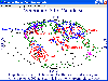
Polygon Maps software
Polygon Maps
Added: September 09, 2013 | Visits: 517
 All Your Maps Are Belong To Us is a Firefox extension that translates URLs for other mapping sites to Google Maps.
Platforms: *nix
| License: Freeware | Size: 10.24 KB | Download (36): All Your Maps Are Belong To Us Download |
Released: September 05, 2010
|
Added: September 17, 2010 | Visits: 3.743
 PolyMap is a desktop mapping program that lets you use your own data to customize the maps supplied with the program. Use the built-in spreadsheet to enter data or paste it from other Windows applications. Alternatively, you can use the import feature to bring in data from external spreadsheets,...
Platforms: Windows
| License: Shareware | Cost: $89.95 USD | Size: 7.37 MB | Download (712): Polymap Download |
Released: October 12, 2002
|
Added: April 12, 2006 | Visits: 10.141
 Rational Reducer optimizes 3D models for real-time presentation. Produces dramatic improvement in 3D rendering performance. Greatly reduces 3D image file size and allows you to easily control 3D model visual quality. Rational Reducer optimizes 3D models for real-time presentation. Produces...
Platforms: Windows, *nix
| License: Demo | Cost: $4950.00 USD | Size: 3.67 MB | Download (915): Rational Reducer Download |
Released: November 10, 2007
|
Added: November 20, 2007 | Visits: 6.089
 Geocode digital images with latitude, longitude, altitude, and direction information. RoboGEO stamps this information onto the actual photo or writes it to the EXIF headers, allowing you to permanently geotag and link your photos to the GPS coordinates. All writing to the EXIF and IPTC headers...
Platforms: Windows
| License: Demo | Cost: $39.95 USD | Size: 8.28 MB | Download (1179): RoboGEO Download |
Added: July 09, 2006 | Visits: 2.412
SplineCalc is multipurpose scientific calculator for implementation of various mathematical operations with maps (grids), data tables, lines, polygons and numbers. You can use arithmetical and logical operations with any above data types. It is possible to specify some surface with usage...
Platforms: Windows
| License: Shareware | Cost: $75.00 USD | Size: 506 KB | Download (541): SplineCalc Download |
Added: July 16, 2006 | Visits: 4.227
MindMaster is a powerful visual tool for planning, collaboration and business process management. MindMaster helps business professionals and teams plan, organize and manage information-based activities. Decisions are made much faster, meeting times are decreased and project planning is greatly...
Platforms: Windows
| License: Shareware | Cost: $29.99 USD | Size: 1.06 MB | Download (183): MindMaster Download |
Released: July 01, 2005
|
Added: March 03, 2006 | Visits: 3.957
 A good travelogue often requires a map showing the destinations or route. With MapCreator you can create the maps necessary for this purpose. The map type, extract and scale are freely adjustable. The maps are of a very high quality and can be used in all media without query and cost.
Platforms: Windows
| License: Freeware | Size: 29.61 MB | Download (565): MapCreator Free Edition Download |
Released: May 01, 2011
|
Added: May 21, 2011 | Visits: 2.583
 Anychart is a flexible Flash based-solution, which allows you to easily display any sort of data dealing with geographical locations. It contains United States Maps with Counties, World Map, etc. XML data file and a set of customizable options make AnyChart Maps a universal solution for web...
Platforms: OS/2, Windows, Mac, *nix, Windows CE, Pocket PC, Palm OS 6.0,Not Applicable,Handheld/Mobile Other,Java,MS-DOS,AS/400
| License: Shareware | Cost: $399.00 USD | Size: 10.27 MB | Download (118): AnyChart Flash Map Component Download |
Added: May 27, 2006 | Visits: 3.841
Flash maps US States. With this fully-clickable map you will be able to improve navigation and provide visitors with better and quicker access to information as well as improve the way you present the information. The map can be used "as is" however it is also easily customizable. In just a few...
Platforms: Windows
| License: Demo | Cost: $69.00 USD | Size: 44 KB | Download (484): Zoom Flash Map US States Download |
Released: November 23, 2006
|
Added: November 23, 2006 | Visits: 6.059
 The program StitchMaps simply joins these maps.
The result is a map that is suitable for programs using raster scan.
The maps used as basis for the assembly were either created by scanning templates, or by exports from digitalized maps.
The program is available as standard and as plus...
The program StitchMaps simply joins these maps.
The result is a map that is suitable for programs using raster scan.
The maps used as basis for the assembly were either created by scanning templates, or by exports from digitalized maps.
The program is available as standard and as plus...
Platforms: Windows
| License: Shareware | Cost: $45.00 USD | Size: 554.8 KB | Download (454): StitchMaps Download |
Released: June 27, 2008
|
Added: July 05, 2008 | Visits: 1.377
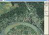
 OMapView is a professional map browser. Both satellite imagery and maps online can be viewed through it. With the cache technology, it improve the user experience of viewing map. And more, the map can be viewed even when the computer is offline. It's a multi-window application, different places...
Platforms: Windows
| License: Shareware | Cost: $29.95 USD | Size: 1.75 MB | Download (131): OMapView Download |
Released: September 19, 2007
|
Added: July 17, 2008 | Visits: 1.615
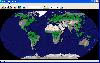
 Versamap draws outline maps on 16 map projections. The program allows users to print publication quality maps; and to export maps in vector graphic (WMF, CGM, DXF, ASCII) and bitmapped (BMP) formats.Versamap is supplied with digital maps from the Versamap Micro World Database, a world map with...
Platforms: Windows
| License: Shareware | Cost: $30.00 USD | Size: 3.98 MB | Download (127): Versamap Download |
Released: October 21, 2009
|
Added: November 24, 2022 | Visits: 1.587
 Open Contacts is an advanced address book program for managing contact info of individuals and organizations with relationships. The program was designed for people who need more beyond legacy address book programs in order to improve dynamic interactions with contacts. With SyncML for Open...
Platforms: Windows, Windows 7
| License: Free | Cost: $0.00 USD | Size: 4.96 MB | Download (444): Open Contacts Download |
Added: August 17, 2008 | Visits: 1.811
Print out a US map in a variety of sizes, from a single sheet of paper to a map almost 7 feet across, using an ordinary printer. You can also print single page maps, or maps 2 pages by 2 pages, 3 pages by 3 pages, etc. up to 8 pages by 8 pages (64 sheets of paper!). You can simply access the map...
Platforms: Windows
| License: Freeware | Size: 290 KB | Download (506): Mega Maps Download |
Released: August 29, 2008
|
Added: September 04, 2008 | Visits: 3.643
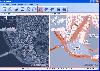
 Map View is a professional map browser. Both satellite imagery and maps online can be viewed through it. With the cache technology, it improve the user experience of viewing map. And more, the map can be viewed even when the computer is offline. It's a multi-window application, different places...
Platforms: Windows
| License: Shareware | Cost: $29.95 USD | Size: 1.91 MB | Download (274): Map View Download |
Released: August 29, 2008
|
Added: September 12, 2008 | Visits: 2.581
 Map Export is a GIS developer oriented tool for downloading and exporting background image.
For a long time, as a GIS developer, Its well known that to find perfect background images is a suffering and painful task. But since the growing up of Google Map, things have been changed. Google Map...
Map Export is a GIS developer oriented tool for downloading and exporting background image.
For a long time, as a GIS developer, Its well known that to find perfect background images is a suffering and painful task. But since the growing up of Google Map, things have been changed. Google Map...
Platforms: Windows
| License: Shareware | Cost: $499.95 USD | Size: 2.35 MB | Download (172): Map Export Download |
Released: April 21, 2008
|
Added: February 04, 2009 | Visits: 1.481
 FusionMaps v3 helps you create animated, interactive and data-driven Flash Maps for your dynamic web applications. Using FusionMaps, you can display geographical data distributed by category, regions or entities. Ideal usage examples are statistical display of data, flight routes, office...
Platforms: Windows, Mac, *nix
| License: Shareware | Cost: $199.00 USD | Size: 26.77 MB | Download (144): FusionMaps Download |
Released: May 06, 2009
|
Added: May 11, 2009 | Visits: 2.292
 FlashMapOne provides a most effective interactive map solutions for your project. Use FlashMapOne, you can create animated, interactive and data-driven Flash Maps for your dynamic web applications. That is a collection of vector maps are driven by XML, can easily be integrated with any scripting...
Platforms: Windows, Mac, *nix
| License: Demo | Cost: $199.95 USD | Size: 1.67 MB | Download (151): Flash Map One Download |
Released: November 06, 2009
|
Added: May 01, 2009 | Visits: 1.191
 Prime sprial plotting software for square (Ulam) and related polygon prime number spirals. Allows multiple prime generating quadratic equations to be displayed simultaneously. Plot data and image files can be saved to disk for further analysis. Demo version is limited to prime spirals based on...
Platforms: Windows
| License: Shareware | Cost: $15.00 USD | Size: 256.84 KB | Download (165): Apophenia Download |
Added: July 16, 2010 | Visits: 951
mod_whois module maps WHOIS queries into standard HTTP requests. After the "translation", the request can be processed by the usual mechanisms (mapping to static content, running CGI & PHP scripts, ...). Compile & Install apxs -i -a -c mod_whois.c Configure Most simplest configuration:...
Platforms: *nix
| License: Freeware | Size: 4.1 KB | Download (95): mod_whois Download |