


Geotag software
Geotag
Released: September 10, 2010
|
Added: September 24, 2010 | Visits: 1.055
 Did you know that great picture from today's lunch might reveal your exact location (and we're not talking about the address on the menu)?
What about those fun pictures of your kids at school? Think before you post. When you put something online, anyone can see it if it isn't password...
Did you know that great picture from today's lunch might reveal your exact location (and we're not talking about the address on the menu)?
What about those fun pictures of your kids at school? Think before you post. When you put something online, anyone can see it if it isn't password...
Platforms: Windows
| License: Freeware | Size: 2.24 MB | Download (106): Geotag Security Download |
Released: June 06, 2012
|
Added: June 06, 2012 | Visits: 391
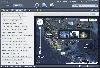
 Geotag is an easy to use application that allows you to match date / time information from photos with location information from a GPS unit or from a map.
The external maps might be necessary in order to perform fine-tune locations.
for WindowsAll
Geotag is an easy to use application that allows you to match date / time information from photos with location information from a GPS unit or from a map.
The external maps might be necessary in order to perform fine-tune locations.
for WindowsAll
Platforms: Windows
| License: Freeware | Download (422): Geotag Download |
Released: January 10, 2011
|
Added: January 19, 2011 | Visits: 2.075
 Cloudatag manages photos and videos using tag cloud, the visual representation of the tags makes it easy for you to manage and organize all photos & videos. You can instantly find or filter out the specific photo on cloud storage or your computer.Cloudatag launches a simple, faster and more...
Platforms: Windows
| License: Freeware | Size: 5.2 MB | Download (189): Cloudatag Media Manager Download |
Released: September 23, 2012
|
Added: September 23, 2012 | Visits: 345
 If you're already using the Google Latitude service on your mobile phone or you want to start using it, Latipics will allow you to geotag your pictures based on where you were at the time the picture was taken!
With its very simple, clean interface you will be able to log into your Google...
If you're already using the Google Latitude service on your mobile phone or you want to start using it, Latipics will allow you to geotag your pictures based on where you were at the time the picture was taken!
With its very simple, clean interface you will be able to log into your Google...
Platforms: Mac
| License: Shareware | Cost: $3.99 USD | Size: 2.6 MB | Download (454): Latipics for Mac Download |
Released: November 16, 2012
|
Added: November 16, 2012 | Visits: 424
 If you're already using the Google Latitude service on your mobile phone or you want to start using it, Latipics will allow you to geotag your pictures based on where you were at the time the picture was taken!
With its very simple, clean interface you will be able to log into your Google...
If you're already using the Google Latitude service on your mobile phone or you want to start using it, Latipics will allow you to geotag your pictures based on where you were at the time the picture was taken!
With its very simple, clean interface you will be able to log into your Google...
Platforms: Windows
| License: Freeware | Size: 3 MB | Download (479): Latipics Download |
Added: August 20, 2013 | Visits: 515
With this plugin you can have Instant GPS Tracking for your WordPress site. (Extended version of GEOTAG plugin.). You can add coordinates to your posts and display maps with these positions. On these maps you can also display KML/KMZ files or the geotags of the images of your post. The plugin...
Platforms: PHP
| License: Freeware | Size: 10 KB | Download (52): Transportlines.com Free Fleet GPS Tracking - Geotag Download |
Added: March 31, 2013 | Visits: 520
This plugin allows you to geotag any of your links and then provides the ability to add a map of your geotagged links to your theme.To install the plugin: 1. Unzip the plugin into the /wp-content/plugins directory on your webserver. 2. Activate the plugin. 3. Navigate to the settings page for the...
Platforms: PHP
| License: Freeware | Size: 10 KB | Download (39): Geo Blogroll Download |
Added: May 15, 2013 | Visits: 393
The exif2gmap simply adds google map and marker of "" linkedjpeg whenever jpeg has geotag info in exif.The geotag is additional location information which locates exif header of jpeg file.Latest digital camera has capability to add geotag using GPS.You also add geotag to existing jpeg using...
Platforms: PHP
| License: Freeware | Size: 10 KB | Download (46): exif2gmap Download |
Released: November 10, 2007
|
Added: November 20, 2007 | Visits: 6.089
 Geocode digital images with latitude, longitude, altitude, and direction information. RoboGEO stamps this information onto the actual photo or writes it to the EXIF headers, allowing you to permanently geotag and link your photos to the GPS coordinates. All writing to the EXIF and IPTC headers...
Platforms: Windows
| License: Demo | Cost: $39.95 USD | Size: 8.28 MB | Download (1179): RoboGEO Download |
Added: January 25, 2010 | Visits: 591
Geotagger lets you geotag your photos using Google Earth.Simply point Google Earth (version 4 only) at the location you want, then drag your images onto Geotagger. It will then insert the coordinates into the Exif data of the images and you're done.
Platforms: Mac
| License: Freeware | Download (94): Geotagger Download |
Added: March 28, 2013 | Visits: 461
The Geolocation plugin allows WordPress users to geotag their posts using the Edit Post page or any geo-enabled WordPress mobile applications such as WordPress for iPhone, WordPress for Android, or WordPress for BlackBerry.Visitors see a short description of the address either before, after, or...
Platforms: PHP
| License: Freeware | Size: 10 KB | Download (42): Geolocation for WordPress Download |
Added: August 06, 2013 | Visits: 394
This plugin will allow you to post geotagged photos to your blog and have them automatically linked to a google map.This works by checking every image in your post and if its got geotag data it will add a icon in the top left of the photo which will open a map in a thick box when clicked. This...
Platforms: PHP
| License: Freeware | Size: 10 KB | Download (46): GeotagPhoto Download |
Released: May 25, 2018
|
Added: June 25, 2018 | Visits: 3.606
 HoudahGeo is a photo geocoding and geotagging tool for Mac. Use HoudahGeo to attach GPS coordinates and location names to your photos.
HoudahGeo writes EXIF and XMP geotags to JPEG and RAW image files. This creates a permanent record of where a photo was taken. Just like a GPS-enabled camera....
HoudahGeo is a photo geocoding and geotagging tool for Mac. Use HoudahGeo to attach GPS coordinates and location names to your photos.
HoudahGeo writes EXIF and XMP geotags to JPEG and RAW image files. This creates a permanent record of where a photo was taken. Just like a GPS-enabled camera....
Platforms: Mac
| License: Demo | Cost: $39.00 USD | Size: 22.87 MB | Download (837): HoudahGeo Download |
Released: January 14, 2010
|
Added: January 16, 2010 | Visits: 3.960
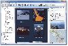
![]() The Picmeta Photo Tracker automatically geotags photos based on track information from any GPS device (.gpx files). It directly writes GPS EXIF data to .jpg, .tif, .crw, .dng, .nef, .pef, .jp2 formats. For other formats such as .cr2 it creates XMP sidecar files. The EXIFcare technology ensures...
The Picmeta Photo Tracker automatically geotags photos based on track information from any GPS device (.gpx files). It directly writes GPS EXIF data to .jpg, .tif, .crw, .dng, .nef, .pef, .jp2 formats. For other formats such as .cr2 it creates XMP sidecar files. The EXIFcare technology ensures...
Platforms: Windows
| License: Freeware | Size: 2.18 MB | Download (192): Picmeta Photo Tracker Download |
Added: February 22, 2010 | Visits: 1.124
Flickr Upcoming.org event details is a Greasemonkey script for Firefox that will show details of the upcoming.org event a photo is attached to. This is based on the new tagging notation introduced this week by flickr and upcoming.org [1]: if the photo does not have an upcoming tag, a select...
Platforms: *nix
| License: Freeware | Download (94): Flickr Upcoming.org event details Download |
Released: July 20, 2012
|
Added: July 20, 2012 | Visits: 514
With GeopIPTC you will be able to read the IPTC city information in pictures and get the corresponding coordinates to your photos from several free services and embed this into the pictures in standard tags in a very professional way. You will also create sets of pictures with all the metadata...
Platforms: Windows
| License: Shareware | Cost: $104.55 USD | Size: 7.32 MB | Download (382): GeoIPTC Download |
Released: October 06, 2012
|
Added: October 06, 2012 | Visits: 509
With GeoIPTC you will be able to read the IPTC city information in pictures and get the corresponding coordinates to your photos from several free services and embed this into the pictures in standard tags in a very professional way. You will also create sets of pictures with all the metadata...
Platforms: Windows
| License: Shareware | Cost: $112.00 USD | Size: 7.32 MB | Download (455): GeoIPTC Geolocalisation de Photos Download |
Released: July 21, 2012
|
Added: July 21, 2012 | Visits: 460
![]() Picmeta PhotoTracker automatically geotags photos based on track information from any GPS device (.gpx files). It directly writes GPS EXIF data to .jpg, .tif, .crw, .dng, .nef, .pef, .jp2 formats. For other formats such as .cr2 it creates XMP sidecar files. The EXIFcare technology ensures that...
Picmeta PhotoTracker automatically geotags photos based on track information from any GPS device (.gpx files). It directly writes GPS EXIF data to .jpg, .tif, .crw, .dng, .nef, .pef, .jp2 formats. For other formats such as .cr2 it creates XMP sidecar files. The EXIFcare technology ensures that...
Platforms: Windows
| License: Freeware | Size: 2.36 MB | Download (387): Picmeta PhotoTracker Download |
Released: July 01, 2012
|
Added: July 01, 2012 | Visits: 752
 Atom GPS freeware easily geotags your photos directly from your GPS device or track log. By simply connecting your GPS Device to Atom GPS and selecting your photos you can add their geolocation in one click. This action allows you to write the geolocation data to your photos exifs (information...
Platforms: Windows
| License: Freeware | Size: 7.58 MB | Download (424): ATOM GPS Download |
Released: October 08, 2012
|
Added: October 08, 2012 | Visits: 286
 abeMeda is a disk and data library for all your media assets, and almost everything that spins -harddisks, CD's, DVD's, ZIP's... abeMeda creates catalogs of your media and their metadata, and offers them offline for browsing and powerful search operations. abeMeda is cross-platform (with...
Platforms: Windows
| License: Shareware | Cost: $39.00 USD | Size: 8.47 MB | Download (54): abeMeda Download |