


Utm Coordinates freeware
Utm Coordinates
Added: May 15, 2010 | Visits: 776
 Tk::Canvas Perl module can create and manipulate Canvas widgets. SYNOPSIS $canvas = $parent->Canvas(?options?); STANDARD OPTIONS -background -highlightthickness -insertwidth -state -borderwidth -insertbackground -relief -tile -cursor -insertborderwidth -selectbackground -takefocus...
Platforms: *nix
Tk::Canvas Perl module can create and manipulate Canvas widgets. SYNOPSIS $canvas = $parent->Canvas(?options?); STANDARD OPTIONS -background -highlightthickness -insertwidth -state -borderwidth -insertbackground -relief -tile -cursor -insertborderwidth -selectbackground -takefocus...
Platforms: *nix
| License: Freeware | Size: 5.7 MB | Download (105): Tk::Canvas Download |
Added: January 25, 2010 | Visits: 421
MouseStat is a menu bar status item that displays mouse location coordinates in the menu bar. (Corner origin is configurable.)
Platforms: Mac
| License: Freeware | Download (98): MouseStat Download |
Released: December 22, 2011
|
Added: January 24, 2012 | Visits: 1.473
 Land surveyors and civil engineers:
o Calculate surveys and manage points, effortlessly
o Run Copan on Windows 2K/XP/Vista/7
o Use it forever and pay nothing
o Choose quadrant bearings or N/S azimuths, and gons or DMS
o Create point files quickly and easily
o Edit...
Platforms: Windows
Land surveyors and civil engineers:
o Calculate surveys and manage points, effortlessly
o Run Copan on Windows 2K/XP/Vista/7
o Use it forever and pay nothing
o Choose quadrant bearings or N/S azimuths, and gons or DMS
o Create point files quickly and easily
o Edit...
Platforms: Windows
| License: Freeware | Size: 5.44 MB | Download (983): Copan Lite Download |
Released: August 23, 2012
|
Added: August 23, 2012 | Visits: 489
Copan is a very efficient and easy-to-use geomatics engineering tool for computing and managing plane survey coordinates. It does numerous coordinate geometry (COGO) calculations, processes and adjusts raw field survey data, computes and adjusts map traverse data, performs map checks, calculates...
Platforms: Windows
| License: Freeware | Download (450): Copan Download |
Released: June 05, 2012
|
Added: June 05, 2012 | Visits: 876
InnerSoft CAD is a add-on component for AutoCAD that allows you to Export the values of an Area/ Length property or coordinates to an Excel Sheet.
Import the vertex coordinates for a set of 2D polylines or 3D polylines from an Excel Sheet (you can choose between 3 different methods).
You can...
Platforms: Windows
| License: Freeware | Download (445): InnerSoft CAD for AutoCAD 2011 Download |
Released: September 07, 2012
|
Added: September 07, 2012 | Visits: 683
 GPS Converter will convert GPS coordinates between three different formats: 34.26965, -116.76783; N 34° 16.179', W 116° 46.07'; and N 34° 16' 10.74", W 116° 46' 4.2". Will map the results in Google Maps.
Platforms: Windows
GPS Converter will convert GPS coordinates between three different formats: 34.26965, -116.76783; N 34° 16.179', W 116° 46.07'; and N 34° 16' 10.74", W 116° 46' 4.2". Will map the results in Google Maps.
Platforms: Windows
| License: Freeware | Size: 1.14 MB | Download (491): GPS Converter Download |
Released: July 13, 2012
|
Added: July 13, 2012 | Visits: 790
Geo Data German Admin contains geodata of the Federal Republic of Germany with geo referenced towns, municipalities, town quarters and other administrative units, postal codes, telephone preselections, nature areas, landscapes, climatic zones and official topographical cartographies.
The data...
Platforms: Windows
| License: Freeware | Download (459): Geo Data German Admin (formerly Geodaten German Houses) Download |
Released: September 02, 2012
|
Added: September 02, 2012 | Visits: 376
Converts between Ordnance Survey Grid References and Latitude/Longitude coordinates. NavigX now supports copy/paste operations and also batch conversion by means of CSV file import.
Fully customisable, calculated precision can be adjusted to suit individual users and in-application registration...
Platforms: Mac
| License: Freeware | Size: 1.5 MB | Download (51): NavigX for Mac OS Download |
Released: October 10, 2012
|
Added: October 10, 2012 | Visits: 569
A software utility that listens on an IP network for UDP datagrams representing the geographical coordinates of the simulated flight path of an instance of the X-Plane® flight simulator, then transforms them into a series of continuously updated KML files that Google Earth® can ingest to create...
Platforms: Mac
| License: Freeware | Size: 768 KB | Download (52): Xplage for Mac OS Download |
Released: July 03, 2012
|
Added: July 03, 2012 | Visits: 608
 A volume of data with map names, map numbers, corner coordinates and completing data of all official topographic maps of the Federal Republic of Germany. TK25: Data base table with data of the maps on a scale 1:25000. TK50: Table with data of the maps on a scale 1:50000. TK100: Table with data of...
Platforms: All
A volume of data with map names, map numbers, corner coordinates and completing data of all official topographic maps of the Federal Republic of Germany. TK25: Data base table with data of the maps on a scale 1:25000. TK50: Table with data of the maps on a scale 1:50000. TK100: Table with data of...
Platforms: All
| License: Freeware | Size: 51.2 KB | Download (51): Geodaten German Topo Download |
Released: August 15, 2012
|
Added: August 15, 2012 | Visits: 885
Geodata of the European and International countries offers you municipalities and postal codes. Georeferences as UTM- and geographic coordinates (WGS84, ETRS89). Suitable for branch searches, periphery searches and distance computations.
International Geo Data with geo referenced localities and...
Platforms: Windows
| License: Freeware | Download (54): Geo Data International Admin (English) Download |
Released: July 15, 2012
|
Added: July 15, 2012 | Visits: 851
Geodata of the European and International countries offers you municipalities and postal codes. Georeferences as UTM- and geographic coordinates (WGS84, ETRS89). Suitable for branch searches, periphery searches and distance computations.
International Geo Data with geo referenced localities and...
Platforms: Windows
| License: Freeware | Download (50): Geo Data International Admin Download |
Released: November 07, 2012
|
Added: November 07, 2012 | Visits: 622
 With this tool you can add GPS coordinates to vCards - electronic business cards - that you have previously exported from e. g. Microsoft Outlook. Therefore the tool uses the address data contained within the vCards and adds the exact GPS position on that basis to the vCard. This way you can use...
Platforms: Windows
With this tool you can add GPS coordinates to vCards - electronic business cards - that you have previously exported from e. g. Microsoft Outlook. Therefore the tool uses the address data contained within the vCards and adds the exact GPS position on that basis to the vCard. This way you can use...
Platforms: Windows
| License: Freeware | Size: 1.47 MB | Download (503): GPS to vCard Download |
Released: August 15, 2012
|
Added: August 15, 2012 | Visits: 523
Copan for Pocket PC is a very functional and easy-to-use geomatics engineering tool for computing and managing plane surveying and mapping coordinates.
It does numerous coordinate geometry (COGO) calculations, processes and adjusts raw field survey data, computes and adjusts map traverse data,...
| License: Freeware | Size: 662 KB | Download (45): Copan for PocketPC Download |
Released: December 19, 2012
|
Added: December 19, 2012 | Visits: 906
Copan for Mobile 6 is a very functional and easy-to-use geomatics engineering tool for computing and managing plane surveying and mapping coordinates.
It does numerous coordinate geometry (COGO) calculations, processes and adjusts raw field survey data, computes and adjusts map traverse data,...
Platforms: Windows
| License: Freeware | Size: 662 KB | Download (56): Copan for Mobile Download |
Released: November 15, 2012
|
Added: November 15, 2012 | Visits: 513
CopanMobile for Palm OS is a very functional and easy-to-use geomatics engineering tool for computing and managing plane surveying and mapping coordinates. It does numerous coordinate geometry (COGO) calculations, processes and adjusts raw field survey data, computes and adjusts map traverse...
Platforms: Palm,OS
| License: Freeware | Size: 341 KB | Download (55): CopanMobile for PalmOS Download |
Released: July 16, 2012
|
Added: July 16, 2012 | Visits: 414
SatGuide introduces SatTracx services that will locate your loved ones, your field force, your assets and will be able to give you your coordinates if you are ever lost! You can ensure that you can only be located by people that you approve. You can use our call center to know your location or...
Platforms: Android, BlackBerry, Pocket PC, Symbian
| License: Freeware | Size: 24 KB | Download (48): SatTracx Download |
Released: June 12, 2012
|
Added: June 12, 2012 | Visits: 289
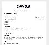 CaveDB is a web-based database system that makes it easy to maintain all of your cave information in one centralized location, including cave maps, coordinates, and access information.
Platforms: Windows, Mac, Linux
CaveDB is a web-based database system that makes it easy to maintain all of your cave information in one centralized location, including cave maps, coordinates, and access information.
Platforms: Windows, Mac, Linux
| License: Freeware | Size: 107.59 KB | Download (48): cavedb Download |
Released: November 03, 2012
|
Added: November 03, 2012 | Visits: 363
A Java library for high precision transformation of geographical coordinates using NTv2 format Grid Shift Files. Includes a JCA adapter.
Platforms: Windows, Mac, Linux
| License: Freeware | Size: 192.92 KB | Download (49): jGridShift Download |
Released: September 19, 2012
|
Added: September 19, 2012 | Visits: 157
Import coordinates, restraints and shifts into a CCPN project. Prepare your NMR structure to be deposited at PDBe.
Platforms: Windows, Mac, Linux
| License: Freeware | Size: 172.54 KB | Download (43): PDBe File Importer For CCPN Download |