


Utm Coordinates software
Utm Coordinates
Released: December 31, 2019
|
Added: January 08, 2020 | Visits: 1.273
 Geodata International - World-wide database of countries with georeferenced towns, municipalities, postal codes and administrative units with WGS84 and UTM coordinates and elevations for geocoding, proximity search, navigation, distance calculation. Often is it necessarily, for an address...
Platforms: Windows, Mac, *nix, Windows 8, Windows 7, iOS, Android, iPhone,iPad
| License: Data Only | Cost: $165.00 USD | Size: 2.4 MB | Download (114): Geodata International Download |
Released: April 21, 2014
|
Added: July 16, 2014 | Visits: 992
 Geodata International - World-wide database of countries with georeferenced towns, municipalities, postal codes and administrative units with WGS84 and UTM coordinates and elevations for geocoding, proximity search, navigation, distance calculation. Often is it necessarily, for an address...
Platforms: Windows, Mac, *nix, DOS, Windows 8, Windows Phone, Windows 7, Windows Server, Android, Handheld, OS/2, BlackBerry,Palm,Java
| License: Demo | Cost: $205.00 USD | Size: 785.78 KB | Download (91): Geodaten International Download |
Released: November 24, 2012
|
Added: November 24, 2012 | Visits: 624
 For the implementation of the INSPIRE directive all so far in Germany available geo references with Gauss-Krueger / DHDN coordinates now must be converted to UTM / ETRS89 coordinates for future use. BetaDLL supports the development of geodetic software on various platforms for this...
Platforms: Windows, Mac, Unix, Linux
| License: Freeware | Size: 1024 KB | Download (53): BetaDLL (English) Download |
Released: December 30, 2019
|
Added: January 08, 2020 | Visits: 3.836
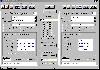
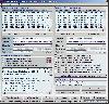
 ORTWIN is a program for the state-wide inquiry of the localities, postal codes and telephone selections in Germany. It finds postal zip codes, telephone pre selections, coordinates and ground level elevations. The program determines municipal codes, local center points, car license codes,...
Platforms: Windows, Windows 8, Windows 7, Windows Server
| License: Shareware | Cost: $120.00 USD | Size: 4.88 MB | Download (180): ORTWIN Download |
Released: September 14, 2011
|
Added: October 03, 2011 | Visits: 1.713
 For the implementation of the INSPIRE directive all so far in Germany available geo references with Gauss-Krueger / DHDN coordinates now must be converted to UTM / ETRS89 coordinates for future use. BetaDLL supports the development of geodetic software on various platforms for this...
Platforms: Windows, Mac, *nix, Windows CE, Pocket PC, iPhone,iPod,Palm,Handheld/Mobile Other,Java
| License: Shareware | Cost: $685.00 USD | Size: 1.04 MB | Download (854): BetaDLL Download |
Added: April 09, 2006 | Visits: 4.388
 AllTrans can be used for world wide professional coordinate transformations between international and national coordinate systems with or without geodetic datum change.
Transformations between State-Plane-Coordinates (NAD83, NAD27, Transverse Mercator, Lambert, Soldner-Cassini, Mercator, EOV,...
AllTrans can be used for world wide professional coordinate transformations between international and national coordinate systems with or without geodetic datum change.
Transformations between State-Plane-Coordinates (NAD83, NAD27, Transverse Mercator, Lambert, Soldner-Cassini, Mercator, EOV,...
Platforms: Windows
| License: Demo | Cost: $99.00 USD | Size: 4.41 MB | Download (470): AllTrans Download |
Released: December 30, 2019
|
Added: January 08, 2020 | Visits: 3.973
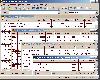
 SEVENPAR is a tool for the calculation of highly exact transformation parameters for the Spatial Helmert and Molodensky Transformation, which make possible precise coordinate transformations from one reference system into another. The determined transformation parameters can be entered directly...
Platforms: Windows, Windows 8, Windows 7, Windows Server
| License: Shareware | Cost: $145.00 USD | Size: 2.78 MB | Download (194): SEVENPAR Download |
Released: June 01, 2012
|
Added: June 01, 2012 | Visits: 478
 For many countries street coordinates are present with coverage degrees upto 100 percent. The geo data offered here are in high-precision quality and are present in different coordinate and reference systems. Street coordinates or also called street section coordinates are meaning the summary of...
Platforms: Windows, Edition 2005,Edition 2005
| License: Demo | Cost: $710.00 USD | Size: 182 KB | Download (49): Geo Data International Streets Download |
Released: July 14, 2012
|
Added: July 14, 2012 | Visits: 536
 For the area of the Federal Republic of Germany more than 19 million house coordinates with a coverage of 100% are available. The geo data offered here are in high-precision quality and are present in different coordinate and reference systems. House Coordinates or also called Geo Coded Building...
| License: Demo | Cost: $1250.00 USD | Size: 111 KB | Download (49): Geodaten German Houses (deutsch) Download |
Released: December 11, 2012
|
Added: December 11, 2012 | Visits: 523
 For the area of the Federal Republic of Germany more than 2,7 million street coordinates with a coverage of 100% are available. The geo data offered here are in high-precision quality and are present in different coordinate and reference systems. Street coordinates or also called street section...
| License: Demo | Cost: $625.00 USD | Size: 68 KB | Download (54): Geo data German Streets (English) Download |
Released: October 25, 2012
|
Added: October 25, 2012 | Visits: 447
 For many countries street coordinates are present with coverage degrees upto 100 percent. The geo data offered here are in high-precision quality and are present in different coordinate and reference systems. Street coordinates or also called street section coordinates are meaning the summary of...
| License: Demo | Cost: $625.00 USD | Size: 66 KB | Download (51): Geodaten International Streets (Deutsch) Download |
Released: July 04, 2012
|
Added: July 04, 2012 | Visits: 429
 For many countries house coordinates are present with coverage degrees upto 100 percent. The geo data offered here are in high-precision quality and are present in different coordinate and reference systems. House Coordinates or also called Geo Coded Building Addresses are meaning the connection...
| License: Demo | Cost: $1250.00 USD | Size: 111 KB | Download (49): Geodaten International Houses (English) Download |
Released: June 19, 2012
|
Added: June 19, 2012 | Visits: 446
 For many countries house coordinates are present with coverage degrees upto 100 percent. The geo data offered here are in high-precision quality and are present in different coordinate and reference systems. House Coordinates or also called Geo Coded Building Addresses are meaning the connection...
| License: Demo | Cost: $1250.00 USD | Size: 111 KB | Download (49): Geodaten International Houses (deutsch) Download |
Released: October 10, 2012
|
Added: October 10, 2012 | Visits: 516
 For the area of the Federal Republic of Germany more than 2,7 million street coordinates with a coverage of 100% are available. The geo data offered here are in high-precision quality and are present in different coordinate and reference systems. Street coordinates or also called street section...
| License: Demo | Cost: $625.00 USD | Size: 68 KB | Download (55): Geodaten German Streets (deutsch) Download |
Added: July 05, 2013 | Visits: 305
 This essentially adds support for map projections to function imtransform from the Image Processing toolbox.The demo demonstrates the reprojection of a geotiff, from geographic latitude and longitude to UTM coordinates.If you just want to display an image as a figure in a different map...
Platforms: Matlab
| License: Shareware | Cost: $0.00 USD | Size: 10 KB | Download (43): mimtransform Download |
Released: October 03, 2013
|
Added: May 14, 2014 | Visits: 554
 SEVENPAR is a tool for the calculation of highly exact transformation parameters for the Spatial Helmert and Molodensky Transformation, which make possible precise coordinate transformations from one reference system into another. The determined transformation parameters can be entered directly...
Platforms: Windows, Windows 7, Windows Server
| License: Shareware | Cost: $170.00 USD | Size: 1.66 MB | Download (38): SEVENPAR English Download |
Released: December 30, 2019
|
Added: January 08, 2020 | Visits: 3.185
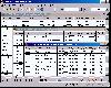
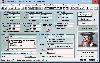 TOPOWIN is a state-wide register of the German Topographic Cartographies, the German Basic Cartography and of localities with geo references in different coordinate systems. It is also a topographic information system. In the division of planning and execution of economical and scientific...
Platforms: Windows, Windows 8, Windows 7, Windows Server
| License: Shareware | Cost: $125.00 USD | Size: 4.56 MB | Download (271): TOPOWIN Download |
Released: September 18, 2012
|
Added: September 18, 2012 | Visits: 467
 DRAGSENS Geo Software is used for the exact position estimation of a towed body, sensor, camera, array or net, dragged behind a ship, aircraft or vehicle. The software allows a real-time estimation of the position of a dragged sensor based on the location of a GPS-receiver. The sensor thereby can...
Platforms: Windows
| License: Shareware | Cost: $825.00 USD | Size: 1.7 MB | Download (405): DRAGSENS Download |
Released: July 26, 2012
|
Added: July 26, 2012 | Visits: 436
 ORTWIN is a program for the state-wide inquiry of the localities, postal codes and telephone selections in Germany. It finds postal zip codes, telephone pre selections, coordinates and ground level elevations. The program determines municipal codes, local center points, car license codes,...
Platforms: Windows
| License: Shareware | Cost: $155.00 USD | Size: 4.81 MB | Download (57): ORTWIN (English) Download |
Added: October 25, 2010 | Visits: 973
Geo::Coordinates::VandH is a Perl module that can convert and manipulate telco V and H coordinates. SYNOPSIS To convert V: 5498 H: 2895 to lat/long coordinates: use Geo::Coordinates::VandH; $blah=new Geo::Coordinates::VandH; ($lat,$lon) = $blah->vh2ll(5498,2895); printf...
Platforms: *nix
| License: Freeware | Size: 4.1 KB | Download (115): Geo::Coordinates::VandH Download |