


Gis Practictioners freeware
Gis Practictioners
Released: June 15, 2012
|
Added: June 15, 2012 | Visits: 370
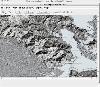
 Provide the building blocks for a GIS system consistent with the current standards from OGIS
Platforms: Windows, Mac, Linux
Provide the building blocks for a GIS system consistent with the current standards from OGIS
Platforms: Windows, Mac, Linux
| License: Freeware | Size: 9.43 MB | Download (52): Geographical Information System Toolkit Download |
Released: July 04, 2012
|
Added: July 04, 2012 | Visits: 426
 Geomajas is a web mapping GIS software with full vectorial editing capabilities, and support for custom attribute relation models in the browser. It has built-in support for any type of query, selection, filtering, snapping, printing, ...
Platforms: Windows, Mac, Linux
Geomajas is a web mapping GIS software with full vectorial editing capabilities, and support for custom attribute relation models in the browser. It has built-in support for any type of query, selection, filtering, snapping, printing, ...
Platforms: Windows, Mac, Linux
| License: Freeware | Size: 44.96 MB | Download (46): Geomajas Download |
Released: July 24, 2012
|
Added: July 24, 2012 | Visits: 261
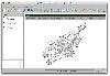
 GeoTech is a GIS based on Eclipse RCP. It uses OpenGL for visualization.
Platforms: Windows, Mac, Linux
GeoTech is a GIS based on Eclipse RCP. It uses OpenGL for visualization.
Platforms: Windows, Mac, Linux
| License: Freeware | Size: 18.55 MB | Download (45): GeoTech Download |
Released: August 07, 2012
|
Added: August 07, 2012 | Visits: 425
GIS Facility Managment module for Grass GIS system
Platforms: Windows, Mac, Linux
| License: Freeware | Size: 27.25 KB | Download (48): GIS_FM for Grass Download |
Released: July 10, 2012
|
Added: July 10, 2012 | Visits: 264
Gis editor, for two persons edit the same shapefile at the same time. Developed with GeoTools.
Platforms: Windows, Mac, Linux
| License: Freeware | Size: 9.82 KB | Download (46): GisDual-edit Download |
Released: July 21, 2012
|
Added: July 21, 2012 | Visits: 209
GISpatialNet is a Java-based GIS tool for mapping characteristic relations to spatial relations.
Platforms: Windows, Mac, Linux
| License: Freeware | Size: 50.34 MB | Download (45): GISpatialNet Download |
Released: July 06, 2012
|
Added: July 06, 2012 | Visits: 443
 The Community Edition (gvSIG CE) is a branch of the gvSIG desktop GIS project at www.gvsig.org. It is open to external contributors and serves as a testbed for community-supplied bug fixes and enhancements.
Platforms: Windows, Mac, Linux
The Community Edition (gvSIG CE) is a branch of the gvSIG desktop GIS project at www.gvsig.org. It is open to external contributors and serves as a testbed for community-supplied bug fixes and enhancements.
Platforms: Windows, Mac, Linux
| License: Freeware | Size: 189.19 MB | Download (45): gvSIG Community Edition Download |
Released: July 09, 2012
|
Added: July 09, 2012 | Visits: 361
Heart (Hydrological and Environmental Analysis and Reporting Tool) is a raster-based GIS-like app for the analysis of hydrological parameters and the generation of associated reports.
Platforms: Windows, Mac, Linux
| License: Freeware | Size: 4.63 MB | Download (44): Heart Download |
Released: December 17, 2012
|
Added: December 17, 2012 | Visits: 375
 HidroSIG is a GIS that supports raster and vectorial maps with modules oriented to the hydrological analysis, time series, remote sensing and more. It has been made 100% in java using VisAD for data visualization and using MySQL to storage all data.
Platforms: Windows, Mac, Linux
HidroSIG is a GIS that supports raster and vectorial maps with modules oriented to the hydrological analysis, time series, remote sensing and more. It has been made 100% in java using VisAD for data visualization and using MySQL to storage all data.
Platforms: Windows, Mac, Linux
| License: Freeware | Size: 151.22 MB | Download (48): HidroSIG Download |
Released: September 10, 2012
|
Added: September 10, 2012 | Visits: 216
jGisTools is a Java library aiming to provide tools for visualizing GIS data in Java applications.
Platforms: Windows, Mac, Linux
| License: Freeware | Size: 6.72 MB | Download (47): jGISTools Download |
Released: July 21, 2012
|
Added: July 21, 2012 | Visits: 421
The JUMP DB Query Plugin is an extension for the OpenJUMP GIS platform that allows OpenJUMP users to give arbitrary database queries to retrieve and display geographic feature sets.
Platforms: Windows, Mac, Linux
| License: Freeware | Size: 484.36 KB | Download (46): JUMP Database Query Plugin Download |
Released: October 02, 2012
|
Added: October 02, 2012 | Visits: 419
 Musmap is a web interface to UMN mapserver. It provides users and profiles management, advanced queries and selections, automatic decodification of columns with joins, easy-to-use configuration (colors, ...)... and so on.
Platforms: Windows, Mac, Linux
Musmap is a web interface to UMN mapserver. It provides users and profiles management, advanced queries and selections, automatic decodification of columns with joins, easy-to-use configuration (colors, ...)... and so on.
Platforms: Windows, Mac, Linux
| License: Freeware | Size: 343.4 KB | Download (49): Musmap - a web GIS software Download |
Released: September 17, 2012
|
Added: September 17, 2012 | Visits: 682
 Open Source Remote Sensing OSSIM project, pronounced 'awesome', will leverage existing algorithms/tools/packages from the open source community in construction of the ultimate Remote Sensing/Image Processing/GIS package. osgPlanet extends OSSIM and Op
Platforms: Windows, Mac, Solaris, Linux
Open Source Remote Sensing OSSIM project, pronounced 'awesome', will leverage existing algorithms/tools/packages from the open source community in construction of the ultimate Remote Sensing/Image Processing/GIS package. osgPlanet extends OSSIM and Op
Platforms: Windows, Mac, Solaris, Linux
| License: Freeware | Size: 42.61 MB | Download (67): OSSIM - Open Source Software Image Map Download |
Released: September 17, 2012
|
Added: September 17, 2012 | Visits: 393
This project provides a set of php classes providing an easy way to connect to an ArcIMS server (GIS mapping and feature server from ESRI). It's the equivalent to the ASP/JSP connector that come with the product. It also provides two out-of-the-box vie
Platforms: Windows, Mac, Linux
| License: Freeware | Size: 135.43 KB | Download (46): phpArcIMS Download |
Released: November 01, 2012
|
Added: November 01, 2012 | Visits: 321
 PIHMgis is a tightly-coupled GIS interface to Penn State Integrated Hydrologic Model (PIHM). It is open source, platform independent and extensible. The tightly-coupled integrated GIS interface to PIHM has been created in the Open Source QGIS
Platforms: Windows, Mac, Linux
PIHMgis is a tightly-coupled GIS interface to Penn State Integrated Hydrologic Model (PIHM). It is open source, platform independent and extensible. The tightly-coupled integrated GIS interface to PIHM has been created in the Open Source QGIS
Platforms: Windows, Mac, Linux
| License: Freeware | Size: 107.98 MB | Download (49): PIHMgis Download |
Released: August 24, 2012
|
Added: August 24, 2012 | Visits: 417
PyOGCLib is a package of classes that implement specifications of the Open GIS Consortium (OGC), allowing Python applications to spatially plug-and-play with other geoprocessing systems.
Platforms: Windows, Mac, Linux
| License: Freeware | Size: 19.79 KB | Download (47): PyOGCLib Download |
Released: December 24, 2012
|
Added: December 24, 2012 | Visits: 501
The remote sensing and GIS library is a set of C++ libraries and commands for the processing of spatial data (raster, vector and point cloud). Functionality is available through an XML interface, ideal for batch processing. Visit www.rsgislib.org
Platforms: Mac, BSD, Linux
| License: Freeware | Size: 1.55 MB | Download (52): RSGISLib Download |
Released: November 25, 2012
|
Added: November 25, 2012 | Visits: 570
 Web-based AJAX tool for creating diagrams of icons and links between them. Features include Google Maps & Google Earth integration, configurable tool palettes, and automated palette generation from a Google Local query.
Platforms: Windows, Mac, Linux
Web-based AJAX tool for creating diagrams of icons and links between them. Features include Google Maps & Google Earth integration, configurable tool palettes, and automated palette generation from a Google Local query.
Platforms: Windows, Mac, Linux
| License: Freeware | Size: 263.33 KB | Download (47): Smoot: Web-based diagram and GIS tool Download |
Released: August 14, 2012
|
Added: August 14, 2012 | Visits: 326
 TreeSap introduces simple yet powerful qualitative querying:rather than specifying a query using numerical measurements ('within 5km') english phrases are used ('near'). In-built fuzzy logic handles vagueness producing results with weighted relevance
Platforms: Windows, Mac, BSD, Linux
TreeSap introduces simple yet powerful qualitative querying:rather than specifying a query using numerical measurements ('within 5km') english phrases are used ('near'). In-built fuzzy logic handles vagueness producing results with weighted relevance
Platforms: Windows, Mac, BSD, Linux
| License: Freeware | Size: 12.19 MB | Download (44): TreeSap - Qualitative Reasoning GIS Download |
Released: December 18, 2012
|
Added: December 18, 2012 | Visits: 402
Tools for creating interactive svg maps from GIS data
Platforms: Windows, Mac, Linux
| License: Freeware | Size: 80.86 KB | Download (49): VectorGIS Download |