


Autodesk Raster freeware
Autodesk Raster
Released: July 22, 2012
|
Added: July 22, 2012 | Visits: 749
 Can be used for extraction of the raster images from PDF files, and saving them to a disk, or converting them to numerous graphic formats including EPS, JPG, GIF, TIFF, PICT, PNG, BMP, and SGI. The product provides you with the easy and convenient way of navigating through images in the image...
Platforms: Mac
Can be used for extraction of the raster images from PDF files, and saving them to a disk, or converting them to numerous graphic formats including EPS, JPG, GIF, TIFF, PICT, PNG, BMP, and SGI. The product provides you with the easy and convenient way of navigating through images in the image...
Platforms: Mac
| License: Freeware | Size: 3.3 MB | Download (373): PDF Image Extractor for Mac OS Download |
Released: November 04, 2012
|
Added: November 04, 2012 | Visits: 586
The perfect application for vector drawings, diagrams, illustrations, raster image handling, filtering and color correction, offering everything users need to create professional level vector artwork, such as posters, brochures, stickers, logos, web design, tshirts and more.
- Improved latest...
Platforms: Mac
| License: Freeware | Size: 5.1 MB | Download (467): VectorDesigner for Mac OS Download |
Released: July 01, 2012
|
Added: July 01, 2012 | Visits: 503
A very affordable solution for the boater that wants to take the Mac aboard for real-time display of position on full color marine raster format BSB and Softcharts. Plug your GPS into your Mac and watch as your boat moves along in real-time, plotting a track behind the boat and logging your...
Platforms: Mac
| License: Freeware | Size: 1.5 MB | Download (45): GPSNavX for Mac OS Download |
Released: July 04, 2012
|
Added: July 04, 2012 | Visits: 354
 What is OpenEV?
OpenEV is a software library and application for viewing and analysing raster and vector geospatial data.
OpenEV is used by private companies, universities, governments and non-profit organizations around the world. OpenEV is both:
* An application for displaying and...
Platforms: Windows
What is OpenEV?
OpenEV is a software library and application for viewing and analysing raster and vector geospatial data.
OpenEV is used by private companies, universities, governments and non-profit organizations around the world. OpenEV is both:
* An application for displaying and...
Platforms: Windows
| License: Freeware | Size: 13.5 MB | Download (46): OpenEV for Windows Download |
Released: October 10, 2012
|
Added: October 10, 2012 | Visits: 369
 What is OpenEV?
OpenEV is a software library and application for viewing and analysing raster and vector geospatial data.
OpenEV is used by private companies, universities, governments and non-profit organizations around the world. OpenEV is both:
* An application for displaying and...
Platforms: Linux
What is OpenEV?
OpenEV is a software library and application for viewing and analysing raster and vector geospatial data.
OpenEV is used by private companies, universities, governments and non-profit organizations around the world. OpenEV is both:
* An application for displaying and...
Platforms: Linux
| License: Freeware | Size: 25 MB | Download (44): OpenEV for Linux Download |
Released: September 15, 2012
|
Added: September 15, 2012 | Visits: 423
maxmpeg4exporter was designed as an Open Source exporter plugin for Autodesk 3ds Max.
Now you will be able to export your 3D graphics into the MPEG-4 format. The MPEG-4 format allows compression of 3D data and media and their encapsulation into one common format.
Platforms: Windows
| License: Freeware | Download (45): maxmpeg4exporter Download |
Released: September 09, 2012
|
Added: September 09, 2012 | Visits: 920
Most CAD (computer aided design) systems and desktop publishing programs have the ability to read and write AutoDesk's DXF (Drawing Exchange Format) vector-based files. AutoCAD DXF is an open industry standard for the exchange of CAD drawings. DXF Converter allows to import DXF files to VGEdit...
Platforms: Windows
| License: Freeware | Size: 9.98 MB | Download (61): DXF Import/Export Converter Download |
Released: October 11, 2012
|
Added: October 11, 2012 | Visits: 778
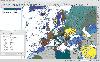 QGIS supports vector, raster, and database formats and lets you browse and create map data on your computer.
Quantum GIS (QGIS) supports many common spatial data formats (e.g. ESRI ShapeFile, geotiff). QGIS supports plugins to do things like display tracks from your GPS.
QGIS aims to be an...
Platforms: Windows
QGIS supports vector, raster, and database formats and lets you browse and create map data on your computer.
Quantum GIS (QGIS) supports many common spatial data formats (e.g. ESRI ShapeFile, geotiff). QGIS supports plugins to do things like display tracks from your GPS.
QGIS aims to be an...
Platforms: Windows
| License: Freeware | Size: 77.3 MB | Download (453): Quantum GIS Download |
Released: July 09, 2012
|
Added: July 09, 2012 | Visits: 361
Heart (Hydrological and Environmental Analysis and Reporting Tool) is a raster-based GIS-like app for the analysis of hydrological parameters and the generation of associated reports.
Platforms: Windows, Mac, Linux
| License: Freeware | Size: 4.63 MB | Download (44): Heart Download |
Released: December 17, 2012
|
Added: December 17, 2012 | Visits: 375
 HidroSIG is a GIS that supports raster and vectorial maps with modules oriented to the hydrological analysis, time series, remote sensing and more. It has been made 100% in java using VisAD for data visualization and using MySQL to storage all data.
Platforms: Windows, Mac, Linux
HidroSIG is a GIS that supports raster and vectorial maps with modules oriented to the hydrological analysis, time series, remote sensing and more. It has been made 100% in java using VisAD for data visualization and using MySQL to storage all data.
Platforms: Windows, Mac, Linux
| License: Freeware | Size: 151.22 MB | Download (48): HidroSIG Download |
Released: November 19, 2012
|
Added: November 19, 2012 | Visits: 539
Img2Eps is image converter written in Java which converts raster images into EPS (Encapsulated Post Script). It supports simple lossless compression, so the generated EPS images are quite small. Generates PostScript Language Level 2.
Platforms: Windows, Mac, Linux
| License: Freeware | Size: 13.53 KB | Download (56): Img2Eps converter Download |
Released: December 18, 2012
|
Added: December 18, 2012 | Visits: 526
importvtk is a C++ plugin to import VTK dataset files into the Autodesk Maya 3D environment. The datasets are imported into specific Maya containers such as Particle, Fluid, Mesh and Curve. importvtk is accessible in the Maya Embedded Language (MEL).
Platforms: Windows, Mac, Linux
| License: Freeware | Size: 487.71 KB | Download (52): importvtk Maya Plugin Download |
Released: August 09, 2012
|
Added: August 09, 2012 | Visits: 207
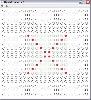 JRasterCreator allows you to easily & visually build a raster file for the mass spectrometry instrument Bruker Daltonics MS ultraflex II by clicking on various spots/locations.
Platforms: Windows, Mac, Linux
JRasterCreator allows you to easily & visually build a raster file for the mass spectrometry instrument Bruker Daltonics MS ultraflex II by clicking on various spots/locations.
Platforms: Windows, Mac, Linux
| License: Freeware | Size: 17.88 KB | Download (49): JRasterCreator Download |
Released: October 19, 2012
|
Added: October 19, 2012 | Visits: 450
KMLMapServer turns any UMN MapServer installation in a flexible KML vector and raster data server. Dynamically serve your MapServer data straight into Google Earth.
Platforms: Windows, Mac, Linux
| License: Freeware | Size: 25.03 KB | Download (44): KML Map Server Download |
Released: September 23, 2012
|
Added: September 23, 2012 | Visits: 360
 A Java application to request calibrated raster maps from compatible web based map servers, and then save the maps in OziExplorer (.map) format.
Platforms: Windows, Mac, Linux
A Java application to request calibrated raster maps from compatible web based map servers, and then save the maps in OziExplorer (.map) format.
Platforms: Windows, Mac, Linux
| License: Freeware | Size: 70.47 KB | Download (45): MapRequest Download |
Released: October 21, 2012
|
Added: October 21, 2012 | Visits: 403
PyPotrace is a Python programming language binding for Peter Selinger's Potrace raster to vector conversion algorithm. No separate Potrace library or application required!
Platforms: Windows, Mac, Linux
| License: Freeware | Size: 1.58 MB | Download (47): PyPotrace Download |
Released: December 24, 2012
|
Added: December 24, 2012 | Visits: 501
The remote sensing and GIS library is a set of C++ libraries and commands for the processing of spatial data (raster, vector and point cloud). Functionality is available through an XML interface, ideal for batch processing. Visit www.rsgislib.org
Platforms: Mac, BSD, Linux
| License: Freeware | Size: 1.55 MB | Download (52): RSGISLib Download |
Added: September 06, 2013 | Visits: 413
Teem is a coordinated group of libraries for representing, processing, and visualizing scientific raster data. Teem includes command-line tools that permit the library functions to be quickly applied to files and streams, without having to write any code. The most important and useful libraries...
Platforms: *nix
| License: Freeware | Size: 1.49 MB | Download (43): Teem Download |
Released: September 01, 2012
|
Added: September 01, 2012 | Visits: 286
ThanCad is a 2dimensional cad, with limited 3d support and raster inclusion capability and emphasis in engineering. It is being written in Python and since it uses the Tkinter library, it is platform independent.
Platforms: Windows, Mac, Linux
| License: Freeware | Size: 1.81 MB | Download (50): ThanCad Download |
Released: December 19, 2012
|
Added: December 19, 2012 | Visits: 648
PolarView is an efficient cross platform ENC chart planner. It supports ENC charts in S57 format (available from NOAA), raster charts in BSB format, as well as world wide standard S63 vector charts. PolarView includes Tides and Currents display, using the industry-standard TCD tide database...
Platforms: Mac
| License: Freeware | Size: 6.2 MB | Download (64): PolarView Download |