


Trimble software
Trimble
Released: November 10, 2007
|
Added: November 20, 2007 | Visits: 6.096
 Geocode digital images with latitude, longitude, altitude, and direction information. RoboGEO stamps this information onto the actual photo or writes it to the EXIF headers, allowing you to permanently geotag and link your photos to the GPS coordinates. All writing to the EXIF and IPTC headers...
Platforms: Windows
Geocode digital images with latitude, longitude, altitude, and direction information. RoboGEO stamps this information onto the actual photo or writes it to the EXIF headers, allowing you to permanently geotag and link your photos to the GPS coordinates. All writing to the EXIF and IPTC headers...
Platforms: Windows
| License: Demo | Cost: $39.95 USD | Size: 8.28 MB | Download (1179): RoboGEO Download |
Added: January 25, 2010 | Visits: 859
 GPSy is a sophisticated Macintosh GPS communications and GIS mapping program. GPSy connects your Macintosh to a broad range of Global Positioning System (GPS) navigational units and has advanced mapping, logging, and data transfer features. GPSy has extensive support for USGS DRG topo maps,...
Platforms: Mac
GPSy is a sophisticated Macintosh GPS communications and GIS mapping program. GPSy connects your Macintosh to a broad range of Global Positioning System (GPS) navigational units and has advanced mapping, logging, and data transfer features. GPSy has extensive support for USGS DRG topo maps,...
Platforms: Mac
| License: Demo | Cost: $0.00 USD | Download (104): GPSy Download |
Released: September 10, 2013
|
Added: October 03, 2013 | Visits: 1.135
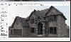 Raylectron is an easy, fast and powerful Sketchup render and animation plugin. It does not need any editing by other graphic software (such as Photoshop) to produce photorealistic renders. You can virtually create rendered images of any size. It provide the user with 4 different rendering mode....
Platforms: Windows
Raylectron is an easy, fast and powerful Sketchup render and animation plugin. It does not need any editing by other graphic software (such as Photoshop) to produce photorealistic renders. You can virtually create rendered images of any size. It provide the user with 4 different rendering mode....
Platforms: Windows
| License: Shareware | Cost: $149.95 USD | Size: 5.78 MB | Download (118): Raylectron Download |
Added: October 27, 2013 | Visits: 813
OpenGTS??a*zNz ("Open GPS Tracking System") is the first available open source project designed specifically to provide web-based GPS tracking services for a "fleet" of vehicles. To date, OpenGTS??a*zNz has been downloaded and put to use in over 90 countries around the world to track many 1000's...
Platforms: Mac
| License: Freeware | Size: 3.97 MB | Download (44): OpenGTS Download |
Released: June 20, 2021
|
Added: August 04, 2021 | Visits: 943
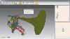 Import, export & convert between different 3D file formats including STL (Stereolithography), OFF (Object File Format), OBJ (Alias Wavefront Object), 3DS (3D-Studio File Format), IV (Inventor File), SAT (Standard ACIS Text), PLY (Stanford Polygon Format), VRML (Virtual Reality), 3DM (Rhinoceros...
Platforms: Windows, Windows 8, Windows 7, Windows Server
Import, export & convert between different 3D file formats including STL (Stereolithography), OFF (Object File Format), OBJ (Alias Wavefront Object), 3DS (3D-Studio File Format), IV (Inventor File), SAT (Standard ACIS Text), PLY (Stanford Polygon Format), VRML (Virtual Reality), 3DM (Rhinoceros...
Platforms: Windows, Windows 8, Windows 7, Windows Server
| License: Shareware | Cost: $74.50 USD | Size: 35.92 MB | Download (155): Autoconverter x64 Download |