


Surveying software
Surveying
Released: September 27, 2009
|
Added: October 01, 2009 | Visits: 2.207
 There is not any professional program on internet like this and you can get it without any effort. I think this could be a handicap because it's dificult to believe, but it's true; try it and you'll be surprised.
It's not only a program to calculate a delaunay triangulation but you can input...
Platforms: Windows
There is not any professional program on internet like this and you can get it without any effort. I think this could be a handicap because it's dificult to believe, but it's true; try it and you'll be surprised.
It's not only a program to calculate a delaunay triangulation but you can input...
Platforms: Windows
| License: Freeware | Size: 12.28 MB | Download (307): LanDTM Download |
Added: August 20, 2010 | Visits: 1.347
 Check Your Network Address Translator for Compatibility with Peer-to-Peer Protocols. If you are accessing the Internet from behind a Network Address Translator (NAT) of some kind, I would appreciate your help in surveying the behavior of different NATs, in terms of how and whether they support a...
Platforms: *nix
Check Your Network Address Translator for Compatibility with Peer-to-Peer Protocols. If you are accessing the Internet from behind a Network Address Translator (NAT) of some kind, I would appreciate your help in surveying the behavior of different NATs, in terms of how and whether they support a...
Platforms: *nix
| License: Freeware | Download (195): NAT Check Download |
Added: October 24, 2010 | Visits: 1.368
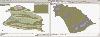
Libgeotiff is a public domain library normally hosted on top of libtiff for writing, and reading GeoTIFF information tags. GeoTIFF represents an effort by over 160 different remote sensing, GIS, cartographic, and surveying related companies and organizations to establish a TIFF based...
Platforms: *nix
| License: Freeware | Size: 819.2 KB | Download (306): libgeotiff Download |
Released: November 17, 2009
|
Added: April 17, 2010 | Visits: 2.527
 CopanMobile for Pocket PC is a very functional and easy-to-use geomatics engineering tool for computing and managing plane surveying and mapping coordinates.
It does numerous coordinate geometry (COGO) calculations, processes and adjusts raw field survey data, computes and adjusts map...
Platforms: Pocket PC, Windows
CopanMobile for Pocket PC is a very functional and easy-to-use geomatics engineering tool for computing and managing plane surveying and mapping coordinates.
It does numerous coordinate geometry (COGO) calculations, processes and adjusts raw field survey data, computes and adjusts map...
Platforms: Pocket PC, Windows
| License: Freeware | Size: 662.68 KB | Download (1153): CopanMobile for PocketPC Download |
Released: October 15, 2010
|
Added: November 13, 2010 | Visits: 1.263
 Civil Survey AutoCAD Clone Software, no learning curve for AutoCAD users, Natively reads and writes AutoCAD DWG files, no need for conversion! Includes Data Colector File Import, COGO, Contours, DTM, Road Design, Sections and Profiles. low-cost alternative to otherwise high priced Land survey,...
Platforms: Windows
Civil Survey AutoCAD Clone Software, no learning curve for AutoCAD users, Natively reads and writes AutoCAD DWG files, no need for conversion! Includes Data Colector File Import, COGO, Contours, DTM, Road Design, Sections and Profiles. low-cost alternative to otherwise high priced Land survey,...
Platforms: Windows
| License: Shareware | Cost: $999.00 USD | Size: 1.66 MB | Download (173): progeEARTH Land Development Suite Download |
Released: April 13, 2011
|
Added: April 23, 2011 | Visits: 1.130
 FrontFace for Business allows you to directly and precisely distribute important information or notifications from various sources such as RSS feeds, SharePoint, Intranet, e-mail accounts, Twitter accounts or instant messaging (IM) applications in real time to the users' computers. Based on the...
Platforms: Windows
FrontFace for Business allows you to directly and precisely distribute important information or notifications from various sources such as RSS feeds, SharePoint, Intranet, e-mail accounts, Twitter accounts or instant messaging (IM) applications in real time to the users' computers. Based on the...
Platforms: Windows
| License: Shareware | Cost: $279.95 USD | Size: 6.82 MB | Download (105): FrontFace for Business Download |
Released: January 10, 2012
|
Added: February 04, 2012 | Visits: 1.171
 Copan Pro -- for Windows 98, NT, 2000, ME, XP, Vista, or 7 -- is a very functional and easy-to-use desktop/netbook geomatics engineering tool for computing and managing plane land surveying and mapping coordinates, and drafting survey maps and plans.
It does numerous coordinate geometry...
Platforms: Windows
Copan Pro -- for Windows 98, NT, 2000, ME, XP, Vista, or 7 -- is a very functional and easy-to-use desktop/netbook geomatics engineering tool for computing and managing plane land surveying and mapping coordinates, and drafting survey maps and plans.
It does numerous coordinate geometry...
Platforms: Windows
| License: Demo | Cost: $650.00 USD | Size: 8.78 MB | Download (126): Copan Pro Download |
Released: September 01, 2012
|
Added: July 21, 2013 | Visits: 842
 TRIANGULATION, ISOLINES, VOLUME, LOADING of XYZ points files, 3DINTERSECTION, cross sections and a longitudinal profile, color-filled contour map; 7 functions for IntelliCAD versions which can load SDS applications (dll).
TRIANGULATION performs the triangulation of a set of 3D points with...
Platforms: Windows
TRIANGULATION, ISOLINES, VOLUME, LOADING of XYZ points files, 3DINTERSECTION, cross sections and a longitudinal profile, color-filled contour map; 7 functions for IntelliCAD versions which can load SDS applications (dll).
TRIANGULATION performs the triangulation of a set of 3D points with...
Platforms: Windows
| License: Shareware | Cost: $36.00 USD | Size: 587 KB | Download (94): TRIANGULATION for IntelliCAD Download |
Released: November 16, 2012
|
Added: November 16, 2012 | Visits: 494
 The goal of VTP is to foster the creation of tools for easily constructing any part of the real world in interactive, 3D digital form.
This goal will require a synergetic convergence of the fields of CAD, GIS, visual simulation, surveying and remote sensing. VTP gathers information and tracks...
Platforms: Mac, Linux
The goal of VTP is to foster the creation of tools for easily constructing any part of the real world in interactive, 3D digital form.
This goal will require a synergetic convergence of the fields of CAD, GIS, visual simulation, surveying and remote sensing. VTP gathers information and tracks...
Platforms: Mac, Linux
| License: Freeware | Size: 2.2 MB | Download (492): Virtual Terrain Project for Mac OS X and Linux Download |
Released: June 18, 2012
|
Added: June 18, 2012 | Visits: 479
 The goal of VTP is to foster the creation of tools for easily constructing any part of the real world in interactive, 3D digital form.
This goal will require a synergetic convergence of the fields of CAD, GIS, visual simulation, surveying and remote sensing. VTP gathers information and tracks...
Platforms: Windows
The goal of VTP is to foster the creation of tools for easily constructing any part of the real world in interactive, 3D digital form.
This goal will require a synergetic convergence of the fields of CAD, GIS, visual simulation, surveying and remote sensing. VTP gathers information and tracks...
Platforms: Windows
| License: Freeware | Size: 1024 KB | Download (420): Virtual Terrain Project for Windows Download |
Released: July 16, 2012
|
Added: July 16, 2012 | Visits: 590
 A questtion for a lot of sportsmen during planing their trainings task: There are a lot of difficult and complicated ways to find out the distance - MyWay provides an easy and comfortable solution to investigate the distance:scan the map of your training area and measure the route by clicking on...
Platforms: Windows
A questtion for a lot of sportsmen during planing their trainings task: There are a lot of difficult and complicated ways to find out the distance - MyWay provides an easy and comfortable solution to investigate the distance:scan the map of your training area and measure the route by clicking on...
Platforms: Windows
| License: Shareware | Cost: $15.00 USD | Size: 7.15 MB | Download (456): MyWay Download |
Released: July 17, 2012
|
Added: July 17, 2012 | Visits: 691
 Draft Survey and Lashing calculations Marine Software Bundle is a user-friendly Draught Survey calculation program for Ships' Officers and Marine Surveyors. It is easily operated using either Keyboard or Mouse. Marine Software Bundle complies with the latest UN ECE standards for Draught Surveying...
Platforms: Windows
Draft Survey and Lashing calculations Marine Software Bundle is a user-friendly Draught Survey calculation program for Ships' Officers and Marine Surveyors. It is easily operated using either Keyboard or Mouse. Marine Software Bundle complies with the latest UN ECE standards for Draught Surveying...
Platforms: Windows
| License: Shareware | Cost: $199.95 USD | Size: 7.59 MB | Download (57): Marine Software Bundle Download |
Released: August 18, 2012
|
Added: August 18, 2012 | Visits: 565
 Create your own online questionnaire and have the answers automatically emailed to you.
Platforms: Windows
Create your own online questionnaire and have the answers automatically emailed to you.
Platforms: Windows
| License: Shareware | Cost: $19.99 USD | Size: 757.76 KB | Download (49): Create Online Surveys Software Download |
Released: August 04, 2012
|
Added: August 04, 2012 | Visits: 615
 Draft Survey and Lashing calculations
Marine Software Bundle is a user-friendly Draught Survey calculation program for Ships' Officers and Marine Surveyors. It is easily operated using either Keyboard or Mouse. Marine Software Bundle complies with the latest UN ECE standards for Draught Surveying...
Platforms: Windows
Draft Survey and Lashing calculations
Marine Software Bundle is a user-friendly Draught Survey calculation program for Ships' Officers and Marine Surveyors. It is easily operated using either Keyboard or Mouse. Marine Software Bundle complies with the latest UN ECE standards for Draught Surveying...
Platforms: Windows
| License: Shareware | Cost: $99.95 USD | Size: 5.44 MB | Download (49): Marine Software Bundle Vista Edition Download |
Released: June 10, 2012
|
Added: June 10, 2012 | Visits: 633
 Maritime Software Suite is a user-friendly Draft Survey, Lashing Calculations and Route Planning software for Ships' Officers and Marine Surveyors. Maritime Software Suite is easily operated using either Keyboard or Mouse. It complies with the latest UN ECE standards and MSC "Code of Safe...
Platforms: Windows
Maritime Software Suite is a user-friendly Draft Survey, Lashing Calculations and Route Planning software for Ships' Officers and Marine Surveyors. Maritime Software Suite is easily operated using either Keyboard or Mouse. It complies with the latest UN ECE standards and MSC "Code of Safe...
Platforms: Windows
| License: Shareware | Cost: $199.95 USD | Size: 6.62 MB | Download (490): MaritimeSoftware Suite Download |
Released: October 16, 2012
|
Added: October 16, 2012 | Visits: 661
 Dicom calculates, converts and computes. The first ever computing tool that deals with dimensions of physical quantities in mathematical expression, Dicom, has the answer to expression like: 30 mi./h.+6 ft./s.+15.24 m./s. to ft./s. Dicom can evaluate expressions anywhere in a rich text formatted...
Platforms: Windows
Dicom calculates, converts and computes. The first ever computing tool that deals with dimensions of physical quantities in mathematical expression, Dicom, has the answer to expression like: 30 mi./h.+6 ft./s.+15.24 m./s. to ft./s. Dicom can evaluate expressions anywhere in a rich text formatted...
Platforms: Windows
| License: Freeware | Size: 2.48 MB | Download (511): Dicom Unit Aware Calculator Download |
Released: May 16, 2013
|
Added: March 08, 2014 | Visits: 908
 Technical Dictionary English to Dutch 170685 entries/translations in Excel or Access- Format. Vocabulary from the fields of electrical engineering, engeneering, automotive, automation, electronics, mechanical , engineering, instrumentation, engineering in general, computer science, space,...
Platforms: Windows
Technical Dictionary English to Dutch 170685 entries/translations in Excel or Access- Format. Vocabulary from the fields of electrical engineering, engeneering, automotive, automation, electronics, mechanical , engineering, instrumentation, engineering in general, computer science, space,...
Platforms: Windows
| License: Demo | Cost: $0.00 USD | Size: 356 KB | Download (60): Technical Dictionary English Dutch Download |
Released: May 16, 2013
|
Added: March 09, 2014 | Visits: 740
 Technical Dictionary Dutch to English 138949 entries/translations in Excel or Access- Format. Vocabulary from the fields of electrical engineering, engeneering, automotive, automation, electronics, mechanical , engineering, instrumentation, engineering in general, computer science, space,...
Platforms: Windows
Technical Dictionary Dutch to English 138949 entries/translations in Excel or Access- Format. Vocabulary from the fields of electrical engineering, engeneering, automotive, automation, electronics, mechanical , engineering, instrumentation, engineering in general, computer science, space,...
Platforms: Windows
| License: Demo | Cost: $0.00 USD | Size: 356 KB | Download (65): Technical Dictionary Dutch English Download |
Released: November 06, 2012
|
Added: November 06, 2012 | Visits: 561
3D Photo Screensavers bring you a new dimension in presenting pictures and 3D scenes. In Egypt, ancient civilization began around 3000 BC under the first Pharaoh and it developed over the next three millennia. Later, the civilization of ancient Egypt entered a period of slow decline during which...
Platforms: Windows
| License: Shareware | Cost: $9.95 USD | Size: 11.8 MB | Download (52): Ancient Egypt 3D Screensaver Download |
Released: June 01, 2012
|
Added: June 01, 2012 | Visits: 446
 The goal of VTP is to foster the creation of tools for easily constructing any part of the real world in interactive, 3D digital form.
This goal will require a synergetic convergence of the fields of CAD, GIS, visual simulation, surveying and remote sensing. VTP gathers information and tracks...
Platforms: Mac, Linux
The goal of VTP is to foster the creation of tools for easily constructing any part of the real world in interactive, 3D digital form.
This goal will require a synergetic convergence of the fields of CAD, GIS, visual simulation, surveying and remote sensing. VTP gathers information and tracks...
Platforms: Mac, Linux
| License: Freeware | Size: 2.2 MB | Download (422): Virtual Terrain Project for Mac OS X and Linux 1.1 Download |