


Surveying freeware
Surveying
Released: September 12, 2012
|
Added: September 12, 2012 | Visits: 583
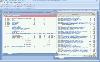
 iPJC is an easy-to-use record keeping system for the land surveying industry. It allows your staff to securely store, retrieve and cross-reference all of your company's survey database records -- of estimates, plans, jobs and contacts -- using your web browsers. It is an open-source system, based...
Platforms: Windows, Mac, Linux, Linux Console, Linux Gnome, Linux GPL, Linux Open Source, Unix
iPJC is an easy-to-use record keeping system for the land surveying industry. It allows your staff to securely store, retrieve and cross-reference all of your company's survey database records -- of estimates, plans, jobs and contacts -- using your web browsers. It is an open-source system, based...
Platforms: Windows, Mac, Linux, Linux Console, Linux Gnome, Linux GPL, Linux Open Source, Unix
| License: Freeware | Size: 6.46 MB | Download (64): iPJC Download |
Released: August 15, 2012
|
Added: August 15, 2012 | Visits: 522
 Copan for Pocket PC is a very functional and easy-to-use geomatics engineering tool for computing and managing plane surveying and mapping coordinates.
It does numerous coordinate geometry (COGO) calculations, processes and adjusts raw field survey data, computes and adjusts map traverse data,...
Copan for Pocket PC is a very functional and easy-to-use geomatics engineering tool for computing and managing plane surveying and mapping coordinates.
It does numerous coordinate geometry (COGO) calculations, processes and adjusts raw field survey data, computes and adjusts map traverse data,...
| License: Freeware | Size: 662 KB | Download (45): Copan for PocketPC Download |
Released: December 19, 2012
|
Added: December 19, 2012 | Visits: 906
Copan for Mobile 6 is a very functional and easy-to-use geomatics engineering tool for computing and managing plane surveying and mapping coordinates.
It does numerous coordinate geometry (COGO) calculations, processes and adjusts raw field survey data, computes and adjusts map traverse data,...
Platforms: Windows
| License: Freeware | Size: 662 KB | Download (56): Copan for Mobile Download |
Released: November 15, 2012
|
Added: November 15, 2012 | Visits: 513
CopanMobile for Palm OS is a very functional and easy-to-use geomatics engineering tool for computing and managing plane surveying and mapping coordinates. It does numerous coordinate geometry (COGO) calculations, processes and adjusts raw field survey data, computes and adjusts map traverse...
Platforms: Palm,OS
| License: Freeware | Size: 341 KB | Download (55): CopanMobile for PalmOS Download |
Released: March 11, 2014
|
Added: September 02, 2014 | Visits: 1.452
 PriMus garantees integrated management of Price Books, Bills of Quantities and Rate Analysis.
The program has specific features to address any kind of Estimating or Quantity surveying issue and is easier and more effective than any other generic spreadsheet software.
With PriMus: Import...
Platforms: Windows, Windows 8
PriMus garantees integrated management of Price Books, Bills of Quantities and Rate Analysis.
The program has specific features to address any kind of Estimating or Quantity surveying issue and is easier and more effective than any other generic spreadsheet software.
With PriMus: Import...
Platforms: Windows, Windows 8
| License: Freeware | Size: 68 MB | Download (50): PriMus Download |
Added: August 03, 2008 | Visits: 913
Abykus is an object-oriented spreadsheet for Windows that adds an exciting new dimension to the classic 'what-if' analysis by allowing complex data types such as matrixes, coordinates, polygons, etc. to be stored in individual cells. Ideally suited for engineering, surveying and other scientific...
Platforms: Windows
| License: Freeware | Size: 573 KB | Download (104): Abykus Download |
Released: May 28, 2010
|
Added: June 04, 2010 | Visits: 2.702
 Copan for Windows desktop/netbook is a very functional and easy-to-use geomatics engineering tool for computing and managing plane land surveying and mapping coordinates.
It does numerous coordinate geometry (COGO) calculations, processes and adjusts raw field survey data, computes and...
Platforms: Windows
Copan for Windows desktop/netbook is a very functional and easy-to-use geomatics engineering tool for computing and managing plane land surveying and mapping coordinates.
It does numerous coordinate geometry (COGO) calculations, processes and adjusts raw field survey data, computes and...
Platforms: Windows
| License: Freeware | Size: 5.28 MB | Download (824): Copan for Windows Download |
Released: September 27, 2009
|
Added: October 01, 2009 | Visits: 2.207
 There is not any professional program on internet like this and you can get it without any effort. I think this could be a handicap because it's dificult to believe, but it's true; try it and you'll be surprised.
It's not only a program to calculate a delaunay triangulation but you can input...
Platforms: Windows
There is not any professional program on internet like this and you can get it without any effort. I think this could be a handicap because it's dificult to believe, but it's true; try it and you'll be surprised.
It's not only a program to calculate a delaunay triangulation but you can input...
Platforms: Windows
| License: Freeware | Size: 12.28 MB | Download (307): LanDTM Download |
Added: August 20, 2010 | Visits: 1.347
Check Your Network Address Translator for Compatibility with Peer-to-Peer Protocols. If you are accessing the Internet from behind a Network Address Translator (NAT) of some kind, I would appreciate your help in surveying the behavior of different NATs, in terms of how and whether they support a...
Platforms: *nix
| License: Freeware | Download (195): NAT Check Download |
Added: October 24, 2010 | Visits: 1.368
Libgeotiff is a public domain library normally hosted on top of libtiff for writing, and reading GeoTIFF information tags. GeoTIFF represents an effort by over 160 different remote sensing, GIS, cartographic, and surveying related companies and organizations to establish a TIFF based...
Platforms: *nix
| License: Freeware | Size: 819.2 KB | Download (306): libgeotiff Download |
Released: November 17, 2009
|
Added: April 17, 2010 | Visits: 2.527
 CopanMobile for Pocket PC is a very functional and easy-to-use geomatics engineering tool for computing and managing plane surveying and mapping coordinates.
It does numerous coordinate geometry (COGO) calculations, processes and adjusts raw field survey data, computes and adjusts map...
Platforms: Pocket PC, Windows
CopanMobile for Pocket PC is a very functional and easy-to-use geomatics engineering tool for computing and managing plane surveying and mapping coordinates.
It does numerous coordinate geometry (COGO) calculations, processes and adjusts raw field survey data, computes and adjusts map...
Platforms: Pocket PC, Windows
| License: Freeware | Size: 662.68 KB | Download (1153): CopanMobile for PocketPC Download |
Released: November 16, 2012
|
Added: November 16, 2012 | Visits: 494
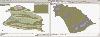
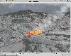
 The goal of VTP is to foster the creation of tools for easily constructing any part of the real world in interactive, 3D digital form.
This goal will require a synergetic convergence of the fields of CAD, GIS, visual simulation, surveying and remote sensing. VTP gathers information and tracks...
Platforms: Mac, Linux
The goal of VTP is to foster the creation of tools for easily constructing any part of the real world in interactive, 3D digital form.
This goal will require a synergetic convergence of the fields of CAD, GIS, visual simulation, surveying and remote sensing. VTP gathers information and tracks...
Platforms: Mac, Linux
| License: Freeware | Size: 2.2 MB | Download (492): Virtual Terrain Project for Mac OS X and Linux Download |
Released: June 18, 2012
|
Added: June 18, 2012 | Visits: 479
 The goal of VTP is to foster the creation of tools for easily constructing any part of the real world in interactive, 3D digital form.
This goal will require a synergetic convergence of the fields of CAD, GIS, visual simulation, surveying and remote sensing. VTP gathers information and tracks...
Platforms: Windows
The goal of VTP is to foster the creation of tools for easily constructing any part of the real world in interactive, 3D digital form.
This goal will require a synergetic convergence of the fields of CAD, GIS, visual simulation, surveying and remote sensing. VTP gathers information and tracks...
Platforms: Windows
| License: Freeware | Size: 1024 KB | Download (420): Virtual Terrain Project for Windows Download |
Released: October 16, 2012
|
Added: October 16, 2012 | Visits: 661
 Dicom calculates, converts and computes. The first ever computing tool that deals with dimensions of physical quantities in mathematical expression, Dicom, has the answer to expression like: 30 mi./h.+6 ft./s.+15.24 m./s. to ft./s. Dicom can evaluate expressions anywhere in a rich text formatted...
Platforms: Windows
Dicom calculates, converts and computes. The first ever computing tool that deals with dimensions of physical quantities in mathematical expression, Dicom, has the answer to expression like: 30 mi./h.+6 ft./s.+15.24 m./s. to ft./s. Dicom can evaluate expressions anywhere in a rich text formatted...
Platforms: Windows
| License: Freeware | Size: 2.48 MB | Download (511): Dicom Unit Aware Calculator Download |
Released: June 01, 2012
|
Added: June 01, 2012 | Visits: 445
 The goal of VTP is to foster the creation of tools for easily constructing any part of the real world in interactive, 3D digital form.
This goal will require a synergetic convergence of the fields of CAD, GIS, visual simulation, surveying and remote sensing. VTP gathers information and tracks...
Platforms: Mac, Linux
The goal of VTP is to foster the creation of tools for easily constructing any part of the real world in interactive, 3D digital form.
This goal will require a synergetic convergence of the fields of CAD, GIS, visual simulation, surveying and remote sensing. VTP gathers information and tracks...
Platforms: Mac, Linux
| License: Freeware | Size: 2.2 MB | Download (422): Virtual Terrain Project for Mac OS X and Linux 1.1 Download |
Released: November 23, 2012
|
Added: November 23, 2012 | Visits: 417
 The goal of VTP is to foster the creation of tools for easily constructing any part of the real world in interactive, 3D digital form.
This goal will require a synergetic convergence of the fields of CAD, GIS, visual simulation, surveying and remote sensing. VTP gathers information and tracks...
Platforms: Windows
The goal of VTP is to foster the creation of tools for easily constructing any part of the real world in interactive, 3D digital form.
This goal will require a synergetic convergence of the fields of CAD, GIS, visual simulation, surveying and remote sensing. VTP gathers information and tracks...
Platforms: Windows
| License: Freeware | Size: 1024 KB | Download (496): Virtual Terrain Project for Windows 1.1 Download |
Released: April 24, 2013
|
Added: September 23, 2013 | Visits: 978
 Complete solution for Motor Surveyor (Free Software for Insurance Surveyor's (Motor))
MSMS helps surveyor to efficiently maintain & store various motor surveying related data.
This saves your time & gives you an accurate business status.
Major Benefits of Motor Survey Management system:...
Platforms: Windows
Complete solution for Motor Surveyor (Free Software for Insurance Surveyor's (Motor))
MSMS helps surveyor to efficiently maintain & store various motor surveying related data.
This saves your time & gives you an accurate business status.
Major Benefits of Motor Survey Management system:...
Platforms: Windows
| License: Freeware | Size: 586 KB | Download (139): MSMS Download |
Released: November 07, 2014
|
Added: November 19, 2014 | Visits: 820
 Importation/Exportation: Import/export trails to gpx file. Unlimited number of trails, and TrackPoints. Export to gpx, Excel, PDF, XPS and KML/KMZ.
Data table: Very flexible data table that allows sorting by columns, with inheritance of data, attributes, etc.
Presentation on map: View...
Platforms: Windows, Windows 8, Windows 7, Windows Server
Importation/Exportation: Import/export trails to gpx file. Unlimited number of trails, and TrackPoints. Export to gpx, Excel, PDF, XPS and KML/KMZ.
Data table: Very flexible data table that allows sorting by columns, with inheritance of data, attributes, etc.
Presentation on map: View...
Platforms: Windows, Windows 8, Windows 7, Windows Server
| License: Freeware | Size: 27.05 MB | Download (611): ediTrail Download |
Released: July 09, 2019
|
Added: July 31, 2019 | Visits: 1.643
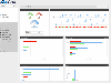
 Revulytics Usage Intelligence, the first solution purpose-built for distributed software on Windows, Macintosh, and Linux platforms, provides deep insight into application usage. See which features are being used and which remain ignored or undiscovered. Advanced reporting lets you filter by...
Platforms: *nix
Revulytics Usage Intelligence, the first solution purpose-built for distributed software on Windows, Macintosh, and Linux platforms, provides deep insight into application usage. See which features are being used and which remain ignored or undiscovered. Advanced reporting lets you filter by...
Platforms: *nix
| License: Freeware | Size: 937 KB | Download (53): Revulytics Usage Intelligence, Linux C++ Download |
Released: July 09, 2019
|
Added: July 30, 2019 | Visits: 1.976
 Revulytics Usage Intelligence, the first solution purpose-built for distributed software on Windows, Macintosh, and Linux platforms, provides deep insight into application usage. See which features are being used and which remain ignored or undiscovered. Advanced reporting lets you filter by...
Platforms: Mac
Revulytics Usage Intelligence, the first solution purpose-built for distributed software on Windows, Macintosh, and Linux platforms, provides deep insight into application usage. See which features are being used and which remain ignored or undiscovered. Advanced reporting lets you filter by...
Platforms: Mac
| License: Freeware | Size: 482 KB | Download (262): Revulytics Usage Intelligence, Mac ObjC Download |