


Longitude And Latitude Map software
Longitude And Latitude Map
Added: July 07, 2010 | Visits: 848
 Fracplanet is an interactive tool for creating random fractal planets and terrain areas with oceans, rivers, lakes and icecaps. The results can be saved in POV-Ray format. The code is licensed under the GPL. Fracplanet project uses Qt and OpenGL. Whats New in This Release: - The main...
Platforms: *nix
| License: Freeware | Size: 68.61 KB | Download (135): Fracplanet Download |
Released: November 17, 2009
|
Added: April 17, 2010 | Visits: 2.522
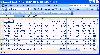
 CopanMobile for Pocket PC is a very functional and easy-to-use geomatics engineering tool for computing and managing plane surveying and mapping coordinates.
It does numerous coordinate geometry (COGO) calculations, processes and adjusts raw field survey data, computes and adjusts map...
CopanMobile for Pocket PC is a very functional and easy-to-use geomatics engineering tool for computing and managing plane surveying and mapping coordinates.
It does numerous coordinate geometry (COGO) calculations, processes and adjusts raw field survey data, computes and adjusts map...
Platforms: Pocket PC, Windows
| License: Freeware | Size: 662.68 KB | Download (1153): CopanMobile for PocketPC Download |
Released: January 10, 2012
|
Added: February 04, 2012 | Visits: 1.164
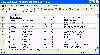
 Copan Pro -- for Windows 98, NT, 2000, ME, XP, Vista, or 7 -- is a very functional and easy-to-use desktop/netbook geomatics engineering tool for computing and managing plane land surveying and mapping coordinates, and drafting survey maps and plans.
It does numerous coordinate geometry...
Copan Pro -- for Windows 98, NT, 2000, ME, XP, Vista, or 7 -- is a very functional and easy-to-use desktop/netbook geomatics engineering tool for computing and managing plane land surveying and mapping coordinates, and drafting survey maps and plans.
It does numerous coordinate geometry...
Platforms: Windows
| License: Demo | Cost: $650.00 USD | Size: 8.78 MB | Download (126): Copan Pro Download |
Released: August 15, 2012
|
Added: August 15, 2012 | Visits: 879
Geodata of the European and International countries offers you municipalities and postal codes. Georeferences as UTM- and geographic coordinates (WGS84, ETRS89). Suitable for branch searches, periphery searches and distance computations.
International Geo Data with geo referenced localities and...
Platforms: Windows
| License: Freeware | Download (54): Geo Data International Admin (English) Download |
Released: July 15, 2012
|
Added: July 15, 2012 | Visits: 845
Geodata of the European and International countries offers you municipalities and postal codes. Georeferences as UTM- and geographic coordinates (WGS84, ETRS89). Suitable for branch searches, periphery searches and distance computations.
International Geo Data with geo referenced localities and...
Platforms: Windows
| License: Freeware | Download (50): Geo Data International Admin Download |
Released: October 17, 2012
|
Added: October 17, 2012 | Visits: 419
Create the GeoDatabase for the entire world. This program create the geographical location Latitude, Longitude, and Altitude (Elevation) for every city, village, region, state, county in the World. The program crawls the data from the website www.heavens-above.com which collect data from US...
Platforms: Windows
| License: Freeware | Size: 1.11 MB | Download (45): GeoMaker Download |
Added: June 20, 2013 | Visits: 360
A simple MATLAB GUI for fetching ozone readings from the TOMS website.User inputs include date and latitude and longitude in decimal degrees. The application requires internet connection.
Platforms: Matlab
| License: Shareware | Cost: $0.00 USD | Size: 10 KB | Download (43): OzoneOverYourHouseMatlabGUI Download |
Added: August 21, 2013 | Visits: 531
autopilot is a command and control system for helicopters (and can be extended for fixed wing aircraft). It provides a three-axis EFIS and moving map on the ground station. The unmanned aerial robot has instrumentation for attitude, engine and position.
Platforms: *nix
| License: Freeware | Size: 737.28 KB | Download (36): autopilot: UAV command and control Download |
Added: November 04, 2006 | Visits: 1.951
 SSSiter is your personal intelligent Web crawler which investigates a given Web site looking for your search phrase and finds information that can be buried in it. SSSiter provides you with the report with a ranked list of page links and text extracts. Using a powerful built-in text search...
Platforms: Windows
| License: Shareware | Cost: $69.95 USD | Size: 1.39 MB | Download (99): Subject Search Siter Download |
Added: June 04, 2006 | Visits: 4.042
 Magic ASCII Picture is an easy to use application that will take an image and process it to create an MAP file of the original image. An MAP file is an HTML, RTF or BMP file of color-coded text characters, that when combined, resemble an image. It is an ASCII Art Photo. And the MAP files are very...
Platforms: Windows
| License: Shareware | Cost: $15.95 USD | Size: 871 KB | Download (382): Magic ASCII Picture Download |
Added: August 06, 2006 | Visits: 3.453
 View world clocks, time zones, and a day and night map, and keep track of public holidays. This program is ideal for businesspeople, travelers, and anyone who wants to stay in touch with colleagues, family, or friends around the world. It displays the current local times of all selected cities...
Platforms: Windows
| License: Shareware | Cost: $22.00 USD | Size: 2.54 MB | Download (108): ZoneTrekker Download |
Released: January 04, 2005
|
Added: September 16, 2006 | Visits: 2.726
 Canadian postal codes database one month subscription service. The database includes Postal code, city name, province name, phone area code, timezone, latitude, longitude and street name in Canada. The complete database contains over 780,000 precise records. Immediate download available in...
Platforms: DOS, OS/2, BeOS, Windows, Mac, *nix, Palm OS, Windows CE
| License: Shareware | Cost: $249.95 USD | Size: 26 KB | Download (445): Canadian Postal Code Database (Gold Edition) Download |
Released: January 01, 2005
|
Added: May 05, 2006 | Visits: 2.914
 United States ZIP codes database one month subscription service. The database includes ZIP code, city name, alias city name, state code, phone area code, city type, county name, country FIPS, time zone, day light saving flag, latitude, longitude and county elevation. The complete database...
Platforms: DOS, OS/2, Windows, Mac, *nix, Palm OS, Windows CE
| License: Shareware | Cost: $39.95 USD | Size: 27 KB | Download (482): United States ZIP Code Database (Premium Edition) Download |
Added: April 28, 2006 | Visits: 2.854
 Geodata of international countries with locals, municipalities and postal codes. Georeferences as UTM- and geographic coordinates (WGS84, ETRS89). Suitable for branch searches, periphery searches and distance computations. These countries are available: Albania, Andorra, Belgium, Bosnia,...
Platforms: DOS, OS/2, BeOS, Palm OS, Windows, Mac, *nix, Windows CE
| License: Shareware | Cost: $195.00 USD | Size: 1.67 MB | Download (120): Geo Data International (English) Download |
Added: January 18, 2010 | Visits: 1.397
Tiled is a general purpose tile map editor. Tiled is built to be easy to use, yet capable of catering to a host of varying game engines, whether your game is an RPG, platformer or Breakout clone. Tiled supports plugins to read and write map formats, in addition to its map format, to support map...
Platforms: *nix
| License: Freeware | Size: 389.12 KB | Download (116): Tiled Download |
Added: February 08, 2010 | Visits: 1.062
Role Playing Tools extends the pen and paper role playing tabletop to the computer by providing a die rolling tool with a full expression language including Javascript functions, tabbed rolling bars, quick summation features, and the ability to save and restore sessions. There is also a client...
Platforms: *nix
| License: Freeware | Size: 2.4 MB | Download (104): Role Playing Tools Download |
Released: August 23, 2012
|
Added: August 23, 2012 | Visits: 485
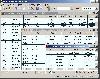
Copan is a very efficient and easy-to-use geomatics engineering tool for computing and managing plane survey coordinates. It does numerous coordinate geometry (COGO) calculations, processes and adjusts raw field survey data, computes and adjusts map traverse data, performs map checks, calculates...
Platforms: Windows
| License: Freeware | Download (450): Copan Download |
Released: October 22, 2012
|
Added: October 22, 2012 | Visits: 465
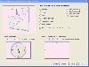 Shadows is a program used to design sundials and astrolabes. It can be used by everybody without any required technical skills. Shadows will calculate everything and print the drawing according the user's preferences. Shadows is used by thousands of users around the world.
Shadows offers a...
Shadows is a program used to design sundials and astrolabes. It can be used by everybody without any required technical skills. Shadows will calculate everything and print the drawing according the user's preferences. Shadows is used by thousands of users around the world.
Shadows offers a...
Platforms: Windows
| License: Freeware | Size: 7.5 MB | Download (457): Shadows Download |
Released: November 27, 2012
|
Added: November 27, 2012 | Visits: 738
 This shows the position of the sun and moon for any place on earth between 1900 and 2049. It can show the sun or moon for any day or the horizon which can be rotated 360 degrees and animated. A database of over 1600 locations is included which includes the name, latitude, longitude and time zone...
Platforms: Windows, Other
| License: Shareware | Cost: $39.00 USD | Size: 3.21 MB | Download (527): Sun & Moon Calculator Download |
Released: November 01, 2012
|
Added: November 01, 2012 | Visits: 482
 The Capturix GPS SDK is a ActiveX OCX Control that provide Visual Basic Developers the interface between GPS receivers and their applications. This is a very simple control with a simple configuration methods and very easy to implement. It provides direct support to MapQuest website and creates...
Platforms: Windows
| License: Shareware | Cost: $39.00 USD | Size: 1.02 MB | Download (55): Capturix GPS SDK Download |