


Longitude And Latitude Map software
Longitude And Latitude Map
Added: May 14, 2013 | Visits: 345
 A function enabling the easy extraction of longitude and latitude data from an IATA code.An input of a 3 character IATA code string and outputs the relevant longitude and latitude of the airport.Using a Matlab's URLread and regexpi to read and extract the data from the relevant websites (in this...
Platforms: Matlab
| License: Shareware | Cost: $0.00 USD | Size: 10 KB | Download (45): IATA code to longitude and latitude Download |
Released: August 21, 2012
|
Added: August 21, 2012 | Visits: 756
Golden World and USA Map Locator for websites, presentations and more. Easy adjustment. Variants of using a map locator: - Real-Estate websites - Quick access to contact organization data, having affiliated network in USA With this fully-clickable map you will be able to improve navigation and...
Platforms: Windows, Mac
| License: Demo | Cost: $249.00 USD | Size: 332 KB | Download (55): World and USA Map Locator Fix Download |
Released: July 02, 2012
|
Added: July 02, 2012 | Visits: 820
 Golden World and USA Map Locator for websites, presentations and more. Easy adjustment. Variants of using a map locator: - Real-Estate websites - Quick access to contact organization data, having affiliated network With this fully-clickable map you will be able to improve navigation and provide...
Platforms: Windows, Mac
| License: Demo | Cost: $249.00 USD | Size: 367 KB | Download (47): Golden World and USA Map Locator Download |
Released: October 01, 2012
|
Added: October 01, 2012 | Visits: 926
 Click-and-Drag Map of USA for websites with wysiwyg editor tool. Easy adjustment. Variants of using a map locator: - Real-Estate websites - Quick access to contact organization data, having affiliated network in USA With this fully-clickable map you will be able to improve navigation and provide...
Platforms: Windows, Mac
| License: Demo | Cost: $99.00 USD | Size: 400 KB | Download (47): Click-and-Drag Map of USA Download |
Released: December 14, 2012
|
Added: December 14, 2012 | Visits: 828
 Click-and-Drag Map of United Kingdom for websites with wysiwyg editor tool. Easy adjustment. Variants of using a map locator: - Real-Estate websites - Quick access to contact organization data, having affiliated network in USA With this fully-clickable map you will be able to improve navigation...
Platforms: Windows, Mac
| License: Demo | Cost: $99.00 USD | Size: 400 KB | Download (49): Click-and-Drag Map of UK regions Download |
Released: September 09, 2012
|
Added: September 09, 2012 | Visits: 838
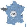 Click-and-Drag Map of France for websites with wysiwyg editor tool. Easy adjustment. Variants of using a map locator: - Real-Estate websites - Quick access to contact organization data, having affiliated network in USA With this fully-clickable map you will be able to improve navigation and...
Platforms: Windows, Mac
| License: Demo | Cost: $99.00 USD | Size: 346 KB | Download (48): Click-and-Drag Map of France Download |
Released: October 01, 2010
|
Added: October 09, 2010 | Visits: 1.605
 GeoDataSource Cities Database Titanium Edition contains 3.1+ million entries with city names in original language and English, feature type classifications, country names in FIPS and ISO, regions, sub-regions, state or First-Order Administrative Division, county or Second-Order Administrative...
Platforms: OS/2, Windows, Mac, *nix, Palm OS, Windows CE, Pocket PC, Palm OS 3.5,Palm OS 4.1,Palm OS 5,Symbian,MS-DOS,BEOS
| License: Demo | Cost: $1649.95 USD | Size: 144.51 KB | Download (824): GeoDataSource World Cities Database Download |
Added: February 03, 2010 | Visits: 1.857
Geo::ECEF is a Perl module that converts between ECEF (earth centered earth fixed) coordinates and latitude, longitude and height above ellipsoid. SYNOPSIS use Geo::ECEF; my $obj=Geo::ECEF->new(); #WGS84 is the default my ($x, $y, $z)=$obj->ecef(39.197807, -77.108574, 55); #Lat (deg), Lon...
Platforms: *nix
| License: Freeware | Size: 5.12 KB | Download (184): Geo::ECEF Download |
Released: October 25, 2012
|
Added: October 25, 2012 | Visits: 924
IP2Location IP - Country - Region - City - Latitude - Longitude - TimeZone - Netspeed Database is a commercial lookup database which can translate IP address to country, net speed, ISP, domain, latitude, longitude and zip code.
for WindowsAll
Platforms: Windows
| License: Freeware | Download (64): IP2Location IP-Country-Region-City-Latitude-Longitude-TimeZone-Netspeed Database Download |
Released: September 17, 2012
|
Added: September 17, 2012 | Visits: 909
IP2Location IP - Country - Region - City - Latitude - Longitude - ZIPCode - TimeZone - ISP - Domain - Netspeed Database is a commercial lookup database which can translate IP address to country, net speed, ISP, domain, latitude, longitude and zip code.
for WindowsAll
Platforms: Windows
| License: Freeware | Download (59): IP2Location IP-Country-Region-City-Latitude-Longitude-ZIPCode-TimeZone-ISP-Domain-Netspeed Database Download |
Added: August 07, 2008 | Visits: 939
IP2Location IP-COUNTRY-REGION-CITY-LATITUDE-LONGITUDE-ISP is commericial lookup database that translates IP address to country, region, city, latitude, longitude and Internet Service Provider (ISP). Developers use this database for projects related to: 1. Display native language and currency; 2....
Platforms: DOS, OS/2, Windows, Mac, *nix, Palm OS, Windows CE
| License: Shareware | Cost: $499.00 USD | Size: 200 KB | Download (463): IP2Location IP-COUNTRY-REGION-CITY-LATITUDE-LONGITUDE-ISP Database May Download |
Released: January 30, 2006
|
Added: November 06, 2006 | Visits: 4.050
 Map Suite Geocode USA is a powerful and feature-rich .NET geocoding engine that comes complete with a highly optimized dataset encompassing the entire United States. Map Suite Geocode USA features a fast, user-friendly .NET interface that enables C# and VB.NET software developers to take a United...
Platforms: Windows
| License: Demo | Cost: $2394.00 USD | Size: 341.13 KB | Download (165): Map Suite Geocode USA Download |
Released: November 24, 2012
|
Added: November 24, 2012 | Visits: 988
Golden UK Map for websites, presentations and more. Easy adjustment. Variants of using a map: - Real-Estate websites - Quick access to contact organization data, having affiliated network in UK With this fully-clickable map you will be able to improve navigation and provide visitors with a better...
Platforms: Windows, Mac
| License: Demo | Cost: $199.00 USD | Size: 341 KB | Download (45): Golden UK and Ireland Map Download |
Released: June 22, 2012
|
Added: June 22, 2012 | Visits: 601
 Major USA Cities and Highway Map has been developed for the business-minded people, who need quick and on-hand access to the network of US roads. It is a rather simple version of professional software with several background images and a nice monitor glass projection. With our user-friendly USA...
Platforms: Windows, Mac, OS/2, Unix, Linux, MS-DOS, AS/400
| License: Shareware | Cost: $399.00 USD | Size: 13.39 MB | Download (48): Major USA cities and highways Download |
Added: May 09, 2013 | Visits: 546
Predict the azimuth and elevation of the Sun within +/- 1 degree at any geodetic latitude, longitude and altitude.Function Call: [Az El] = SolarAzEl('2008/02/18 13:10:00',60,15,0)Input List:UTC Date and Time - Use format YYYY/MM/DD hh:mm:ssLatitude - Site Latitude in degrees -90:90 -> S(-)...
Platforms: Matlab
| License: Freeware | Size: 10 KB | Download (47): Solar Azimuth and Elevation Estimation Download |
Added: August 11, 2013 | Visits: 484
This algorithm will accept a Latitude, Longitude and Altitude location as well as a specific universal coordinated time. It will use this information and calculate the position of the moon in a local coordinate frame (az and alt aka az and el).Example Function Call:[Az El] = LunarAzEl('1991/05/19...
Platforms: Matlab
| License: Freeware | Size: 10 KB | Download (44): Lunar Azimuth and Altitude Estimation Algorithm Download |
Released: July 12, 2012
|
Added: July 12, 2012 | Visits: 673
FaceBook @Desktop is a light-weight client that sits in your system tray, like any other messenger software, and will alert you as soon as some new activity happens in your Facebook stream. The alerts are presented as unobtrusive pop-ups on the desktop that automatically fade after some time. You...
Platforms: Windows
| License: Commercial | Cost: $1.00 USD | Size: 622 KB | Download (51): Facebook @Desktop Download |
Released: November 01, 2012
|
Added: November 01, 2012 | Visits: 439
 Interactive Deutschlandkarte for websites with wysiwyg editor tool. Easy adjustment. Variants of using a map locator: - Real-Estate websites - Quick access to contact organization data, having affiliated network in USA With this fully-clickable map you will be able to improve navigation and...
Platforms: Windows, Mac
| License: Demo | Cost: $99.00 USD | Size: 336 KB | Download (46): Click-and-Drag Map of Germany Download |
Added: August 08, 2013 | Visits: 677
ECEF2LLA - convert earth-centered earth-fixed (ECEF) cartesian coordinates to latitude, longitude, and altitude.USAGE:[lat,lon,alt] = ecef2lla(x,y,z)lat = geodetic latitude (radians)lon = longitude (radians)alt = height above WGS84 ellipsoid (m)x = ECEF X-coordinate (m)y = ECEF Y-coordinate (m)z...
Platforms: Matlab
| License: Freeware | Size: 10 KB | Download (46): Convert Cartesian (ECEF) Coordinates to lat, lon, alt Download |
Released: November 07, 2014
|
Added: November 19, 2014 | Visits: 819
 Importation/Exportation: Import/export trails to gpx file. Unlimited number of trails, and TrackPoints. Export to gpx, Excel, PDF, XPS and KML/KMZ.
Data table: Very flexible data table that allows sorting by columns, with inheritance of data, attributes, etc.
Presentation on map: View...
Importation/Exportation: Import/export trails to gpx file. Unlimited number of trails, and TrackPoints. Export to gpx, Excel, PDF, XPS and KML/KMZ.
Data table: Very flexible data table that allows sorting by columns, with inheritance of data, attributes, etc.
Presentation on map: View...
Platforms: Windows, Windows 8, Windows 7, Windows Server
| License: Freeware | Size: 27.05 MB | Download (611): ediTrail Download |