


Latitude Longitude Distance Formula software
Latitude Longitude Distance Formula
Released: July 27, 2012
|
Added: July 27, 2012 | Visits: 403
 The 'UK Postcodes' package will provide you with the extended UK postcodes database as well as UK geographical data like latitude and longitude. The 'UK Postcodes' package includes the information on: UK Postcode, Latitude, Longitude. 1 622 036 precise records are in the 'UK Postcodes' package....
Platforms: Windows
The 'UK Postcodes' package will provide you with the extended UK postcodes database as well as UK geographical data like latitude and longitude. The 'UK Postcodes' package includes the information on: UK Postcode, Latitude, Longitude. 1 622 036 precise records are in the 'UK Postcodes' package....
Platforms: Windows
| License: Shareware | Cost: $39.95 USD | Size: 8.26 MB | Download (45): UK Postcodes Download |
Released: July 27, 2012
|
Added: July 27, 2012 | Visits: 430
 The 'Canadian Postal Codes' package will provide you with the extended Canadian Postal Codes database as well as Canadian geographical data like latitude and longitude. The 'Canadian Postal Codes' package includes the information on: Canadian Postal code, Latitude, Longitude. 809 036 precise...
Platforms: Windows
The 'Canadian Postal Codes' package will provide you with the extended Canadian Postal Codes database as well as Canadian geographical data like latitude and longitude. The 'Canadian Postal Codes' package includes the information on: Canadian Postal code, Latitude, Longitude. 809 036 precise...
Platforms: Windows
| License: Shareware | Cost: $24.95 USD | Size: 5.16 MB | Download (51): Canadian Postal Codes Download |
Released: July 27, 2012
|
Added: July 27, 2012 | Visits: 481
 The 'German Postal Codes' package will provide you with the extended German Postal Codes database as well as german geographical data like latitude and longitude. The 'German Postal Codes' package includes the information on: german Postal code, Latitude, Longitude. 14 958 precise records are in...
Platforms: Windows
The 'German Postal Codes' package will provide you with the extended German Postal Codes database as well as german geographical data like latitude and longitude. The 'German Postal Codes' package includes the information on: german Postal code, Latitude, Longitude. 14 958 precise records are in...
Platforms: Windows
| License: Shareware | Cost: $24.95 USD | Size: 99 KB | Download (50): German Postal Codes Download |
Added: May 10, 2013 | Visits: 293
These tracks are intended to be visualised on maps, plotted as distance/altitude profiles, have statistics derived from them, etc.The 'base' trackfield CCK field knows about latitude, longitude, altitude and distance.Due to the flexibility of the system, the distance/altitude pairs can be...
Platforms: Windows, Mac, *nix, PHP, BSD Solaris
| License: Freeware | Download (54): Trackfield 5.x-0.5 Download |
Added: May 05, 2013 | Visits: 408
This is a simple module to let users store their location on the edit account page. It uses HTML5d-deOaos geolocation API and stores latitude and longitude. How you use that data is up to other modules.
Platforms: PHP
| License: Freeware | Size: 20.48 KB | Download (46): HTML5 user geolocation Download |
Added: September 16, 2006 | Visits: 2.495
 In the Dynamic Link Library GeoDLL geodesic functions like coordinate transformation, reference system changes, meridian strip changes, user defined coordinate and reference systems, distance calculation, maps functions and more geodesic functions are contained to bind them into own applications....
Platforms: Windows, Windows CE
In the Dynamic Link Library GeoDLL geodesic functions like coordinate transformation, reference system changes, meridian strip changes, user defined coordinate and reference systems, distance calculation, maps functions and more geodesic functions are contained to bind them into own applications....
Platforms: Windows, Windows CE
| License: Shareware | Cost: $290.00 USD | Size: 1.01 MB | Download (112): GEODLL32 Download |
Added: April 29, 2006 | Visits: 2.662
 In the Dynamic Link Library GeoDLL geodesic functions like coordinate transformation, reference system changes, meridian strip changes, user defined coordinate and reference systems, distance calculation, maps functions and more geodesic functions are contained to bind them into own applications....
Platforms: Windows, Windows CE
In the Dynamic Link Library GeoDLL geodesic functions like coordinate transformation, reference system changes, meridian strip changes, user defined coordinate and reference systems, distance calculation, maps functions and more geodesic functions are contained to bind them into own applications....
Platforms: Windows, Windows CE
| License: Shareware | Cost: $290.00 USD | Size: 1.02 MB | Download (120): GEODLL32 (English) Download |
Added: May 28, 2006 | Visits: 2.341
 ZIPCodeWorld Desktop is a standalone Windows application that performs several ZIP code and postal code search functions such as data query, distance calculation and store locator in one simple interface. The software can be used together with all ZIPCodeWorld & PostalCodeWorld databases....
Platforms: Windows
ZIPCodeWorld Desktop is a standalone Windows application that performs several ZIP code and postal code search functions such as data query, distance calculation and store locator in one simple interface. The software can be used together with all ZIPCodeWorld & PostalCodeWorld databases....
Platforms: Windows
| License: Shareware | Cost: $99.00 USD | Size: 1.14 MB | Download (113): ZIPCodeWorld Desktop Download |
Released: March 15, 2008
|
Added: April 30, 2008 | Visits: 4.647
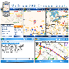 With MobiumGPS , your Windows Mobile device is turned into an advanced Mobile Navigation System with turn-by-turn voice announcements and detailed driving directions. You can search over 15 million point of interests (POIs) - places like hotels, restaurants, shopping malls and other tourist...
Platforms: Windows
With MobiumGPS , your Windows Mobile device is turned into an advanced Mobile Navigation System with turn-by-turn voice announcements and detailed driving directions. You can search over 15 million point of interests (POIs) - places like hotels, restaurants, shopping malls and other tourist...
Platforms: Windows
| License: Demo | Cost: $9.95 USD | Size: 806.13 KB | Download (1554): Mobium GPS Navigation System Download |
Added: January 09, 2010 | Visits: 1.144
Geo::Lookup::ByTime is a Perl module to lookup location by time. SYNOPSIS use Geo::Lookup::ByTime; $lookup = Geo::Lookup::ByTime->new( @points ); my $pt = $lookup->nearest( $tm ); Given a set of timestamped locations guess the location at a particular time. This is a useful operation...
Platforms: *nix
| License: Freeware | Size: 15.36 KB | Download (94): Geo::Lookup::ByTime Download |
Added: January 25, 2010 | Visits: 699
CoordinatesX is an application that transforms geodetic and Cartesian coordinates. It will make the conversions from Geodetic latitude, longitude and heights to planet centered Cartesian coordinates and vice versa. Works for various planetary ellipsoids, including user defined...
Platforms: Mac
| License: Freeware | Download (165): CoordinatesX Download |
Released: September 02, 2012
|
Added: September 02, 2012 | Visits: 643
Develop precise, efficient, and reliable GPS software in record time with this multithreaded component for desktop and mobile devices, including PocketPC, Windows CE, Tablet PC, Smartphone and now Windows Mobile! Over fifty classes in one lightweight assembly give you unparalleled features while...
Platforms: Windows, Pocket PC, Handheld/Mobile Other
| License: Shareware | Cost: $279.00 USD | Size: 10.34 MB | Download (51): GPS.NET Download |
Released: November 22, 2012
|
Added: November 22, 2012 | Visits: 540
 mdNavMobile is a waypoint-based GPS navigation solution for the Windows Mobile platform. It can guide you from waypoint to waypoint while keeping you informed of all relevant navigation data. All NMEA-data from a GPS is automatically logged to file so you can 'replay' a trip with variable speed....
Platforms: Windows, Pocket PC, Handheld/Mobile Other
mdNavMobile is a waypoint-based GPS navigation solution for the Windows Mobile platform. It can guide you from waypoint to waypoint while keeping you informed of all relevant navigation data. All NMEA-data from a GPS is automatically logged to file so you can 'replay' a trip with variable speed....
Platforms: Windows, Pocket PC, Handheld/Mobile Other
| License: Freeware | Size: 30 KB | Download (48): mdNavMobile Download |
Released: January 09, 2013
|
Added: January 09, 2013 | Visits: 670
 This utility can be used to analyze GPS log files and then generate graphs, summaries, reports and Google Earth (TM) compatible KML files. With the PRO version you can create trip reports with details such as drive time, drive distance, stop time, etc.
Platforms: Windows
This utility can be used to analyze GPS log files and then generate graphs, summaries, reports and Google Earth (TM) compatible KML files. With the PRO version you can create trip reports with details such as drive time, drive distance, stop time, etc.
Platforms: Windows
| License: Freeware | Size: 648 KB | Download (540): KML Generator Download |
Released: December 16, 2012
|
Added: December 16, 2012 | Visits: 320
The open source augmented reality server, or POI (Point of Interest) search. In its simplest form, it takes a database of points with latitude/longitude, and a search request at a given latitude/longitude, and returns the points sorted by distance.
Platforms: Windows, Mac, Linux
| License: Freeware | Size: 177.21 KB | Download (45): LightRod Download |
Released: October 13, 2012
|
Added: October 13, 2012 | Visits: 528
This compact widget will search Zip Codes by city. Results take you to the ZipCodeWidget.com site. Enter the city only, multiple results will show. Results show the Latitude, Longitude, County, State. The site has search by county, state, keyword, and you can also calculate distance.
Platforms: Mac
| License: Freeware | Size: 40.96 KB | Download (53): Zip Code Mini City Search Download |
Added: March 29, 2013 | Visits: 490
A collection of geodetic functions that solve a variety of problems in geodesy. Supports a wide range of common and user-defined reference ellipsoids. Most functions are vectorized. Functions include:Angle Conversions deg2rad - Degrees to radians dms2deg - Degrees,minutes,seconds to degrees...
Platforms: Matlab
| License: Freeware | Size: 40.96 KB | Download (46): Geodetic Toolbox Download |
Added: June 25, 2013 | Visits: 286
If carefully built, a sundial is perfectly capable of keeping accurate time. The problem is that you need a different sundial for every combination of latitude, longitude, and day of the year. Fortunately MATLABdlT« can make this a manageable problem. By turning this procedure around, you can...
Platforms: Matlab
| License: Shareware | Cost: $0.00 USD | Size: 20.48 KB | Download (39): Building Sundials Download |
Added: July 07, 2013 | Visits: 322
This module will geocode just about anything you throw at it or hook up to it including addresses, GPX files, geo-tagged images, and KML files.It is commonly used to automatically geocode Addressfield addresses into Geofield points for display on Openlayers Maps.This module also makes available...
Platforms: PHP
| License: Shareware | Cost: $0.00 USD | Size: 10 KB | Download (39): Geocoder (Sripts) Download |
Added: November 01, 2013 | Visits: 450
Java OceanAtlas (or simply JOA) is a software application for viewing and manipulating oceanographic profile data. JOA was designed primarily for oceanographic sections but is also useful for looking at data also in the latitude-longitude domain. Here's a brief list of what JOA can do: * Open a...
Platforms: Mac
| License: Freeware | Size: 14.1 MB | Download (46): Java OceanAtlas Download |