


Latitude Longitude Distance Formula software
Latitude Longitude Distance Formula
Released: August 12, 2012
|
Added: August 12, 2012 | Visits: 704
 The database includes total of 49 data fields which consists of:
ZIP Code, Classification, Primary Record, City, City Alias Name, City Type, Mailing Name, State, State FIPS, Latitude, Longitude, Elevation, Area Code, County Name, County FIPS, Time Zone, Day Light Saving, MSA, MSA Name, PMSA, PMSA...
Platforms: Windows, Mac, Palm,OS
The database includes total of 49 data fields which consists of:
ZIP Code, Classification, Primary Record, City, City Alias Name, City Type, Mailing Name, State, State FIPS, Latitude, Longitude, Elevation, Area Code, County Name, County FIPS, Time Zone, Day Light Saving, MSA, MSA Name, PMSA, PMSA...
Platforms: Windows, Mac, Palm,OS
| License: Demo | Cost: $45.95 USD | Size: 3.01 MB | Download (397): IGEOCODE US ZIP Codes Gold Edition Download |
Released: September 20, 2012
|
Added: September 20, 2012 | Visits: 479
 IP2Location Desktop translates IP address to country, city, region, latitude, longitude, ZIP code, ISP and domain name using XML Web Service. Users can perform 90 queries per month using Free account. Please visit homepage for more information.
Platforms: Windows
IP2Location Desktop translates IP address to country, city, region, latitude, longitude, ZIP code, ISP and domain name using XML Web Service. Users can perform 90 queries per month using Free account. Please visit homepage for more information.
Platforms: Windows
| License: Shareware | Cost: $0.00 USD | Size: 796 KB | Download (60): IP2Location Geolocation Application Download |
Released: July 20, 2012
|
Added: July 20, 2012 | Visits: 409
 Pysolar is a Python library for calculating the position of the sun relative to the earth as a function of latitude, longitude, and time. There is also code included for other problems related to the development of photovoltaic systems. Still in alpha.
Platforms: Windows, Mac, Linux
Pysolar is a Python library for calculating the position of the sun relative to the earth as a function of latitude, longitude, and time. There is also code included for other problems related to the development of photovoltaic systems. Still in alpha.
Platforms: Windows, Mac, Linux
| License: Freeware | Size: 21.28 KB | Download (45): Pysolar Download |
Added: May 09, 2013 | Visits: 552
Predict the azimuth and elevation of the Sun within +/- 1 degree at any geodetic latitude, longitude and altitude.Function Call: [Az El] = SolarAzEl('2008/02/18 13:10:00',60,15,0)Input List:UTC Date and Time - Use format YYYY/MM/DD hh:mm:ssLatitude - Site Latitude in degrees -90:90 -> S(-)...
Platforms: Matlab
| License: Freeware | Size: 10 KB | Download (47): Solar Azimuth and Elevation Estimation Download |
Added: August 11, 2013 | Visits: 487
This algorithm will accept a Latitude, Longitude and Altitude location as well as a specific universal coordinated time. It will use this information and calculate the position of the moon in a local coordinate frame (az and alt aka az and el).Example Function Call:[Az El] = LunarAzEl('1991/05/19...
Platforms: Matlab
| License: Freeware | Size: 10 KB | Download (44): Lunar Azimuth and Altitude Estimation Algorithm Download |
Added: August 24, 2010 | Visits: 1.495
GIS::Distance::Vincenty Perl module contains Thaddeus Vincenty distance calculations. SYNOPSIS my $calc = GIS::Distance::Vincenty->new(); my $distance = $calc->distance( $lon1, $lat1 => $lon2, $lat2 ); For the benefit of the terminally obsessive (as well as the genuinely needy), Thaddeus...
Platforms: *nix
| License: Freeware | Size: 8.19 KB | Download (125): GIS::Distance::Vincenty Download |
Added: July 07, 2013 | Visits: 525
In geomatic projects, it is often required to generate a regular grid containing points at pre determined intervals. Such grids could be used as a reference to georectify toposheets.This script when run asks for the bounding box of the study area in latitude and longitude, the sampling density or...
Platforms: Matlab
| License: Freeware | Size: 10 KB | Download (39): Interpolation of Latitude and Longitude within specified bounding box Download |
Added: January 18, 2010 | Visits: 1.453
Religion::Islam::Qibla is a Perl module that calculates the Muslim Qiblah Direction, Great Circle Distance, and Great Circle Direction. SYNOPSIS use Religion::Islam::Qibla; #create new object with default options, Destination point is Kabah Lat=21 Deg N, Long 40 Deg E my $qibla =...
Platforms: *nix
| License: Freeware | Size: 4.1 KB | Download (266): Religion::Islam::Qibla Download |
Released: September 08, 2009
|
Added: September 14, 2009 | Visits: 3.883
 PhotoGPSEditor is an easy to use meta-data editor for photo (JPEG, RAW) files, plus it can match data from GPS (gpx or NMEA) files. The program is freeware, however, donations can be made to help support future development. With PhotoGPSEditor you can add location and summary details to a...
Platforms: Mac
PhotoGPSEditor is an easy to use meta-data editor for photo (JPEG, RAW) files, plus it can match data from GPS (gpx or NMEA) files. The program is freeware, however, donations can be made to help support future development. With PhotoGPSEditor you can add location and summary details to a...
Platforms: Mac
| License: Freeware | Size: 2.39 MB | Download (1335): PhotoGPSEditor Download |
Released: August 24, 2012
|
Added: August 24, 2012 | Visits: 478
 The 'NZ Postcodes' package will provide you with the extended NZ Postcodes database as well as NZ geographical data like postcode, suburb, street address, latitude and longitude. The 'NZ Postcodes' database includes the information on: NZ postode, suburb, street address, latitude and longitude....
Platforms: Windows, Mac, Android, BlackBerry, iPhone, iPod, iTouch, Java, Linux, Linux Console, Linux Gnome, Linux GPL, Linux Open Source, MS-DOS, Netware, OpenVMS, Palm, Pocket PC, Symbian, Unix
The 'NZ Postcodes' package will provide you with the extended NZ Postcodes database as well as NZ geographical data like postcode, suburb, street address, latitude and longitude. The 'NZ Postcodes' database includes the information on: NZ postode, suburb, street address, latitude and longitude....
Platforms: Windows, Mac, Android, BlackBerry, iPhone, iPod, iTouch, Java, Linux, Linux Console, Linux Gnome, Linux GPL, Linux Open Source, MS-DOS, Netware, OpenVMS, Palm, Pocket PC, Symbian, Unix
| License: Shareware | Cost: $24.95 USD | Size: 781 KB | Download (51): NZ Postcodes Download |
Added: August 18, 2013 | Visits: 486
Geotagmapper adds geographical identification metadata (latitude and longitude) to the HTML header.You only have to specify your address.Installation : 1. Copy complete folder to '/wp-content/plugins/' or upload from wordpress.org 2. Activate in Plugins menu 3. Enter your address in...
Platforms: PHP
| License: Freeware | Size: 174.08 KB | Download (45): Geotagmapper Download |
Released: July 31, 2010
|
Added: September 02, 2010 | Visits: 2.897
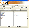 CDXZipStream is a complete solution for analyzing address and demographic data into Microsoft Excel. CDXZipStream also has built in features for geocoding, mapping, zip code lists by state or county, reverse look-up, calculating distance or finding the zip codes within a specified radius. No...
Platforms: Windows, Other
CDXZipStream is a complete solution for analyzing address and demographic data into Microsoft Excel. CDXZipStream also has built in features for geocoding, mapping, zip code lists by state or county, reverse look-up, calculating distance or finding the zip codes within a specified radius. No...
Platforms: Windows, Other
| License: Shareware | Cost: $29.95 USD | Size: 7.38 MB | Download (133): CDXZipStream Download |
Added: August 06, 2010 | Visits: 918
Geography::NationalGrid::TW is a Perl module to convert Taiwan Datum (TWD67/TM2, TWD97/TM2) to/from Latitude and Longitude. SYNOPSIS You should _create_ the object using the Geography::NationalGrid factory class, but you still need to know the object interface, given below. # default TWD97...
Platforms: *nix
| License: Freeware | Size: 5.12 KB | Download (107): Geography::NationalGrid::TW Download |
Added: January 25, 2010 | Visits: 678
LatitudeZERO brings the geographical world of latitude and longitude coordinates into FileMaker Pro with our LatitudeZERO plug-in.Use LatitudeZERO to:Calculate the distance between two ZIP codesCalculate the distance between coordinatesReturn results in miles, kilometers or nautical...
Platforms: Mac
| License: Demo | Cost: $0.00 USD | Size: 728 KB | Download (130): LatitudeZERO Download |
Added: May 10, 2013 | Visits: 459
These modifications allow you to create and maintain a list of vendors in the admin section and present them to your customer. Vendors are presented to the customer by distance (in miles) using a latitude & longitude algorithm based upon the customers_default_address_id entry_postcode in the...
Platforms: Windows, *nix, PHP, BSD
| License: Freeware | Download (64): Vendor Locator Displayed by Distance Download |
Added: September 02, 2013 | Visits: 359
Function to find the minimum distance loop from given set of points.This function uses the distance formula to genrate a minimum distance loop.function mindist = minimumdistance(X,Y,x,y)X = X coordinate vectorY = Y coordinate vector(x,y) point where the loop is to be startedThis point is labeled...
Platforms: Matlab
| License: Shareware | Cost: $0.00 USD | Size: 10 KB | Download (44): Minimum Distance loop between 'n' number of points Download |
Added: July 05, 2013 | Visits: 370
OpenLayers Proximity enables geographical proximity search for the OpenLayers module (6.x-2.x). The module exposes a filter to the Views module where users can specify starting point and radius of the proximity search. The starting point can be specified by simply providing the name of its...
Platforms: PHP
| License: Freeware | Size: 20.48 KB | Download (40): OpenLayers Proximity Download |
Added: January 09, 2006 | Visits: 3.149
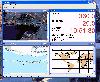 - you can show a current GPS data (Speed, Direction, Longitude, Latitude, Time, Date, Height);
- you can open any of scanned maps (in a "bmp" or "dib" format);
- you can calibrate the scanned maps yourself by two calibration points only (left-top and right-bottom);
- calibrations are stored...
Platforms: Windows
- you can show a current GPS data (Speed, Direction, Longitude, Latitude, Time, Date, Height);
- you can open any of scanned maps (in a "bmp" or "dib" format);
- you can calibrate the scanned maps yourself by two calibration points only (left-top and right-bottom);
- calibrations are stored...
Platforms: Windows
| License: Demo | Cost: $9.50 USD | Size: 3.58 MB | Download (537): VIGps Download |
Released: January 07, 2006
|
Added: July 19, 2006 | Visits: 2.279
 GeoDataSource Cities Database Gold Edition contains 2.9+ million entries with city names in original language and English, feature type classifications, country names in FIPS and ISO, regions, sub-regions, state or First- Order Administrative Division, county or Second-Order Administrative...
Platforms: DOS, OS/2, BeOS, Palm OS, Windows, Mac, *nix, Windows CE
GeoDataSource Cities Database Gold Edition contains 2.9+ million entries with city names in original language and English, feature type classifications, country names in FIPS and ISO, regions, sub-regions, state or First- Order Administrative Division, county or Second-Order Administrative...
Platforms: DOS, OS/2, BeOS, Palm OS, Windows, Mac, *nix, Windows CE
| License: Shareware | Cost: $1049.95 USD | Size: 164 KB | Download (110): GeoDataSource World Cities Database (Gold Edition) Download |
Released: August 19, 2012
|
Added: August 19, 2012 | Visits: 458
No matter if you are an experienced player, a highly-handicapped beginner, or even a golf coach, GXP3 + iGXP is a great application suite to improve your golf game. This is because GXP3 and iGXP was created by players to players. No fancy useless graphics. Just the info you need, where you want...
Platforms: Mac
| License: Freeware | Size: 20 MB | Download (482): GXP for Mac OS Download |