


Kml To Kmz software
Kml To Kmz
Released: April 15, 2019
|
Added: May 14, 2019 | Visits: 1.445
 GeoJson KML To DXF Converter allows batch convert Keyhole Markup Language format to AutoCAD Drawing Exchange Format format (KML to DXF KMZ to DXF GeoJosn to DXF) is fast and easy to use tool .
Key Features
Convert KML to AutoCAD(dxf file).
Convert KMZ to AutoCAD(dxf file).
Convert GeoJson...
Platforms: Windows, Windows 8, Windows 7, Windows Server
GeoJson KML To DXF Converter allows batch convert Keyhole Markup Language format to AutoCAD Drawing Exchange Format format (KML to DXF KMZ to DXF GeoJosn to DXF) is fast and easy to use tool .
Key Features
Convert KML to AutoCAD(dxf file).
Convert KMZ to AutoCAD(dxf file).
Convert GeoJson...
Platforms: Windows, Windows 8, Windows 7, Windows Server
| License: Shareware | Cost: $98.00 USD | Size: 3.86 MB | Download (308): SmartDWG GeoJson KML to DXF Converter Download |
Released: February 01, 2016
|
Added: February 13, 2016 | Visits: 481
 NMEA Converter is a product to convert various types of data
NMEA to UDP Converter
UDP to NMEA Converter(Reserved)
GPS to HDT Converter(Reserved)
NMEA to KML Converter(Reserved)
NMEA to KMZ Converter(Reserved)
KML to NMEA Converter(Reserved)
KMZ to NMEA Converter(Reserved)
Platforms: Windows, Windows 8, Windows 7, Windows Server
NMEA Converter is a product to convert various types of data
NMEA to UDP Converter
UDP to NMEA Converter(Reserved)
GPS to HDT Converter(Reserved)
NMEA to KML Converter(Reserved)
NMEA to KMZ Converter(Reserved)
KML to NMEA Converter(Reserved)
KMZ to NMEA Converter(Reserved)
Platforms: Windows, Windows 8, Windows 7, Windows Server
| License: Demo | Cost: $29.00 USD | Size: 509 KB | Download (49): NMEA Converter Download |
Added: May 21, 2010 | Visits: 1.911
 Geo::KML::PolyMap is a Perl module to generate KML/KMZ-format choropleth (shaded polygonal) maps viewable in Google Earth. SYNOPSIS use Geo::KML::PolyMap qw(generate_kml_file generate_kmz_file); # Clusters "Total Population" data for "Foobar City" in $entities into 5 bins; # renders using...
Platforms: *nix
Geo::KML::PolyMap is a Perl module to generate KML/KMZ-format choropleth (shaded polygonal) maps viewable in Google Earth. SYNOPSIS use Geo::KML::PolyMap qw(generate_kml_file generate_kmz_file); # Clusters "Total Population" data for "Foobar City" in $entities into 5 bins; # renders using...
Platforms: *nix
| License: Freeware | Size: 11.26 KB | Download (399): Geo::KML::PolyMap Download |
Released: June 11, 2012
|
Added: June 11, 2012 | Visits: 386
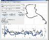 This program takes NMEA, CSV, GPR or GPX logfiles from your GPS device, manages your tracks and exports them as KML to Google Earth. Investigate altitude and speed information, measure distances and cut tracks.
Platforms: Windows, Mac, Linux
This program takes NMEA, CSV, GPR or GPX logfiles from your GPS device, manages your tracks and exports them as KML to Google Earth. Investigate altitude and speed information, measure distances and cut tracks.
Platforms: Windows, Mac, Linux
| License: Freeware | Size: 1.77 MB | Download (46): GpRoko - Track Analyzer Download |
Released: November 10, 2007
|
Added: November 20, 2007 | Visits: 6.096
 Geocode digital images with latitude, longitude, altitude, and direction information. RoboGEO stamps this information onto the actual photo or writes it to the EXIF headers, allowing you to permanently geotag and link your photos to the GPS coordinates. All writing to the EXIF and IPTC headers...
Platforms: Windows
Geocode digital images with latitude, longitude, altitude, and direction information. RoboGEO stamps this information onto the actual photo or writes it to the EXIF headers, allowing you to permanently geotag and link your photos to the GPS coordinates. All writing to the EXIF and IPTC headers...
Platforms: Windows
| License: Demo | Cost: $39.95 USD | Size: 8.28 MB | Download (1179): RoboGEO Download |
Released: July 20, 2012
|
Added: July 20, 2012 | Visits: 522
With GeopIPTC you will be able to read the IPTC city information in pictures and get the corresponding coordinates to your photos from several free services and embed this into the pictures in standard tags in a very professional way. You will also create sets of pictures with all the metadata...
Platforms: Windows
| License: Shareware | Cost: $104.55 USD | Size: 7.32 MB | Download (382): GeoIPTC Download |
Released: October 06, 2012
|
Added: October 06, 2012 | Visits: 514
With GeoIPTC you will be able to read the IPTC city information in pictures and get the corresponding coordinates to your photos from several free services and embed this into the pictures in standard tags in a very professional way. You will also create sets of pictures with all the metadata...
Platforms: Windows
| License: Shareware | Cost: $112.00 USD | Size: 7.32 MB | Download (455): GeoIPTC Geolocalisation de Photos Download |
Released: May 25, 2018
|
Added: June 25, 2018 | Visits: 3.614
 HoudahGeo is a photo geocoding and geotagging tool for Mac. Use HoudahGeo to attach GPS coordinates and location names to your photos.
HoudahGeo writes EXIF and XMP geotags to JPEG and RAW image files. This creates a permanent record of where a photo was taken. Just like a GPS-enabled camera....
Platforms: Mac
HoudahGeo is a photo geocoding and geotagging tool for Mac. Use HoudahGeo to attach GPS coordinates and location names to your photos.
HoudahGeo writes EXIF and XMP geotags to JPEG and RAW image files. This creates a permanent record of where a photo was taken. Just like a GPS-enabled camera....
Platforms: Mac
| License: Demo | Cost: $39.00 USD | Size: 22.87 MB | Download (837): HoudahGeo Download |
Released: July 01, 2012
|
Added: July 01, 2012 | Visits: 759
 Atom GPS freeware easily geotags your photos directly from your GPS device or track log. By simply connecting your GPS Device to Atom GPS and selecting your photos you can add their geolocation in one click. This action allows you to write the geolocation data to your photos exifs (information...
Platforms: Windows
Atom GPS freeware easily geotags your photos directly from your GPS device or track log. By simply connecting your GPS Device to Atom GPS and selecting your photos you can add their geolocation in one click. This action allows you to write the geolocation data to your photos exifs (information...
Platforms: Windows
| License: Freeware | Size: 7.58 MB | Download (430): ATOM GPS Download |
Released: August 23, 2012
|
Added: August 23, 2012 | Visits: 669
 All-in-one software for creation of custom GPS maps compatible with Garmin GPS units. Mapwel supports routing, ESRI shapefiles, OpenStreetMap OSM, Google Earth KML and KMZ, cGPSmapper MP and GPX files. Mapwel custom GPS mapping capability and user icons editor are often used in forestry,...
Platforms: Windows
All-in-one software for creation of custom GPS maps compatible with Garmin GPS units. Mapwel supports routing, ESRI shapefiles, OpenStreetMap OSM, Google Earth KML and KMZ, cGPSmapper MP and GPX files. Mapwel custom GPS mapping capability and user icons editor are often used in forestry,...
Platforms: Windows
| License: Shareware | Cost: $45.00 USD | Size: 12.28 MB | Download (454): Mapwel Download |
Released: December 22, 2012
|
Added: December 22, 2012 | Visits: 471
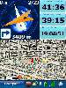 Run.GPS Trainer UV is the perfect tool to take along doing all sorts of sports like running, skiing, hiking, and many more. Run.GPS Trainer UV is compatible with most PocketPCs and Smartphones (requires Windows Mobile 2003 Pocket PC, Windows Mobile 5 or Windows Mobile 6). Recording *...
Platforms: Windows, Pocket PC
Run.GPS Trainer UV is the perfect tool to take along doing all sorts of sports like running, skiing, hiking, and many more. Run.GPS Trainer UV is compatible with most PocketPCs and Smartphones (requires Windows Mobile 2003 Pocket PC, Windows Mobile 5 or Windows Mobile 6). Recording *...
Platforms: Windows, Pocket PC
| License: Shareware | Cost: $33.99 USD | Size: 6.29 MB | Download (606): Run.GPS Trainer UV Download |
Added: May 10, 2013 | Visits: 476
This KML data can be downloaded by visitors and opened in Google Earth™, allowing your site's news to be displayed geographically.Any type of XML data can be used to create a KML document.InstallationUnpack in your modules folder (usually /sites/all/modules/) and enable under Administer > Site...
Platforms: Windows, Mac, *nix, PHP, BSD Solaris
| License: Freeware | Download (52): XML to KML 6.x-0.5 Download |
Released: November 25, 2012
|
Added: November 25, 2012 | Visits: 594
KML Editor is a small, Java based application specially designed to offer user a simple editor for KML files suitable for Google Maps, Google Earth and other applications.
This editor allows for raw text editing, addition of timestamps and timespans for placemarks, and merging of KML files....
Platforms: Windows
| License: Freeware | Download (71): KML Editor Download |
Released: August 24, 2012
|
Added: August 24, 2012 | Visits: 552
 EasyAcreage is program for WinXP or Vista program that allows you to calculate area from KML files exported out of Google Earth. This means you do not even have to leave your house to measure a field anymore. Simply use the free version of Google Earth, mark the area you wish to measure, save it...
Platforms: Windows
EasyAcreage is program for WinXP or Vista program that allows you to calculate area from KML files exported out of Google Earth. This means you do not even have to leave your house to measure a field anymore. Simply use the free version of Google Earth, mark the area you wish to measure, save it...
Platforms: Windows
| License: Shareware | Cost: $20.00 USD | Size: 472 KB | Download (530): EasyAcreage Download |
Released: January 09, 2013
|
Added: January 09, 2013 | Visits: 670
 This utility can be used to analyze GPS log files and then generate graphs, summaries, reports and Google Earth (TM) compatible KML files. With the PRO version you can create trip reports with details such as drive time, drive distance, stop time, etc.
Platforms: Windows
This utility can be used to analyze GPS log files and then generate graphs, summaries, reports and Google Earth (TM) compatible KML files. With the PRO version you can create trip reports with details such as drive time, drive distance, stop time, etc.
Platforms: Windows
| License: Freeware | Size: 648 KB | Download (540): KML Generator Download |
Released: January 28, 2012
|
Added: February 09, 2012 | Visits: 817
 KMLReduce optimizes the size of KML files by analyzing, reducing, and removing coordinates from polygons contained within the file. This allows you to distribute the KML file online and use less traffic for users and services accessing the fille.
KMLReduce works on KML files that contian...
Platforms: Windows
KMLReduce optimizes the size of KML files by analyzing, reducing, and removing coordinates from polygons contained within the file. This allows you to distribute the KML file online and use less traffic for users and services accessing the fille.
KMLReduce works on KML files that contian...
Platforms: Windows
| License: Shareware | Cost: $24.95 USD | Size: 636.75 KB | Download (437): KMLReduce Download |
Released: March 12, 2012
|
Added: April 02, 2012 | Visits: 1.077
 Visualize your data in 3D! Quick, easy and inexpensive. Graph Earth enables management, marketing and other business professionals to create stunning visual representations of their data, all without the time and costs associated with a full-featured GIS. Viewable by Everyone! Create one of a...
Platforms: Windows
Visualize your data in 3D! Quick, easy and inexpensive. Graph Earth enables management, marketing and other business professionals to create stunning visual representations of their data, all without the time and costs associated with a full-featured GIS. Viewable by Everyone! Create one of a...
Platforms: Windows
| License: Demo | Cost: $24.95 USD | Size: 469 KB | Download (96): Graph Earth Download |
Released: August 27, 2012
|
Added: August 27, 2012 | Visits: 828
World Wind KML Viewer is a simple application built using the Java programming language that demonstrates loading, displaying, and interacting with KML content in World Wind.
Now you can view and explore our planet with the help of this easy-to-use tool.
Platforms: Windows
| License: Freeware | Download (475): World Wind KML Viewer Download |
Released: August 14, 2012
|
Added: August 14, 2012 | Visits: 692
View your Analytics Georeports on a 3D Google Earth Globe in the integrated browser (which utilises the Google Earth Internet-Plugin) or export your data to a .kml file which you can import in the standalone version of Google Earth.Simply choose one of your Analytics profiles, specify a timeframe...
Platforms: Mac
| License: Freeware | Size: 931.84 KB | Download (441): Analytics to Earth for Mac OS Download |
Released: June 20, 2012
|
Added: June 20, 2012 | Visits: 702
 Make graph into Googlr Earth to illustrate your presentations, papers, etc. GE-Graph was developed to generate graphs from kml files saved by GE. The file generated by GE-Graph can be exported to Google Earth. Make Bars graph Make graph with geometrical shapes (circles, squares, triangles, etc)....
Platforms: Windows
Make graph into Googlr Earth to illustrate your presentations, papers, etc. GE-Graph was developed to generate graphs from kml files saved by GE. The file generated by GE-Graph can be exported to Google Earth. Make Bars graph Make graph with geometrical shapes (circles, squares, triangles, etc)....
Platforms: Windows
| License: Freeware | Size: 1.81 MB | Download (57): GE-Graph Download |