


Handheld Gps Units software
Handheld Gps Units
Released: August 23, 2012
|
Added: August 23, 2012 | Visits: 667
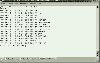
 All-in-one software for creation of custom GPS maps compatible with Garmin GPS units. Mapwel supports routing, ESRI shapefiles, OpenStreetMap OSM, Google Earth KML and KMZ, cGPSmapper MP and GPX files. Mapwel custom GPS mapping capability and user icons editor are often used in forestry,...
Platforms: Windows
| License: Shareware | Cost: $45.00 USD | Size: 12.28 MB | Download (454): Mapwel Download |
Released: December 25, 2012
|
Added: December 25, 2012 | Visits: 288
 ForeRunner X01 toolkit provides an easy access to Forerunner 201/301/305/305E GPS-units. There are multiple command line tools to read data from GPS into database and tools to export data in different formats like gpx and tcx.
Platforms: Windows, Mac, BSD, Linux
| License: Freeware | Size: 3.01 MB | Download (50): Forerunner X01 Toolkit Download |
Released: September 05, 2012
|
Added: September 05, 2012 | Visits: 326
 A Java Framework for connecting to and exchanging data from GPS units to J2ME Mobile Devices. Serial and Bluetooth connections to GPS devices. Support for NMEA-0183 GPS Standard. An Observer-Design Pattern makes the library extendable. Based on GPSlib4j.
Platforms: Windows, Mac, Linux
| License: Freeware | Size: 3.22 MB | Download (43): libGPS4j2me Download |
Released: November 27, 2012
|
Added: November 27, 2012 | Visits: 223
OpenNMEA is an open-source Java library for parsing NMEA sentence strings from GPS units into a more useful format, to facilitate interaction between your application and a GPS unit.
Platforms: Windows, Mac, Linux
| License: Freeware | Size: 180.16 KB | Download (44): OpenNMEA Download |
Released: December 25, 2012
|
Added: December 25, 2012 | Visits: 350
If you have a handheld GPS receiver, Geotagalog will let you take full advantage of the Places feature in iPhoto '09 with any digital camera supported by OS X. Geotagalog uses our advanced geotagging technology to combine a GPX tracklog file with the pictures on your camera, in a straightforward...
Platforms: Mac
| License: Shareware | Cost: $25.00 USD | Size: 13.6 MB | Download (57): Geotagalog Download |
Added: July 09, 2013 | Visits: 394
GPS Manager is a GUI for organizing GPS data (i.e. waypoints, tracks, routes, etc.). It is able to download data from and upload data to many different GPS units. The main motivation for the development of GPS Manger (besides the fun in it) is that many GPS units have very limited memory. GPS...
Platforms: *nix
| License: Freeware | Size: 225.28 KB | Download (34): GPS Manager Download |
Released: November 10, 2007
|
Added: November 20, 2007 | Visits: 6.094
 Geocode digital images with latitude, longitude, altitude, and direction information. RoboGEO stamps this information onto the actual photo or writes it to the EXIF headers, allowing you to permanently geotag and link your photos to the GPS coordinates. All writing to the EXIF and IPTC headers...
Platforms: Windows
| License: Demo | Cost: $39.95 USD | Size: 8.28 MB | Download (1179): RoboGEO Download |
Added: September 15, 2006 | Visits: 3.032
 Create thumbnail based web photo galleries. Interfaces with Garmin GPS units for creating georeferenced images, EXIF support, customizable HTML template files, integrated FTP, program automation, image batch processor, XML image description support, copyright stamper, built-in e-mailer, an HTTP...
Platforms: Windows
| License: Commercial | Cost: $39.95 USD | Size: 4.7 MB | Download (219): RoboPhoto Download |
Added: August 18, 2008 | Visits: 1.353
 Allows you to connect your hand held Global Positioning System (GPS) unit to your computer, download your waypoints, and plot them in AutoCAD or export them in .dxf Also plots the points on free public domain Aerial photos and topo maps. Works on most Garmin and Magellan GPS units, and AutoCAD...
Platforms: Windows
| License: Shareware | Cost: $345.00 USD | Size: 9.9 MB | Download (543): GPS2CAD Download |
Added: January 25, 2010 | Visits: 1.035
TrailRunner is a route planning software for all kinds of long distance sports like running, biking, hiking, inline-skating, skiing and more. If you ever asked yourself how long your workout routes are and what route you should choose for this evening - then TrailRunner should be your...
Platforms: Mac
| License: Freeware | Download (123): TrailRunner Download |
Released: September 24, 2012
|
Added: September 24, 2012 | Visits: 442
 Paralog is the world's leading skydiving logbook and flight analysis software made by skydivers for skydivers - and BASE jumpers!.
Paralog downloads jump details from all electronic freefall loggers on the market: Neptune by Alti-2, ProTrack and AltiTrack by Larsen & Brusgaard and Skytronic...
Paralog is the world's leading skydiving logbook and flight analysis software made by skydivers for skydivers - and BASE jumpers!.
Paralog downloads jump details from all electronic freefall loggers on the market: Neptune by Alti-2, ProTrack and AltiTrack by Larsen & Brusgaard and Skytronic...
Platforms: Linux
| License: Demo | Cost: $49.95 USD | Size: 7 MB | Download (538): Paralog for Linux Download |
Released: September 07, 2012
|
Added: September 07, 2012 | Visits: 518
 Paralog is the world's leading skydiving logbook and flight analysis software made by skydivers for skydivers - and BASE jumpers!.
Paralog downloads jump details from all electronic freefall loggers on the market: Neptune by Alti-2, ProTrack and AltiTrack by Larsen & Brusgaard and Skytronic...
Paralog is the world's leading skydiving logbook and flight analysis software made by skydivers for skydivers - and BASE jumpers!.
Paralog downloads jump details from all electronic freefall loggers on the market: Neptune by Alti-2, ProTrack and AltiTrack by Larsen & Brusgaard and Skytronic...
Platforms: Mac
| License: Demo | Cost: $49.95 USD | Size: 8.5 MB | Download (525): Paralog for Mac OS X Download |
Released: September 23, 2012
|
Added: September 23, 2012 | Visits: 458
 Paralog is the world's leading skydiving logbook and flight analysis software made by skydivers for skydivers - and BASE jumpers!.
Paralog downloads jump details from all electronic freefall loggers on the market: Neptune by Alti-2, ProTrack and AltiTrack by Larsen & Brusgaard and Skytronic...
Paralog is the world's leading skydiving logbook and flight analysis software made by skydivers for skydivers - and BASE jumpers!.
Paralog downloads jump details from all electronic freefall loggers on the market: Neptune by Alti-2, ProTrack and AltiTrack by Larsen & Brusgaard and Skytronic...
Platforms: Windows
| License: Demo | Cost: $49.95 USD | Size: 8.5 MB | Download (537): Paralog Download |
Released: October 11, 2012
|
Added: October 11, 2012 | Visits: 405
EPS is a moving map project. If can use GPS units (currently GARMIN).
Platforms: Windows, Mac, Linux
| License: Freeware | Size: 1.26 MB | Download (44): EPS - The Elgaard Positioning System Download |
Released: June 15, 2012
|
Added: June 15, 2012 | Visits: 392
 Application for geocaching or waymarking that allows you to import GPX or LOC files for editing. You can print out cheat sheets to take on the trail, export to KML or HTML, and send the data to your handheld GPS unit.
Platforms: Windows, Mac, Linux
| License: Freeware | Size: 19.78 MB | Download (52): TinyGPX Download |
Added: June 26, 2013 | Visits: 342
HRV tracker is designed to log R-R intervals from an ANT-compatible heart rate strap. This application can receive data from either a serial-port ANT receiver device (e.g.: the SparkFun ANT USB stick) or the ANT USB receiver stick that ships with many ANT-compatible heart rate monitors and GPS...
Platforms: Mac
| License: Shareware | Cost: $0.00 USD | Size: 409.6 KB | Download (44): HRV tracker Download |
Added: November 23, 2013 | Visits: 579
GiPSy Flight Manager is an extension for FireFox web browser that provides: * downloading flight tracklogs from your GPS instrument and creating IGC in a very easy and intuitive way * well arranged and usable logbook of all your flights * route optimization - you can compute the best route...
Platforms: Mac
| License: Freeware | Size: 7.61 MB | Download (83): GiPSy Flight Manager Download |
Added: November 19, 2013 | Visits: 359
HRV tracker is designed to log R-R intervals from an ANT-compatible heart rate strap. This application can receive data from either a serial-port ANT receiver device (e.g.: the SparkFun ANT USB stick) or the ANT USB receiver stick that ships with many ANT-compatible heart rate monitors and GPS...
Platforms: Mac
| License: Shareware | Cost: $0.00 USD | Size: 71.68 KB | Download (38): HRV tracker Beta Download |
Added: August 11, 2006 | Visits: 3.340
GPS Express provides a feature rich interface to serial NMEA-0183 protocol data and works with most NMEA-0183 devices, including GPS Receivers. GPS Express is available in three versions (Standard, Professional, Graphical). STANDARD displays the title, value, and units for each parameter....
Platforms: Windows
| License: Shareware | Cost: $65.00 USD | Size: 2.1 MB | Download (169): GPS Express Standard Edition Download |
Added: April 11, 2013 | Visits: 743
In the past several years compact radio navigation receivers have proliferated in the civilian market place, generally under the name of GPS or Global Positioning System. Appearing as handheld units or built into cars, mobile phones, and airplanes, these commercial applications originated from a...
Platforms: Matlab
| License: Freeware | Size: 1.04 MB | Download (45): GPS Navigation Toolbox GNT Download |