


Greece Esri Shapefiles software
Greece Esri Shapefiles
Released: May 01, 2011
|
Added: May 23, 2011 | Visits: 1.404
 Convert ESRI ShapeFiles (.SHP) geolocation data into AnyMap format to be used with AnyChart. AnyChart Flash Map Converter allows making use of a wide choice of maps with AnyChart Flash Component, a GIS visualization system that recognizes map data in AnyMap format only. AnyChart Flash Map...
Platforms: Windows
| License: Freeware | Size: 1.62 MB | Download (130): AnyChart Flash Map Converter Download |
Added: September 02, 2010 | Visits: 2.490
 Geo::ShapeFile is a Perl extension for handling ESRI GIS Shapefiles. SYNOPSIS use Geo::ShapeFile; my $shapefile = new Geo::ShapeFile("roads"); for(1 .. $shapefile->shapes()) { my $shape = $shapefile->get_shp_record($_); # see Geo::ShapeFile::Shape docs for what to do with $shape my...
Platforms: *nix
| License: Freeware | Size: 276.48 KB | Download (147): Geo::ShapeFile Download |
Added: September 17, 2013 | Visits: 419
JShapeFile - Easy, Pure Java Support for Editing ShapeFiles Purchase JShapeFile JShapefile from NVision Solutions Inc. provides a pure Java method to read and write ESRI shapefiles from your Java application # JShapeFile API (JavaDocs) # JShapeFile Code Samples # Shapefile XML DTD Documentation...
Platforms: Mac
| License: Demo | Cost: $0.00 USD | Size: 20.48 KB | Download (41): JShapeFile Download |
Added: January 25, 2010 | Visits: 1.227
ArcExplorer is a lightweight GIS data viewer developed by ESRI. This freely available software offers an easy way to perform basic GIS functions. ArcExplorer is used for a variety of display, query, and data retrieval applications and supports a wide variety of standard data sources. It can be...
Platforms: Mac
| License: Freeware | Size: 13.3 MB | Download (161): ArcExplorer Download |
Released: August 23, 2012
|
Added: August 23, 2012 | Visits: 666
 All-in-one software for creation of custom GPS maps compatible with Garmin GPS units. Mapwel supports routing, ESRI shapefiles, OpenStreetMap OSM, Google Earth KML and KMZ, cGPSmapper MP and GPX files. Mapwel custom GPS mapping capability and user icons editor are often used in forestry,...
Platforms: Windows
| License: Shareware | Cost: $45.00 USD | Size: 12.28 MB | Download (454): Mapwel Download |
Released: November 20, 2015
|
Added: April 20, 2016 | Visits: 3.087
 The Eye4Software Coordinate Calculator is an easy to use tool to perform map or GPS coordinate conversions. The software can be used to transform a single coordinate or a batch of coordinates read from a comma separated, database or ESRI shapefiles. The software is shipped with a MS Access...
Platforms: Windows, Windows 7
| License: Shareware | Cost: $119.00 USD | Size: 8.96 MB | Download (249): Eye4Software Coordinate Calculator Download |
Released: October 09, 2015
|
Added: January 07, 2016 | Visits: 3.754
 Eye4Software Hydromagic is hydrographic survey software for Windows. It can be used to generare depth maps using a GPS or RTK receiver and an echosounder or fishfinder.
After recording the sounding, you can generate DTM's (Digital Terrain Models), depth contours, 3D views and cross-sections....
Eye4Software Hydromagic is hydrographic survey software for Windows. It can be used to generare depth maps using a GPS or RTK receiver and an echosounder or fishfinder.
After recording the sounding, you can generate DTM's (Digital Terrain Models), depth contours, 3D views and cross-sections....
Platforms: Windows, Windows 8, Windows 7, Windows Server
| License: Demo | Cost: $1549.93 USD | Size: 83.02 MB | Download (170): Eye4Software Hydromagic Download |
Released: October 24, 2012
|
Added: October 24, 2012 | Visits: 678
 QGIS supports vector, raster, and database formats and lets you browse and create map data on your computer.
Quantum GIS (QGIS) supports many common spatial data formats (e.g. ESRI ShapeFile, geotiff). QGIS supports plugins to do things like display tracks from your GPS.
QGIS aims to be an...
QGIS supports vector, raster, and database formats and lets you browse and create map data on your computer.
Quantum GIS (QGIS) supports many common spatial data formats (e.g. ESRI ShapeFile, geotiff). QGIS supports plugins to do things like display tracks from your GPS.
QGIS aims to be an...
Platforms: Linux
| License: Freeware | Size: 1024 KB | Download (460): Quantum GIS form Linux Download |
Released: August 10, 2012
|
Added: August 10, 2012 | Visits: 476
 WindRose PRO plots wind roses, minimum, average and maximum values and rays.
WindRose PRO is a software for plotting wind roses and other directional data.
Data can be loaded as comma separated values (CSV) files or from Excel files.
Plots can be saved in BMP format or exported in DXF...
WindRose PRO plots wind roses, minimum, average and maximum values and rays.
WindRose PRO is a software for plotting wind roses and other directional data.
Data can be loaded as comma separated values (CSV) files or from Excel files.
Plots can be saved in BMP format or exported in DXF...
Platforms: Windows
| License: Shareware | Cost: $81.20 USD | Size: 5.4 MB | Download (446): WindRose PRO Download |
Released: July 24, 2012
|
Added: July 24, 2012 | Visits: 784
 QGIS supports vector, raster, and database formats and lets you browse and create map data on your computer.
Quantum GIS (QGIS) supports many common spatial data formats (e.g. ESRI ShapeFile, geotiff). QGIS supports plugins to do things like display tracks from your GPS.
QGIS aims to be an...
QGIS supports vector, raster, and database formats and lets you browse and create map data on your computer.
Quantum GIS (QGIS) supports many common spatial data formats (e.g. ESRI ShapeFile, geotiff). QGIS supports plugins to do things like display tracks from your GPS.
QGIS aims to be an...
Platforms: Mac
| License: Freeware | Size: 1024 KB | Download (440): Quantum GIS form Mac Download |
Released: August 25, 2012
|
Added: August 25, 2012 | Visits: 628
 GPS Mapping Software for Windows, Loading topographic maps, realtime navigation, track recording, manage GPS devices and more. The software can be used with various map formats including: GeoTiff, BSB Nautical Charts, AutoCad DXF files, ESRI Shapefiles. Using calibration you can also use scanned...
Platforms: Windows
| License: Shareware | Cost: $149.00 USD | Size: 11.13 MB | Download (48): Eye4Software GPS Mapping Studio Download |
Released: October 11, 2012
|
Added: October 11, 2012 | Visits: 774
 QGIS supports vector, raster, and database formats and lets you browse and create map data on your computer.
Quantum GIS (QGIS) supports many common spatial data formats (e.g. ESRI ShapeFile, geotiff). QGIS supports plugins to do things like display tracks from your GPS.
QGIS aims to be an...
QGIS supports vector, raster, and database formats and lets you browse and create map data on your computer.
Quantum GIS (QGIS) supports many common spatial data formats (e.g. ESRI ShapeFile, geotiff). QGIS supports plugins to do things like display tracks from your GPS.
QGIS aims to be an...
Platforms: Windows
| License: Freeware | Size: 77.3 MB | Download (453): Quantum GIS Download |
Added: May 10, 2013 | Visits: 463
JJFMapper is a cartography program for PHP. It serves maps realtime and/or saves them to disk. Can read ESRI Shapefiles and GPX files. It streams, saves, or returns an image via the GD library. It is controlled by an easy to learn XML config document. It supports truetype fonts and gdf fonts. It...
Platforms: Windows, Mac, *nix, PHP, BSD Solaris
| License: Freeware | Download (53): JJFMapper Download |
Released: January 05, 2023
|
Added: January 17, 2024 | Visits: 518
 MyDraw for Mac is an advanced diagramming software and vector graphics drawing tool. This diagram software includes powerful features to help you create flowcharts, org charts, mind maps, network diagrams, floor plans, family tree diagrams, general business diagrams, vector drawings, flyers,...
Platforms: Mac
| License: Shareware | Cost: $69.00 USD | Size: 273.53 MB | Download (129): MyDraw Download |
Added: September 23, 2010 | Visits: 952
BytesFall ShapeFiles is a PHP library that allows reading and editing of an ESRI ShapeFile and all the associated information.. Get BytesFall ShapeFiles at SourceForge.net. Fast, secure and free downloads from the largest Open Source applications and software directory. BytesFall ShapeFiles is a...
Platforms: *nix
| License: Freeware | Size: 58.37 KB | Download (128): BytesFall ShapeFiles Download |
Added: May 10, 2013 | Visits: 417
BytesFall ShapeFiles is a PHP library that allows reading and editing of an ESRI ShapeFile and all the associated information.
Platforms: Windows, Mac, *nix, PHP, BSD Solaris
| License: Freeware | Download (60): BytesFall ShapeFiles Download |
Added: June 09, 2010 | Visits: 1.188
Geo::Shapelib is a Perl extension for reading and writing shapefiles as defined by ESRI. SYNOPSIS use Geo::Shapelib qw/:all/; or use Geo::Shapelib qw/:all/; my $shapefile = new Geo::Shapelib { Name => stations, Shapetype => POINT, FieldNames => [Name,Code,Founded]; FieldTypes =>...
Platforms: *nix
| License: Freeware | Size: 266.24 KB | Download (134): Geo::Shapelib Download |
Released: June 07, 2012
|
Added: June 07, 2012 | Visits: 350
Integrate the power of the fully AJAX enabled technology of ICEfaces into the framework of the ESRI WebADF. No need to code in Javascript or to handle XML communication to build AJAX functionalities. OnlineDemo: http://www2.pch.etat.lu/pchViewer
Platforms: Windows, Mac, Linux
| License: Freeware | Size: 2.01 MB | Download (44): ICEwebADF: ICEfaces + ESRI ArcGIS WebADF Download |
Released: November 16, 2006
|
Added: August 25, 2007 | Visits: 10.060
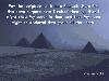 One of our series of religious screen savers. This one contains 40 photos of scenes from various places in Egypt (Cairo, Pyramids), Greece (Athens, Corinth) and Israel (Haifa, Jerusalem, Sea of Galilee, Masada) that can be viewed original size or stretched to fit screen without distortion. 27...
Platforms: Windows
| License: Shareware | Cost: $18.00 USD | Size: 2.89 MB | Download (340): A Biblical Pilgrimage To The Holy Lands Download |
Released: November 10, 2007
|
Added: November 20, 2007 | Visits: 6.091
 Geocode digital images with latitude, longitude, altitude, and direction information. RoboGEO stamps this information onto the actual photo or writes it to the EXIF headers, allowing you to permanently geotag and link your photos to the GPS coordinates. All writing to the EXIF and IPTC headers...
Platforms: Windows
| License: Demo | Cost: $39.95 USD | Size: 8.28 MB | Download (1179): RoboGEO Download |