


Gps Maps Michelin software
Gps Maps Michelin
Added: October 25, 2010 | Visits: 1.222
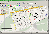
 GMap is a Map editor for GPS maps that runs on linux. This project is a work in progress. GMap reads various formats and writes .mp polish map format files suitable for compiling using the cgpsmapper compiler. I also have some notes relating to the use of GPS tools on Linux and the use of...
Platforms: *nix
| License: Shareware | Cost: $0.00 USD | Size: 952.32 KB | Download (203): GMap 0.0.4 Download |
Released: August 23, 2012
|
Added: August 23, 2012 | Visits: 667
 All-in-one software for creation of custom GPS maps compatible with Garmin GPS units. Mapwel supports routing, ESRI shapefiles, OpenStreetMap OSM, Google Earth KML and KMZ, cGPSmapper MP and GPX files. Mapwel custom GPS mapping capability and user icons editor are often used in forestry,...
Platforms: Windows
| License: Shareware | Cost: $45.00 USD | Size: 12.28 MB | Download (454): Mapwel Download |
Released: August 24, 2012
|
Added: August 24, 2012 | Visits: 552
 The GPSMapEdit software was designed for visual authoring of GPS-maps in various proprietary cartographic formats. GPSMapEdit will help you work with Garmin MapSource, Polish format (input files for cGPSmapper.exe), ALAN Map 500/600, Holux, Navitel Navigator (Pocket PC navigation software).
Platforms: Windows
| License: Demo | Cost: $65.00 USD | Size: 2.4 MB | Download (54): GPSMapEdit Portable Download |
Released: June 20, 2012
|
Added: June 20, 2012 | Visits: 537
 The GPSMapEdit software was designed for visual authoring of GPS-maps in various proprietary cartographic formats. GPSMapEdit will help you work with Garmin MapSource, Polish format (input files for cGPSmapper.exe), ALAN Map 500/600, Holux, Navitel Navigator (Pocket PC navigation software).
Platforms: Windows
| License: Demo | Cost: $65.00 USD | Size: 2.4 MB | Download (51): GPSMapEdit Download |
Released: March 14, 2018
|
Added: June 20, 2018 | Visits: 802
 With Final Selection you can make the selection of your photos as you have always wanted!
- Create your selection of photos using the colors, give them a score using the stars and order them by dragging them to the position you want
- Save your projects for future revisions
- Add custom...
With Final Selection you can make the selection of your photos as you have always wanted!
- Create your selection of photos using the colors, give them a score using the stars and order them by dragging them to the position you want
- Save your projects for future revisions
- Add custom...
Platforms: Windows 8, Windows 7, Windows
| License: Freeware | Size: 11.67 MB | Download (155): Final Selection Download |
Released: October 11, 2012
|
Added: October 11, 2012 | Visits: 601
QLandkarte GT is a handy, easy to use program specially designed to offer users a ultimate outdoor aficionado's tool.
This application offers support for GPS maps in GeoTiff format as well as Garmin's img vector map format.
for WindowsXP, Vista, 7
Platforms: Windows, Windows Vista, 7
| License: Freeware | Download (498): QLandkarte GT Download |
Released: June 13, 2012
|
Added: June 13, 2012 | Visits: 727
 View maps of Earth and other planets with PrettyMap! See current day and night regions, learn geography by taking the quiz, enjoy 3D elevation surfaces, measure distances between locations and create your own maps with special places! PrettyMap lets you view vector and raster maps and images...
Platforms: Windows, Pocket PC
| License: Shareware | Cost: $19.95 USD | Size: 4.02 MB | Download (56): PrettyMap - World Atlas and Maps, GPS Download |
Added: May 10, 2013 | Visits: 1.089
This project allows someone to track a GPS enabled cell phone using Google maps.For this project it is used a Motorola i355 cell phone on the Sprint/Nextel network. You need to have a data plan so that you can make updates to your website from the cellphone. Project includes J2ME cell phone...
Platforms: Windows, Mac, *nix, PHP, BSD Solaris
| License: Freeware | Download (81): GPS Tracker Download |
Added: February 15, 2010 | Visits: 2.250
GPS Tracker project allows someone to track a GPS enabled cell phone using Google maps. For this project I used a Motorola i355 cell phone on the Sprint/Nextel network. You need to have a data plan so that you can make updates to your website from the cellphone. Please read the ReadMe.txt file...
Platforms: *nix
| License: Freeware | Download (203): GPS Tracker Download |
Released: November 10, 2007
|
Added: November 20, 2007 | Visits: 6.092
 Geocode digital images with latitude, longitude, altitude, and direction information. RoboGEO stamps this information onto the actual photo or writes it to the EXIF headers, allowing you to permanently geotag and link your photos to the GPS coordinates. All writing to the EXIF and IPTC headers...
Platforms: Windows
| License: Demo | Cost: $39.95 USD | Size: 8.28 MB | Download (1179): RoboGEO Download |
Added: July 10, 2010 | Visits: 1.477
GPS::PRN is a package for PRN - Object ID conversions. SYNOPSIS use GPS::PRN; my $obj = GPS::PRN->new(); print "PRN: ", $obj->prn_oid(22231), "n"; print "OID: ", $obj->oid_prn(1), "n"; This module maps GPS PRN number to Satellite OID and vice versa. Object Identification Number (OID)...
Platforms: *nix
| License: Freeware | Size: 4.1 KB | Download (230): GPS::PRN Download |
Released: March 01, 2010
|
Added: April 22, 2010 | Visits: 2.519
Mapyx Quo is an intuitive, easy to learn and, surprisingly simple-to-use digital mapping program which enables you to connect your GPS to your PC and manage all your waypoints, routes and tracks. View information such as elevation, distance, speed, ETA and many more. Quo supports numerous...
Platforms: Windows, Windows CE
| License: Freeware | Size: 44.95 MB | Download (7377): Mapyx Quo Download |
Released: July 01, 2012
|
Added: July 01, 2012 | Visits: 756
 Atom GPS freeware easily geotags your photos directly from your GPS device or track log. By simply connecting your GPS Device to Atom GPS and selecting your photos you can add their geolocation in one click. This action allows you to write the geolocation data to your photos exifs (information...
Platforms: Windows
| License: Freeware | Size: 7.58 MB | Download (430): ATOM GPS Download |
Released: September 07, 2012
|
Added: September 07, 2012 | Visits: 681
 GPS Converter will convert GPS coordinates between three different formats: 34.26965, -116.76783; N 34° 16.179', W 116° 46.07'; and N 34° 16' 10.74", W 116° 46' 4.2". Will map the results in Google Maps.
Platforms: Windows
| License: Freeware | Size: 1.14 MB | Download (491): GPS Converter Download |
Released: November 01, 2012
|
Added: November 01, 2012 | Visits: 486
 The Capturix GPS SDK is a ActiveX OCX Control that provide Visual Basic Developers the interface between GPS receivers and their applications. This is a very simple control with a simple configuration methods and very easy to implement. It provides direct support to MapQuest website and creates...
Platforms: Windows
| License: Shareware | Cost: $39.00 USD | Size: 1.02 MB | Download (55): Capturix GPS SDK Download |
Released: August 15, 2013
|
Added: August 20, 2013 | Visits: 972
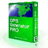 The GPS Generator PRO application is designed for providing assitance in developing, testing and debugging programs and equipment working with the NMEA-0183 protocol. This application can also be used for learning and testing navigation applications and equipment before purchasing.
GPS Generator...
The GPS Generator PRO application is designed for providing assitance in developing, testing and debugging programs and equipment working with the NMEA-0183 protocol. This application can also be used for learning and testing navigation applications and equipment before purchasing.
GPS Generator...
Platforms: Windows, Other
| License: Shareware | Cost: $84.99 USD | Size: 4.3 MB | Download (994): GPS Generator PRO Download |
Released: August 25, 2012
|
Added: August 25, 2012 | Visits: 630
 GPS Mapping Software for Windows, Loading topographic maps, realtime navigation, track recording, manage GPS devices and more. The software can be used with various map formats including: GeoTiff, BSB Nautical Charts, AutoCad DXF files, ESRI Shapefiles. Using calibration you can also use scanned...
Platforms: Windows
| License: Shareware | Cost: $149.00 USD | Size: 11.13 MB | Download (48): Eye4Software GPS Mapping Studio Download |
Released: June 13, 2012
|
Added: June 13, 2012 | Visits: 898
![]() With the new Icons-Land Vista Style GIS/GPS/Map Icon Set now it is much more comfortable to use local service applications, GPS tracking and GIS applications, and any kind of mapping applications. GIS/GPS/Map Icons are meant to help users to orient oneself when using maps, to facilitate their...
With the new Icons-Land Vista Style GIS/GPS/Map Icon Set now it is much more comfortable to use local service applications, GPS tracking and GIS applications, and any kind of mapping applications. GIS/GPS/Map Icons are meant to help users to orient oneself when using maps, to facilitate their...
Platforms: Windows, Mac, Pocket PC, Java, Handheld/Mobile Other
| License: Demo | Cost: $120.00 USD | Size: 2.53 MB | Download (57): Icons-Land Vista Style GIS/GPS/MAP Icon Set Download |
Added: July 09, 2013 | Visits: 556
This project allows someone to track a GPS enabled cell phone using Google maps.For this project it is used a Motorola i355 cell phone on the Sprint/Nextel network. You need to have a data plan so that you can make updates to your website from the cellphone.Project includes J2ME cell phone source...
Platforms: PHP
| License: Freeware | Size: 204.8 KB | Download (46): GPS Tracker for Scripts Download |
Released: September 07, 2014
|
Added: September 21, 2014 | Visits: 754
![]() With the new Icons-Land GIS/GPS/Map Vector Icons now it is much more comfortable to use local service applications, GPS tracking and GIS applications, and any kind of mapping applications.
GIS/GPS/Map Icons are meant to help users to orient oneself when using maps, to facilitate their...
With the new Icons-Land GIS/GPS/Map Vector Icons now it is much more comfortable to use local service applications, GPS tracking and GIS applications, and any kind of mapping applications.
GIS/GPS/Map Icons are meant to help users to orient oneself when using maps, to facilitate their...
Platforms: Windows, Mac, Windows 8, Windows 7, iOS
| License: Demo | Cost: $180.00 USD | Size: 5.56 MB | Download (40): Icons-Land GIS/GPS/MAP Vector Icons Download |