


Google Earth software
Google Earth
Added: May 15, 2013 | Visits: 399
 The exif2gmap simply adds google map and marker of "" linkedjpeg whenever jpeg has geotag info in exif.The geotag is additional location information which locates exif header of jpeg file.Latest digital camera has capability to add geotag using GPS.You also add geotag to existing jpeg using...
Platforms: PHP
The exif2gmap simply adds google map and marker of "" linkedjpeg whenever jpeg has geotag info in exif.The geotag is additional location information which locates exif header of jpeg file.Latest digital camera has capability to add geotag using GPS.You also add geotag to existing jpeg using...
Platforms: PHP
| License: Freeware | Size: 10 KB | Download (46): exif2gmap Download |
Released: October 21, 2009
|
Added: November 24, 2022 | Visits: 1.593
 Open Contacts is an advanced address book program for managing contact info of individuals and organizations with relationships. The program was designed for people who need more beyond legacy address book programs in order to improve dynamic interactions with contacts. With SyncML for Open...
Platforms: Windows, Windows 7
Open Contacts is an advanced address book program for managing contact info of individuals and organizations with relationships. The program was designed for people who need more beyond legacy address book programs in order to improve dynamic interactions with contacts. With SyncML for Open...
Platforms: Windows, Windows 7
| License: Free | Cost: $0.00 USD | Size: 4.96 MB | Download (444): Open Contacts Download |
Released: August 02, 2012
|
Added: August 02, 2012 | Visits: 412
 Visualize your data...in 3D! Quick, easy and inexpensive. GraphEarth enables marketing and other business professionals to create stunning visual representations of their data, all without the time and costs associated with a full-featured GIS. Create one of a kind deliverables and distribute...
Platforms: Windows
Visualize your data...in 3D! Quick, easy and inexpensive. GraphEarth enables marketing and other business professionals to create stunning visual representations of their data, all without the time and costs associated with a full-featured GIS. Create one of a kind deliverables and distribute...
Platforms: Windows
| License: Demo | Cost: $19.95 USD | Size: 463 KB | Download (498): GraphEarth Download |
Added: April 24, 2013 | Visits: 451
Matlab script to read KML files into a mapstruct structure array and offers the option of writing to a Shapefile. KML files must be of a uniform type: Point, LineString, LinearRing orPolygon. The output contains 5-6 fields, 'Geometry', 'X', 'Y', 'altitude', 'Id' and 'name'. The final field is...
Platforms: Matlab
| License: Freeware | Size: 10 KB | Download (45): KML-Matlab-Shapefile conversion Download |
Added: May 07, 2013 | Visits: 360
MODLAND Tile Calculatorto generate a kml file for showing in google earth. help us to find the exact land cover of a MODIS tile pixel.
Platforms: Matlab
| License: Shareware | Cost: $0.00 USD | Size: 10 KB | Download (39): Modis Tile pixel Download |
Added: May 03, 2013 | Visits: 532
Open Web Analytics (OWA) is open source web analytics software that you can use to track and analyze how people use your web sites and applications. The goal of the project Open Web Analytics is to provide web site owners and developers with easy ways to add web analytics to their sites using...
Platforms: PHP
| License: Shareware | Cost: $0.00 USD | Size: 2.14 MB | Download (42): Open Web Analytics Download |
Added: March 30, 2013 | Visits: 294
Have small amount of HDD space on Your server ? Now it's no problem (at least if You have db space unlimited) This plugin will store all uploded files into DB. I'm using it for my photo gallery (http://marek.bisz.pl). There will be further features (file metadata, geolocation info, kml output for...
Platforms: PHP
| License: Freeware | Size: 10 KB | Download (46): evDbFiles Download |
Added: July 29, 2013 | Visits: 400
Timeline Map was built as a Views 2 style plug-in.It is based on Timemap.js project, so Timemap.js (from http://code.google.com/p/timemap/) has to be included in the moduled-deOaos js directory.It allows you to load one or more datasets onto both a map and a timeline simultaneously. Only items in...
Platforms: PHP
| License: Freeware | Size: 30.72 KB | Download (45): Timelinemap Download |
Added: July 16, 2013 | Visits: 367
CocoaSlideShow is a Mac OS X simple, fast image viewer, spiritual son of Slides!. CocoaSlideShow is the perfect companion for iPhone GPS tagged photos. With CocoaSlideShow you can: * easily select a few pictures out of big folders screencast * display your photos fullscreen, and use Apple...
Platforms: Mac
| License: Freeware | Size: 10.24 KB | Download (40): CocoaSlideShow Download |
Added: November 26, 2013 | Visits: 361
collective.geo.kml provides KML views for georeferenced objects, allowing Plone containers and collections to be visualized in Google Earth. It also provides a map view to Plone Folder and Topic content types to display kml data.
Platforms: *nix
| License: Shareware | Cost: $0.00 USD | Size: 30.72 KB | Download (38): collective.geo.kml Download |
Added: July 21, 2013 | Visits: 623
Features: * Zenity for a GUI * Adds extra repositories: Ubuntu restricted, extras, Medibuntu, Getdeb, Dropbox (only if you select to install Dropbox) * Installs from repositories: The GIMP, Pidgin, WINE, Choose between the best 3 docks for Linux (Docky, Cairo Dock and Avant Window...
Platforms: *nix
| License: Freeware | Size: 61.44 KB | Download (36): Ubuntu Start Download |
Released: November 01, 2012
|
Added: November 01, 2012 | Visits: 489
 The Capturix GPS SDK is a ActiveX OCX Control that provide Visual Basic Developers the interface between GPS receivers and their applications. This is a very simple control with a simple configuration methods and very easy to implement. It provides direct support to MapQuest website and creates...
Platforms: Windows
The Capturix GPS SDK is a ActiveX OCX Control that provide Visual Basic Developers the interface between GPS receivers and their applications. This is a very simple control with a simple configuration methods and very easy to implement. It provides direct support to MapQuest website and creates...
Platforms: Windows
| License: Shareware | Cost: $39.00 USD | Size: 1.02 MB | Download (55): Capturix GPS SDK Download |
Released: June 13, 2012
|
Added: June 13, 2012 | Visits: 1.139
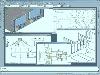 CAD CAM Linking Design with CNC Machining, AutoCAD Clone Design natively reads and writes AutoCAD DWG files, no need for conversion! progeCAM Professional offers machinists the choice of multi-axis milling, lathe or wire EDM. AutoLISP, VBA, ADS programming, import from PDF, Advanced Rendering, 3D...
Platforms: Windows
CAD CAM Linking Design with CNC Machining, AutoCAD Clone Design natively reads and writes AutoCAD DWG files, no need for conversion! progeCAM Professional offers machinists the choice of multi-axis milling, lathe or wire EDM. AutoLISP, VBA, ADS programming, import from PDF, Advanced Rendering, 3D...
Platforms: Windows
| License: Shareware | Cost: $1475.00 USD | Size: 202.77 MB | Download (430): progeCAD-CAM IntelliCAD CNC Download |
Added: May 10, 2013 | Visits: 334
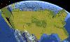
Earth3D exists as a Java and a C++ application. Both can be used at least on Linux, Windows and MacOS X. The speed of both applications is similar, the Java version seems not to be slower. So both versions are quite similar. There are users that just want to use the application to view the...
Platforms: Windows, Mac, *nix, C/C++, BSD Solaris
| License: Freeware | Download (52): Earth3D Download |
Added: July 03, 2013 | Visits: 369
GeoPress adds geographic tagging of your posts and pages. You can enter an address, points on a map, or enter latitude & longitude using the post interface. You can also include the post location within the body itself to make it easy to geotag using emailed posts and desktop clients. Maps can be...
Platforms: PHP
| License: Freeware | Size: 10 KB | Download (50): GeoPress Download |
Added: October 19, 2013 | Visits: 357
This is a simple Java application which lists the locations stored in your local iPhone backup files, or where it currently is at by find my iPhone. Features Find my iPhone tracking. Auto loading of backup folders on Windows (7 tested, Vista/NT/XP should work), and Mac OSX (10.6.7 tested)....
Platforms: Mac
| License: Shareware | Cost: $0.00 USD | Size: 3.22 MB | Download (35): iPhoneStalker Download |
Added: August 19, 2008 | Visits: 651
 With PixGPS it's easy to track the exact positioin where you took your photos. You need a GPS Receiver. Download the photos and the track file from the GPS. PixGPS will calculate the position of each photo and insert this in the EXIF data of each photo. You can also see the location on a map...
Platforms: Windows
With PixGPS it's easy to track the exact positioin where you took your photos. You need a GPS Receiver. Download the photos and the track file from the GPS. PixGPS will calculate the position of each photo and insert this in the EXIF data of each photo. You can also see the location on a map...
Platforms: Windows
| License: Shareware | Cost: $19.95 USD | Size: 1.45 MB | Download (467): PixGPS Download |
Added: August 19, 2008 | Visits: 3.676
 Fugawi Global Navigator and Fugawi Marine ENC are the ideal PC software tool for route planning, GPS programming, and real-time GPS navigation on land, sea and in the air. With Fugawi Global Navigator you can navigate in real time using the widest variety of digital maps, such as NOAA RNC,...
Platforms: Windows
Fugawi Global Navigator and Fugawi Marine ENC are the ideal PC software tool for route planning, GPS programming, and real-time GPS navigation on land, sea and in the air. With Fugawi Global Navigator you can navigate in real time using the widest variety of digital maps, such as NOAA RNC,...
Platforms: Windows
| License: Demo | Cost: $119.95 USD | Size: 40.05 MB | Download (1120): Fugawi Global Navigator Download |
Released: December 29, 2010
|
Added: January 06, 2011 | Visits: 4.325
 OkMap is a GPS and map software that:
-Works with vectorial maps and calibrates raster maps
-Organizes paths by creating waypoints, routes and tracks
-Uploads/downloads data to/from your GPS
-Uses altitude DEM data
-Supports GPS real-time navigation
-Sends/receives vehicles position...
Platforms: Windows
OkMap is a GPS and map software that:
-Works with vectorial maps and calibrates raster maps
-Organizes paths by creating waypoints, routes and tracks
-Uploads/downloads data to/from your GPS
-Uses altitude DEM data
-Supports GPS real-time navigation
-Sends/receives vehicles position...
Platforms: Windows
| License: Freeware | Size: 20.25 MB | Download (1277): OkMap Download |
Added: August 31, 2008 | Visits: 3.348
GeoVisu is a visualization software for geographic data - graphic files, images and GPS. It provides real time GPS navigation (moving map - NMEA 0183 protocol or Garmin USB), displayed with diverse geographic data (MIF, GPX, NMEA, KML/KMZ, SHP, ECW, GeoTiff, MrSID). It can download waypoints,...
Platforms: Windows
| License: Freeware | Size: 1.5 MB | Download (1383): GeoVisu Download |