


Google Earth software
Google Earth
Released: October 10, 2012
|
Added: October 10, 2012 | Visits: 569
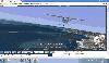
 A software utility that listens on an IP network for UDP datagrams representing the geographical coordinates of the simulated flight path of an instance of the X-Plane® flight simulator, then transforms them into a series of continuously updated KML files that Google Earth® can ingest to create...
Platforms: Mac
A software utility that listens on an IP network for UDP datagrams representing the geographical coordinates of the simulated flight path of an instance of the X-Plane® flight simulator, then transforms them into a series of continuously updated KML files that Google Earth® can ingest to create...
Platforms: Mac
| License: Freeware | Size: 768 KB | Download (52): Xplage for Mac OS Download |
Released: November 25, 2012
|
Added: November 25, 2012 | Visits: 594
KML Editor is a small, Java based application specially designed to offer user a simple editor for KML files suitable for Google Maps, Google Earth and other applications.
This editor allows for raw text editing, addition of timestamps and timespans for placemarks, and merging of KML files....
Platforms: Windows
| License: Freeware | Download (71): KML Editor Download |
Released: October 03, 2012
|
Added: October 03, 2012 | Visits: 564
Coral View is a handy, easy to use application specially designed to offer you a lightweight XML based database (Infobase).
This tool is developed to be suitable for storing and retrieving numeric values, electronic documents, web pages, Internet addresses and Google Earth Places.
for WindowsAll
Platforms: Windows
| License: Freeware | Download (50): Coral View Download |
Released: August 20, 2012
|
Added: August 20, 2012 | Visits: 683
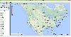
View amazing satellite images of earth with the free version of google earth software.Google earth is a totally free software which enables you zoom in from satellite,view,rotate or tilt just like a camera of the entire earth inside your pc.It works just point and click on any part of earth or by...
Platforms: Windows
| License: Freeware | Size: 798 KB | Download (529): Free Satellite images Download |
Released: October 16, 2012
|
Added: October 16, 2012 | Visits: 356
 fly_earth_chung is a free 3D flight / car / shoot simulator using google earth geplugin, javascript and freebasic. Explore the world in plane,car or feet. Include a freebasic exe application for sound/joystick interface and web launcher.
Platforms: Windows, Mac, Linux
fly_earth_chung is a free 3D flight / car / shoot simulator using google earth geplugin, javascript and freebasic. Explore the world in plane,car or feet. Include a freebasic exe application for sound/joystick interface and web launcher.
Platforms: Windows, Mac, Linux
| License: Freeware | Size: 5.1 MB | Download (52): fly_earth_chung Download |
Released: August 10, 2012
|
Added: August 10, 2012 | Visits: 260
This PHP script allows You to plot bubble charts on Google Earth. Have Your data in a query, view, table with fields: folder, name, latitude, longitude, radius, color, additional data. Set the DB parameters in the config file, and enjoy the results.
Platforms: Windows, Mac, Linux
| License: Freeware | Size: 3.07 KB | Download (44): GEarthPlot Download |
Released: June 11, 2012
|
Added: June 11, 2012 | Visits: 386
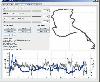 This program takes NMEA, CSV, GPR or GPX logfiles from your GPS device, manages your tracks and exports them as KML to Google Earth. Investigate altitude and speed information, measure distances and cut tracks.
Platforms: Windows, Mac, Linux
This program takes NMEA, CSV, GPR or GPX logfiles from your GPS device, manages your tracks and exports them as KML to Google Earth. Investigate altitude and speed information, measure distances and cut tracks.
Platforms: Windows, Mac, Linux
| License: Freeware | Size: 1.77 MB | Download (46): GpRoko - Track Analyzer Download |
Released: October 23, 2012
|
Added: October 23, 2012 | Visits: 394
Converts Google Earth KML file to a CSV file, and vice versa. This enables you to plot all custom POIs with Google Earth first before transferring them into your Garmin GPS using the POI Loader.
Platforms: Windows, Mac, BSD, Linux
| License: Freeware | Size: 273.25 KB | Download (43): KMLCSV Converter Download |
Released: November 11, 2012
|
Added: November 11, 2012 | Visits: 408
With this tool a single image or a sequence of images can be transformed into a Super Overlay for Google Earth.
Platforms: Windows, Mac, Linux
| License: Freeware | Size: 12.78 MB | Download (57): Super Overlay Generator Download |
Released: November 20, 2012
|
Added: November 20, 2012 | Visits: 346
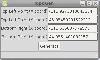 TopoGen is a small PyGTK application which will make a topographic image overlay for Google Earth using the given coordinate boundaries.
Platforms: Windows, Mac, Linux
TopoGen is a small PyGTK application which will make a topographic image overlay for Google Earth using the given coordinate boundaries.
Platforms: Windows, Mac, Linux
| License: Freeware | Size: 30.28 KB | Download (54): TopoGen Download |
Released: October 16, 2012
|
Added: October 16, 2012 | Visits: 673
PhotoKML can be used to generate KML files that show pictures on the Google Earth map. You can either import pictures that are already geo-referenced or link your picture with a GPS track. The tool will generate a self contained kmz file that include all the icosn & thumbnails versions of the...
Platforms: Mac
| License: Freeware | Size: 235.52 KB | Download (57): PhotoKML Download |
Added: May 10, 2013 | Visits: 474
KML is short for Keyhole Markup Language. It is a form of XML that is widely used for transferring geographic information, chiefly to Google Earth but also to other systems that can understand KML.The format can be used to transfer points, lines and shapes - both 2D and 3D - though this module...
Platforms: Windows, Mac, *nix, PHP, BSD Solaris
| License: Freeware | Download (57): KML module Download |
Added: April 06, 2013 | Visits: 383
Creates a file in kmz format that can be opened into Google Earth.GEplot uses the same syntax as the traditional plot function but requires Latitude and Longitude (WGS84) instead of x and y.Examples:GEplot('my_track',Lat,Lon);GEplot('my_track',Lat,Lon,'o-r','MarkerSize',10,'LineWidth',3)Colors...
Platforms: Matlab
| License: Freeware | Size: 30.72 KB | Download (45): GEplot Download |
Added: July 14, 2013 | Visits: 233
GESCATTER creates a .kml file that displays colored circles at the locations specified by the vectors LON and LAT similar to ML's builtin function, SCATTER.The color of the circles is scaled relative to the values provided in third input, C.I searched the FEX's many submissions dealing with...
Platforms: Matlab
| License: Freeware | Size: 10 KB | Download (48): GESCATTER Download |
Added: April 12, 2013 | Visits: 444
ct_gearth is a new content type based on the Google Earth API. Users can attach .kml files to a node (with upload module), which in turn is displayed through the Google Earth API. If a user attaches several .kml files it is possible to choose between them via a drop-down box.This module is part...
Platforms: PHP
| License: Freeware | Size: 10 KB | Download (43): KML content type Download |
Added: October 26, 2013 | Visits: 387
Cartographica allows you to use your Mac to explore and refine data, create beautiful maps, export information for the web using Google Maps and Google Earth (via our KML Export capabilities). Merge data from several sources. Get local data from your government in CSV Latitude and Longitude (or...
Platforms: Mac
| License: Shareware | Cost: $495.00 USD | Size: 45.76 MB | Download (41): Cartographica Download |
Added: November 26, 2013 | Visits: 201
GeoToad is a tool for serious geocachers. It lets you make advanced queries to find the perfect caches to hit on your day out, and export them to any imaginable format. Here is what it can do: On-demand queries for geocaches based on 15 different constraints: query type, distance, difficulty,...
Platforms: *nix
| License: Freeware | Size: 1.41 MB | Download (33): GeoToad Download |
Released: January 12, 2014
|
Added: September 18, 2014 | Visits: 790
 Maps Downloader For Google Map is a smart tool which can help you download tile satellite images from google map fastly and stably.It can stitch tile images into one big seamless image:Software can stitch tile images into one big seamless image such as GeoTIFF and GeoJPEG. But if the exported...
Platforms: Windows, Windows 7, Windows Server
Maps Downloader For Google Map is a smart tool which can help you download tile satellite images from google map fastly and stably.It can stitch tile images into one big seamless image:Software can stitch tile images into one big seamless image such as GeoTIFF and GeoJPEG. But if the exported...
Platforms: Windows, Windows 7, Windows Server
| License: Shareware | Cost: $49.95 USD | Size: 4.71 MB | Download (1243): Maps Dwonloader For Google Map Download |
Released: January 13, 2014
|
Added: October 09, 2014 | Visits: 846
 Maps Downloader For Google Terrain is a smart tool which can help you download tile satellite images from google map fastly and stably.It can stitch tile images into one big seamless image:Software can stitch tile images into one big seamless image such as GeoTIFF and GeoJPEG. But if the...
Platforms: Windows, Windows 7, Windows Server
Maps Downloader For Google Terrain is a smart tool which can help you download tile satellite images from google map fastly and stably.It can stitch tile images into one big seamless image:Software can stitch tile images into one big seamless image such as GeoTIFF and GeoJPEG. But if the...
Platforms: Windows, Windows 7, Windows Server
| License: Shareware | Cost: $49.95 USD | Size: 4.72 MB | Download (1234): Maps Downloader For Google Terrain |
Released: August 11, 2014
|
Added: October 09, 2014 | Visits: 1.064
 Maps Downloader For Google Satellite is a smart tool which can help you download tile satellite images from google map fastly and stably.It can stitch tile images into one big seamless image:Software can stitch tile images into one big seamless image such as GeoTIFF and GeoJPEG. But if the...
Platforms: Windows, Windows 7, Windows Server
Maps Downloader For Google Satellite is a smart tool which can help you download tile satellite images from google map fastly and stably.It can stitch tile images into one big seamless image:Software can stitch tile images into one big seamless image such as GeoTIFF and GeoJPEG. But if the...
Platforms: Windows, Windows 7, Windows Server
| License: Shareware | Cost: $49.95 USD | Size: 4.74 MB | Download (1240): Maps Downloader For Google Satellite |