


Detailed Maps Norway software
Detailed Maps Norway
Added: September 16, 2013 | Visits: 432
 The Bing Maps iOS Control is an Objective-C control for embedding maps directly into native iOS apps. With a rich, gesture-based UI provided by Seadragon, the Bing Maps iOS Control provides support for adding pushpins and other overlays to the map, allows your device location to be displayed, and...
Platforms: Mac
| License: Shareware | Cost: $0.00 USD | Size: 6.64 MB | Download (43): Bing Maps Control for iOS Download |
Added: June 23, 2013 | Visits: 399
Magic Maps was designed from the ground up as a Mac application. As such, it benefits from enhanced ease-of-use and increased performance. Desktop integration Magic Maps seamlessly integrates with your desktop environment so that you can work more productively. Drag and Drop. To import data,...
Platforms: Mac
| License: Commercial | Cost: $19.99 USD | Size: 43.4 MB | Download (38): Magic Maps Download |
Added: October 30, 2013 | Visits: 495
This utility provides monitoring of the port maps used by hosts associated with an AirPort base station when NAT is used. It provides both a detailed and simplified view of open ports; the detailed view shows information on the remote hosts being accessed by local hosts, while the simplified view...
Platforms: Mac
| License: Freeware | Size: 51.2 KB | Download (37): AirPort Port Inspector Download |
Added: August 28, 2013 | Visits: 602
Diversity Maps is a data visualization tool for plant geneticists and breeders. It generates publication-quality, vector-based chromosome maps displaying differences in marker states between individuals. Features Displays haplotype similarity by color; Sorts accessions automatically to...
Platforms: *nix
| License: Freeware | Size: 4.24 MB | Download (33): Diversity Maps For Linux Download |
Added: October 05, 2013 | Visits: 750
This app makes it easy to display a map for given address in django templates. No API keys, manual geocoding, html/js copy-pasting or django model changes is needed. Installation pip install geopy pip install django-easy-maps Then add 'easy_maps' to INSTALLED_APPS and run ./manage.py syncdb...
Platforms: *nix
| License: Freeware | Size: 10.24 KB | Download (56): django-easy-maps Download |
Added: September 09, 2013 | Visits: 520
All Your Maps Are Belong To Us is a Firefox extension that translates URLs for other mapping sites to Google Maps.
Platforms: *nix
| License: Freeware | Size: 10.24 KB | Download (36): All Your Maps Are Belong To Us Download |
Released: September 05, 2010
|
Added: September 17, 2010 | Visits: 3.748
 PolyMap is a desktop mapping program that lets you use your own data to customize the maps supplied with the program. Use the built-in spreadsheet to enter data or paste it from other Windows applications. Alternatively, you can use the import feature to bring in data from external spreadsheets,...
Platforms: Windows
| License: Shareware | Cost: $89.95 USD | Size: 7.37 MB | Download (712): Polymap Download |
Added: July 26, 2006 | Visits: 2.371
 Versamap draws outline maps on 14 map projections. The program allows users to print publication quality maps on any printer supported by Windows; and to export maps in vector graphic (WMF, CGM, DXF, ASCII) and bitmapped (BMP) formats.
Versamap is supplied with digital maps from the Versamap...
Versamap draws outline maps on 14 map projections. The program allows users to print publication quality maps on any printer supported by Windows; and to export maps in vector graphic (WMF, CGM, DXF, ASCII) and bitmapped (BMP) formats.
Versamap is supplied with digital maps from the Versamap...
Platforms: Windows
| License: Shareware | Cost: $30.00 USD | Size: 896 KB | Download (124): Versamap for Windows Download |
Released: November 10, 2007
|
Added: November 20, 2007 | Visits: 6.092
 Geocode digital images with latitude, longitude, altitude, and direction information. RoboGEO stamps this information onto the actual photo or writes it to the EXIF headers, allowing you to permanently geotag and link your photos to the GPS coordinates. All writing to the EXIF and IPTC headers...
Platforms: Windows
| License: Demo | Cost: $39.95 USD | Size: 8.28 MB | Download (1179): RoboGEO Download |
Added: July 16, 2006 | Visits: 4.232
MindMaster is a powerful visual tool for planning, collaboration and business process management. MindMaster helps business professionals and teams plan, organize and manage information-based activities. Decisions are made much faster, meeting times are decreased and project planning is greatly...
Platforms: Windows
| License: Shareware | Cost: $29.99 USD | Size: 1.06 MB | Download (184): MindMaster Download |
Released: November 06, 2004
|
Added: July 05, 2006 | Visits: 3.085
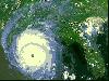 Eye in the Sky screensaver contains 43 detailed satellite images of Earth. The following images are included: Antarctica, Argentina, Asian dust cloud over Korea and Japan, Australia, Bahamas, Bosporus Straits - Turkey, Central America, Coral Atolls, Cuba Florida and Bahamas, Cypress, Dasht-e...
Platforms: Windows
| License: Demo | Cost: $11.00 USD | Size: 4.54 MB | Download (117): Eye in the Sky Download |
Released: July 01, 2005
|
Added: March 03, 2006 | Visits: 3.959
 A good travelogue often requires a map showing the destinations or route. With MapCreator you can create the maps necessary for this purpose. The map type, extract and scale are freely adjustable. The maps are of a very high quality and can be used in all media without query and cost.
Platforms: Windows
| License: Freeware | Size: 29.61 MB | Download (565): MapCreator Free Edition Download |
Released: May 01, 2011
|
Added: May 21, 2011 | Visits: 2.586
 Anychart is a flexible Flash based-solution, which allows you to easily display any sort of data dealing with geographical locations. It contains United States Maps with Counties, World Map, etc. XML data file and a set of customizable options make AnyChart Maps a universal solution for web...
Platforms: OS/2, Windows, Mac, *nix, Windows CE, Pocket PC, Palm OS 6.0,Not Applicable,Handheld/Mobile Other,Java,MS-DOS,AS/400
| License: Shareware | Cost: $399.00 USD | Size: 10.27 MB | Download (118): AnyChart Flash Map Component Download |
Added: May 27, 2006 | Visits: 3.847
Flash maps US States. With this fully-clickable map you will be able to improve navigation and provide visitors with better and quicker access to information as well as improve the way you present the information. The map can be used "as is" however it is also easily customizable. In just a few...
Platforms: Windows
| License: Demo | Cost: $69.00 USD | Size: 44 KB | Download (484): Zoom Flash Map US States Download |
Released: November 09, 2006
|
Added: November 14, 2006 | Visits: 4.291
 Geo World is a handy application for finding out detailed information about any country in the world. One of its advantages is that you can find the country you were looking for by Internet Country Code, Capital and etc. Also it's supplied with more than 530 images which represent flags and maps...
Platforms: Windows
| License: Shareware | Cost: $25.00 USD | Size: 6.24 MB | Download (324): Geo World Download |
Released: November 23, 2006
|
Added: November 23, 2006 | Visits: 6.062
 The program StitchMaps simply joins these maps.
The result is a map that is suitable for programs using raster scan.
The maps used as basis for the assembly were either created by scanning templates, or by exports from digitalized maps.
The program is available as standard and as plus...
The program StitchMaps simply joins these maps.
The result is a map that is suitable for programs using raster scan.
The maps used as basis for the assembly were either created by scanning templates, or by exports from digitalized maps.
The program is available as standard and as plus...
Platforms: Windows
| License: Shareware | Cost: $45.00 USD | Size: 554.8 KB | Download (454): StitchMaps Download |
Released: January 02, 2007
|
Added: January 06, 2007 | Visits: 2.636
 Imports gridded data into Microsoft MapPoint, to produce attractive data maps that resemble contour maps.
Input data consists of a value that is defined for various (gridded) geographic coordinates. Common text output formats such as CSV are supported.
Can handle imperfect data, holes,...
Imports gridded data into Microsoft MapPoint, to produce attractive data maps that resemble contour maps.
Input data consists of a value that is defined for various (gridded) geographic coordinates. Common text output formats such as CSV are supported.
Can handle imperfect data, holes,...
Platforms: Windows
| License: Shareware | Cost: $75.00 USD | Size: 2.16 MB | Download (907): GridImp Download |
Released: June 27, 2008
|
Added: July 05, 2008 | Visits: 1.379
 OMapView is a professional map browser. Both satellite imagery and maps online can be viewed through it. With the cache technology, it improve the user experience of viewing map. And more, the map can be viewed even when the computer is offline. It's a multi-window application, different places...
Platforms: Windows
| License: Shareware | Cost: $29.95 USD | Size: 1.75 MB | Download (131): OMapView Download |
Added: August 06, 2008 | Visits: 706
 ajmZip Manager will provide you with detailed information and demographics for each zip code area in the US. Longitude, latitude, time zone, demographics going back to 1980 - it's all here. Compute distances between zip codes and determine zip codes within a radius. Produce maps using the...
Platforms: Windows
| License: Shareware | Cost: $39.00 USD | Size: 16.81 MB | Download (515): ajmZip Manager Download |
Released: October 21, 2009
|
Added: November 24, 2022 | Visits: 1.592
 Open Contacts is an advanced address book program for managing contact info of individuals and organizations with relationships. The program was designed for people who need more beyond legacy address book programs in order to improve dynamic interactions with contacts. With SyncML for Open...
Platforms: Windows, Windows 7
| License: Free | Cost: $0.00 USD | Size: 4.96 MB | Download (444): Open Contacts Download |