


Gps Coordinates Conversion freeware
Gps Coordinates Conversion
Released: March 01, 2010
|
Added: April 22, 2010 | Visits: 2.515
 Mapyx Quo is an intuitive, easy to learn and, surprisingly simple-to-use digital mapping program which enables you to connect your GPS to your PC and manage all your waypoints, routes and tracks. View information such as elevation, distance, speed, ETA and many more. Quo supports numerous...
Platforms: Windows, Windows CE
| License: Freeware | Size: 44.95 MB | Download (7377): Mapyx Quo Download |
Released: January 30, 2024
|
Added: February 06, 2024 | Visits: 5.426
 Pixillion is a free JPEG and image file format conversion software for Mac. Pixillion Image Converter Software Free can convert files from and to JPEG and other file formats like gif, tiff, png, pdf and more. Before converting your file Pixillion allows you to view the image within the...
Platforms: Mac
| License: Freeware | Size: 4.5 MB | Download (2685): Pixillion Image Converter Free for Mac Download |
Released: September 08, 2009
|
Added: September 14, 2009 | Visits: 3.870
 PhotoGPSEditor is an easy to use meta-data editor for photo (JPEG, RAW) files, plus it can match data from GPS (gpx or NMEA) files. The program is freeware, however, donations can be made to help support future development. With PhotoGPSEditor you can add location and summary details to a...
Platforms: Mac
| License: Freeware | Size: 2.39 MB | Download (1330): PhotoGPSEditor Download |
Released: December 29, 2010
|
Added: January 06, 2011 | Visits: 4.315
 OkMap is a GPS and map software that:
-Works with vectorial maps and calibrates raster maps
-Organizes paths by creating waypoints, routes and tracks
-Uploads/downloads data to/from your GPS
-Uses altitude DEM data
-Supports GPS real-time navigation
-Sends/receives vehicles position...
OkMap is a GPS and map software that:
-Works with vectorial maps and calibrates raster maps
-Organizes paths by creating waypoints, routes and tracks
-Uploads/downloads data to/from your GPS
-Uses altitude DEM data
-Supports GPS real-time navigation
-Sends/receives vehicles position...
Platforms: Windows
| License: Freeware | Size: 20.25 MB | Download (1277): OkMap Download |
Released: November 17, 2009
|
Added: April 17, 2010 | Visits: 2.519
 CopanMobile for Pocket PC is a very functional and easy-to-use geomatics engineering tool for computing and managing plane surveying and mapping coordinates.
It does numerous coordinate geometry (COGO) calculations, processes and adjusts raw field survey data, computes and adjusts map...
CopanMobile for Pocket PC is a very functional and easy-to-use geomatics engineering tool for computing and managing plane surveying and mapping coordinates.
It does numerous coordinate geometry (COGO) calculations, processes and adjusts raw field survey data, computes and adjusts map...
Platforms: Pocket PC, Windows
| License: Freeware | Size: 662.68 KB | Download (1153): CopanMobile for PocketPC Download |
Released: January 24, 2011
|
Added: February 17, 2011 | Visits: 2.464
 GPS log-maker. Software create *.plt track file, *.rte route file and, optionally, NMEA-log file.
The program from TL_Gate*.cab can work via COM-port or Franson GpsGate software API, but it requires installed GpsGate in any case. If GpsGate is installed the best way is to use it.
TrackLog...
GPS log-maker. Software create *.plt track file, *.rte route file and, optionally, NMEA-log file.
The program from TL_Gate*.cab can work via COM-port or Franson GpsGate software API, but it requires installed GpsGate in any case. If GpsGate is installed the best way is to use it.
TrackLog...
Platforms: Windows
| License: Freeware | Size: 91.3 KB | Download (1002): DXsoft TrackLog Download |
Released: July 17, 2013
|
Added: September 18, 2013 | Visits: 5.602
 Text2Html is a freeware plain text to HTML converter. This application is ideal for webmasters who must quickly convert many plain text files into HTML format. Text2Html features Windows Explorer integration. This allows the selection of any number of files and folders for conversion in any...
Platforms: Windows
| License: Freeware | Size: 1.15 MB | Download (1001): Text2Html Download |
Added: March 12, 2006 | Visits: 12.989
HS GPS is a software library (with full C source code) which provides access to a NMEA-183 compliant GPS receiver via a serial communications port, decoding NMEA sentences: $GPGGA, $GPGSA, $GPGSV, $GPGLL, $GPRMC and $GPVTG. Decoded parameters include: time, date, position, altitude, speed, course...
Platforms: Palm OS, Windows
| License: Freeware | Size: 309 KB | Download (973): HS NMEA GPS C Source Library 1.0 Download |
Released: January 25, 2010
|
Added: August 18, 2010 | Visits: 1.059
 Set of programs to convert GPS-tracks of *.gpx, *.mps, *.plt or *.nmea format to route files *.rt2. Software creates two route files - forward route and backward one.
Platforms: Windows
| License: Freeware | Size: 26.06 KB | Download (878): Gpx2rt2 Download |
Added: June 17, 2010 | Visits: 3.057
FLAC is a lossless compression method for audio files. Using it, one is able to reduce the filesize and keep the same audio quality as a regular WAV file (CD quality). The FLAC format is open source, and can be read without any problem by such applications as Amarok or Kaffeine. Wav and Flac...
Platforms: *nix
| License: Freeware | Download (822): Wav and Flac conversion Download |
Added: October 22, 2006 | Visits: 5.405
 Uconeer has 370 units in 42 categories. Covers all the basic categories but adds engineering specific categories like enthalpy, entropy, heat capacity, heat transfer coefficient, moment of inertia, stress, surface tension, thermal conductivity, torque and viscosity. Converts feet, inches and...
| License: Freeware | Size: 478 KB | Download (696): Uconeer - Units Conversion for Engineers Download |
Released: January 20, 2012
|
Added: March 05, 2013 | Visits: 847
 A program to convert GPS-track of *.gpx, *.mps, *.plt or *.nmea format to Navitel Tracks.bin "blue line" file.
Platforms: Windows
| License: Freeware | Size: 31.64 KB | Download (623): Gpx2bin Download |
Added: August 26, 2008 | Visits: 1.995
Simple String Conversion works to convert any character string to the right version for C, C++, JavaScript or VisualBasic programming languages. The conversion speed epends, as is logical, on the quantity and length of the text to be converted, and the power of the PC you use to run the...
Platforms: Windows
| License: Freeware | Size: 1024 B | Download (622): Simple String Conversion Download |
Released: June 10, 2012
|
Added: June 10, 2012 | Visits: 1.016
Video Magic Free is a powerful but easy to use freeware for multimedia file conversion. Expanding your multimedia entertainment, Video Magic Free realizes you to freely access and enjoy video files on both PC and your popular portable device. Possessing Video Magic Free, you will have a wonderful...
Platforms: Windows
| License: Freeware | Size: 18.14 MB | Download (584): Video Magic Free Download |
Released: March 23, 2012
|
Added: April 08, 2012 | Visits: 1.626
 Flash Magazine Free PDF to ePub is a standalone and efficient desktop application to convert PDF format to ePub. That is to say, this PDF to ePub conversion tool has the ability to convert PDF file and finally output an eBook format, which is supported by many mobile devices, such as iPad,...
Platforms: Windows, Windows CE
| License: Freeware | Size: 10.19 MB | Download (571): Flash Magazine Free PDF to ePub Download |
Released: January 09, 2013
|
Added: January 09, 2013 | Visits: 664
 This utility can be used to analyze GPS log files and then generate graphs, summaries, reports and Google Earth (TM) compatible KML files. With the PRO version you can create trip reports with details such as drive time, drive distance, stop time, etc.
Platforms: Windows
| License: Freeware | Size: 648 KB | Download (540): KML Generator Download |
Released: January 15, 2013
|
Added: January 15, 2013 | Visits: 674
![]() Use your GPS equipped Windows Mobile device to create a Google Earth compatible KML file and track log. Also tracks total distance, elevation gain and average speed.
Use your GPS equipped Windows Mobile device to create a Google Earth compatible KML file and track log. Also tracks total distance, elevation gain and average speed.
Platforms: Windows, Pocket PC
| License: Freeware | Size: 61 KB | Download (539): Catfood Tracker Download |
Released: November 16, 2012
|
Added: November 16, 2012 | Visits: 485
 Provides hours of entertainment by combining the technology in your phone with one of the fastest-growing international hide and seek games - geocaching (also known as "GPS treasure hunt"). By using your Nokia's GPS and built-in Internet, Geocache Navigator™ creates a seamless and exciting...
Platforms: Handheld/Mobile Other, Java
| License: Freeware | Size: 225.28 KB | Download (534): Geocache Navigator Download |
Released: August 25, 2012
|
Added: August 25, 2012 | Visits: 591
VirtualGPS - is a free, small utility, which fully emulates GPS receiver and returns your location (by using cellular towers and wifi hotspots). Location accuracy is about 50-500m. TUTORIAL 1. Run VirtualGPS, wait less than 1 minute until GPS: ON (or OFF in bad case) will be shown. 2. Run...
Platforms: Windows, Mac, Palm OS 1.0, Palm OS 2.0, Palm OS 2.1, Palm OS 3.0, Palm OS 3.1, Palm OS 3.2
| License: Freeware | Size: 195 KB | Download (529): VirtualGPS Download |
Released: November 04, 2012
|
Added: November 04, 2012 | Visits: 1.369
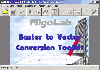 Software development kit for CAD/CAM/ GIS and graphic software developers. Converts from raster to vector and refines architect, mechanical, tech drawing, maps, math graphs, graphics for books and journals and more. ActiveX and Com Component are also available. Refines vector graphics, creates...
Platforms: Windows
| License: Freeware | Size: 2.67 MB | Download (526): Algolab Raster to Vector Conversion CAD/ Download |