


Gps Coordinates Conversion software
Gps Coordinates Conversion
Released: September 07, 2012
|
Added: September 07, 2012 | Visits: 682
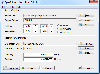
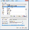
 GPS Converter will convert GPS coordinates between three different formats: 34.26965, -116.76783; N 34° 16.179', W 116° 46.07'; and N 34° 16' 10.74", W 116° 46' 4.2". Will map the results in Google Maps.
Platforms: Windows
| License: Freeware | Size: 1.14 MB | Download (491): GPS Converter Download |
Released: November 07, 2012
|
Added: November 07, 2012 | Visits: 621
 With this tool you can add GPS coordinates to vCards - electronic business cards - that you have previously exported from e. g. Microsoft Outlook. Therefore the tool uses the address data contained within the vCards and adds the exact GPS position on that basis to the vCard. This way you can use...
Platforms: Windows
| License: Freeware | Size: 1.47 MB | Download (503): GPS to vCard Download |
Added: August 18, 2013 | Visits: 524
 A collection of utilities for translating GPS coordinates to related coordinate systems (Earth Centere Fixed, Topocentric, UTM) with auxiliary routins for horizon computation and ray ellipsoid intercepts.
Platforms: Matlab
| License: Freeware | Size: 1.28 MB | Download (57): GPS Coordinate Transformations Download |
Released: May 25, 2018
|
Added: June 25, 2018 | Visits: 3.613
 HoudahGeo is a photo geocoding and geotagging tool for Mac. Use HoudahGeo to attach GPS coordinates and location names to your photos.
HoudahGeo writes EXIF and XMP geotags to JPEG and RAW image files. This creates a permanent record of where a photo was taken. Just like a GPS-enabled camera....
HoudahGeo is a photo geocoding and geotagging tool for Mac. Use HoudahGeo to attach GPS coordinates and location names to your photos.
HoudahGeo writes EXIF and XMP geotags to JPEG and RAW image files. This creates a permanent record of where a photo was taken. Just like a GPS-enabled camera....
Platforms: Mac
| License: Demo | Cost: $39.00 USD | Size: 22.87 MB | Download (837): HoudahGeo Download |
Released: November 20, 2015
|
Added: April 20, 2016 | Visits: 3.090
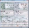
 The Eye4Software Coordinate Calculator is an easy to use tool to perform map or GPS coordinate conversions. The software can be used to transform a single coordinate or a batch of coordinates read from a comma separated, database or ESRI shapefiles. The software is shipped with a MS Access...
Platforms: Windows, Windows 7
| License: Shareware | Cost: $119.00 USD | Size: 8.96 MB | Download (249): Eye4Software Coordinate Calculator Download |
Released: July 13, 2017
|
Added: August 30, 2017 | Visits: 4.510
 TRANSDAT geosoftware executes coordinate transformations and geodetic datum shifts between many coordinate and reference systems of America, Australasia, Europe, Germany special and world-wide, with high precision and high speed: 1.The current and historical coordinate and reference systems of...
Platforms: Windows, Windows 8, Windows 7, Windows Server
| License: Shareware | Cost: $170.00 USD | Size: 4.43 MB | Download (325): TRANSDAT Download |
Released: May 02, 2014
|
Added: May 14, 2014 | Visits: 738
 TRANSDAT geosoftware executes coordinate transformations and geodetic datum shifts between many coordinate and reference systems of America, Australasia, Europe, Germany special and world-wide, with high precision and high speed: 1.The current and historical coordinate and reference systems of...
Platforms: Windows, Windows 8, Windows 7, Windows Server
| License: Shareware | Cost: $210.00 USD | Size: 2.91 MB | Download (53): TRANSDAT English Download |
Added: February 15, 2010 | Visits: 2.251
GPS Tracker project allows someone to track a GPS enabled cell phone using Google maps. For this project I used a Motorola i355 cell phone on the Sprint/Nextel network. You need to have a data plan so that you can make updates to your website from the cellphone. Please read the ReadMe.txt file...
Platforms: *nix
| License: Freeware | Download (203): GPS Tracker Download |
Released: November 10, 2007
|
Added: November 20, 2007 | Visits: 6.096
 Geocode digital images with latitude, longitude, altitude, and direction information. RoboGEO stamps this information onto the actual photo or writes it to the EXIF headers, allowing you to permanently geotag and link your photos to the GPS coordinates. All writing to the EXIF and IPTC headers...
Platforms: Windows
| License: Demo | Cost: $39.95 USD | Size: 8.28 MB | Download (1179): RoboGEO Download |
Added: June 06, 2010 | Visits: 1.204
Happy Camel is intended to combine your digital camera with your GPS device. It you feed it a list of digital photos and a tracklog, it figures out where these images were taken. Happy Camel can embed this position in the EXIF-data of your photos and create a .kmz file for Google Earth...
Platforms: *nix
| License: Freeware | Size: 19.46 KB | Download (95): Happy Camel 1 Beta Download |
Released: December 05, 2008
|
Added: December 19, 2008 | Visits: 2.080
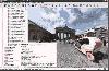 The Panorado 4.0 image viewer/browser offers a comfortable, innovative mouse-oriented interface for panning and zooming. This makes it particularly suitable for viewing panoramic pictures, pictures exceeding the screen size, and HDR (High Dynamic Range) images. As a Windows application, it...
Platforms: Windows
| License: Shareware | Cost: $29.99 USD | Size: 2.72 MB | Download (137): Panorado Download |
Released: November 23, 2012
|
Added: November 23, 2012 | Visits: 525
 The main purpose of this popular tool is to quickly and easily resize photos from a digital camera to a smaller size for further use (especially to share the photos on web or by email). Nevertheless, Jpeg Resampler 2010 also offers many other features such as
* convert between image formats...
The main purpose of this popular tool is to quickly and easily resize photos from a digital camera to a smaller size for further use (especially to share the photos on web or by email). Nevertheless, Jpeg Resampler 2010 also offers many other features such as
* convert between image formats...
Platforms: Windows
| License: Freeware | Size: 1.3 MB | Download (55): JPEG Resampler Download |
Released: November 02, 2012
|
Added: November 02, 2012 | Visits: 518
 The main purpose of this popular tool is to quickly and easily resize photos from a digital camera to a smaller size for further use (especially to share the photos on web or by email). Nevertheless, Jpeg Resampler 2010 also offers many other features such as * convert between image formats (JPG,...
Platforms: Windows
| License: Freeware | Size: 1.3 MB | Download (52): JPEG Resampler 2010 Download |
Released: September 20, 2012
|
Added: September 20, 2012 | Visits: 482
Location spy will enable you to send an SMS and retrieve the location (GSM or GPS) of the handset delivered to you via SMS.
The location information as responded by the Location Spy depends on the model of the phone. If the phone has GPS capabilities, the GPS coordinates will be retrieved, which...
Platforms: Windows, Mac, Vist
| License: Shareware | Cost: $199.99 USD | Size: 1000 KB | Download (425): Location Spy Download |
Released: August 19, 2012
|
Added: August 19, 2012 | Visits: 661
 The Eye4Software Coordinate Calculator is an easy to use desktop software tool, to perform gps coordinate conversions from one coordinate system to another. It can also be used to convert coordinates between different map datums. The software can be used to convert a single coordinate, or to...
Platforms: Windows
| License: Shareware | Cost: $43.51 USD | Size: 1.4 MB | Download (462): Coordinate Calculator Download |
Added: July 19, 2013 | Visits: 490
MassGeotagger lets you select a photo, a photo folder or a folder tree and update the latitude and longitude coordinates in the EXIF data of the selected photos. To get the GPS coordinates, the method of choice is to select one or several GPX files and set the difference of time between APN time...
Platforms: Mac
| License: Shareware | Cost: $0.00 USD | Size: 4.95 MB | Download (55): MassGeotagger Download |
Added: July 28, 2013 | Visits: 260
libchamplain is a C library created to provide a GTK+ widget to display rasterized maps. Here are some key features of "libchamplain": ?*A* Display a map (OpenStreetMap Mapnik) ?*A* Tiles are downloaded and cached ?*A* You can drag to move (la Google Maps) ?*A* without or with kinetic...
Platforms: *nix
| License: Freeware | Size: 655.36 KB | Download (39): libchamplain Download |
Added: June 28, 2013 | Visits: 372
gpx2map reads a gps track in GPX format (as produced by e.g. gpsbabel) and writes out an Google Map or or OpenStreetMaps mash-up containing the route and a height profile. gpx2map can also show GPS-tagged photos along the map. Installation Just copy (or link) the file gpx2map into your path or...
Platforms: *nix
| License: Freeware | Size: 92.16 KB | Download (45): gpx2map Download |
Added: March 12, 2006 | Visits: 2.733
 This is the pefect computer program for searchers of Bigfoot.This program lets you record detailed information about eachof your quests and/or encounters, such as: DATE OF SIGHTING, TIME, SIGHTING DETAILS, LOCATION INFO, GPS COORDINATES, SOUNDINFO, SMELLS, MOTION SENSOR ACTIVITY, NIGHT VISION...
Platforms: Windows
| License: Shareware | Cost: $9.99 USD | Size: 880 KB | Download (724): Bigfoot Searcher Download |
Released: February 01, 2003
|
Added: June 13, 2006 | Visits: 4.269
 This program was made for Metal Detector users by Metal Detector users! The author (programmer) contacted over 100 metal detector users and asked them what features they wanted in a computer program for their hobby, and 'Metal Detector - Treasure Hunter Professional' is a result of those top...
Platforms: Windows
| License: Shareware | Cost: $10.00 USD | Size: 968 KB | Download (263): Metal Detector - Treasure Hunter Pro Download |