


Gis freeware
Gis
Added: January 25, 2010 | Visits: 722
 GRASS GIS, commonly referred to as GRASS (Geographic Resources Analysis Support System), is a Geographic Information System (GIS) used for geospatial data management and analysis, image processing, graphics/maps production, spatial modeling, and visualization. GRASS is currently used in academic...
Platforms: Mac
| License: Freeware | Download (116): GRASS GIS Download |
Added: June 21, 2010 | Visits: 1.464
QLandkarte can view and upload map files, track and waypoint data to your Garmin GPS receiver. Garmins MapSource software is hardly the only reason for me to boot into Windows and it does not look like Garmin ever wants to address Linux users by writing a portable piece of software. So I...
Platforms: *nix
| License: Freeware | Size: 972.8 KB | Download (116): QLandkarte Download |
Added: February 05, 2010 | Visits: 770
Geotools is an open source Java GIS toolkit for developing standards compliant solutions. GeoTools project provides an implementation of Open Geospatial Consortium (OGC) specifications as they are developed. Geotools maintains an open development process, with public collaboration on new ideas...
Platforms: *nix
| License: Freeware | Size: 26 MB | Download (113): GeoTools Download |
Added: May 21, 2010 | Visits: 909
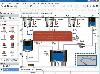
CartoWeb is a comprehensive and ready-to-use Web-GIS (Geographical Information System) as well as a convenient framework for building advanced and customized applications. Developed by Camptocamp SA, it is based on the UMN MapServer engine and is released under the GNU General Public License...
Platforms: *nix
| License: Freeware | Size: 11.6 MB | Download (109): CartoWeb Download |
Added: September 22, 2010 | Visits: 922
ArcheOS is the acronym of Archeological Operating System. ArcheOS distribution is a GNU/Linux live distribution built for archaeological aims and based on PCLinuxOS. Here you can download the .iso image. To run ArcheOS, you have to burn a DVD with archeos_1-0-1.iso and put it inside your DVD...
Platforms: *nix
| License: Freeware | Size: 1.07 GB | Download (107): ArcheOS Download |
Added: June 11, 2010 | Visits: 998
GeoServer project connects your information to the Geospatial Web. With GeoServer, you can publish and edit data using open standards. Your information is made available in a large variety of formats as maps/images or actual geospatial data. GeoServers transactional capabilities offer robust...
Platforms: *nix
| License: Freeware | Size: 25.9 MB | Download (104): GeoServer Download |
Added: September 24, 2010 | Visits: 1.314
WMS Javascript Library is an object-oriented JavaScript library for creating dynamic Web-based maps from otherwise static WMS (Web Map Service) images by adding pan/zoom functionality with Google Maps-like draggability. Custom clickable overlays can be added to create a useful GIS. WMS...
Platforms: *nix
| License: Freeware | Size: 389.12 KB | Download (104): WMS Javascript Library Download |
Added: January 25, 2010 | Visits: 640
Geo3D's features include:Flexible mouse and keyboard navigation through and around the models with many configuration options Open and save 3DMF files (3D Metafile) in text or binary format Preview 3DMF textures Export 2D images and animation sequences in PEG, PNG, TIFF, and Photoshop format at...
Platforms: Mac
| License: Freeware | Download (102): Geo3D Download |
Added: July 05, 2010 | Visits: 743
MaxEntropy is a Perl5 module for Maximum Entropy Modeling and Feature Induction. SYNOPSIS use Statistics::MaxEntropy; # debugging messages; default 0 $Statistics::MaxEntropy::debug = 0; # maximum number of iterations for IIS; default 100 $Statistics::MaxEntropy::NEWTON_max_it = 100; #...
Platforms: *nix
| License: Freeware | Size: 41.98 KB | Download (100): Statistics::MaxEntropy Download |
Added: May 10, 2013 | Visits: 892
MonetDB is a open-source database system for high-performance applications in data mining, OLAP, GIS, XML Query, text and multimedia retrieval. MonetDB often achieves a significant speed improvement for SQL and XQuery over other open-source systems. Use the product strands as your roadmap for...
Platforms: Windows, Mac, *nix, C/C++, BSD Solaris
| License: Freeware | Download (100): MonetDB Download |
Added: September 17, 2010 | Visits: 1.157
PostGIS adds support for geographic objects to the PostgreSQL object-relational database. In effect, PostGIS "spatially enables" the PostgreSQL server, allowing it to be used as a backend spatial database for geographic information systems (GIS), much like ESRIs SDE or Oracles Spatial extension....
Platforms: *nix
| License: Freeware | Size: 1.4 MB | Download (98): PostGIS Download |
Added: August 08, 2010 | Visits: 1.138
Mercator Grid project is a real time strategy game using GIS data. Mercator Grid is a networked real-time strategy game that incorporates actual GIS map terrain and NATO map symbology (MIL-STD-2500B). It can be configured to include several player roles, including fire team leaders and...
Platforms: *nix
| License: Freeware | Download (96): Mercator Grid Download |
Added: January 25, 2010 | Visits: 639
Anatas is a scriptable drag-and-drop application that converts text 3DMF files to binary form and vice versa.
Platforms: Mac
| License: Freeware | Download (92): Anatas Download |
Added: January 14, 2010 | Visits: 1.200
OGDI is the Open Geographic Datastore Interface. OGDI is an application programming interface (API) that uses a standardized access methods to work in conjunction with GIS software packages (the application) and various geospatial data products. OGDI uses a client/server architecture to...
Platforms: *nix
| License: Freeware | Size: 911.36 KB | Download (91): Open Geographic Datastore Interface Download |
Added: October 23, 2010 | Visits: 719
openModeller library is a spatial distribution modelling library, providing a uniform method for modelling distribution patterns using a variety of modelling algorithms. openModeller can be used via programatic interfaces, including SOAP and SWIG-python, as well as via a user friendly desktop...
Platforms: *nix
| License: Freeware | Download (90): openModeller Download |
Added: May 10, 2013 | Visits: 808
Road Advertisement Panel Control is a web-based system to record, and manage advertisement panels in the roads. Cross-platform application written in PHP. It uses a GIS component based on mapserver to visualize the advertisement panel locations.
Platforms: Windows, Mac, *nix, PHP, BSD Solaris
| License: Freeware | Download (81): Road Advertisement Panel Control Download |
Added: May 10, 2013 | Visits: 578
Do you need to see DXF files in Php? This software is for you! You can see DXF files in PHP and execute query inside. It's the best for GIS applications!
Platforms: Windows, Mac, *nix, PHP, BSD Solaris
| License: Freeware | Download (72): Convert DXF to .sql Download |
Released: October 01, 2012
|
Added: October 01, 2012 | Visits: 945
 Visual Graph is a standard ActiveX component for developing graphics-related applications of various industries, such as power, coal, chemical, automation monitor, simulation, graphical modeling, graphical topology analysis, vector drawing, tables, geographic information system (GIS), workflow,...
Platforms: Windows
| License: Freeware | Size: 6.66 MB | Download (68): Visual Graph ActiveX Component Download |
Released: November 15, 2012
|
Added: November 15, 2012 | Visits: 1.048
GeoDataSource Free Cities Edition provides geographical database of world features, cities with place names and region names.
Free database of worldwide cities in text format suitable for any applications requiring a comprehensive list of cities and country code. It is a subset of the paid...
Platforms: Windows
| License: Freeware | Download (68): GeoDataSource World Cities Database Free Edition Download |
Released: September 17, 2012
|
Added: September 17, 2012 | Visits: 676
 Open Source Remote Sensing OSSIM project, pronounced 'awesome', will leverage existing algorithms/tools/packages from the open source community in construction of the ultimate Remote Sensing/Image Processing/GIS package. osgPlanet extends OSSIM and Op
Platforms: Windows, Mac, Solaris, Linux
| License: Freeware | Size: 42.61 MB | Download (67): OSSIM - Open Source Software Image Map Download |