


Gis freeware
Gis
Released: December 04, 2012
|
Added: December 04, 2012 | Visits: 315
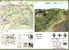
 An attempt to design minimum cost broadband networks with the use of a modified version of the Particle Swarm Optimization method. A GIS subsystem is used for the visualization of data and results.
Platforms: Windows, Mac, Linux
An attempt to design minimum cost broadband networks with the use of a modified version of the Particle Swarm Optimization method. A GIS subsystem is used for the visualization of data and results.
Platforms: Windows, Mac, Linux
| License: Freeware | Size: 1.02 MB | Download (55): NetDesigner GIS Download |
Added: August 18, 2008 | Visits: 1.362
 Genesis IV is a landscape database and graphics system particularly targeted at Professional GIS and Educational users. Create great graphics for your clients, enthuse and educate your students, or explore geographical data, GenesisIV is unique multifaceted software and much more than a simple...
Platforms: Windows
Genesis IV is a landscape database and graphics system particularly targeted at Professional GIS and Educational users. Create great graphics for your clients, enthuse and educate your students, or explore geographical data, GenesisIV is unique multifaceted software and much more than a simple...
Platforms: Windows
| License: Freeware | Size: 23.84 MB | Download (606): GenesisIV Download |
Added: August 12, 2008 | Visits: 955
NewCyber3D provides full source code CDs covering a wide range of topics relevant to OpenGL GIS, terrain, stereo display, image processing and visualization. Each CD includes the entire OpenGL program and demonstrations with full source codes (including library source codes), project files,...
Platforms: Windows
| License: Freeware | Download (549): NewCyber3D Download |
Added: January 14, 2010 | Visits: 1.206
OGDI is the Open Geographic Datastore Interface. OGDI is an application programming interface (API) that uses a standardized access methods to work in conjunction with GIS software packages (the application) and various geospatial data products. OGDI uses a client/server architecture to...
Platforms: *nix
| License: Freeware | Size: 911.36 KB | Download (91): Open Geographic Datastore Interface Download |
Added: February 05, 2010 | Visits: 774
Geotools is an open source Java GIS toolkit for developing standards compliant solutions. GeoTools project provides an implementation of Open Geospatial Consortium (OGC) specifications as they are developed. Geotools maintains an open development process, with public collaboration on new ideas...
Platforms: *nix
| License: Freeware | Size: 26 MB | Download (113): GeoTools Download |
Released: November 16, 2012
|
Added: November 16, 2012 | Visits: 493
 The goal of VTP is to foster the creation of tools for easily constructing any part of the real world in interactive, 3D digital form.
This goal will require a synergetic convergence of the fields of CAD, GIS, visual simulation, surveying and remote sensing. VTP gathers information and tracks...
Platforms: Mac, Linux
The goal of VTP is to foster the creation of tools for easily constructing any part of the real world in interactive, 3D digital form.
This goal will require a synergetic convergence of the fields of CAD, GIS, visual simulation, surveying and remote sensing. VTP gathers information and tracks...
Platforms: Mac, Linux
| License: Freeware | Size: 2.2 MB | Download (492): Virtual Terrain Project for Mac OS X and Linux Download |
Released: October 22, 2012
|
Added: October 22, 2012 | Visits: 589
IrriPro is the only software that let you design an irrigation system only by drawing the elements: now it's possible, thanks to the INDO technology (Irrigation Network Data Object) developed by Irriworks, to draw the elements of a system (such as outlets, pipes, etc) and of a terrain, not only...
Platforms: Windows
| License: Freeware | Size: 161 MB | Download (467): IrriPro Download |
Released: June 18, 2012
|
Added: June 18, 2012 | Visits: 478
 The goal of VTP is to foster the creation of tools for easily constructing any part of the real world in interactive, 3D digital form.
This goal will require a synergetic convergence of the fields of CAD, GIS, visual simulation, surveying and remote sensing. VTP gathers information and tracks...
Platforms: Windows
The goal of VTP is to foster the creation of tools for easily constructing any part of the real world in interactive, 3D digital form.
This goal will require a synergetic convergence of the fields of CAD, GIS, visual simulation, surveying and remote sensing. VTP gathers information and tracks...
Platforms: Windows
| License: Freeware | Size: 1024 KB | Download (420): Virtual Terrain Project for Windows Download |
Released: August 16, 2012
|
Added: August 16, 2012 | Visits: 530
uDig is a user-friendly desktop Internet GIS, a core element in an internet aware Geographic Information System.
The application is an open source spatial data viewer / editor, that comes with a special emphasis on the OpenGIS standards for internet GIS, the Web Map Server and Web Feature Server...
Platforms: Windows
| License: Freeware | Download (439): uDig Download |
Released: October 17, 2012
|
Added: October 17, 2012 | Visits: 866
![]() Icons-Land Company advertises exclusive set of icons - Vista Style Points of Interest Icon Set V2. The images are represented in 4 variations of colors (green, blue, red, orange) and 2 variations of backgrounds (plain and circled). Colors variety helps distinguishing the same objects on the map...
Platforms: Windows, Mac, Linux, Handheld/Mobile Other, Java
Icons-Land Company advertises exclusive set of icons - Vista Style Points of Interest Icon Set V2. The images are represented in 4 variations of colors (green, blue, red, orange) and 2 variations of backgrounds (plain and circled). Colors variety helps distinguishing the same objects on the map...
Platforms: Windows, Mac, Linux, Handheld/Mobile Other, Java
| License: Freeware | Size: 17.49 MB | Download (61): Icons-Land Vista Style POI Icon Set Download |
Released: October 01, 2012
|
Added: October 01, 2012 | Visits: 951
 Visual Graph is a standard ActiveX component for developing graphics-related applications of various industries, such as power, coal, chemical, automation monitor, simulation, graphical modeling, graphical topology analysis, vector drawing, tables, geographic information system (GIS), workflow,...
Platforms: Windows
Visual Graph is a standard ActiveX component for developing graphics-related applications of various industries, such as power, coal, chemical, automation monitor, simulation, graphical modeling, graphical topology analysis, vector drawing, tables, geographic information system (GIS), workflow,...
Platforms: Windows
| License: Freeware | Size: 6.66 MB | Download (68): Visual Graph ActiveX Component Download |
Released: September 14, 2012
|
Added: September 14, 2012 | Visits: 308
GeoPhyloBuilder was specially designed as an accessible and handy extension for ArcGIS.
GeoPhyloBuilder is a tool that allows you to build a spatiotemporal phylogeographic GIS model from a tree and a set of geographical features.
Platforms: Windows, 2K, XP, Windows Vista, 7
| License: Freeware | Download (46): GeoPhyloBuilder Download |
Released: October 01, 2012
|
Added: October 01, 2012 | Visits: 381
 An expensive GIS software is maybe not suitable for your purpose. If you are using one for analysis or simulation and feeling one of these: huge, complicated, slow and unremovable, it's time to change. Why MicroCity? Versatile: Additional to fundamental GIS functions, many unique libraries such...
Platforms: Windows
An expensive GIS software is maybe not suitable for your purpose. If you are using one for analysis or simulation and feeling one of these: huge, complicated, slow and unremovable, it's time to change. Why MicroCity? Versatile: Additional to fundamental GIS functions, many unique libraries such...
Platforms: Windows
| License: Freeware | Size: 3.95 MB | Download (544): Portable MicroCity Download |
Released: August 18, 2012
|
Added: August 18, 2012 | Visits: 371
 An expensive GIS software is maybe not suitable for your purpose. If you are using one for analysis or simulation and feeling one of these: huge, complicated, slow and unremovable, it's time to change. Why MicroCity? Versatile: Additional to fundamental GIS functions, many unique libraries such...
Platforms: Windows
An expensive GIS software is maybe not suitable for your purpose. If you are using one for analysis or simulation and feeling one of these: huge, complicated, slow and unremovable, it's time to change. Why MicroCity? Versatile: Additional to fundamental GIS functions, many unique libraries such...
Platforms: Windows
| License: Freeware | Size: 3 MB | Download (530): MicroCity Download |
Released: July 17, 2012
|
Added: July 17, 2012 | Visits: 482
 JMARS is an acronym that stands for Java Mission-planning and Analysis for Remote Sensing. It is a geospatial information system (GIS) developed by ASU's Mars Space Flight Facility to provide mission planning and data-analysis tools to NASA's orbiters, instrument team members, students of all...
Platforms: Windows, Mac, Linux
JMARS is an acronym that stands for Java Mission-planning and Analysis for Remote Sensing. It is a geospatial information system (GIS) developed by ASU's Mars Space Flight Facility to provide mission planning and data-analysis tools to NASA's orbiters, instrument team members, students of all...
Platforms: Windows, Mac, Linux
| License: Freeware | Size: 52.2 MB | Download (48): JMARS Download |
Released: June 01, 2012
|
Added: June 01, 2012 | Visits: 445
 The goal of VTP is to foster the creation of tools for easily constructing any part of the real world in interactive, 3D digital form.
This goal will require a synergetic convergence of the fields of CAD, GIS, visual simulation, surveying and remote sensing. VTP gathers information and tracks...
Platforms: Mac, Linux
The goal of VTP is to foster the creation of tools for easily constructing any part of the real world in interactive, 3D digital form.
This goal will require a synergetic convergence of the fields of CAD, GIS, visual simulation, surveying and remote sensing. VTP gathers information and tracks...
Platforms: Mac, Linux
| License: Freeware | Size: 2.2 MB | Download (422): Virtual Terrain Project for Mac OS X and Linux 1.1 Download |
Released: November 23, 2012
|
Added: November 23, 2012 | Visits: 417
 The goal of VTP is to foster the creation of tools for easily constructing any part of the real world in interactive, 3D digital form.
This goal will require a synergetic convergence of the fields of CAD, GIS, visual simulation, surveying and remote sensing. VTP gathers information and tracks...
Platforms: Windows
The goal of VTP is to foster the creation of tools for easily constructing any part of the real world in interactive, 3D digital form.
This goal will require a synergetic convergence of the fields of CAD, GIS, visual simulation, surveying and remote sensing. VTP gathers information and tracks...
Platforms: Windows
| License: Freeware | Size: 1024 KB | Download (496): Virtual Terrain Project for Windows 1.1 Download |
Released: October 25, 2012
|
Added: October 25, 2012 | Visits: 254
 CartoWeb gis php5 plugin for Kml, geoRSS and geoJSON, OpenLayers export of mapserver layers. Visit exportgge.sourceforge.net/kml/en for latest news and doc.Plugin CartoWeb php5 d'export KML, geoRSS et geoJSON.+d'infos sur exportgge.sourceforge.net/
Platforms: Windows, Mac, Linux
CartoWeb gis php5 plugin for Kml, geoRSS and geoJSON, OpenLayers export of mapserver layers. Visit exportgge.sourceforge.net/kml/en for latest news and doc.Plugin CartoWeb php5 d'export KML, geoRSS et geoJSON.+d'infos sur exportgge.sourceforge.net/
Platforms: Windows, Mac, Linux
| License: Freeware | Size: 14.06 MB | Download (47): exportGge Download |
Released: August 12, 2012
|
Added: August 12, 2012 | Visits: 322
 GeOxygene aims at providing an open framework which implements OGC/ISO specifications for the development and deployment of geographic (GIS) applications. It is a open source contribution of the COGIT lab. at the IGN (the French National Mapping Agency).
Platforms: Windows, Mac, Linux
GeOxygene aims at providing an open framework which implements OGC/ISO specifications for the development and deployment of geographic (GIS) applications. It is a open source contribution of the COGIT lab. at the IGN (the French National Mapping Agency).
Platforms: Windows, Mac, Linux
| License: Freeware | Size: 1.11 MB | Download (49): GeOxygene Download |
Released: September 16, 2012
|
Added: September 16, 2012 | Visits: 262
The development community in building GIS solutions is sustaining an enormous level of effort. The GeoAPI project aims to reduce duplication and increase interoperability by providing neutral, interface-only APIs derived from OGC/ISO Standards.
Platforms: Windows, Mac, Linux
| License: Freeware | Size: 3 MB | Download (48): GeoAPI Download |