


Waypoints software
Waypoints
Released: June 19, 2004
|
Added: May 19, 2006 | Visits: 3.262
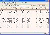 Complete voyage planning utility for ocean and coastal shipping and yachts,
unlimited number of waypoints, greatcircle or rhumbline. Caculates average weather enroute
as well as estimated vessels performance and optimal speed settings.
Includes hurricane tracking, calculation of CPA and TCPA...
Complete voyage planning utility for ocean and coastal shipping and yachts,
unlimited number of waypoints, greatcircle or rhumbline. Caculates average weather enroute
as well as estimated vessels performance and optimal speed settings.
Includes hurricane tracking, calculation of CPA and TCPA...
Platforms: Windows
| License: Shareware | Cost: $75.00 USD | Size: 1.58 MB | Download (173): NavTools Route Download |
Released: April 27, 2010
|
Added: September 27, 2010 | Visits: 3.149
 The RouteWriter add-in imports and exports waypoints for Microsoft MapPoint routes whilst maintaining their route order. Although MapPoint can import and export waypoints as pushpins, their order is usually re-arranged.
RouteWriter exports waypoints and their matching pushpins to Excel with...
The RouteWriter add-in imports and exports waypoints for Microsoft MapPoint routes whilst maintaining their route order. Although MapPoint can import and export waypoints as pushpins, their order is usually re-arranged.
RouteWriter exports waypoints and their matching pushpins to Excel with...
Platforms: Windows
| License: Shareware | Cost: $75.00 USD | Size: 3.14 MB | Download (222): RouteWriter Download |
Released: November 15, 2012
|
Added: December 09, 2012 | Visits: 777
 The MPRouteWriter add-in imports and exports waypoints for Microsoft MapPoint routes whilst maintaining their route order. Although MapPoint can import and export waypoints as pushpins, their order is usually re-arranged.
MPRouteWriter exports waypoints and their matching pushpins to Excel...
The MPRouteWriter add-in imports and exports waypoints for Microsoft MapPoint routes whilst maintaining their route order. Although MapPoint can import and export waypoints as pushpins, their order is usually re-arranged.
MPRouteWriter exports waypoints and their matching pushpins to Excel...
Platforms: Windows
| License: Shareware | Cost: $75.00 USD | Size: 3.29 MB | Download (100): MPRouteWriter Download |
Added: August 27, 2013 | Visits: 474
 GeoCosm is an Open Street Map map Viewer that allows the generation of GPX files containing waypoints. Helpfull when planning Caching tours for Geocaching. It allows the conversion of GeoCoordinates in different popular formats
Platforms: Mac
| License: Freeware | Size: 286.72 KB | Download (36): GeoCosm Download |
Added: August 24, 2013 | Visits: 434
Palm::Magellan::NavCompanion is a Perl module that gives you access to the waypoints in the Magellan's GPS Companion "Companion Waypoints.pdb" file. You have to be able to load that file, which probably means that you have it on your computer rather than your Palm. On my machine, this file shows...
Platforms: *nix
| License: Freeware | Size: 10.24 KB | Download (43): Palm::Magellan::NavCompanion Download |
Added: October 08, 2013 | Visits: 461
NPGPX is a Qt-based Netscape plugin that displays GPX files (GPS eXchange) with waypoints, routes, and tracks embedded in a webpage, with optional background maps.
Platforms: *nix
| License: Freeware | Size: 81.92 KB | Download (37): NPGPX Download |
Released: November 10, 2007
|
Added: November 20, 2007 | Visits: 6.090
 Geocode digital images with latitude, longitude, altitude, and direction information. RoboGEO stamps this information onto the actual photo or writes it to the EXIF headers, allowing you to permanently geotag and link your photos to the GPS coordinates. All writing to the EXIF and IPTC headers...
Platforms: Windows
| License: Demo | Cost: $39.95 USD | Size: 8.28 MB | Download (1179): RoboGEO Download |
Added: January 15, 2006 | Visits: 4.093
 GPS Software - Download waypoints and routes from Garmin GPS. Upload waypoints and routes to Garmin GPS. Excel and Text files supported! This software is very easy to use!
Platforms: Windows
| License: Shareware | Cost: $29.95 USD | Size: 1.29 MB | Download (203): Frontbase GPS Download |
Added: August 18, 2008 | Visits: 1.350
 Allows you to connect your hand held Global Positioning System (GPS) unit to your computer, download your waypoints, and plot them in AutoCAD or export them in .dxf Also plots the points on free public domain Aerial photos and topo maps. Works on most Garmin and Magellan GPS units, and AutoCAD...
Platforms: Windows
| License: Shareware | Cost: $345.00 USD | Size: 9.9 MB | Download (543): GPS2CAD Download |
Released: December 29, 2010
|
Added: January 06, 2011 | Visits: 4.317
 OkMap is a GPS and map software that:
-Works with vectorial maps and calibrates raster maps
-Organizes paths by creating waypoints, routes and tracks
-Uploads/downloads data to/from your GPS
-Uses altitude DEM data
-Supports GPS real-time navigation
-Sends/receives vehicles position...
OkMap is a GPS and map software that:
-Works with vectorial maps and calibrates raster maps
-Organizes paths by creating waypoints, routes and tracks
-Uploads/downloads data to/from your GPS
-Uses altitude DEM data
-Supports GPS real-time navigation
-Sends/receives vehicles position...
Platforms: Windows
| License: Freeware | Size: 20.25 MB | Download (1277): OkMap Download |
Added: September 09, 2010 | Visits: 2.503
Geo::Gpx is a Perl module to create and parse GPX files. SYNOPSIS # Version 0.10 compatibility use Geo::Gpx; my $gpx = Geo::Gpx->new( @waypoints ); my $xml = $gpx->xml; # New API, generate GPX my $gpx = Geo::Gpx->new(); $gpx->waypoints(@wpt); my $xml = $gpx->xml(1.0); # Parse GPX...
Platforms: *nix
| License: Freeware | Size: 12.29 KB | Download (214): Geo::Gpx Download |
Added: January 25, 2010 | Visits: 698
Mac SimpleGPS is Macintosh application designed to manage waypoints, routes and tracks on your GPSR (global positioning satellite receiver). The best use for Mac SimpleGPS is to download .LOC (waypoint location) files from GeoCaching.com and transfer them to your GPSr. It is also a great way to...
Platforms: Mac
| License: Freeware | Download (101): Mac SimpleGPS Download |
Added: January 25, 2010 | Visits: 708
The Garmin iQue 3600 is a PalmOS 5 PDA with built-in GPS capabilities and comes with Windows software only. iQue Conduit allows you to export tracks and waypoints from the iQue to your Mac during a HotSync operation. Data is exported in the standard XML-based GPX format and can then be brought...
Platforms: Mac
| License: Freeware | Size: 115 KB | Download (102): iQue Conduit Download |
Added: January 25, 2010 | Visits: 810
Geocaching Menu makes it easy to download geocaching waypoints from webpages directly to your GPS device without the need of first saving these on the computer. Geocaching is an outdoor activity that most often involves the use of a Global Positioning System ("GPS") receiver or traditional...
Platforms: Mac
| License: Shareware | Cost: $0.00 USD | Download (108): Geocaching Menu Download |
Released: March 01, 2010
|
Added: April 22, 2010 | Visits: 2.516
Mapyx Quo is an intuitive, easy to learn and, surprisingly simple-to-use digital mapping program which enables you to connect your GPS to your PC and manage all your waypoints, routes and tracks. View information such as elevation, distance, speed, ETA and many more. Quo supports numerous...
Platforms: Windows, Windows CE
| License: Freeware | Size: 44.95 MB | Download (7377): Mapyx Quo Download |
Released: September 08, 2012
|
Added: September 08, 2012 | Visits: 551
Allows you to transfer waypoints, tracks, and routes between your Mac and Garmin device and manage your data using your Garmin maps. RoadTrip provides the ability to search for points of interest from the convenience of your Mac and then send the locations to your Garmin GPS.
Platforms: Mac
| License: Freeware | Size: 50.3 MB | Download (61): Garmin RoadTrip for Mac OS Download |
Released: November 12, 2012
|
Added: November 12, 2012 | Visits: 485
 Create and edit waypoints, tracklogs, routes, and insert scanned images of map. More than 160 GPS models recognized. Garmin, Magellan, Eagle and others
- Most complete free program for GPS devices
- Compatible with more than 160 GPS models
- Support for Garmin, Magellan and others
- Easily...
Create and edit waypoints, tracklogs, routes, and insert scanned images of map. More than 160 GPS models recognized. Garmin, Magellan, Eagle and others
- Most complete free program for GPS devices
- Compatible with more than 160 GPS models
- Support for Garmin, Magellan and others
- Easily...
Platforms: Windows
| License: Freeware | Size: 54.92 MB | Download (57): GPS TrackMaker Download |
Released: June 07, 2012
|
Added: June 07, 2012 | Visits: 472
 Gpi2Gps converts Waypoints from Garmin GPI file format (i.e. Garmin POI Loader) to Google Earth (KMZ) or GPS compatible format (GPX) in a few steps. With GPI to GPs converter you are able to transform from GPI to GPs. Download your waypoints from your GPS or Palm PDAs and save it in .GPI format...
Platforms: Windows
| License: Demo | Cost: $20.00 USD | Size: 635 KB | Download (68): GPI to GPs converter Download |
Released: August 20, 2012
|
Added: August 20, 2012 | Visits: 373
GPSBabel reads, writes, and manipulates GPS waypoints in a variety of formats. Over 100 supported formats include GPX, Magellan and Garmin serial and USB protocols, Geocaching *.loc, Garmin Mapsource, and Magellan Mapsend. For Windows, Linux, Mac.
Platforms: Windows, Mac, BSD, Linux
| License: Freeware | Size: 1.05 MB | Download (45): GPSBabel Download |
Released: October 26, 2012
|
Added: October 26, 2012 | Visits: 510
RoadTrip allows you to search for points of interest (POIs), create and organize waypoints, routes and tracks, and easily send them to your Garmin GPS.
Platforms: Mac
| License: Freeware | Size: 50.3 MB | Download (55): Garmin RoadTrip Download |