


Kmz software
Kmz
Released: November 10, 2007
|
Added: November 20, 2007 | Visits: 6.089
 Geocode digital images with latitude, longitude, altitude, and direction information. RoboGEO stamps this information onto the actual photo or writes it to the EXIF headers, allowing you to permanently geotag and link your photos to the GPS coordinates. All writing to the EXIF and IPTC headers...
Platforms: Windows
| License: Demo | Cost: $39.95 USD | Size: 8.28 MB | Download (1179): RoboGEO Download |
Added: May 21, 2010 | Visits: 1.906
 Geo::KML::PolyMap is a Perl module to generate KML/KMZ-format choropleth (shaded polygonal) maps viewable in Google Earth. SYNOPSIS use Geo::KML::PolyMap qw(generate_kml_file generate_kmz_file); # Clusters "Total Population" data for "Foobar City" in $entities into 5 bins; # renders using...
Platforms: *nix
| License: Freeware | Size: 11.26 KB | Download (399): Geo::KML::PolyMap Download |
Released: July 18, 2012
|
Added: July 18, 2012 | Visits: 791
 Create own true to scale maps, store online maps locally with Vivo techology, map editor, dataexchange with Google Earth by Copy and Paste, GPS enabled coordinates, import of free OpenStreatMap data and GPS Exchange and GPS logger data, compatible with "GPS for Google Earth", area calculation...
Platforms: Windows
| License: Shareware | Cost: $65.00 USD | Size: 6.36 MB | Download (398): Dr. Regener LandMap Vivo Download |
Released: February 01, 2016
|
Added: February 13, 2016 | Visits: 475
 NMEA Converter is a product to convert various types of data
NMEA to UDP Converter
UDP to NMEA Converter(Reserved)
GPS to HDT Converter(Reserved)
NMEA to KML Converter(Reserved)
NMEA to KMZ Converter(Reserved)
KML to NMEA Converter(Reserved)
KMZ to NMEA Converter(Reserved)
NMEA Converter is a product to convert various types of data
NMEA to UDP Converter
UDP to NMEA Converter(Reserved)
GPS to HDT Converter(Reserved)
NMEA to KML Converter(Reserved)
NMEA to KMZ Converter(Reserved)
KML to NMEA Converter(Reserved)
KMZ to NMEA Converter(Reserved)
Platforms: Windows, Windows 8, Windows 7, Windows Server
| License: Demo | Cost: $29.00 USD | Size: 509 KB | Download (49): NMEA Converter Download |
Released: April 15, 2019
|
Added: May 14, 2019 | Visits: 1.436
 GeoJson KML To DXF Converter allows batch convert Keyhole Markup Language format to AutoCAD Drawing Exchange Format format (KML to DXF KMZ to DXF GeoJosn to DXF) is fast and easy to use tool .
Key Features
Convert KML to AutoCAD(dxf file).
Convert KMZ to AutoCAD(dxf file).
Convert GeoJson...
GeoJson KML To DXF Converter allows batch convert Keyhole Markup Language format to AutoCAD Drawing Exchange Format format (KML to DXF KMZ to DXF GeoJosn to DXF) is fast and easy to use tool .
Key Features
Convert KML to AutoCAD(dxf file).
Convert KMZ to AutoCAD(dxf file).
Convert GeoJson...
Platforms: Windows, Windows 8, Windows 7, Windows Server
| License: Shareware | Cost: $98.00 USD | Size: 3.86 MB | Download (298): SmartDWG GeoJson KML to DXF Converter Download |
Released: March 12, 2012
|
Added: April 02, 2012 | Visits: 1.070
 Visualize your data in 3D! Quick, easy and inexpensive. Graph Earth enables management, marketing and other business professionals to create stunning visual representations of their data, all without the time and costs associated with a full-featured GIS. Viewable by Everyone! Create one of a...
Platforms: Windows
| License: Demo | Cost: $24.95 USD | Size: 469 KB | Download (96): Graph Earth Download |
Released: July 20, 2012
|
Added: July 20, 2012 | Visits: 514
With GeopIPTC you will be able to read the IPTC city information in pictures and get the corresponding coordinates to your photos from several free services and embed this into the pictures in standard tags in a very professional way. You will also create sets of pictures with all the metadata...
Platforms: Windows
| License: Shareware | Cost: $104.55 USD | Size: 7.32 MB | Download (382): GeoIPTC Download |
Released: October 06, 2012
|
Added: October 06, 2012 | Visits: 509
With GeoIPTC you will be able to read the IPTC city information in pictures and get the corresponding coordinates to your photos from several free services and embed this into the pictures in standard tags in a very professional way. You will also create sets of pictures with all the metadata...
Platforms: Windows
| License: Shareware | Cost: $112.00 USD | Size: 7.32 MB | Download (455): GeoIPTC Geolocalisation de Photos Download |
Released: June 20, 2012
|
Added: June 20, 2012 | Visits: 694
 Make graph into Googlr Earth to illustrate your presentations, papers, etc. GE-Graph was developed to generate graphs from kml files saved by GE. The file generated by GE-Graph can be exported to Google Earth. Make Bars graph Make graph with geometrical shapes (circles, squares, triangles, etc)....
Platforms: Windows
| License: Freeware | Size: 1.81 MB | Download (57): GE-Graph Download |
Released: August 24, 2012
|
Added: August 24, 2012 | Visits: 544
 EasyAcreage is program for WinXP or Vista program that allows you to calculate area from KML files exported out of Google Earth. This means you do not even have to leave your house to measure a field anymore. Simply use the free version of Google Earth, mark the area you wish to measure, save it...
Platforms: Windows
| License: Shareware | Cost: $20.00 USD | Size: 472 KB | Download (530): EasyAcreage Download |
Released: August 02, 2012
|
Added: August 02, 2012 | Visits: 409
 Visualize your data...in 3D! Quick, easy and inexpensive. GraphEarth enables marketing and other business professionals to create stunning visual representations of their data, all without the time and costs associated with a full-featured GIS. Create one of a kind deliverables and distribute...
Platforms: Windows
| License: Demo | Cost: $19.95 USD | Size: 463 KB | Download (498): GraphEarth Download |
Added: April 06, 2013 | Visits: 380
Creates a file in kmz format that can be opened into Google Earth.GEplot uses the same syntax as the traditional plot function but requires Latitude and Longitude (WGS84) instead of x and y.Examples:GEplot('my_track',Lat,Lon);GEplot('my_track',Lat,Lon,'o-r','MarkerSize',10,'LineWidth',3)Colors...
Platforms: Matlab
| License: Freeware | Size: 30.72 KB | Download (45): GEplot Download |
Released: December 10, 2023
|
Added: December 19, 2023 | Visits: 245
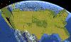
 Google Maps Downloader is a tool that can automatically download the Google Maps images to your PC. It can download the small tiles and save them to your hard disk, including the normal maps, satellite maps, hybrid maps, terrain maps, customized google maps. After downloading, you can view the...
Platforms: Windows 8, Windows 7, Windows
| License: Shareware | Cost: $59.00 USD | Size: 30.6 MB | Download (70): Google Maps Downloader |
Added: August 31, 2008 | Visits: 3.344
GeoVisu is a visualization software for geographic data - graphic files, images and GPS. It provides real time GPS navigation (moving map - NMEA 0183 protocol or Garmin USB), displayed with diverse geographic data (MIF, GPX, NMEA, KML/KMZ, SHP, ECW, GeoTiff, MrSID). It can download waypoints,...
Platforms: Windows
| License: Freeware | Size: 1.5 MB | Download (1383): GeoVisu Download |
Released: May 25, 2018
|
Added: June 25, 2018 | Visits: 3.606
 HoudahGeo is a photo geocoding and geotagging tool for Mac. Use HoudahGeo to attach GPS coordinates and location names to your photos.
HoudahGeo writes EXIF and XMP geotags to JPEG and RAW image files. This creates a permanent record of where a photo was taken. Just like a GPS-enabled camera....
HoudahGeo is a photo geocoding and geotagging tool for Mac. Use HoudahGeo to attach GPS coordinates and location names to your photos.
HoudahGeo writes EXIF and XMP geotags to JPEG and RAW image files. This creates a permanent record of where a photo was taken. Just like a GPS-enabled camera....
Platforms: Mac
| License: Demo | Cost: $39.00 USD | Size: 22.87 MB | Download (837): HoudahGeo Download |
Added: June 11, 2010 | Visits: 998
GeoServer project connects your information to the Geospatial Web. With GeoServer, you can publish and edit data using open standards. Your information is made available in a large variety of formats as maps/images or actual geospatial data. GeoServers transactional capabilities offer robust...
Platforms: *nix
| License: Freeware | Size: 25.9 MB | Download (104): GeoServer Download |
Added: June 06, 2010 | Visits: 1.198
Happy Camel is intended to combine your digital camera with your GPS device. It you feed it a list of digital photos and a tracklog, it figures out where these images were taken. Happy Camel can embed this position in the EXIF-data of your photos and create a .kmz file for Google Earth...
Platforms: *nix
| License: Freeware | Size: 19.46 KB | Download (95): Happy Camel 1 Beta Download |
Released: January 11, 2011
|
Added: January 19, 2011 | Visits: 1.400
 TransLT is designed to calculate the transformation parameters and the transformation of coordinates between two coordinates systems is a fast and practical way. The software is aimed at specialists who use GPS technology to perform geodetic works.
Main features of TransLT:
- Calculation of...
TransLT is designed to calculate the transformation parameters and the transformation of coordinates between two coordinates systems is a fast and practical way. The software is aimed at specialists who use GPS technology to perform geodetic works.
Main features of TransLT:
- Calculation of...
Platforms: Windows
| License: Demo | Cost: $90.00 USD | Size: 98.37 MB | Download (2402): TransLT Download |
Released: October 09, 2015
|
Added: January 07, 2016 | Visits: 3.750
 Eye4Software Hydromagic is hydrographic survey software for Windows. It can be used to generare depth maps using a GPS or RTK receiver and an echosounder or fishfinder.
After recording the sounding, you can generate DTM's (Digital Terrain Models), depth contours, 3D views and cross-sections....
Eye4Software Hydromagic is hydrographic survey software for Windows. It can be used to generare depth maps using a GPS or RTK receiver and an echosounder or fishfinder.
After recording the sounding, you can generate DTM's (Digital Terrain Models), depth contours, 3D views and cross-sections....
Platforms: Windows, Windows 8, Windows 7, Windows Server
| License: Demo | Cost: $1549.93 USD | Size: 83.02 MB | Download (170): Eye4Software Hydromagic Download |
Released: January 28, 2012
|
Added: February 09, 2012 | Visits: 812
 KMLReduce optimizes the size of KML files by analyzing, reducing, and removing coordinates from polygons contained within the file. This allows you to distribute the KML file online and use less traffic for users and services accessing the fille.
KMLReduce works on KML files that contian...
KMLReduce optimizes the size of KML files by analyzing, reducing, and removing coordinates from polygons contained within the file. This allows you to distribute the KML file online and use less traffic for users and services accessing the fille.
KMLReduce works on KML files that contian...
Platforms: Windows
| License: Shareware | Cost: $24.95 USD | Size: 636.75 KB | Download (437): KMLReduce Download |