


Interrupted Map Projections software
Interrupted Map Projections
Released: September 19, 2007
|
Added: July 17, 2008 | Visits: 1.615
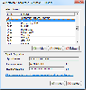
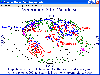 Versamap draws outline maps on 16 map projections. The program allows users to print publication quality maps; and to export maps in vector graphic (WMF, CGM, DXF, ASCII) and bitmapped (BMP) formats.Versamap is supplied with digital maps from the Versamap Micro World Database, a world map with...
Platforms: Windows
| License: Shareware | Cost: $30.00 USD | Size: 3.98 MB | Download (127): Versamap Download |
Added: July 26, 2006 | Visits: 2.367
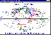 Versamap draws outline maps on 14 map projections. The program allows users to print publication quality maps on any printer supported by Windows; and to export maps in vector graphic (WMF, CGM, DXF, ASCII) and bitmapped (BMP) formats.
Versamap is supplied with digital maps from the Versamap...
Versamap draws outline maps on 14 map projections. The program allows users to print publication quality maps on any printer supported by Windows; and to export maps in vector graphic (WMF, CGM, DXF, ASCII) and bitmapped (BMP) formats.
Versamap is supplied with digital maps from the Versamap...
Platforms: Windows
| License: Shareware | Cost: $30.00 USD | Size: 896 KB | Download (124): Versamap for Windows Download |
Added: July 10, 2013 | Visits: 339
 basemap is an add-on toolkit for Matplotlib that lets you plot data on map projections with coastlines, lakes, rivers and political boundaries. See http://scipy.org/Cookbook/Matplotlib/Maps for an example of what it can do.
Platforms: *nix
| License: Freeware | Size: 98.63 MB | Download (35): basemap Download |
Added: August 07, 2008 | Visits: 783
Versamap draws outline maps on 16 map projections. The program allows users to print publication quality maps; and to export maps in vector graphic (WMF, CGM, DXF, ASCII) and bitmapped (BMP) formats. Versamap is supplied with digital maps from the Versamap Micro World Database, a world map with...
Platforms: Windows
| License: Shareware | Cost: $30.00 USD | Size: 4.07 KB | Download (103): Versamap 3 for Windows Download |
Added: July 05, 2013 | Visits: 304
This essentially adds support for map projections to function imtransform from the Image Processing toolbox.The demo demonstrates the reprojection of a geotiff, from geographic latitude and longitude to UTM coordinates.If you just want to display an image as a figure in a different map...
Platforms: Matlab
| License: Shareware | Cost: $0.00 USD | Size: 10 KB | Download (43): mimtransform Download |
Released: October 27, 2016
|
Added: November 03, 2016 | Visits: 532
 Nevron Map for Reporting Services is an advanced report for all versions Microsoft Reporting Services. It is designed to provide report authors with an easy and powerful way to create choropleth maps that are tightly integrated with your data. The component delivers an unmatched set of features...
Platforms: Windows, Windows 8, Windows 7, Windows Server
| License: Shareware | Cost: $589.00 USD | Size: 182.21 MB | Download (65): Nevron Map for SSRS Download |
Released: September 16, 2015
|
Added: October 06, 2015 | Visits: 500
 Nevron Map for SharePoint is an advanced web part for all versions Microsoft SharePoint (WSS3.0, SharePoint 2007, 2010 and 2013). It is designed to provide an easy and powerful way to create choropleth maps that are tightly integrated with your data. The Map Web Part delivers a great set of...
Platforms: Windows, Windows 8, Windows 7, Windows Server
| License: Shareware | Cost: $889.00 USD | Size: 99.87 MB | Download (35): Nevron Map for SharePoint Download |
Released: November 20, 2015
|
Added: April 20, 2016 | Visits: 3.086
 The Eye4Software Coordinate Calculator is an easy to use tool to perform map or GPS coordinate conversions. The software can be used to transform a single coordinate or a batch of coordinates read from a comma separated, database or ESRI shapefiles. The software is shipped with a MS Access...
Platforms: Windows, Windows 7
| License: Shareware | Cost: $119.00 USD | Size: 8.96 MB | Download (249): Eye4Software Coordinate Calculator Download |
Released: July 21, 2010
|
Added: September 25, 2010 | Visits: 1.349
 Toolkit to add GPS and coordinate conversion functionality to your software and scripts (GPS API). All NMEA0183 protocol versions are supported and can be filtered by NMEA sentence type and talker ID. Garmin USB PVT support. Information on GPS status can also be retrieved: GPS fix quality,...
Platforms: Windows
| License: Shareware | Cost: $99.00 USD | Size: 2.2 MB | Download (121): Eye4Software GPS API Download |
Released: November 12, 2012
|
Added: November 12, 2012 | Visits: 476
With Geodesy.NET, you can quickly and easily convert geographic coordinates from one system to another. Several hundred coordinate system conversions are supported, and all conversions can be done in under three lines of code. Full support is included for both desktops as well as mobile devices!...
Platforms: Windows
| License: Shareware | Cost: $99.00 USD | Size: 61.42 MB | Download (48): Geodesy.NET Download |
Added: March 30, 2013 | Visits: 574
The National Snow and Ice Data Center (NSIDC) and Scientific Committee on Antarctic Research (SCAR) use a version of the polar stereographic projection that Matlab does not have. This file does transformations to geographic coordinates from map coordinates to facilitate comparisons with other...
Platforms: Matlab
| License: Shareware | Cost: $0.00 USD | Size: 10 KB | Download (48): polar stereographic coordinate transformation (map to lat/lon) Download |
Released: August 08, 2019
|
Added: September 09, 2019 | Visits: 2.902
 AnyMap JS Maps is an advanced JavaScript/HTML5 mapping library which makes you able to easily create interactive maps that look great on any device including PCs, Macs, iPhones, iPads, Android devices and others - on any platform and in any browser.
AnyMap JS is perfect for interactive...
AnyMap JS Maps is an advanced JavaScript/HTML5 mapping library which makes you able to easily create interactive maps that look great on any device including PCs, Macs, iPhones, iPads, Android devices and others - on any platform and in any browser.
AnyMap JS is perfect for interactive...
Platforms: Windows, Mac, *nix, Windows 8, Windows 7, Windows Server, iOS, Android, iPhone,iPad
| License: Shareware | Cost: $49.00 USD | Size: 17.81 MB | Download (1022): AnyMap JS Maps Download |
Released: June 09, 2012
|
Added: June 09, 2012 | Visits: 338
 OziExplorer is interactive, it allows you to work, on your computer screen, with digital maps that you have purchased or scanned yourself. By using these maps OziExplorer allows you to plan your trip by creating waypoints, routes and tracks on screen and upload these to your GPS.
With...
OziExplorer is interactive, it allows you to work, on your computer screen, with digital maps that you have purchased or scanned yourself. By using these maps OziExplorer allows you to plan your trip by creating waypoints, routes and tracks on screen and upload these to your GPS.
With...
Platforms: Windows
| License: Shareware | Cost: $95.00 USD | Size: 7 MB | Download (431): OziExplorer Download |
Released: August 19, 2012
|
Added: August 19, 2012 | Visits: 659
 The Eye4Software Coordinate Calculator is an easy to use desktop software tool, to perform gps coordinate conversions from one coordinate system to another. It can also be used to convert coordinates between different map datums. The software can be used to convert a single coordinate, or to...
Platforms: Windows
| License: Shareware | Cost: $43.51 USD | Size: 1.4 MB | Download (462): Coordinate Calculator Download |
Released: October 21, 2012
|
Added: October 21, 2012 | Visits: 444
The perfect companion to Time Palette and stunning on a Cinema Display, EarthDesk replaces your static desktop picture with an animated, real-time rendered image of the Earth, continuously updating in the background while you work. The software supports eleven different map projections, political...
Platforms: Mac
| License: Shareware | Cost: $0.00 USD | Size: 4 MB | Download (49): EarthDesk 2.7.1 Download |
Released: February 03, 2004
|
Added: March 24, 2006 | Visits: 3.799
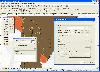 The CANVAS 9 GIS Mapping Edition adds native support for Geographic Information System (GIS) data to Canvas. You can take measurements in geographic coordinates, import industry standard SHAPE and GeoTIFF files into unlimited numbers of automatically aligned overlapping layers and choose among...
Platforms: Windows
| License: Shareware | Cost: $549.99 USD | Size: 53.3 MB | Download (188): Canvas GIS Mapping Edition Download |
Added: August 02, 2010 | Visits: 885
GMT is an open source collection of ~60 tools for manipulating geographic and Cartesian data sets (including filtering, trend fitting, gridding, projecting, etc.) and producing Encapsulated PostScript File (EPS) illustrations ranging from simple x-y plots via contour maps to artificially...
Platforms: *nix
| License: Freeware | Download (98): GMT Download |
Released: January 11, 2011
|
Added: January 19, 2011 | Visits: 1.400
 TransLT is designed to calculate the transformation parameters and the transformation of coordinates between two coordinates systems is a fast and practical way. The software is aimed at specialists who use GPS technology to perform geodetic works.
Main features of TransLT:
- Calculation of...
TransLT is designed to calculate the transformation parameters and the transformation of coordinates between two coordinates systems is a fast and practical way. The software is aimed at specialists who use GPS technology to perform geodetic works.
Main features of TransLT:
- Calculation of...
Platforms: Windows
| License: Demo | Cost: $90.00 USD | Size: 98.37 MB | Download (2402): TransLT Download |
Released: October 09, 2015
|
Added: January 07, 2016 | Visits: 3.751
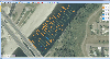 Eye4Software Hydromagic is hydrographic survey software for Windows. It can be used to generare depth maps using a GPS or RTK receiver and an echosounder or fishfinder.
After recording the sounding, you can generate DTM's (Digital Terrain Models), depth contours, 3D views and cross-sections....
Eye4Software Hydromagic is hydrographic survey software for Windows. It can be used to generare depth maps using a GPS or RTK receiver and an echosounder or fishfinder.
After recording the sounding, you can generate DTM's (Digital Terrain Models), depth contours, 3D views and cross-sections....
Platforms: Windows, Windows 8, Windows 7, Windows Server
| License: Demo | Cost: $1549.93 USD | Size: 83.02 MB | Download (170): Eye4Software Hydromagic Download |
Released: August 25, 2012
|
Added: August 25, 2012 | Visits: 626
 GPS Mapping Software for Windows, Loading topographic maps, realtime navigation, track recording, manage GPS devices and more. The software can be used with various map formats including: GeoTiff, BSB Nautical Charts, AutoCad DXF files, ESRI Shapefiles. Using calibration you can also use scanned...
Platforms: Windows
| License: Shareware | Cost: $149.00 USD | Size: 11.13 MB | Download (48): Eye4Software GPS Mapping Studio Download |