


Gis Data software
Gis Data
Added: August 08, 2010 | Visits: 1.144
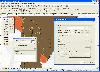
 Mercator Grid project is a real time strategy game using GIS data. Mercator Grid is a networked real-time strategy game that incorporates actual GIS map terrain and NATO map symbology (MIL-STD-2500B). It can be configured to include several player roles, including fire team leaders and...
Platforms: *nix
| License: Freeware | Download (97): Mercator Grid Download |
Added: January 25, 2010 | Visits: 1.230
ArcExplorer is a lightweight GIS data viewer developed by ESRI. This freely available software offers an easy way to perform basic GIS functions. ArcExplorer is used for a variety of display, query, and data retrieval applications and supports a wide variety of standard data sources. It can be...
Platforms: Mac
| License: Freeware | Size: 13.3 MB | Download (161): ArcExplorer Download |
Released: September 10, 2012
|
Added: September 10, 2012 | Visits: 216
jGisTools is a Java library aiming to provide tools for visualizing GIS data in Java applications.
Platforms: Windows, Mac, Linux
| License: Freeware | Size: 6.72 MB | Download (47): jGISTools Download |
Released: December 18, 2012
|
Added: December 18, 2012 | Visits: 401
Tools for creating interactive svg maps from GIS data
Platforms: Windows, Mac, Linux
| License: Freeware | Size: 80.86 KB | Download (49): VectorGIS Download |
Added: May 10, 2013 | Visits: 414
SharpMap is a simple-to-use map renderer that renders GIS data for use in web and desktop applications. The engine is written in C# and based on the .NET 2.0 framework. SharpMap is released under GNU Lesser General Public LicenseFeatures - Embed the engine using any .NET language, including C#,...
Platforms: Windows, ASP.NET,
| License: Freeware | Download (61): SharpMap Download |
Released: February 03, 2004
|
Added: March 24, 2006 | Visits: 3.803
 The CANVAS 9 GIS Mapping Edition adds native support for Geographic Information System (GIS) data to Canvas. You can take measurements in geographic coordinates, import industry standard SHAPE and GeoTIFF files into unlimited numbers of automatically aligned overlapping layers and choose among...
Platforms: Windows
| License: Shareware | Cost: $549.99 USD | Size: 53.3 MB | Download (188): Canvas GIS Mapping Edition Download |
Released: October 24, 2012
|
Added: October 24, 2012 | Visits: 678
 QGIS supports vector, raster, and database formats and lets you browse and create map data on your computer.
Quantum GIS (QGIS) supports many common spatial data formats (e.g. ESRI ShapeFile, geotiff). QGIS supports plugins to do things like display tracks from your GPS.
QGIS aims to be an...
QGIS supports vector, raster, and database formats and lets you browse and create map data on your computer.
Quantum GIS (QGIS) supports many common spatial data formats (e.g. ESRI ShapeFile, geotiff). QGIS supports plugins to do things like display tracks from your GPS.
QGIS aims to be an...
Platforms: Linux
| License: Freeware | Size: 1024 KB | Download (460): Quantum GIS form Linux Download |
Released: July 24, 2012
|
Added: July 24, 2012 | Visits: 784
 QGIS supports vector, raster, and database formats and lets you browse and create map data on your computer.
Quantum GIS (QGIS) supports many common spatial data formats (e.g. ESRI ShapeFile, geotiff). QGIS supports plugins to do things like display tracks from your GPS.
QGIS aims to be an...
QGIS supports vector, raster, and database formats and lets you browse and create map data on your computer.
Quantum GIS (QGIS) supports many common spatial data formats (e.g. ESRI ShapeFile, geotiff). QGIS supports plugins to do things like display tracks from your GPS.
QGIS aims to be an...
Platforms: Mac
| License: Freeware | Size: 1024 KB | Download (440): Quantum GIS form Mac Download |
Released: October 11, 2012
|
Added: October 11, 2012 | Visits: 776
 QGIS supports vector, raster, and database formats and lets you browse and create map data on your computer.
Quantum GIS (QGIS) supports many common spatial data formats (e.g. ESRI ShapeFile, geotiff). QGIS supports plugins to do things like display tracks from your GPS.
QGIS aims to be an...
QGIS supports vector, raster, and database formats and lets you browse and create map data on your computer.
Quantum GIS (QGIS) supports many common spatial data formats (e.g. ESRI ShapeFile, geotiff). QGIS supports plugins to do things like display tracks from your GPS.
QGIS aims to be an...
Platforms: Windows
| License: Freeware | Size: 77.3 MB | Download (453): Quantum GIS Download |
Released: July 23, 2012
|
Added: July 23, 2012 | Visits: 485
T2K Pro integrates the rich world of GIS datasets and transfers your Geographic information data into Google earth. T2K Pro handles rich data types and access large volumes of geographic data stored in files and databases; T2K PRO handles raster (imagery), Vector Map data and GPS Tracks/...
Platforms: Windows
| License: Shareware | Cost: $90.00 USD | Size: 20.89 MB | Download (54): T2K Pro Download |
Added: January 25, 2010 | Visits: 931
GrassPro is based on the free, open-source product "GRASS 6.0.1 GIS." It offers offers a host of ready-to-use GIS software and utilities, including: MapServer for publishing dynamic, navigable maps with layers over the Internet; PostGIS which enables spatial, geographic support for the included...
Platforms: Mac
| License: Demo | Cost: $0.00 USD | Download (109): GrassPro Download |
Released: September 17, 2012
|
Added: September 17, 2012 | Visits: 650
 Global Mapper is more than just a utility; it has built in functionality for distance and area calculations, raster blending, feathering, spectral analysis and contrast adjustment, elevation querying, line of sight calculations, cut-and-fill volume calculations, as well as advanced capabilities...
Platforms: Windows
| License: Demo | Cost: $349.00 USD | Size: 30 MB | Download (547): Global Mapper x64 Download |
Released: August 25, 2012
|
Added: August 25, 2012 | Visits: 598
 Global Mapper is more than just a utility; it has built in functionality for distance and area calculations, raster blending, feathering, spectral analysis and contrast adjustment, elevation querying, line of sight calculations, cut-and-fill volume calculations, as well as advanced capabilities...
Platforms: Windows
| License: Demo | Cost: $349.00 USD | Size: 39.6 MB | Download (537): Global Mapper Download |
Released: October 16, 2012
|
Added: October 16, 2012 | Visits: 425
 Finally, high-quality map production software that works. MAPublisher® cartography software seamlessly integrates over 40 GIS tools into the Adobe Illustrator environment to help you create maps the way you want, how you want. Import the most widely used GIS data formats, including those from...
Platforms: Mac
| License: Shareware | Cost: $1399.00 USD | Size: 222.9 MB | Download (471): MAPublisher Download |
Released: December 09, 2023
|
Added: December 23, 2023 | Visits: 1.132
 Offline Map Maker is a tool that help you to get offline tile images from Google Maps, Openstreetmap, Yandex Maps, Yahoo Maps, Mapquest, Gaode map, Tencent Maps, Baidu Maps, Tianditu, Arcgis Online, OneMap, Whereis, mapy.cz, Mappy, Waze, Sentinel-2 map, Strava Gloabal Heatmap, Wikimapia,...
Platforms: Windows 8, Windows 7, Windows
| License: Shareware | Cost: $79.00 USD | Size: 31.11 MB | Download (309): Offline Map Maker Download |
Released: December 12, 2023
|
Added: December 23, 2023 | Visits: 1.241
 Universal Maps Downloader is a tool that help you to get small tile images from Google Maps, Openstreetmap, Yandex Maps, Yahoo Maps, Mapquest, Gaode map, Tencent Maps, Baidu Maps, Tianditu, Arcgis Online, OneMap, Whereis, mapy.cz, Mappy, Waze, Sentinel-2 map, Strava Gloabal Heatmap, Wikimapia,...
Platforms: Windows 8, Windows 7, Windows
| License: Shareware | Cost: $69.00 USD | Size: 30.7 MB | Download (147): Universal Maps Downloader |
Released: July 25, 2007
|
Added: September 26, 2007 | Visits: 3.505
 AvisMap GIS Engine is a comprehensive SDK for the development of custom GIS applications and solutions. This SDK provides several ActiveX (OCX) controls which support Visual Basic, VB.NET, C#, Visual C++ and other ActiveX compatible programming languages, with Microsoft Visual Studio versions 6,...
Platforms: Windows
| License: Shareware | Cost: $199.00 USD | Size: 43.76 MB | Download (157): AvisMap GIS Engine Download |
Added: August 18, 2010 | Visits: 1.131
GIS-Knoppix is a bootable Linux CD with pre-installed GIS software. It is based on Knoppix..
Platforms: *nix
| License: Freeware | Size: 700 MB | Download (147): GIS Knoppix Download |
Released: May 01, 2011
|
Added: May 23, 2011 | Visits: 1.406
 Convert ESRI ShapeFiles (.SHP) geolocation data into AnyMap format to be used with AnyChart. AnyChart Flash Map Converter allows making use of a wide choice of maps with AnyChart Flash Component, a GIS visualization system that recognizes map data in AnyMap format only. AnyChart Flash Map...
Platforms: Windows
| License: Freeware | Size: 1.62 MB | Download (130): AnyChart Flash Map Converter Download |
Released: March 12, 2012
|
Added: April 02, 2012 | Visits: 1.076
 Visualize your data in 3D! Quick, easy and inexpensive. Graph Earth enables management, marketing and other business professionals to create stunning visual representations of their data, all without the time and costs associated with a full-featured GIS. Viewable by Everyone! Create one of a...
Platforms: Windows
| License: Demo | Cost: $24.95 USD | Size: 469 KB | Download (96): Graph Earth Download |