


Gis software
Gis
Released: December 04, 2012
|
Added: December 04, 2012 | Visits: 314
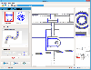
 An attempt to design minimum cost broadband networks with the use of a modified version of the Particle Swarm Optimization method. A GIS subsystem is used for the visualization of data and results.
Platforms: Windows, Mac, Linux
| License: Freeware | Size: 1.02 MB | Download (49): NetDesigner GIS Download |
Released: October 31, 2014
|
Added: November 18, 2014 | Visits: 594
 Vextractor Lite is an auto-tracing program for converting raster images into vector formats by building centerlines and outlines. This tool could be used for the tracing photo, logotypes and other line art images for use in Vector Graphics Design software. You can also vectorize charts,...
Platforms: Windows, Windows 8, Windows 7
| License: Shareware | Cost: $49.95 USD | Size: 13.24 MB | Download (39): Vextractor Lite Download |
Released: November 29, 2016
|
Added: December 03, 2016 | Visits: 1.268
 EWDraw CAD Component is a powerful vector graphics ActiveX for 3D and 2D visualisation and animation. You can use it for CAD,CAM,GIS and others. The EWDraw is based on Open CASCADE geometric kernel and openGL .The component is realized as a run-time Windows 64/32 bit OCX (ActiveX control). Either...
Platforms: Windows, Windows 7
| License: Shareware | Cost: $2599.00 USD | Size: 64.77 MB | Download (186): EWDraw CAD Component Download |
Added: September 09, 2006 | Visits: 3.801
 EasyMap VCL is a Delphi/C++Builder components set for creating your own GIS-related solutions without MapInfo, MapX, MapObjects, WinGIS etc.
EasyMap VCL allows to add following functionalities in Delphi/C++Builder application:
- MIF/MID vector maps displaying in Longitude/Lantitude...
EasyMap VCL is a Delphi/C++Builder components set for creating your own GIS-related solutions without MapInfo, MapX, MapObjects, WinGIS etc.
EasyMap VCL allows to add following functionalities in Delphi/C++Builder application:
- MIF/MID vector maps displaying in Longitude/Lantitude...
Platforms: Windows
| License: Shareware | Cost: $69.95 USD | Size: 1.37 MB | Download (196): EasyMap VCL Download |
Released: November 10, 2007
|
Added: November 20, 2007 | Visits: 6.089
 Geocode digital images with latitude, longitude, altitude, and direction information. RoboGEO stamps this information onto the actual photo or writes it to the EXIF headers, allowing you to permanently geotag and link your photos to the GPS coordinates. All writing to the EXIF and IPTC headers...
Platforms: Windows
| License: Demo | Cost: $39.95 USD | Size: 8.28 MB | Download (1179): RoboGEO Download |
Added: August 18, 2008 | Visits: 1.357
 Genesis IV is a landscape database and graphics system particularly targeted at Professional GIS and Educational users. Create great graphics for your clients, enthuse and educate your students, or explore geographical data, GenesisIV is unique multifaceted software and much more than a simple...
Platforms: Windows
| License: Freeware | Size: 23.84 MB | Download (606): GenesisIV Download |
Added: August 12, 2008 | Visits: 952
NewCyber3D provides full source code CDs covering a wide range of topics relevant to OpenGL GIS, terrain, stereo display, image processing and visualization. Each CD includes the entire OpenGL program and demonstrations with full source codes (including library source codes), project files,...
Platforms: Windows
| License: Freeware | Download (549): NewCyber3D Download |
Added: January 14, 2010 | Visits: 1.200
OGDI is the Open Geographic Datastore Interface. OGDI is an application programming interface (API) that uses a standardized access methods to work in conjunction with GIS software packages (the application) and various geospatial data products. OGDI uses a client/server architecture to...
Platforms: *nix
| License: Freeware | Size: 911.36 KB | Download (91): Open Geographic Datastore Interface Download |
Added: February 05, 2010 | Visits: 770
Geotools is an open source Java GIS toolkit for developing standards compliant solutions. GeoTools project provides an implementation of Open Geospatial Consortium (OGC) specifications as they are developed. Geotools maintains an open development process, with public collaboration on new ideas...
Platforms: *nix
| License: Freeware | Size: 26 MB | Download (113): GeoTools Download |
Added: January 25, 2010 | Visits: 924
GrassPro is based on the free, open-source product "GRASS 6.0.1 GIS." It offers offers a host of ready-to-use GIS software and utilities, including: MapServer for publishing dynamic, navigable maps with layers over the Internet; PostGIS which enables spatial, geographic support for the included...
Platforms: Mac
| License: Demo | Cost: $0.00 USD | Download (109): GrassPro Download |
Released: May 24, 2010
|
Added: July 12, 2010 | Visits: 960
 Aspose.Flash is a non-graphical .NET Flash management component allowing developers to dynamically generate and edit Flash® content directly from .NET applications. It provides support for Flash v8, Flash v9, Flash Lite and ActionScript allowing you to create, parse and modify flash files. Using...
Platforms: Windows
| License: Shareware | Cost: $399.00 USD | Size: 15.3 MB | Download (98): Aspose.Flash for .NET Download |
Released: March 29, 2020
|
Added: April 06, 2020 | Visits: 2.723
GeoDLL is a Geodetic Development Kit / Geodetic Function Library with worldwide 2D and 3D Coordinate Transformation, Datum Shift, Meridian Convergence and Extra Parameter with highest accuracy. Furthermore: Helmert and Molodensky Parameters, NTv2, HARN, INSPIRE, EPSG, Digital Elevation Model...
Platforms: Windows, Windows 8, Windows 7, Windows Server
| License: Shareware | Cost: $560.00 USD | Size: 5.23 MB | Download (295): GeoDLL Download |
Released: March 06, 2011
|
Added: March 10, 2011 | Visits: 983
 Total CAD View Server is a reliable full featured CAD viewer. An ActiveX control allows you viewing and printing.
CAD drawings via your Internet Explorer browser. The control is very small in size to provide fast downloading. No other additional software is required. Giving access to any...
Total CAD View Server is a reliable full featured CAD viewer. An ActiveX control allows you viewing and printing.
CAD drawings via your Internet Explorer browser. The control is very small in size to provide fast downloading. No other additional software is required. Giving access to any...
Platforms: Windows
| License: Shareware | Cost: $295.00 USD | Size: 2.82 MB | Download (164): Total GIS View Server Download |
Released: April 05, 2011
|
Added: April 11, 2011 | Visits: 1.739
 CtrlCAD is a 2D source code cad for C++.It is the starting point to build your own customized drawing applications. The library is furnished in source code formats for c++
More then 1000 functions,well documented with a lot of examples.
CtrlCAD features:
- Supported formats: AutoCAD DWG/...
CtrlCAD is a 2D source code cad for C++.It is the starting point to build your own customized drawing applications. The library is furnished in source code formats for c++
More then 1000 functions,well documented with a lot of examples.
CtrlCAD features:
- Supported formats: AutoCAD DWG/...
Platforms: Windows
| License: Shareware | Cost: $1800.00 USD | Size: 2.3 MB | Download (146): CtrlCAD source code C++ Download |
Released: June 13, 2010
|
Added: September 08, 2011 | Visits: 927
 Silverlight Map Viewer is a .NET native GIS viewer control which allows developers to create interactive mapping application on the web browser. Packed with powerful AJAX interactive, simple API that makes coding easy. It is compatible with Silveright 4.0 and Visual Studio 2010. It includes many...
Platforms: Windows
| License: Shareware | Cost: $199.00 USD | Size: 4.96 MB | Download (758): SwiftGIS Silverlight MapViewer Download |
Released: November 16, 2012
|
Added: November 16, 2012 | Visits: 489
 The goal of VTP is to foster the creation of tools for easily constructing any part of the real world in interactive, 3D digital form.
This goal will require a synergetic convergence of the fields of CAD, GIS, visual simulation, surveying and remote sensing. VTP gathers information and tracks...
The goal of VTP is to foster the creation of tools for easily constructing any part of the real world in interactive, 3D digital form.
This goal will require a synergetic convergence of the fields of CAD, GIS, visual simulation, surveying and remote sensing. VTP gathers information and tracks...
Platforms: Mac, Linux
| License: Freeware | Size: 2.2 MB | Download (492): Virtual Terrain Project for Mac OS X and Linux Download |
Released: October 22, 2012
|
Added: October 22, 2012 | Visits: 586
IrriPro is the only software that let you design an irrigation system only by drawing the elements: now it's possible, thanks to the INDO technology (Irrigation Network Data Object) developed by Irriworks, to draw the elements of a system (such as outlets, pipes, etc) and of a terrain, not only...
Platforms: Windows
| License: Freeware | Size: 161 MB | Download (467): IrriPro Download |
Released: June 18, 2012
|
Added: June 18, 2012 | Visits: 472
 The goal of VTP is to foster the creation of tools for easily constructing any part of the real world in interactive, 3D digital form.
This goal will require a synergetic convergence of the fields of CAD, GIS, visual simulation, surveying and remote sensing. VTP gathers information and tracks...
The goal of VTP is to foster the creation of tools for easily constructing any part of the real world in interactive, 3D digital form.
This goal will require a synergetic convergence of the fields of CAD, GIS, visual simulation, surveying and remote sensing. VTP gathers information and tracks...
Platforms: Windows
| License: Freeware | Size: 1024 KB | Download (420): Virtual Terrain Project for Windows Download |
Released: October 16, 2012
|
Added: October 16, 2012 | Visits: 424
 Finally, high-quality map production software that works. MAPublisher® cartography software seamlessly integrates over 40 GIS tools into the Adobe Illustrator environment to help you create maps the way you want, how you want. Import the most widely used GIS data formats, including those from...
Platforms: Mac
| License: Shareware | Cost: $1399.00 USD | Size: 222.9 MB | Download (465): MAPublisher Download |
Released: August 16, 2012
|
Added: August 16, 2012 | Visits: 526
uDig is a user-friendly desktop Internet GIS, a core element in an internet aware Geographic Information System.
The application is an open source spatial data viewer / editor, that comes with a special emphasis on the OpenGIS standards for internet GIS, the Web Map Server and Web Feature Server...
Platforms: Windows
| License: Freeware | Download (439): uDig Download |