


Geotiff software
Geotiff
Added: June 16, 2013 | Visits: 345
 GEOTIFF_READ: read geotiff using imread and assign map info from infinfo. I = GEOTIFF_READ('filename'); Reads whole images I = GEOTIFF_READ('filename','pixel_subset', [minx maxx miny maxy]); I = GEOTIFF_READ('filename','map_subset' , [minx maxx miny maxy]); extract subset of the specified.%...
Platforms: Matlab
| License: Shareware | Cost: $0.00 USD | Size: 10 KB | Download (47): geotiff reader Download |
Added: October 24, 2010 | Visits: 1.365
Libgeotiff is a public domain library normally hosted on top of libtiff for writing, and reading GeoTIFF information tags. GeoTIFF represents an effort by over 160 different remote sensing, GIS, cartographic, and surveying related companies and organizations to establish a TIFF based...
Platforms: *nix
| License: Freeware | Size: 819.2 KB | Download (306): libgeotiff Download |
Added: June 20, 2013 | Visits: 359
Makes a geoTiff using gdal_translate with the supplied top left and bottom right lat long in WGS84. Can be used in contunction with getTile to save tiles as GeoTiffs
Platforms: Matlab
| License: Freeware | Size: 10 KB | Download (46): makeGeoTiff Download |
Released: February 03, 2004
|
Added: March 24, 2006 | Visits: 3.801
 The CANVAS 9 GIS Mapping Edition adds native support for Geographic Information System (GIS) data to Canvas. You can take measurements in geographic coordinates, import industry standard SHAPE and GeoTIFF files into unlimited numbers of automatically aligned overlapping layers and choose among...
Platforms: Windows
| License: Shareware | Cost: $549.99 USD | Size: 53.3 MB | Download (188): Canvas GIS Mapping Edition Download |
Added: April 29, 2013 | Visits: 416
This program can write a 2D or 3D array to a single or multi-band GeoTIFF file. For more information and examples, please visit:http://www.rotman-baycrest.on.ca/~jimmy/geotiffwriteor type: help geotiffwriteMATLAB's Mapping Toolbox only provides a "geotiffread" function, but it does not have a...
Platforms: Matlab
| License: Freeware | Size: 20.48 KB | Download (44): geotiffwrite Download |
Added: June 14, 2013 | Visits: 400
Polar orbiting remote sensing satellites have an orbital inclination of about 9 degrees to the vertical. Because of this georeferenced satellite scenes are not straight but slanting (rotated). It is generally useful to have a vector containing the boundary of the image. Since an image can...
Platforms: Matlab
| License: Freeware | Size: 10 KB | Download (40): GeoTiff Outliner Download |
Added: August 13, 2013 | Visits: 391
In large scale mapping projects with numerous satellite images, it is useful to have a vector file depicting the boundary of the images. This script when run from the folder containing the images, it automatically detects the geotiffs and extracts their image area boundary and constructs a...
Platforms: Matlab
| License: Freeware | Size: 10 KB | Download (49): GeoTiff PathRow Download |
Released: September 14, 2014
|
Added: October 16, 2014 | Visits: 6.486
 Vextractor is a vectorizer program for transforming raster images into vector formats by building centerlines and outlines. This tool could be used for the vectorizing photo, logotypes and other line art images for use in Vector Graphics Design software. You can also vectorize charts, drawings,...
Platforms: Windows, Windows 7
| License: Shareware | Cost: $99.95 USD | Size: 2.97 MB | Download (517): Vextractor Download |
Released: October 20, 2006
|
Added: November 07, 2006 | Visits: 2.331
 T2K or tiles2kml enables you to efficiently load large set of imagery or raster maps very quickly into GoogleEarth using Region-Based Network Links. This method has an onRegion option, which specifies to load the Region data only when the Region is active. So only the needed set of data is loaded...
Platforms: Windows
| License: Shareware | Cost: $40.00 USD | Size: 8.39 MB | Download (585): Tiles2kml Download |
Released: February 10, 2016
|
Added: August 13, 2018 | Visits: 2.400
 ActualMap is a set of high-performance, .NET mapping components and controls for embedding maps in desktop applications. ActualMap gives you the ability to generate maps, drill-down capability, thematic mapping, routing, vehicle tracking and other features that will make the maps fully...
Platforms: Windows, Windows 8, Windows 7, Windows Server
| License: Shareware | Cost: $799.00 USD | Size: 16.85 MB | Download (627): ActualMap Download |
Released: April 22, 2008
|
Added: April 26, 2008 | Visits: 9.513
 The free AvisMap Viewer opens most GIS/CAD and raster image file types and most ArcView, ArcExplorer, and MapInfo projects. Besides just opening and viewing files, the Viewer supports an extensive list of features including visual layer properties control, legend control, thematic mapping,...
Platforms: Windows
| License: Freeware | Size: 22.28 MB | Download (1734): AvisMap Free Viewer Download |
Added: August 31, 2008 | Visits: 3.344
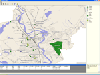
GeoVisu is a visualization software for geographic data - graphic files, images and GPS. It provides real time GPS navigation (moving map - NMEA 0183 protocol or Garmin USB), displayed with diverse geographic data (MIF, GPX, NMEA, KML/KMZ, SHP, ECW, GeoTiff, MrSID). It can download waypoints,...
Platforms: Windows
| License: Freeware | Size: 1.5 MB | Download (1383): GeoVisu Download |
Added: August 16, 2008 | Visits: 943
Thuban is an interactive viewer for geographic data (GIS), that offers its users diverse advanced ways and means to view and explore this type of material.It is not only a free geographical information explorer but also of open code. So, you can freely use it and also modify it if you wish. Here...
Platforms: Windows
| License: Freeware | Size: 4 KB | Download (145): Thuban Download |
Added: June 11, 2010 | Visits: 999
GeoServer project connects your information to the Geospatial Web. With GeoServer, you can publish and edit data using open standards. Your information is made available in a large variety of formats as maps/images or actual geospatial data. GeoServers transactional capabilities offer robust...
Platforms: *nix
| License: Freeware | Size: 25.9 MB | Download (104): GeoServer Download |
Released: February 03, 2011
|
Added: February 27, 2011 | Visits: 1.161
 Vextractor is a vectorizer program for transforming raster images into vector formats by building centerlines and outlines. This tool could be used for the vectorizing photo, logotypes and other line art images for use in Vector Graphics Design software. You can also vectorize charts, drawings,...
Platforms: Windows
| License: Shareware | Cost: $99.95 USD | Size: 3.99 MB | Download (309): Vextractor x64 Download |
Released: October 09, 2015
|
Added: January 07, 2016 | Visits: 3.751
 Eye4Software Hydromagic is hydrographic survey software for Windows. It can be used to generare depth maps using a GPS or RTK receiver and an echosounder or fishfinder.
After recording the sounding, you can generate DTM's (Digital Terrain Models), depth contours, 3D views and cross-sections....
Eye4Software Hydromagic is hydrographic survey software for Windows. It can be used to generare depth maps using a GPS or RTK receiver and an echosounder or fishfinder.
After recording the sounding, you can generate DTM's (Digital Terrain Models), depth contours, 3D views and cross-sections....
Platforms: Windows, Windows 8, Windows 7, Windows Server
| License: Demo | Cost: $1549.93 USD | Size: 83.02 MB | Download (170): Eye4Software Hydromagic Download |
Released: March 05, 2012
|
Added: March 19, 2012 | Visits: 1.739
 Download Software to Sort Pictures, sort Photos, sort Images - at SortPictures.net; Picture sorter can sort pictures, sort images, sort photos and organize graphic files. Sort pictures by date taken, sort pictures by time, sort picture files by year, sort pictures by camera model and even sort...
Platforms: Windows
| License: Shareware | Cost: $39.95 USD | Size: 16.58 MB | Download (132): Download Software to Sort Pictures |
Released: October 24, 2012
|
Added: October 24, 2012 | Visits: 677
 QGIS supports vector, raster, and database formats and lets you browse and create map data on your computer.
Quantum GIS (QGIS) supports many common spatial data formats (e.g. ESRI ShapeFile, geotiff). QGIS supports plugins to do things like display tracks from your GPS.
QGIS aims to be an...
QGIS supports vector, raster, and database formats and lets you browse and create map data on your computer.
Quantum GIS (QGIS) supports many common spatial data formats (e.g. ESRI ShapeFile, geotiff). QGIS supports plugins to do things like display tracks from your GPS.
QGIS aims to be an...
Platforms: Linux
| License: Freeware | Size: 1024 KB | Download (460): Quantum GIS form Linux Download |
Released: August 23, 2012
|
Added: August 23, 2012 | Visits: 665
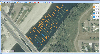
 All-in-one software for creation of custom GPS maps compatible with Garmin GPS units. Mapwel supports routing, ESRI shapefiles, OpenStreetMap OSM, Google Earth KML and KMZ, cGPSmapper MP and GPX files. Mapwel custom GPS mapping capability and user icons editor are often used in forestry,...
Platforms: Windows
| License: Shareware | Cost: $45.00 USD | Size: 12.28 MB | Download (454): Mapwel Download |
Released: July 24, 2012
|
Added: July 24, 2012 | Visits: 783
 QGIS supports vector, raster, and database formats and lets you browse and create map data on your computer.
Quantum GIS (QGIS) supports many common spatial data formats (e.g. ESRI ShapeFile, geotiff). QGIS supports plugins to do things like display tracks from your GPS.
QGIS aims to be an...
QGIS supports vector, raster, and database formats and lets you browse and create map data on your computer.
Quantum GIS (QGIS) supports many common spatial data formats (e.g. ESRI ShapeFile, geotiff). QGIS supports plugins to do things like display tracks from your GPS.
QGIS aims to be an...
Platforms: Mac
| License: Freeware | Size: 1024 KB | Download (440): Quantum GIS form Mac Download |