


Geotiff software
Geotiff
Released: June 22, 2012
|
Added: June 22, 2012 | Visits: 708
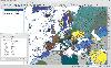
 Thuban is an interactive geographic data viewer (GIS viewer) which features methods to visualize, explore, and analyze geographic information.
Thuban is an Interactive Geographic Data Viewer with the following features:
# Vector Data Support: Shapefile, PostGIS Layer and OGR
# Raster Data...
Platforms: Windows
Thuban is an interactive geographic data viewer (GIS viewer) which features methods to visualize, explore, and analyze geographic information.
Thuban is an Interactive Geographic Data Viewer with the following features:
# Vector Data Support: Shapefile, PostGIS Layer and OGR
# Raster Data...
Platforms: Windows
| License: Freeware | Size: 11.22 MB | Download (429): Thuban for Windows Download |
Released: October 21, 2012
|
Added: October 21, 2012 | Visits: 746
Thuban is an interactive geographic data viewer (GIS viewer) which features methods to visualize, explore, and analyze geographic information.
Thuban is an Interactive Geographic Data Viewer with the following features:
# Vector Data Support: Shapefile, PostGIS Layer and OGR
# Raster Data...
Platforms: Linux
| License: Freeware | Size: 1.18 MB | Download (464): Thuban for Linux Download |
Released: October 11, 2012
|
Added: October 11, 2012 | Visits: 604
QLandkarte GT is a handy, easy to use program specially designed to offer users a ultimate outdoor aficionado's tool.
This application offers support for GPS maps in GeoTiff format as well as Garmin's img vector map format.
for WindowsXP, Vista, 7
Platforms: Windows, Windows Vista, 7
| License: Freeware | Download (498): QLandkarte GT Download |
Released: September 17, 2012
|
Added: September 17, 2012 | Visits: 590
 ExifTool is free software used for reading, writing, and manipulating image, audio and video metadata. It is platform independent and is both a Perl library and command-line application. ExifTool is a popular tool to incorporate into different types of digital workflows and supports many types of...
Platforms: Windows
ExifTool is free software used for reading, writing, and manipulating image, audio and video metadata. It is platform independent and is both a Perl library and command-line application. ExifTool is a popular tool to incorporate into different types of digital workflows and supports many types of...
Platforms: Windows
| License: Freeware | Size: 2.9 MB | Download (448): ExifTool Download |
Released: November 16, 2012
|
Added: November 16, 2012 | Visits: 485
 ExifTool is free software used for reading, writing, and manipulating image, audio and video metadata. It is platform independent and is both a Perl library and command-line application. ExifTool is a popular tool to incorporate into different types of digital workflows and supports many types of...
Platforms: Mac
ExifTool is free software used for reading, writing, and manipulating image, audio and video metadata. It is platform independent and is both a Perl library and command-line application. ExifTool is a popular tool to incorporate into different types of digital workflows and supports many types of...
Platforms: Mac
| License: Freeware | Size: 2.9 MB | Download (486): ExifTool for Mac OS X Download |
Released: June 25, 2012
|
Added: June 25, 2012 | Visits: 877
 The free AvisMap Viewer opens most GIS/CAD and raster image file types and most ArcView, ArcExplorer, and MapInfo projects. Besides just opening and viewing files, the Viewer supports an extensive list of features including visual layer properties control, legend control, thematic mapping,...
Platforms: Windows
The free AvisMap Viewer opens most GIS/CAD and raster image file types and most ArcView, ArcExplorer, and MapInfo projects. Besides just opening and viewing files, the Viewer supports an extensive list of features including visual layer properties control, legend control, thematic mapping,...
Platforms: Windows
| License: Freeware | Size: 23.17 MB | Download (449): Free Shapefile Viewer Download |
Released: November 19, 2012
|
Added: November 19, 2012 | Visits: 683
 thDIMIN Image Viewer n5 is a free and useful image utility that lets you to view images in countless formats, and apply a variety of effects with this powerful , small and fast application. Dimin Viewer incorporates unique visualization ideas, like Panoramic Photographs Tool and Big Image...
Platforms: Windows
thDIMIN Image Viewer n5 is a free and useful image utility that lets you to view images in countless formats, and apply a variety of effects with this powerful , small and fast application. Dimin Viewer incorporates unique visualization ideas, like Panoramic Photographs Tool and Big Image...
Platforms: Windows
| License: Freeware | Size: 4 MB | Download (58): DIMIN Viewer n5 Download |
Released: August 25, 2012
|
Added: August 25, 2012 | Visits: 635
 GPS Mapping Software for Windows, Loading topographic maps, realtime navigation, track recording, manage GPS devices and more. The software can be used with various map formats including: GeoTiff, BSB Nautical Charts, AutoCad DXF files, ESRI Shapefiles. Using calibration you can also use scanned...
Platforms: Windows
GPS Mapping Software for Windows, Loading topographic maps, realtime navigation, track recording, manage GPS devices and more. The software can be used with various map formats including: GeoTiff, BSB Nautical Charts, AutoCad DXF files, ESRI Shapefiles. Using calibration you can also use scanned...
Platforms: Windows
| License: Shareware | Cost: $149.00 USD | Size: 11.13 MB | Download (48): Eye4Software GPS Mapping Studio Download |
Released: October 09, 2012
|
Added: October 09, 2012 | Visits: 437
 OkCustomMap is a software to produce Garmin Custom Maps.
Supports many map formats:
- OkMap
- Ecw
- GeoTiff
- World files
- OziExplorer
- GpsTuner
You can customize:
- The quality of the output JPEG images (0=Bad, 100=Good)
- The KML transparency (0=Transparent, 255=Opaque)
- The KML draw...
Platforms: Windows
OkCustomMap is a software to produce Garmin Custom Maps.
Supports many map formats:
- OkMap
- Ecw
- GeoTiff
- World files
- OziExplorer
- GpsTuner
You can customize:
- The quality of the output JPEG images (0=Bad, 100=Good)
- The KML transparency (0=Transparent, 255=Opaque)
- The KML draw...
Platforms: Windows
| License: Freeware | Size: 3.22 MB | Download (56): OkCustomMap Download |
Released: January 29, 2013
|
Added: January 29, 2013 | Visits: 588
 SWIFT WX Professional runs on any desktop or laptop computer and provides you with up-to-the-minute Radar, Satellite, Storm Warnings, and Hail Reports. It will even alert you up to an hour in advance of approaching rain or thunderstorms, and predict to the nearest minute when those storms will...
Platforms: Windows
SWIFT WX Professional runs on any desktop or laptop computer and provides you with up-to-the-minute Radar, Satellite, Storm Warnings, and Hail Reports. It will even alert you up to an hour in advance of approaching rain or thunderstorms, and predict to the nearest minute when those storms will...
Platforms: Windows
| License: Shareware | Cost: $159.50 USD | Size: 20.45 MB | Download (574): SWIFT WX Professional Download |
Released: October 11, 2012
|
Added: October 11, 2012 | Visits: 778
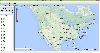
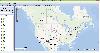
 QGIS supports vector, raster, and database formats and lets you browse and create map data on your computer.
Quantum GIS (QGIS) supports many common spatial data formats (e.g. ESRI ShapeFile, geotiff). QGIS supports plugins to do things like display tracks from your GPS.
QGIS aims to be an...
Platforms: Windows
QGIS supports vector, raster, and database formats and lets you browse and create map data on your computer.
Quantum GIS (QGIS) supports many common spatial data formats (e.g. ESRI ShapeFile, geotiff). QGIS supports plugins to do things like display tracks from your GPS.
QGIS aims to be an...
Platforms: Windows
| License: Freeware | Size: 77.3 MB | Download (453): Quantum GIS Download |
Released: November 12, 2012
|
Added: November 12, 2012 | Visits: 429
Raster Utility (for AutoCAD) functions: - Inserting raster images. Raster Utility can recognize pairs of the files, raster and world file (TIFF and TFW, ...) or can directly read information from georeferenced files (GEOTIFF). - Grouping of the raster images. It is possible to make groups of...
Platforms: Windows
| License: Commercial | Cost: $269.00 USD | Size: 2.86 MB | Download (485): Raster Utility Download |
Released: November 05, 2012
|
Added: November 05, 2012 | Visits: 463
Lyn is a lightweight and fast image browser and viewer.
Lyn natively supports all popular image formats like JPEG, TIFF, JPEG 2000, PNG, PPM, TGA, RAW, HDR, OpenEXR animated GIF and any other image format supported by Mac OS X.
Features:
* Progressive display on single or multiple monitor...
Platforms: Mac
| License: Freeware | Size: 6.9 MB | Download (53): Lyn Download |
Added: July 05, 2013 | Visits: 307
This essentially adds support for map projections to function imtransform from the Image Processing toolbox.The demo demonstrates the reprojection of a geotiff, from geographic latitude and longitude to UTM coordinates.If you just want to display an image as a figure in a different map...
Platforms: Matlab
| License: Shareware | Cost: $0.00 USD | Size: 10 KB | Download (43): mimtransform Download |
Added: July 02, 2013 | Visits: 356
Terragen??a*zNz 2 is a powerful solution for rendering and animating realistic natural environments. Create entire worlds from your imagination, or import real world terrain datasets and use Terragen 2 to create the most realistic visualisations possible. You control the weather, landscape,...
Platforms: Mac
| License: Shareware | Cost: $0.00 USD | Size: 16.5 MB | Download (45): Terragen 2 Download |
Released: January 12, 2014
|
Added: September 18, 2014 | Visits: 790
 Maps Downloader For Google Map is a smart tool which can help you download tile satellite images from google map fastly and stably.It can stitch tile images into one big seamless image:Software can stitch tile images into one big seamless image such as GeoTIFF and GeoJPEG. But if the exported...
Platforms: Windows, Windows 7, Windows Server
Maps Downloader For Google Map is a smart tool which can help you download tile satellite images from google map fastly and stably.It can stitch tile images into one big seamless image:Software can stitch tile images into one big seamless image such as GeoTIFF and GeoJPEG. But if the exported...
Platforms: Windows, Windows 7, Windows Server
| License: Shareware | Cost: $49.95 USD | Size: 4.71 MB | Download (1243): Maps Dwonloader For Google Map Download |
Released: July 23, 2014
|
Added: September 23, 2014 | Visits: 905
 Maps Downloader For Yahoo Map is a smart tool which can help you download tile satellite images from google map fastly and stably.It can stitch tile images into one big seamless image:Software can stitch tile images into one big seamless image such as GeoTIFF and GeoJPEG. But if the exported...
Platforms: Windows, Windows 7, Windows Server
Maps Downloader For Yahoo Map is a smart tool which can help you download tile satellite images from google map fastly and stably.It can stitch tile images into one big seamless image:Software can stitch tile images into one big seamless image such as GeoTIFF and GeoJPEG. But if the exported...
Platforms: Windows, Windows 7, Windows Server
| License: Shareware | Cost: $49.95 USD | Size: 4.84 MB | Download (1233): Maps Downloader For Yahoo Map |
Released: February 02, 2014
|
Added: September 23, 2014 | Visits: 1.109
 Maps Downloader For Bing Map is a smart tool which can help you download tile satellite images from google map fastly and stably.It can stitch tile images into one big seamless image:Software can stitch tile images into one big seamless image such as GeoTIFF and GeoJPEG. But if the exported...
Platforms: Windows, Windows 7, Windows Server
Maps Downloader For Bing Map is a smart tool which can help you download tile satellite images from google map fastly and stably.It can stitch tile images into one big seamless image:Software can stitch tile images into one big seamless image such as GeoTIFF and GeoJPEG. But if the exported...
Platforms: Windows, Windows 7, Windows Server
| License: Shareware | Cost: $49.95 USD | Size: 7.12 MB | Download (1231): Maps Downloader For Bing Map |
Released: January 13, 2014
|
Added: October 09, 2014 | Visits: 846
 Maps Downloader For Google Terrain is a smart tool which can help you download tile satellite images from google map fastly and stably.It can stitch tile images into one big seamless image:Software can stitch tile images into one big seamless image such as GeoTIFF and GeoJPEG. But if the...
Platforms: Windows, Windows 7, Windows Server
Maps Downloader For Google Terrain is a smart tool which can help you download tile satellite images from google map fastly and stably.It can stitch tile images into one big seamless image:Software can stitch tile images into one big seamless image such as GeoTIFF and GeoJPEG. But if the...
Platforms: Windows, Windows 7, Windows Server
| License: Shareware | Cost: $49.95 USD | Size: 4.72 MB | Download (1234): Maps Downloader For Google Terrain |
Released: August 11, 2014
|
Added: October 09, 2014 | Visits: 1.064
 Maps Downloader For Google Satellite is a smart tool which can help you download tile satellite images from google map fastly and stably.It can stitch tile images into one big seamless image:Software can stitch tile images into one big seamless image such as GeoTIFF and GeoJPEG. But if the...
Platforms: Windows, Windows 7, Windows Server
Maps Downloader For Google Satellite is a smart tool which can help you download tile satellite images from google map fastly and stably.It can stitch tile images into one big seamless image:Software can stitch tile images into one big seamless image such as GeoTIFF and GeoJPEG. But if the...
Platforms: Windows, Windows 7, Windows Server
| License: Shareware | Cost: $49.95 USD | Size: 4.74 MB | Download (1240): Maps Downloader For Google Satellite |