


Geographic Information Systems software
Geographic Information Systems
Released: June 22, 2012
|
Added: June 22, 2012 | Visits: 706
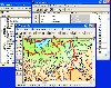
 Thuban is an interactive geographic data viewer (GIS viewer) which features methods to visualize, explore, and analyze geographic information.
Thuban is an Interactive Geographic Data Viewer with the following features:
# Vector Data Support: Shapefile, PostGIS Layer and OGR
# Raster Data...
Thuban is an interactive geographic data viewer (GIS viewer) which features methods to visualize, explore, and analyze geographic information.
Thuban is an Interactive Geographic Data Viewer with the following features:
# Vector Data Support: Shapefile, PostGIS Layer and OGR
# Raster Data...
Platforms: Windows
| License: Freeware | Size: 11.22 MB | Download (429): Thuban for Windows Download |
Released: October 21, 2012
|
Added: October 21, 2012 | Visits: 745
Thuban is an interactive geographic data viewer (GIS viewer) which features methods to visualize, explore, and analyze geographic information.
Thuban is an Interactive Geographic Data Viewer with the following features:
# Vector Data Support: Shapefile, PostGIS Layer and OGR
# Raster Data...
Platforms: Linux
| License: Freeware | Size: 1.18 MB | Download (464): Thuban for Linux Download |
Added: October 18, 2010 | Visits: 976
Plugdaemon is a tool that is inspired by, but not based on, the plug-gw from Trusted Information Systems. It was originally a simpler wannabe, but the connection balancing code and other features makes it a lot more useful (as of 2.3.1 its also a feature-complete replacement for plug-gw)....
Platforms: *nix
| License: Freeware | Size: 14.34 KB | Download (101): plugdaemon Download |
Added: February 08, 2010 | Visits: 1.188
SchoolTool project is a common information systems platform for school administration. SchoolTool is a project to develop a common global school administration infrastructure that is freely available under an Open Source licence. The vision is to create a platform that is equally compelling...
Platforms: *nix
| License: Freeware | Size: 1.02 KB | Download (168): SchoolTool Download |
Released: June 21, 2012
|
Added: June 21, 2012 | Visits: 911
 Commonly referred to as GRASS, this is a free Geographic Information System (GIS) used for geospatial data management and analysis, image processing, graphics/maps production, spatial modeling, and visualization. GRASS is currently used in academic and commercial settings around the world, as...
Platforms: Mac
| License: Freeware | Size: 59 MB | Download (57): Grass GIS for Mac OS X Download |
Released: September 01, 2012
|
Added: September 01, 2012 | Visits: 538
New Zealand Distributed Information Systems (NZDIS)
Distributed, heterogenous, agent-based framework for intelligent/semantic information and services integration.
Platforms: Windows, Mac, Linux
| License: Freeware | Size: 118.49 KB | Download (49): Distributed Information System (NZDIS) Download |
Released: November 05, 2012
|
Added: November 05, 2012 | Visits: 467
About OpenMap
A mapping application and a Java Beans based toolkit for building applications and applets displaying geographic information. Using OpenMap components, you can access data from legacy applications, in-place, in a distributed setting. At its core, OpenMap is a set of Swing components...
Platforms: Mac
| License: Freeware | Size: 18.8 MB | Download (51): OpenMap 4.6.1 Download |
Added: April 13, 2013 | Visits: 679
Open Information Systems for Emergency Services (Open ISES) is a community of software developers, paramedics, EMTs, law enforcement & fire fighters working together to create open source software & training materials for the emergency service communit
Platforms: PHP
| License: Shareware | Cost: $0.00 USD | Size: 1.25 MB | Download (41): The Open ISES Project Download |
Added: November 28, 2013 | Visits: 466
FMaps is here to answer the lack of user friendly opensource GIS/RS (Geographic Information System/ Remote Sensing) application on the Linux and Gnome compatible platforms.
Platforms: *nix
| License: Freeware | Size: 225.28 KB | Download (38): FMaps Download |
Added: September 16, 2010 | Visits: 1.256
ProM Import Framework project allows you to extract process enactment event logs from a set of information systems. These can be exported in the MXML format, which is the standard event log data format for Process Mining analysis techniques. Process Mining is a family of a-posteriori analysis...
Platforms: *nix
| License: Freeware | Size: 419.84 KB | Download (99): ProM Import Framework Download |
Added: May 27, 2010 | Visits: 782
Dataxi project is a collection of tools for developing form-based information systems. Dataxi enables one to quickly build an application based on forms with which the user can access the underlying database in order to query, read, edit and write. Dataxi is the link between the user interface...
Platforms: *nix
| License: Freeware | Size: 1.3 MB | Download (98): Dataxi Download |
Released: July 23, 2012
|
Added: July 23, 2012 | Visits: 485
T2K Pro integrates the rich world of GIS datasets and transfers your Geographic information data into Google earth. T2K Pro handles rich data types and access large volumes of geographic data stored in files and databases; T2K PRO handles raster (imagery), Vector Map data and GPS Tracks/...
Platforms: Windows
| License: Shareware | Cost: $90.00 USD | Size: 20.89 MB | Download (54): T2K Pro Download |
Added: May 10, 2013 | Visits: 581
OrangeHRM is emerging in line with the new generation of HR Information Systems (HRIS) and will assist you in managing your company's most important asset - human resource.Based on modular architecture, this comprehensive Open Source solution reflects the main areas of HR Management from simple...
Platforms: Windows, Mac, *nix, PHP, BSD Solaris
| License: Freeware | Download (66): OrangeHRM 2.3b2 Download |
Released: September 21, 2011
|
Added: October 05, 2011 | Visits: 2.929
 DTM DB Stress is a utility for stress testing the server parts of information systems and
database applications, as well as DBMSs and servers themselves. This tool allows you to create and
configure a continuous set of requests to the server of the OLAP (query execution) and OLTP...
DTM DB Stress is a utility for stress testing the server parts of information systems and
database applications, as well as DBMSs and servers themselves. This tool allows you to create and
configure a continuous set of requests to the server of the OLAP (query execution) and OLTP...
Platforms: Windows
| License: Demo | Cost: $179.00 USD | Size: 1.09 MB | Download (136): DTM DB Stress Download |
Released: July 25, 2007
|
Added: September 26, 2007 | Visits: 3.503
 AvisMap GIS Engine is a comprehensive SDK for the development of custom GIS applications and solutions. This SDK provides several ActiveX (OCX) controls which support Visual Basic, VB.NET, C#, Visual C++ and other ActiveX compatible programming languages, with Microsoft Visual Studio versions 6,...
Platforms: Windows
| License: Shareware | Cost: $199.00 USD | Size: 43.76 MB | Download (157): AvisMap GIS Engine Download |
Added: August 04, 2008 | Visits: 1.170
 GIS ObjectLand is a universal Geographic Information System for Windows. Key capabilities: vector-raster maps; multiuser data editing; import and export for MIF/MID (MapInfo), SHP (ArcView), DXF (AutoCAD), DBF (dBASE), CSV; setting access permissions to data for different categories of users;...
Platforms: Windows
| License: Shareware | Cost: $99.00 USD | Size: 23.54 MB | Download (537): GIS ObjectLand Download |
Added: August 04, 2008 | Visits: 2.669
OrangeHRM is emerging in line with the new generation of HR Information Systems (HRIS) and will assist you in managing your company's most important asset - human resource. Based on modular architecture, this comprehensive Open Source solution reflects the main areas of HR Management from simple...
Platforms: *nix, Windows
| License: Freeware | Size: 1.1 MB | Download (89): OrangeHRM Download |
Added: August 20, 2008 | Visits: 978
Copiks PhotoMapper helps you organize your photos by adding geographic information to the EXIF - data of the image called geotagging.The information can be inserted manually or using GPS data that you can import to the program.The location, photo thumbnails and GPS polygons can be exported...
Platforms: Windows
| License: Freeware | Size: 4 KB | Download (119): Copiks PhotoMapper Download |
Released: July 26, 2012
|
Added: July 26, 2012 | Visits: 1.454
Care2x (formerly Care 2002) is software for hospitals and health care organizations. It is designed to integrate the different information systems existing in these organizations into a single efficient system. It solves the problems inherent in a network of multiple programs that are...
Platforms: *nix
| License: Freeware | Size: 16.4 MB | Download (399): CARE2X Download |
Added: September 17, 2010 | Visits: 1.163
PostGIS adds support for geographic objects to the PostgreSQL object-relational database. In effect, PostGIS "spatially enables" the PostgreSQL server, allowing it to be used as a backend spatial database for geographic information systems (GIS), much like ESRIs SDE or Oracles Spatial extension....
Platforms: *nix
| License: Freeware | Size: 1.4 MB | Download (98): PostGIS Download |