


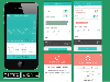
Garmin Geocaching software
Garmin Geocaching
Released: March 01, 2010
|
Added: April 22, 2010 | Visits: 2.515
 Mapyx Quo is an intuitive, easy to learn and, surprisingly simple-to-use digital mapping program which enables you to connect your GPS to your PC and manage all your waypoints, routes and tracks. View information such as elevation, distance, speed, ETA and many more. Quo supports numerous...
Platforms: Windows, Windows CE
| License: Freeware | Size: 44.95 MB | Download (7377): Mapyx Quo Download |
Added: August 31, 2008 | Visits: 3.343
GeoVisu is a visualization software for geographic data - graphic files, images and GPS. It provides real time GPS navigation (moving map - NMEA 0183 protocol or Garmin USB), displayed with diverse geographic data (MIF, GPX, NMEA, KML/KMZ, SHP, ECW, GeoTiff, MrSID). It can download waypoints,...
Platforms: Windows
| License: Freeware | Size: 1.5 MB | Download (1383): GeoVisu Download |
Released: December 29, 2010
|
Added: January 06, 2011 | Visits: 4.315
 OkMap is a GPS and map software that:
-Works with vectorial maps and calibrates raster maps
-Organizes paths by creating waypoints, routes and tracks
-Uploads/downloads data to/from your GPS
-Uses altitude DEM data
-Supports GPS real-time navigation
-Sends/receives vehicles position...
OkMap is a GPS and map software that:
-Works with vectorial maps and calibrates raster maps
-Organizes paths by creating waypoints, routes and tracks
-Uploads/downloads data to/from your GPS
-Uses altitude DEM data
-Supports GPS real-time navigation
-Sends/receives vehicles position...
Platforms: Windows
| License: Freeware | Size: 20.25 MB | Download (1277): OkMap Download |
Released: November 10, 2007
|
Added: November 20, 2007 | Visits: 6.089
 Geocode digital images with latitude, longitude, altitude, and direction information. RoboGEO stamps this information onto the actual photo or writes it to the EXIF headers, allowing you to permanently geotag and link your photos to the GPS coordinates. All writing to the EXIF and IPTC headers...
Platforms: Windows
| License: Demo | Cost: $39.95 USD | Size: 8.28 MB | Download (1179): RoboGEO Download |
Released: October 25, 2016
|
Added: October 26, 2016 | Visits: 691
 PredictBGL is a beautiful insulin dose calculator that predicts Hypos and blood sugar levels hours ahead.
PredictBGL dramatically simplifies blood glucose management and insulin dosing with tracking of insulin on board, variable ratios/targets throughout the day, live sharing between school...
PredictBGL is a beautiful insulin dose calculator that predicts Hypos and blood sugar levels hours ahead.
PredictBGL dramatically simplifies blood glucose management and insulin dosing with tracking of insulin on board, variable ratios/targets throughout the day, live sharing between school...
Platforms: Windows, Mac, Windows 7, iOS, Android, iPhone,iPod,iTouch
| License: Shareware | Cost: $9.95 USD | Size: 427.59 KB | Download (659): PredictBGL Diabetes Manager Download |
Added: August 04, 2008 | Visits: 2.755
This free program allows you to plan and record your trips with a GPS receiver and share your local knowledge of trails with others, you can also use the program to print topographic maps with these trails, either on a single page or, as a mosaic, on many sheets of paper. GPS Mapping Sofware...
Platforms: Windows
| License: Freeware | Size: 1024 KB | Download (626): Wissenbach Map Download |
Released: December 22, 2012
|
Added: December 22, 2012 | Visits: 468
 Run.GPS Trainer UV is the perfect tool to take along doing all sorts of sports like running, skiing, hiking, and many more. Run.GPS Trainer UV is compatible with most PocketPCs and Smartphones (requires Windows Mobile 2003 Pocket PC, Windows Mobile 5 or Windows Mobile 6). Recording *...
Platforms: Windows, Pocket PC
| License: Shareware | Cost: $33.99 USD | Size: 6.29 MB | Download (600): Run.GPS Trainer UV Download |
Added: August 18, 2008 | Visits: 1.350
 Allows you to connect your hand held Global Positioning System (GPS) unit to your computer, download your waypoints, and plot them in AutoCAD or export them in .dxf Also plots the points on free public domain Aerial photos and topo maps. Works on most Garmin and Magellan GPS units, and AutoCAD...
Platforms: Windows
| License: Shareware | Cost: $345.00 USD | Size: 9.9 MB | Download (543): GPS2CAD Download |
Added: August 10, 2008 | Visits: 3.457
Add GPS support to your C# or VB.NET application.Works with Garmin, Magellan, Navman or any NMEA 0183 enabled GPS. Support for UTM, SPCS (NAD83/NAD27), British National Grid, Swiss Grid, Irish Grid and many more national coordinate systems. Many examples included to get you started. For Windows...
Platforms: Windows, Windows CE
| License: Shareware | Cost: $79.00 USD | Size: 186 KB | Download (540): GpsTools .NET Download |
Released: November 16, 2012
|
Added: November 16, 2012 | Visits: 485
 Provides hours of entertainment by combining the technology in your phone with one of the fastest-growing international hide and seek games - geocaching (also known as "GPS treasure hunt"). By using your Nokia's GPS and built-in Internet, Geocache Navigator™ creates a seamless and exciting...
Platforms: Handheld/Mobile Other, Java
| License: Freeware | Size: 225.28 KB | Download (528): Geocache Navigator Download |
Released: January 11, 2013
|
Added: January 11, 2013 | Visits: 728
 Super GPS Store Search Helps You Find The Best Deals On GPS's Search though thousands of GPS related products with ease. Shopping Secured By Amazon.com All this in this free application, requires no install, has no adware or spyware.
Platforms: Windows
| License: Freeware | Size: 756 KB | Download (517): Super GPS Store Search Software Download |
Released: December 26, 2012
|
Added: December 26, 2012 | Visits: 703
If you've ever thought about becoming a GeoCacher, then you know that the only way to get GPX files from GeoCaching. com is to pay for their membership services. That means a regular monthly charge to your credit card. But your PocketPC or GPS unit requires this type of file. This isn't a problem...
Platforms: Linux
| License: Commercial | Cost: $9.99 USD | Size: 4 KB | Download (512): GeoCache GPX Grabber Download |
Released: November 23, 2012
|
Added: November 23, 2012 | Visits: 257
With OpenStreetMap.org, you can export maps (for free) in XML OSM format. These maps are pretty handy - but if you want to load them onto your GPS, this free utility will allow you to easily convert the OSM files to IMG files which you can import into your Garmin GPS.
Platforms: Mac
| License: Freeware | Size: 2.5 MB | Download (511): OSMtoIMG for Mac OS Download |
Added: March 11, 2006 | Visits: 2.088
 This is the perfect computer program for folks that enjoy Geocaching.Now you can keep detailed records of each cache you find and those that you have already located. This program is very userfriendly, you can easily TAB through each data field, or use the mouse. You only enter information in the...
Platforms: Windows
| License: Shareware | Cost: $14.99 USD | Size: 879 KB | Download (498): Geocaching Download |
Released: October 11, 2012
|
Added: October 11, 2012 | Visits: 598
QLandkarte GT is a handy, easy to use program specially designed to offer users a ultimate outdoor aficionado's tool.
This application offers support for GPS maps in GeoTiff format as well as Garmin's img vector map format.
for WindowsXP, Vista, 7
Platforms: Windows, Windows Vista, 7
| License: Freeware | Download (498): QLandkarte GT Download |
Released: November 26, 2012
|
Added: November 26, 2012 | Visits: 546
Let this software and a GPS logger do the hard work of assigning precise Places metadata to your photos. Why import ungeotagged pictures into iPhoto, when its so straightforward to GPS-enable your favorite camera?
Geotagalogs sophisticated automatic geotagging technology combines locations from...
Platforms: Mac
| License: Freeware | Size: 13.8 MB | Download (498): Geotagalog for Mac OS Download |
Released: October 22, 2012
|
Added: October 22, 2012 | Visits: 419
An intuitive geocache management and planning tool. Manage all your Geocaches from one place. Send only the caches you want to your GPS receiver. When you're done Geocaching, download them to Geocache Manager to automatically update your finds. Import Geocaches from queries, .loc or .gpx files....
Platforms: Mac
| License: Freeware | Size: 5 MB | Download (497): Geocache Manager for Mac OS Download |
Released: October 08, 2012
|
Added: October 08, 2012 | Visits: 833
ITN Converter Travel is both a route converter supporting many formats and a simple and efficient route planner. The converter supports routes file formats (roadbook) from many GPS or mapping software, the most popular are TomTom, Navigon, Garmin, MapPoint or MapSource. This converter can easily...
Platforms: Windows
| License: Freeware | Download (492): ITN Converter Travel Download |
Released: September 07, 2012
|
Added: September 07, 2012 | Visits: 474
A powerful and flexible journal application that allows all levels of athletes and fitness enthusiasts to get the most from their training and racing. It allows you to easily and quickly track your training, monitor your progress, and built a history of your training. You can manually enter your...
Platforms: Mac
| License: Freeware | Size: 20 MB | Download (485): iSMARTtrain for Mac OS Download |
Released: October 11, 2012
|
Added: October 11, 2012 | Visits: 538
A utility for uploading, downloading, and transcoding GPS data among GPS devices, GPX files, and KML files (for Google Earth). The resulting files can be used in a variety of applications available for the Macintosh, including TrackRunner, TrailRunner, and of course Google Earth.
Use...
Platforms: Mac
| License: Freeware | Size: 1.8 MB | Download (483): LoadMyTracks for Mac OS Download |