


Garmin Aviation software
Garmin Aviation
Added: June 21, 2010 | Visits: 1.471
 QLandkarte can view and upload map files, track and waypoint data to your Garmin GPS receiver. Garmins MapSource software is hardly the only reason for me to boot into Windows and it does not look like Garmin ever wants to address Linux users by writing a portable piece of software. So I...
Platforms: *nix
| License: Freeware | Size: 972.8 KB | Download (116): QLandkarte Download |
Released: March 01, 2010
|
Added: April 22, 2010 | Visits: 2.520
Mapyx Quo is an intuitive, easy to learn and, surprisingly simple-to-use digital mapping program which enables you to connect your GPS to your PC and manage all your waypoints, routes and tracks. View information such as elevation, distance, speed, ETA and many more. Quo supports numerous...
Platforms: Windows, Windows CE
| License: Freeware | Size: 44.95 MB | Download (7377): Mapyx Quo Download |
Released: August 23, 2012
|
Added: August 23, 2012 | Visits: 668
 All-in-one software for creation of custom GPS maps compatible with Garmin GPS units. Mapwel supports routing, ESRI shapefiles, OpenStreetMap OSM, Google Earth KML and KMZ, cGPSmapper MP and GPX files. Mapwel custom GPS mapping capability and user icons editor are often used in forestry,...
Platforms: Windows
| License: Shareware | Cost: $45.00 USD | Size: 12.28 MB | Download (454): Mapwel Download |
Released: June 20, 2012
|
Added: June 20, 2012 | Visits: 783
GPX and TCX file welder is a small, easy to use application specially designed to help you substitute the missing GPS information in Garmin TCX files when devices lacking a GPS receiver are used to collect training data (Garmin FR 60, heartrate and pedometer only).
This application is also...
Platforms: Windows
| License: Freeware | Download (425): GPX and TCX file welder Download |
Released: August 13, 2012
|
Added: August 13, 2012 | Visits: 462
Allows you to load custom points of interest into your unit. The input files can be downloaded from the internet or you can create your own. With POI Loader, you can configure the unit to alert you when you are within a certain distance of a point or if you are driving over a certain speed near a...
Platforms: Mac
| License: Freeware | Size: 10.3 MB | Download (52): Garmin POI Loader for Mac OS Download |
Released: June 07, 2012
|
Added: June 07, 2012 | Visits: 384
This application converts the XML Polar file (from polarpersonaltrainer.com) to TCX Garmin file. All websites which register your trainers don't allow XML files from Polar. Tested with these models: RS300X, CS200
Platforms: Windows, Mac, Linux
| License: Freeware | Size: 352.08 KB | Download (57): XML Polar to TCX Garmin Converter Download |
Released: November 20, 2012
|
Added: November 20, 2012 | Visits: 859
The authors of the best-selling World Record Paper Airplane Books bring you the absolute best in paper aviation knowledge, designs and flying skills.
We want to thank you all for such positive feedback on our iPad app.
This app includes:
- Fully animated folding instructions
- Great flying...
Platforms: Mac
| License: Commercial | Cost: $1.99 USD | Size: 46.9 MB | Download (61): World Record Paper Airplanes Download |
Added: May 10, 2013 | Visits: 369
OpenAviation aims to offer an open source solution to the aviation industry, mainly to third tier operators and AMEs. Ease of use and regulation compliancy are the most important goals for this application.OpenAviation is a web-based application suite written with PHP/MySQL to be used by the...
Platforms: Windows, Mac, *nix, PHP, BSD Solaris
| License: Freeware | Download (57): OpenAviation Download |
Added: June 19, 2013 | Visits: 353
This is a MacOSX framework to communcate with Garmin USB devices.
Platforms: Mac
| License: Freeware | Size: 30.72 KB | Download (36): GarminKit Download |
Added: November 20, 2013 | Visits: 443
The development of a Consolidated Storm Prediction for Aviation (CoSPA) product has been initiated by the Federal Aviation Administration (FAA) in order to replace a plethora of currently available weather forecast products by a single forecast to be used in all government-provided aviation...
Platforms: Mac
| License: Shareware | Cost: $0.00 USD | Size: 1.02 KB | Download (34): CoSPA Viewer Download |
Added: August 21, 2013 | Visits: 436
The avdbtools package (short for aviation database tools) is a collection of software designed to assist in creating and maintaining databases for aviation applications. As of this release, avdbtools consists of a single application that converts the National Airspace Data files distributed by...
Platforms: *nix
| License: Freeware | Size: 122.88 KB | Download (37): avdbtools Download |
Added: August 05, 2013 | Visits: 410
GPStrans is a program which allows track, route, and waypoint data to be transferred to and from a Garmin GPS. It also supports Mayko mXmap formats which enable you to create a route using your 'favorite' map and load the data into the GPS. Tracks r
Platforms: *nix
| License: Freeware | Size: 81.92 KB | Download (41): gpstrans Download |
Added: November 27, 2013 | Visits: 670
Garble is a portable modular C++ program and library for interfacing to Garmin GPS receivers.
Platforms: *nix
| License: Freeware | Size: 20.48 KB | Download (41): Garble Download |
Added: September 15, 2006 | Visits: 3.033
 Create thumbnail based web photo galleries. Interfaces with Garmin GPS units for creating georeferenced images, EXIF support, customizable HTML template files, integrated FTP, program automation, image batch processor, XML image description support, copyright stamper, built-in e-mailer, an HTTP...
Platforms: Windows
| License: Commercial | Cost: $39.95 USD | Size: 4.7 MB | Download (219): RoboPhoto Download |
Released: November 10, 2007
|
Added: November 20, 2007 | Visits: 6.096
 Geocode digital images with latitude, longitude, altitude, and direction information. RoboGEO stamps this information onto the actual photo or writes it to the EXIF headers, allowing you to permanently geotag and link your photos to the GPS coordinates. All writing to the EXIF and IPTC headers...
Platforms: Windows
| License: Demo | Cost: $39.95 USD | Size: 8.28 MB | Download (1179): RoboGEO Download |
Added: August 11, 2008 | Visits: 1.006
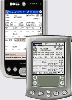
 Track Scheduled and Actual Flight Times in Zulu, Local, or Domicile time zones. Organize Aircraft, Crew changes, Delay and Mechanical Information for each flight. Calculate FAR 121 duty limitations and evaluate FAR 121 rest requirements. Manage your Monthly Schedule and Datebook from your PDA....
Platforms: Windows, Palm OS
| License: Shareware | Cost: $59.95 USD | Size: 3.61 MB | Download (527): Airline Pilot's Daily Aviation Logbook Download |
Added: August 26, 2008 | Visits: 1.108
 Track Scheduled and Actual Flight Times in Zulu, Local, or Domicile time zones. Organize Aircraft, Crew changes, Delay and Mechanical Information for each flight. Calculate FAR 121 duty limitations and evaluate FAR 121 rest requirements. Manage your Monthly Schedule and Datebook from your PDA....
Platforms: Windows
| License: Shareware | Cost: $59.95 USD | Size: 4.06 MB | Download (548): Airline Pilots Daily Aviation Log PPC Download |
Added: August 10, 2008 | Visits: 3.466
Add GPS support to your C# or VB.NET application.Works with Garmin, Magellan, Navman or any NMEA 0183 enabled GPS. Support for UTM, SPCS (NAD83/NAD27), British National Grid, Swiss Grid, Irish Grid and many more national coordinate systems. Many examples included to get you started. For Windows...
Platforms: Windows, Windows CE
| License: Shareware | Cost: $79.00 USD | Size: 186 KB | Download (540): GpsTools .NET Download |
Added: January 25, 2010 | Visits: 1.310
GPS Connect is a freeware program for Mac OS X which offers connectivity to Garmin GPS receivers. The intended use is to backup waypoints from the GPS to your computer. Downloaded waypoints may be saved in a native file format or exported to a variety of other formats such as tab-delimited,...
Platforms: Mac
| License: Freeware | Size: 1.2 MB | Download (108): GPS Connect Download |
Added: January 25, 2010 | Visits: 745
MacCaching is a Geocache Manager support Garmin and Magallen GPS receivers. Caches are managed in Lists which can be groups of caches in a certain area, caches you own, or caches you haven't found yet. An iPod or Palm-based device can be used for Paperless Caching when sending caches to your GPS....
Platforms: Mac
| License: Freeware | Download (104): MacCaching Download |