


Esri Shapefile software
Esri Shapefile
Added: September 23, 2010 | Visits: 955
 BytesFall ShapeFiles is a PHP library that allows reading and editing of an ESRI ShapeFile and all the associated information.. Get BytesFall ShapeFiles at SourceForge.net. Fast, secure and free downloads from the largest Open Source applications and software directory. BytesFall ShapeFiles is a...
Platforms: *nix
| License: Freeware | Size: 58.37 KB | Download (128): BytesFall ShapeFiles Download |
Added: May 10, 2013 | Visits: 418
BytesFall ShapeFiles is a PHP library that allows reading and editing of an ESRI ShapeFile and all the associated information.
Platforms: Windows, Mac, *nix, PHP, BSD Solaris
| License: Freeware | Download (60): BytesFall ShapeFiles Download |
Released: September 21, 2008
|
Added: September 24, 2008 | Visits: 1.970
 Full featured and affordable image and vector viewing and processing for
ActiveX,.NET,C#,VB.NET,VB,C++,DLL,LIB at your fingertips.Image and vectordata viewing with Scrolling, Zooming, Panning. Unlimited layers, you can plug multiple raster and vector layers into the viewer, where each...
Full featured and affordable image and vector viewing and processing for
ActiveX,.NET,C#,VB.NET,VB,C++,DLL,LIB at your fingertips.Image and vectordata viewing with Scrolling, Zooming, Panning. Unlimited layers, you can plug multiple raster and vector layers into the viewer, where each...
Platforms: Windows
| License: Commercial | Cost: $149.00 USD | Size: 23.84 MB | Download (124): THBImage Download |
Released: December 17, 2012
|
Added: January 06, 2013 | Visits: 733
 A pack of MindFusion advanced diagramming, mapping, charting, scheduling, Gantt and reporting components for WPF. The controls can be used in many types of business applications that need to visualize process management, resource planning, organizational structures, etc.
The Calendar control...
A pack of MindFusion advanced diagramming, mapping, charting, scheduling, Gantt and reporting components for WPF. The controls can be used in many types of business applications that need to visualize process management, resource planning, organizational structures, etc.
The Calendar control...
Platforms: Windows
| License: Commercial | Cost: $850.00 USD | Size: 112.71 MB | Download (63): MindFusion.WPF Pack Download |
Released: August 23, 2012
|
Added: August 23, 2012 | Visits: 668
 All-in-one software for creation of custom GPS maps compatible with Garmin GPS units. Mapwel supports routing, ESRI shapefiles, OpenStreetMap OSM, Google Earth KML and KMZ, cGPSmapper MP and GPX files. Mapwel custom GPS mapping capability and user icons editor are often used in forestry,...
Platforms: Windows
| License: Shareware | Cost: $45.00 USD | Size: 12.28 MB | Download (454): Mapwel Download |
Released: December 17, 2012
|
Added: December 17, 2012 | Visits: 302
SHP Viewer is a simple shapefile viewer. The Esri Shapefile or simply a shapefile is a popular geospatial vector data format for geographic information systems (GIS). A shapefile is a digital vector storage format for storing geometric location and associated attribute information. This format...
Platforms: Mac
| License: Commercial | Cost: $2.99 USD | Size: 512 KB | Download (48): SHP Viewer Download |
Added: September 17, 2013 | Visits: 421
JShapeFile - Easy, Pure Java Support for Editing ShapeFiles Purchase JShapeFile JShapefile from NVision Solutions Inc. provides a pure Java method to read and write ESRI shapefiles from your Java application # JShapeFile API (JavaDocs) # JShapeFile Code Samples # Shapefile XML DTD Documentation...
Platforms: Mac
| License: Demo | Cost: $0.00 USD | Size: 20.48 KB | Download (41): JShapeFile Download |
Released: October 24, 2012
|
Added: October 24, 2012 | Visits: 678
 QGIS supports vector, raster, and database formats and lets you browse and create map data on your computer.
Quantum GIS (QGIS) supports many common spatial data formats (e.g. ESRI ShapeFile, geotiff). QGIS supports plugins to do things like display tracks from your GPS.
QGIS aims to be an...
QGIS supports vector, raster, and database formats and lets you browse and create map data on your computer.
Quantum GIS (QGIS) supports many common spatial data formats (e.g. ESRI ShapeFile, geotiff). QGIS supports plugins to do things like display tracks from your GPS.
QGIS aims to be an...
Platforms: Linux
| License: Freeware | Size: 1024 KB | Download (460): Quantum GIS form Linux Download |
Released: July 24, 2012
|
Added: July 24, 2012 | Visits: 784
 QGIS supports vector, raster, and database formats and lets you browse and create map data on your computer.
Quantum GIS (QGIS) supports many common spatial data formats (e.g. ESRI ShapeFile, geotiff). QGIS supports plugins to do things like display tracks from your GPS.
QGIS aims to be an...
QGIS supports vector, raster, and database formats and lets you browse and create map data on your computer.
Quantum GIS (QGIS) supports many common spatial data formats (e.g. ESRI ShapeFile, geotiff). QGIS supports plugins to do things like display tracks from your GPS.
QGIS aims to be an...
Platforms: Mac
| License: Freeware | Size: 1024 KB | Download (440): Quantum GIS form Mac Download |
Released: January 29, 2013
|
Added: January 29, 2013 | Visits: 588
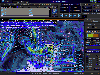
 SWIFT WX Professional runs on any desktop or laptop computer and provides you with up-to-the-minute Radar, Satellite, Storm Warnings, and Hail Reports. It will even alert you up to an hour in advance of approaching rain or thunderstorms, and predict to the nearest minute when those storms will...
Platforms: Windows
| License: Shareware | Cost: $159.50 USD | Size: 20.45 MB | Download (574): SWIFT WX Professional Download |
Released: October 11, 2012
|
Added: October 11, 2012 | Visits: 776
 QGIS supports vector, raster, and database formats and lets you browse and create map data on your computer.
Quantum GIS (QGIS) supports many common spatial data formats (e.g. ESRI ShapeFile, geotiff). QGIS supports plugins to do things like display tracks from your GPS.
QGIS aims to be an...
QGIS supports vector, raster, and database formats and lets you browse and create map data on your computer.
Quantum GIS (QGIS) supports many common spatial data formats (e.g. ESRI ShapeFile, geotiff). QGIS supports plugins to do things like display tracks from your GPS.
QGIS aims to be an...
Platforms: Windows
| License: Freeware | Size: 77.3 MB | Download (453): Quantum GIS Download |
Added: May 10, 2013 | Visits: 414
SharpMap is a simple-to-use map renderer that renders GIS data for use in web and desktop applications. The engine is written in C# and based on the .NET 2.0 framework. SharpMap is released under GNU Lesser General Public LicenseFeatures - Embed the engine using any .NET language, including C#,...
Platforms: Windows, ASP.NET,
| License: Freeware | Download (61): SharpMap Download |
Released: May 17, 2014
|
Added: August 09, 2014 | Visits: 899
 ATMOGRAPH is advanced weather model data visualization and analysis software for meteorologists, storm chasers, aviators, forecasters, and enthusiasts alike, allowing users to import custom GRIB data and choose from a built-in list of weather models including the GFS, NAM, HRRR, HRW, RAP, NAVGEM,...
Platforms: Windows, Windows 8, Windows 7
| License: Shareware | Cost: $200.00 USD | Size: 8.75 MB | Download (38): ATMOGRAPH ModelVis Download |
Released: September 16, 2015
|
Added: October 06, 2015 | Visits: 501
 Nevron Map for SharePoint is an advanced web part for all versions Microsoft SharePoint (WSS3.0, SharePoint 2007, 2010 and 2013). It is designed to provide an easy and powerful way to create choropleth maps that are tightly integrated with your data. The Map Web Part delivers a great set of...
Platforms: Windows, Windows 8, Windows 7, Windows Server
| License: Shareware | Cost: $889.00 USD | Size: 99.87 MB | Download (35): Nevron Map for SharePoint Download |
Added: September 02, 2010 | Visits: 2.494
Geo::ShapeFile is a Perl extension for handling ESRI GIS Shapefiles. SYNOPSIS use Geo::ShapeFile; my $shapefile = new Geo::ShapeFile("roads"); for(1 .. $shapefile->shapes()) { my $shape = $shapefile->get_shp_record($_); # see Geo::ShapeFile::Shape docs for what to do with $shape my...
Platforms: *nix
| License: Freeware | Size: 276.48 KB | Download (147): Geo::ShapeFile Download |
Released: February 01, 2015
|
Added: February 23, 2015 | Visits: 2.233
 Manco Shapefile Editor is a powerful tool for creating and editing shapefiles, with easy, almost “on the fly”, geometry and data editing and possibility of direct creation of the shapefiles from the image files by image processing algorithms. This product is constantly developing and you will...
Platforms: Windows, Windows 7
| License: Shareware | Cost: $100.00 USD | Size: 6.14 MB | Download (110): Manco Shapefile Editor Download |
Added: June 09, 2010 | Visits: 1.189
Geo::Shapelib is a Perl extension for reading and writing shapefiles as defined by ESRI. SYNOPSIS use Geo::Shapelib qw/:all/; or use Geo::Shapelib qw/:all/; my $shapefile = new Geo::Shapelib { Name => stations, Shapetype => POINT, FieldNames => [Name,Code,Founded]; FieldTypes =>...
Platforms: *nix
| License: Freeware | Size: 266.24 KB | Download (134): Geo::Shapelib Download |
Released: June 25, 2012
|
Added: June 25, 2012 | Visits: 873
 The free AvisMap Viewer opens most GIS/CAD and raster image file types and most ArcView, ArcExplorer, and MapInfo projects. Besides just opening and viewing files, the Viewer supports an extensive list of features including visual layer properties control, legend control, thematic mapping,...
Platforms: Windows
| License: Freeware | Size: 23.17 MB | Download (449): Free Shapefile Viewer Download |
Released: June 07, 2012
|
Added: June 07, 2012 | Visits: 352
Integrate the power of the fully AJAX enabled technology of ICEfaces into the framework of the ESRI WebADF. No need to code in Javascript or to handle XML communication to build AJAX functionalities. OnlineDemo: http://www2.pch.etat.lu/pchViewer
Platforms: Windows, Mac, Linux
| License: Freeware | Size: 2.01 MB | Download (44): ICEwebADF: ICEfaces + ESRI ArcGIS WebADF Download |
Added: April 24, 2013 | Visits: 449
Matlab script to read KML files into a mapstruct structure array and offers the option of writing to a Shapefile. KML files must be of a uniform type: Point, LineString, LinearRing orPolygon. The output contains 5-6 fields, 'Geometry', 'X', 'Y', 'altitude', 'Id' and 'name'. The final field is...
Platforms: Matlab
| License: Freeware | Size: 10 KB | Download (45): KML-Matlab-Shapefile conversion Download |