


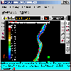
Contour Maps software
Contour Maps
Released: June 06, 2004
|
Added: January 24, 2006 | Visits: 3.189
 The "xyExtract" software is used for to extract data from a 2D graph (orthogonal and nonorthogonal axes) contained in a graphic file (scanned, PDF document or in a some file like gif, jpg, etc). The graphic file must be saved in a bitmap file. Then, the "xyExtract" converts the graph back to xy...
| License: Shareware | Cost: $25.00 USD | Size: 450 KB | Download (771): xyExtract Graph Digitizer Download |
Released: April 25, 2017
|
Added: April 27, 2017 | Visits: 4.804
 Simple, powerful and inexpensive CAD software for surveying. You can do triangulation, isolines, color-filled contour maps, sections, intersections, volume and much more. You can process hundreds of thousands of points or triangles, even on less powerful PCs.
Through its own CAD system (called...
Simple, powerful and inexpensive CAD software for surveying. You can do triangulation, isolines, color-filled contour maps, sections, intersections, volume and much more. You can process hundreds of thousands of points or triangles, even on less powerful PCs.
Through its own CAD system (called...
Platforms: Windows, Windows 8, Windows 7, Windows Server
| License: Shareware | Cost: $84.00 USD | Size: 1.04 MB | Download (360): RTOPO Download |
Added: June 07, 2013 | Visits: 352
 TableDemo.m contains all of the code necessary to duplicate the analysis performed in the "Generating Optimal Tables using MATLAB Products" webinar including:Code to optimize the location of break points in a tableCode to generate contour maps of the residuals
Platforms: Matlab
| License: Freeware | Size: 10 KB | Download (39): Optimizing breakpoints for Tables Download |
Released: July 09, 2023
|
Added: August 06, 2023 | Visits: 168
 Simple, powerful and inexpensive CAD software for surveying. You can do triangulation, isolines, color-filled contour maps, sections, intersections, volume and much more. You can process hundreds of thousands of points or triangles, even on less powerful PCs.
Through its own CAD system...
Simple, powerful and inexpensive CAD software for surveying. You can do triangulation, isolines, color-filled contour maps, sections, intersections, volume and much more. You can process hundreds of thousands of points or triangles, even on less powerful PCs.
Through its own CAD system...
Platforms: Windows, Windows 8, Windows 7, Windows Server
| License: Shareware | Cost: $125.00 USD | Size: 2.48 MB | Download (15): RTOPO Hydrology Download |
Released: January 02, 2007
|
Added: January 06, 2007 | Visits: 2.635
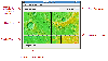
 Imports gridded data into Microsoft MapPoint, to produce attractive data maps that resemble contour maps.
Input data consists of a value that is defined for various (gridded) geographic coordinates. Common text output formats such as CSV are supported.
Can handle imperfect data, holes,...
Imports gridded data into Microsoft MapPoint, to produce attractive data maps that resemble contour maps.
Input data consists of a value that is defined for various (gridded) geographic coordinates. Common text output formats such as CSV are supported.
Can handle imperfect data, holes,...
Platforms: Windows
| License: Shareware | Cost: $75.00 USD | Size: 2.16 MB | Download (907): GridImp Download |
Released: April 11, 2017
|
Added: April 22, 2017 | Visits: 1.419
 An add-on for AUTOCAD 2002-2018, which makes the triangulation of a set of POINT entities, the intersection curves (isolines) between a set of 3DFACE entities and a set of equidistance plans, horizontally or vertically and the volume and center of gravity of a set of bodies or between surfaces...
Platforms: Windows, Windows 8, Windows 7
| License: Shareware | Cost: $84.00 USD | Size: 648 KB | Download (156): TRIANGULATION for AutoCAD Download |
Released: June 27, 2012
|
Added: June 27, 2012 | Visits: 449
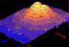 3DFieldPro is a contouring plotting and 4D-3D data program. 3DFieldPro converts your data into contour maps, surface or volume plots.3DFieldPro allows create the contours (isolines) on surface and isosurfaces in volume from regular data set or scattered points.
All aspects of 2D or 3D maps can...
3DFieldPro is a contouring plotting and 4D-3D data program. 3DFieldPro converts your data into contour maps, surface or volume plots.3DFieldPro allows create the contours (isolines) on surface and isosurfaces in volume from regular data set or scattered points.
All aspects of 2D or 3D maps can...
Platforms: Windows
| License: Shareware | Cost: $416.64 USD | Size: 3.6 MB | Download (62): 3DFieldPro Download |
Added: August 02, 2010 | Visits: 885
GMT is an open source collection of ~60 tools for manipulating geographic and Cartesian data sets (including filtering, trend fitting, gridding, projecting, etc.) and producing Encapsulated PostScript File (EPS) illustrations ranging from simple x-y plots via contour maps to artificially...
Platforms: *nix
| License: Freeware | Download (98): GMT Download |
Added: January 25, 2010 | Visits: 659
SmileLab is an integrated working and production environment for viewing and analyzing numerical data of any sizes, and produce professional graphical documents.SmileLab offers a wide range of data representation models: curves, contour maps, vector fields, 3D surface. High-level graphical...
Platforms: Mac
| License: Demo | Cost: $0.00 USD | Download (92): SmileLab Download |
Released: October 27, 2012
|
Added: October 27, 2012 | Visits: 569
Data visualization and automation software for Mac OS X. Its plotting interface makes easier to plot data by importing files, specifying intermediate computations and access display settings, all in the same interface.
You can also work by writing scripts which perform the data processing tasks...
Platforms: Mac
| License: Freeware | Size: 30 MB | Download (46): SmileLab for Mac OS Download |
Released: July 17, 2012
|
Added: July 17, 2012 | Visits: 480
 JMARS is an acronym that stands for Java Mission-planning and Analysis for Remote Sensing. It is a geospatial information system (GIS) developed by ASU's Mars Space Flight Facility to provide mission planning and data-analysis tools to NASA's orbiters, instrument team members, students of all...
Platforms: Windows, Mac, Linux
| License: Freeware | Size: 52.2 MB | Download (48): JMARS Download |
Released: September 05, 2012
|
Added: September 05, 2012 | Visits: 460
 CLiq is more advanced than the CPT section of the current LiqIT software and provides users an easy to use graphical environment specifically tailored for CPT and CPTU data. The new software addresses advanced issues such as cyclic softening in clay-like soils and thin layer/layer transition zone...
Platforms: Windows
| License: Commercial | Cost: $300.00 USD | Size: 4.13 MB | Download (516): CLiq Download |
Added: May 10, 2013 | Visits: 390
GMT is an open source collection of ~60 tools for manipulating geographic and Cartesian data sets (including filtering, trend fitting, gridding, projecting, etc.) and producing Encapsulated PostScript File (EPS) illustrations ranging from simple x-y plots via contour maps to artificially...
Platforms: *nix, C/C++, BSD
| License: Freeware | Download (54): GMT Application Download |
Added: November 14, 2010 | Visits: 1.954
Crossfire Maps packages includes maps for the Crossfire MUD client. Crossfire is a multi-player graphical arcade and adventure game made for X. It has certain flavours from other games, especially Gauntlet and the rogue-like games (Nethack, Moria, Angband, and Ragnarok). Any number of players...
Platforms: *nix
| License: Freeware | Size: 21.2 MB | Download (165): Crossfire Maps Download |
Added: May 22, 2010 | Visits: 1.533
Maps project is a topographal map and aerial photo generator and viewer. Maps allows users to generate topographical maps and aerial photographs of any region in the United States. It uses data provided by the USGS through the geoserver system. The interactive view lets you move around,...
Platforms: *nix
| License: Freeware | Size: 11.26 KB | Download (139): Maps Download |
Released: January 12, 2012
|
Added: February 04, 2012 | Visits: 1.494
 Bubble maps software does scatter plot and circle charts in Excel, useful for advanced business analysis.
Excel provides the ability to draw bubble maps and scatter plots, but they are less refined than a bubble map you can make with the Smart Bubble Charts software. In Excel: (1) Chart...
Bubble maps software does scatter plot and circle charts in Excel, useful for advanced business analysis.
Excel provides the ability to draw bubble maps and scatter plots, but they are less refined than a bubble map you can make with the Smart Bubble Charts software. In Excel: (1) Chart...
Platforms: Windows
| License: Shareware | Cost: $54.65 USD | Size: 16.32 MB | Download (126): Bubble Maps Software Download |
Released: November 22, 2012
|
Added: November 22, 2012 | Visits: 578
 Gloss Contour Button and Surface Suite delivers "to die for" visual appeal, tab and MouseOver capable focus, light footprints, and futuristic "ContourClient" drawing behavior to .Net user interfaces.When we first expanded to .Net from Win32, we were disturbed by the absence of a useful equivalent...
Platforms: Windows
| License: Shareware | Cost: $49.00 USD | Size: 1024 KB | Download (50): Gloss Contour Buttons, Surfaces for .Net Download |
Released: September 24, 2012
|
Added: September 24, 2012 | Visits: 919
This software development kit (SDK) provides the binaries and programming reference for the Bing Maps WPF Control (Beta).
When the installation completes, you can choose to open the Bing Maps WPF Control (Beta) SDK help file (BingMapsWPFControlSDK.chm).
Get Bing Maps WPF Control and give it a...
Platforms: Windows, XP, 2003, Windows Vista, 2008, 7
| License: Freeware | Download (52): Bing Maps WPF Control Download |
Released: June 13, 2012
|
Added: June 13, 2012 | Visits: 937
 Add realistic 3D capabilities to your online Bing Maps. Bing Maps 3D brings you another step closer to knowing "what it is like out there". You can search, browse, and organize local information viewed in three dimensions, just the way it exists in the real world. This enables you to more...
Platforms: Windows
| License: Freeware | Size: 1.2 MB | Download (511): Microsoft Bing Maps 3D Download |
Added: April 22, 2013 | Visits: 360
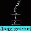
Plots contour points onto given image. The contour vector is assumed to be in the domain as defined in ToPolar.m (another file submitted by me)
Platforms: Matlab
| License: Shareware | Cost: $0.00 USD | Size: 10 KB | Download (47): Contour Plot onto Image Download |