GE-Path 1.4.5 |
|
|
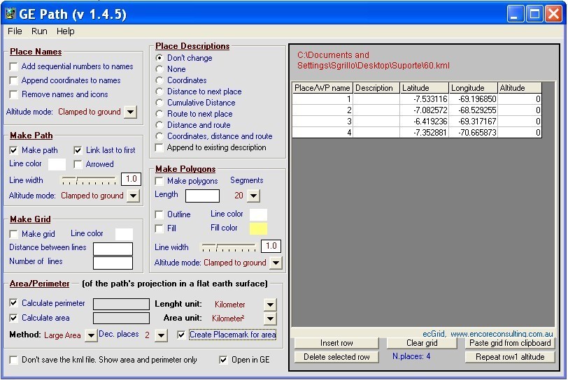
GE-Path was developed to make paths and/or draw circles and polygons with place marks saved by Google Earth. The data can also be typed into the application or pasted/exported to the clipboard. Files generated by GE-Path are exported to Google Earth. Read kml file saved by Google Earth Link the placemarks (simple or arrowed lines) Add sequential numbers and/or append the coordinates to the placemark's names Calculate distances between...
|