


Topo Maps Usa freeware
Topo Maps Usa
Released: July 14, 2012
|
Added: July 14, 2012 | Visits: 614
 e-OSMClient is a lightweight browser for displaing tiled maps. It was primarily designed to be used for displaying OSM rendered maps (Mapnik, Osmarender, Cycle Map,...), but it can work with any kind of tiled map servers (Virtual earth, World Wind,...). eOSMClient uses a local cache for saving...
Platforms: Windows
| License: Freeware | Size: 759 KB | Download (394): e-OSM Client Download |
Released: October 25, 2012
|
Added: October 25, 2012 | Visits: 795
 StatPlanet Map Maker is a free program for creating highly interactive Flash maps which can be published online. A stand-alone offline version is also included. Data can be imported automatically, so new interactive maps can be created within minutes. Maps are completely customizable. Use the...
Platforms: Windows
| License: Freeware | Size: 7.4 MB | Download (534): StatPlanet Map Maker Download |
Released: July 16, 2012
|
Added: July 16, 2012 | Visits: 554
 Midway Modders Mappack 1 - five new massive multiplayer maps for Battlestations Midway Indian Ocean Raid Tokyo Express Super Steel Mosters Ironbottom Sound Operation Ten-Go (sinking the Yamato) 100% compatibility with original version of Battlestations Midway. Just download it and install...
Platforms: Mac
| License: Freeware | Size: 199.97 MB | Download (463): Battlestations Midway Modders Mappack 1 (MacOS) Download |
Released: September 01, 2012
|
Added: September 01, 2012 | Visits: 640
 Midway Modders Mappack 1 - five new massive multiplayer maps for Battlestations Midway Indian Ocean Raid Tokyo Express Super Steel Mosters Ironbottom Sound Operation Ten-Go (sinking the Yamato) 100% compatibility with original version of Battlestations Midway. Just download it and install...
Platforms: Windows
| License: Freeware | Size: 197.58 MB | Download (456): Battlestations Midway Modders Mappack 1 (PC Win) Download |
Released: September 05, 2012
|
Added: September 05, 2012 | Visits: 507
 Create your map with MapNDragons and play your game. MapNDragon is an easy tool for master to create and view 2D maps. Don't waste your time creating maps with your pencil, use this helpfull tool!!
Platforms: Windows, Mac, Linux
| License: Freeware | Size: 1.04 MB | Download (50): Maps and Dragons Download |
Added: May 10, 2013 | Visits: 487
 Printing sequences or maps containing non-ASCII strings results in escape sequences. This function uses the not-so-commonly-known "string_escape" codec to facilitate printing such sequences for quick-viewing.
Platforms: Windows, Mac, *nix, Python, BSD Solaris
| License: Freeware | Download (59): repr() of containers with non-ASCII strings Download |
Added: May 10, 2013 | Visits: 507
Features - provides an API to help other modules display Google Maps - defines a display plugin for Views - provides some default pages containing maps of nodes and users - defines a macro language and provides an interface for building macros ("[gmap|stuff]") so that users can put maps in their...
Platforms: Windows, Mac, *nix, PHP, BSD Solaris
| License: Freeware | Download (65): GMap Module Download |
Added: May 10, 2013 | Visits: 1.088
This project allows someone to track a GPS enabled cell phone using Google maps.For this project it is used a Motorola i355 cell phone on the Sprint/Nextel network. You need to have a data plan so that you can make updates to your website from the cellphone. Project includes J2ME cell phone...
Platforms: Windows, Mac, *nix, PHP, BSD Solaris
| License: Freeware | Download (81): GPS Tracker Download |
Added: May 10, 2013 | Visits: 462
This php application allows you to easily record your travel destinations and display them with Google maps.It simply stores the trip points in a xml flat file (no SQL database needed). Each point can be included in many trips.
Platforms: Windows, Mac, *nix, PHP, BSD Solaris
| License: Freeware | Download (59): phpGMapTrips Download |
Added: May 10, 2013 | Visits: 518
Tierra Internet Mapper is a set of PHP scripts working with MySQL, AT&T's WebDot and GraphViz software to dynamically build graphical maps of internet routes. This tool can be used to map out funnels in network traffic and organization of network.
Platforms: Windows, Mac, *nix, PHP, BSD Solaris
| License: Freeware | Download (61): Tierra Internet Mapper Download |
Added: May 10, 2013 | Visits: 521
phpWeatherMap is a set of php scripts to generate weather maps for (almost) every country in the world. Weather data is fetched from the official METAR Airport Weather at weather.noaa.gov. Currently there are more than 5000 weather stations in over 200 countries. You can easily download new maps...
Platforms: Windows, Mac, *nix, PHP, BSD Solaris
| License: Freeware | Download (61): phpWeatherMap Download |
Added: May 10, 2013 | Visits: 364
Hme application is a 2D program, used for creating, manipulating and viewing height maps. A height map is a 2D representation of a 3D terrain. Each 'color' represents a height. Things it can do: - Generate a random terrain. - Place a height, over the terrain (freehand lines). - Dig (escavate)...
Platforms: Windows, Mac, *nix, C/C++, BSD Solaris
| License: Freeware | Download (66): Hme Application Download |
Added: September 05, 2013 | Visits: 502
function alt_km=ITU_P1511(lat,long)computes altitude of a site at given lat,long coordinatesby means of bicubic interpolation using itu topo 0.5 degrees resolutionmatrix.refer to ITU-R Recommendation P 1511.INPUTSlat: latitude + = North, -=southlong: longitude, positive degrees East.Required...
Platforms: Matlab
| License: Freeware | Size: 10 KB | Download (54): Altitude in Km above sea level for a given pair of coordinates (lat,long) Download |
Added: September 17, 2013 | Visits: 358
The PlanetEye WordPress Google Map plug-in allows a blogger to link blog posts to any of the places on PlanetEye.com. With a growing list of hotels, restaurants, attractions, landmarks and other points of interest to the traveller, these links give the reader access to useful information related...
Platforms: PHP
| License: Freeware | Size: 10 KB | Download (46): PlanetEye Maps Download |
Added: August 18, 2013 | Visits: 392
slack1f42 is a command-line tool for reading and editing 1f42 H262 maps. The 1f42 H262 maps are H262 (or MPEG if you very much prefer) stream descriptions containing information such as stream frame rate, stream duration and number of frames, file position of stream frames and so forth. 1f42...
Platforms: *nix
| License: Freeware | Size: 133.12 KB | Download (35): slack1f42 Download |
Added: September 17, 2013 | Visits: 231
seek-1f42 is a library for reading 1f42 H262 maps. The 1f42 H262 maps are H262 (or MPEG if you very much prefer) stream descriptions containing information such as stream frame rate, stream duration and number of frames, file position of stream frames and so forth.
Platforms: *nix
| License: Freeware | Size: 112.64 KB | Download (36): seek-1f42 Download |
Added: July 28, 2013 | Visits: 260
libchamplain is a C library created to provide a GTK+ widget to display rasterized maps. Here are some key features of "libchamplain": ?*A* Display a map (OpenStreetMap Mapnik) ?*A* Tiles are downloaded and cached ?*A* You can drag to move (la Google Maps) ?*A* without or with kinetic...
Platforms: *nix
| License: Freeware | Size: 655.36 KB | Download (39): libchamplain Download |
Added: August 17, 2013 | Visits: 430
django-geoportail is a Django app that adds maps and photos from the French National Geographic Institute to GeoDjango. Geodjango with the maps and photos from the French National Geographic Institute. * Installation: see INSTALL * Get involved: http://bitbucket.org/bruno/django-geoportail/...
Platforms: *nix
| License: Freeware | Size: 30.72 KB | Download (39): django-geoportail Download |
Released: December 27, 2017
|
Added: March 31, 2018 | Visits: 5.447
 This complete risk template software or risk management tool includes all you need to deal with ISO 31000, COSO Enterprise Risk Management, PMI Risk (Project), Internal Audit.
It contains: a Risk Register, multiple Risk Heat Maps and Matrices, a KRI register, a Treatment register, a Control...
This complete risk template software or risk management tool includes all you need to deal with ISO 31000, COSO Enterprise Risk Management, PMI Risk (Project), Internal Audit.
It contains: a Risk Register, multiple Risk Heat Maps and Matrices, a KRI register, a Treatment register, a Control...
Platforms: Windows, Windows 8, Windows 7, Windows Server
| License: Freeware | Size: 2.93 MB | Download (919): Risk Register Template Software Download |
Released: October 17, 2018
|
Added: October 25, 2018 | Visits: 624
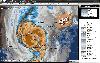 USA Radars Weather Browser is one of the fastest and best ways to view the latest weather conditions. Free weather radars & forecasting browser for Windows. Originally started in 2008, created to bring together some of the latest and most reliable weather information on the internet into one easy...
Platforms: Windows, Windows 8, Windows 7, Windows Server
| License: Freeware | Size: 4.9 MB | Download (92): USA Radars Weather Browser Download |