


Student Information System freeware
Student Information System
Added: August 13, 2008 | Visits: 962
 The tool for individual and group conducting projects on creation, introduction and support of software. Free from use of the 3d-party applications and services. You do not need to establish and adjust any paid or free-of-charge the databases. The program is developed by us as the base tool of...
Platforms: Windows
The tool for individual and group conducting projects on creation, introduction and support of software. Free from use of the 3d-party applications and services. You do not need to establish and adjust any paid or free-of-charge the databases. The program is developed by us as the base tool of...
Platforms: Windows
| License: Freeware | Size: 2.08 MB | Download (101): Projects Explorer Download |
Added: June 22, 2010 | Visits: 833
mod_cbroker is an Apache module, for effective building of CORBA applications WWW front-ends, easy integration CORBA applications into Web. With ModCBroker it is possible to create WWW interfaces layer in general CORBA infrastructure of enterprise information system and clearly separate...
Platforms: *nix
| License: Freeware | Size: 1.1 MB | Download (89): mod_cbroker Download |
Added: January 25, 2010 | Visits: 729
GRASS GIS, commonly referred to as GRASS (Geographic Resources Analysis Support System), is a Geographic Information System (GIS) used for geospatial data management and analysis, image processing, graphics/maps production, spatial modeling, and visualization. GRASS is currently used in academic...
Platforms: Mac
| License: Freeware | Download (116): GRASS GIS Download |
Added: January 25, 2010 | Visits: 977
Compendium is the semantic hypertext concept mapping tool at the heart of the Compendium methodology. It is the result of over 15 years' continual research, deployment and development of a tool to support the real time mapping of discussions in meetings, collaborative modelling, and the longer...
Platforms: Mac
| License: Freeware | Download (113): Compendium Download |
Released: October 24, 2012
|
Added: October 24, 2012 | Visits: 681
 QGIS supports vector, raster, and database formats and lets you browse and create map data on your computer.
Quantum GIS (QGIS) supports many common spatial data formats (e.g. ESRI ShapeFile, geotiff). QGIS supports plugins to do things like display tracks from your GPS.
QGIS aims to be an...
Platforms: Linux
QGIS supports vector, raster, and database formats and lets you browse and create map data on your computer.
Quantum GIS (QGIS) supports many common spatial data formats (e.g. ESRI ShapeFile, geotiff). QGIS supports plugins to do things like display tracks from your GPS.
QGIS aims to be an...
Platforms: Linux
| License: Freeware | Size: 1024 KB | Download (460): Quantum GIS form Linux Download |
Released: July 24, 2012
|
Added: July 24, 2012 | Visits: 786
 QGIS supports vector, raster, and database formats and lets you browse and create map data on your computer.
Quantum GIS (QGIS) supports many common spatial data formats (e.g. ESRI ShapeFile, geotiff). QGIS supports plugins to do things like display tracks from your GPS.
QGIS aims to be an...
Platforms: Mac
QGIS supports vector, raster, and database formats and lets you browse and create map data on your computer.
Quantum GIS (QGIS) supports many common spatial data formats (e.g. ESRI ShapeFile, geotiff). QGIS supports plugins to do things like display tracks from your GPS.
QGIS aims to be an...
Platforms: Mac
| License: Freeware | Size: 1024 KB | Download (440): Quantum GIS form Mac Download |
Released: August 01, 2012
|
Added: August 01, 2012 | Visits: 652
 Thousands of people might know well about Excel, they play it as a daily tool in their work. However, the datas between each single Excel are normally unable to repeat, exchange and share theirselves automatically. If we consider Excel as brick, then a house will not be built without laying...
Platforms: Windows
Thousands of people might know well about Excel, they play it as a daily tool in their work. However, the datas between each single Excel are normally unable to repeat, exchange and share theirselves automatically. If we consider Excel as brick, then a house will not be built without laying...
Platforms: Windows
| License: Freeware | Size: 89.34 MB | Download (50): BC Excel Server 2008 Standard-Complete Download |
Released: July 03, 2012
|
Added: July 03, 2012 | Visits: 608
 A volume of data with map names, map numbers, corner coordinates and completing data of all official topographic maps of the Federal Republic of Germany. TK25: Data base table with data of the maps on a scale 1:25000. TK50: Table with data of the maps on a scale 1:50000. TK100: Table with data of...
Platforms: All
A volume of data with map names, map numbers, corner coordinates and completing data of all official topographic maps of the Federal Republic of Germany. TK25: Data base table with data of the maps on a scale 1:25000. TK50: Table with data of the maps on a scale 1:50000. TK100: Table with data of...
Platforms: All
| License: Freeware | Size: 51.2 KB | Download (51): Geodaten German Topo Download |
Released: October 19, 2012
|
Added: October 19, 2012 | Visits: 560
 Thousands of people might know well about Excel, they play it as a daily tool in their work. However, the datas between each single Excel are normally unable to repeat, exchange and share theirselves automatically. If we consider Excel as brick, then a house will not be built without laying...
Platforms: Windows
Thousands of people might know well about Excel, they play it as a daily tool in their work. However, the datas between each single Excel are normally unable to repeat, exchange and share theirselves automatically. If we consider Excel as brick, then a house will not be built without laying...
Platforms: Windows
| License: Freeware | Size: 91.57 MB | Download (45): BC Excel Server 2008 Enterprise-Complete Download |
Released: August 05, 2012
|
Added: August 05, 2012 | Visits: 552
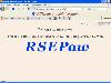 Multilingual Web generator and administrator of communicating applications (XML/Ajax/MySQL/ODBC), to install on a PHP5 web server. No specific knowledge is required to build in few minutes the applications and to use them from a configurable homepage. RSEPaw synthesizes the behaviour and the...
Platforms: Windows, Linux
Multilingual Web generator and administrator of communicating applications (XML/Ajax/MySQL/ODBC), to install on a PHP5 web server. No specific knowledge is required to build in few minutes the applications and to use them from a configurable homepage. RSEPaw synthesizes the behaviour and the...
Platforms: Windows, Linux
| License: Freeware | Size: 4.38 MB | Download (375): RSEPaw Download |
Released: October 11, 2012
|
Added: October 11, 2012 | Visits: 778
 QGIS supports vector, raster, and database formats and lets you browse and create map data on your computer.
Quantum GIS (QGIS) supports many common spatial data formats (e.g. ESRI ShapeFile, geotiff). QGIS supports plugins to do things like display tracks from your GPS.
QGIS aims to be an...
Platforms: Windows
QGIS supports vector, raster, and database formats and lets you browse and create map data on your computer.
Quantum GIS (QGIS) supports many common spatial data formats (e.g. ESRI ShapeFile, geotiff). QGIS supports plugins to do things like display tracks from your GPS.
QGIS aims to be an...
Platforms: Windows
| License: Freeware | Size: 77.3 MB | Download (453): Quantum GIS Download |
Released: August 08, 2012
|
Added: August 08, 2012 | Visits: 376
GIT is an open source library that operates image transcoding for mobile applications. GaWis is an open source information system for the creation, management and use of a customizable information source about mobile devices.
Platforms: Windows, Mac, Linux
| License: Freeware | Size: 30.85 MB | Download (49): GIT and GaWis Download |
Released: July 17, 2012
|
Added: July 17, 2012 | Visits: 327
SpellingPractice automates self-paced spelling tests and practice with audible pre-recorded cues. The application includes GUIs to record words, enter student information, and perform tests and practice.
Platforms: Windows, Mac, Linux
| License: Freeware | Size: 19.86 KB | Download (49): SpellingPractice Download |
Released: October 16, 2012
|
Added: October 16, 2012 | Visits: 459
The Tennessee Traffic Cameras widget provides a simple and easy way to view traffic cameras from across the state of Tennessee, all in one place. The traffic widget ties into the TDOT Smartway Information System, the city of Brentwood, the city of Franklin and the city of Murfreesboro.
Currently...
Platforms: Mac
| License: Freeware | Size: 163.84 KB | Download (53): Tennessee Traffic Cameras Download |
Added: May 07, 2013 | Visits: 382
The ICCD Parser Module extends the Feeds Module implementing a parser for the ICCD xml files.ICCD ("Istituto Centrale per il Catalogo e la Documentazione" also known as "Central Institute for Cataloguing and Documentation") is the body within the Ministry for Cultural Heritage and Activities of...
Platforms: PHP
| License: Freeware | Size: 10 KB | Download (45): ICCD Parser Download |
Added: September 27, 2013 | Visits: 547
Copies files to filenames based on their contents hashedassets is a command-line tool that copies files to filenames based on their contents. It also writes a map of what was renamed to what, so you can find your files. Main purpose of this is that you can add a far future Expires header to...
Platforms: *nix
| License: Freeware | Size: 20.48 KB | Download (40): hashedassets Download |
Released: October 09, 2012
|
Added: October 09, 2012 | Visits: 817
System Information HTML Application is an hta file that will perform a full system scan to retreive information about Hardware, OS and System components.
System Information HTML Application has a simple and comprehensive interface that will quickly guide you through all its features.
Platforms: Windows, Windows Vista, 7
| License: Freeware | Download (425): System Information HTML Application Download |
Added: May 10, 2013 | Visits: 565
This script allows you to read the System information and Softwares installed in Windows NT/XP/2000/9x.
Platforms: Windows, Python,
| License: Freeware | Download (59): Reading the System information Download |
Added: November 23, 2006 | Visits: 4.638
AIDA32 is a professional system information, diagnostics and benchmarking program for Windows platforms. It extracts details of all components of the PC. It can display information on the screen, print it, or save it to file in various formats like HTML, CSV or XML. For corporate users, AIDA32...
Platforms: Windows
| License: Freeware | Size: 2.31 MB | Download (932): AIDA32 - Enterprise System Information Download |
Added: March 14, 2006 | Visits: 5.820
AIDA32 is a professional system information and network audit program for Windows platforms. It extracts details of all components of the PC. It can display information on the screen, print it, or save it to file in various formats like CSV or XML. For corporate users, AIDA32 Network Edition...
Platforms: Windows
| License: Freeware | Size: 2.08 MB | Download (969): AIDA32 - Network System Information Download |