


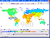
Satellite Maps freeware
Satellite Maps
Added: March 21, 2010 | Visits: 1.090
 Audio::Xmpcr is a Perl API to the XM PCR Satellite radio. It offers two different operating modes (direct and remote+daemon) via a single interface.This is very alpha, use at your own risk. It has only been tested only with few cards. 16 meg all-in-wonder rage 128 capture card. 8 meg...
Platforms: *nix
Audio::Xmpcr is a Perl API to the XM PCR Satellite radio. It offers two different operating modes (direct and remote+daemon) via a single interface.This is very alpha, use at your own risk. It has only been tested only with few cards. 16 meg all-in-wonder rage 128 capture card. 8 meg...
Platforms: *nix
| License: Freeware | Size: 44.03 KB | Download (104): Audio::Xmpcr Download |
Added: July 06, 2010 | Visits: 1.202
JGraphpad is a diagram editor for Swing that offers the functionality to create flow charts, maps, and UML diagrams. This release compiles with JGraph 5.7.3.1. Toolbox buttons to create edges or vertices no longer persist selection state. The former behaviour can be restored by setting...
Platforms: *nix
| License: Freeware | Size: 962.56 KB | Download (132): JGraphpad Community Edition Download |
Added: August 10, 2010 | Visits: 879
settevion is a program that allows you to edit the channels in your Skymaster DXL 9400 Satellite Receiver. This receiver was sold under the name Tevion FTA 203 by Aldi. Note that the current version does not allow writing radio channels into the receiver. Also note: This program makes use of...
Platforms: *nix
| License: Freeware | Size: 39.94 KB | Download (144): settevion Download |
Added: April 24, 2010 | Visits: 1.027
WebService::Mappoint is a client SOAP implementation for Mappoint, Microsofts geographic maps web service, based on SOAP::Lite. SYNOPSIS Map fetch example for use with Mappoint 3.0 service. use WebService::Mappoint; use MIME::Base64; my $render = new WebService::Mappoint::Render(); my...
Platforms: *nix
| License: Freeware | Size: 8.19 KB | Download (119): WebService::Mappoint Download |
Added: November 02, 2010 | Visits: 1.338
QUAKE 4 Quakemas Map Pack is a bonus collection for Christmas with maps for Quake 4. This Map Pack is compatible with QUAKE 4 1.0, and updates 1.0.4.0 and 1.0.5.0. This Map Pack consists of the file pak013.pk4 and contains the following multiplayer maps: Campgrounds Redux (q4dm9): With...
Platforms: *nix
| License: Freeware | Size: 16.4 MB | Download (85): QUAKE 4 Quakemas Map Download |
Added: May 21, 2010 | Visits: 1.911
Geo::KML::PolyMap is a Perl module to generate KML/KMZ-format choropleth (shaded polygonal) maps viewable in Google Earth. SYNOPSIS use Geo::KML::PolyMap qw(generate_kml_file generate_kmz_file); # Clusters "Total Population" data for "Foobar City" in $entities into 5 bins; # renders using...
Platforms: *nix
| License: Freeware | Size: 11.26 KB | Download (399): Geo::KML::PolyMap Download |
Added: June 10, 2010 | Visits: 1.667
Audio::Radio::Sirius is a Perl module to control a Sirius satellite radio tuner. SYNOPSIS Sirius satellite radio (http://www.sirius.com) is a US based satellite radio serice. While none of the tuners they make have serial or USB connectors, it has been found that generation 2.5 tuners...
Platforms: *nix
| License: Freeware | Size: 13.31 KB | Download (184): Audio::Radio::Sirius Download |
Added: November 17, 2010 | Visits: 979
KImageMapEditor is a tool for Linux/KDE that allows you to edit image maps of HTML files. KImageMapEditor project can be fully integrated with Quanta since it is based on KPart technology..
Platforms: *nix
| License: Freeware | Size: 645.12 KB | Download (141): KImageMapEditor Download |
Added: October 07, 2010 | Visits: 1.476
Video Disk Recorder (VDR) is a digital satellite receiver program using Linux and DVB technologies. Video Disk Recorder can record MPEG2 streams, as well as output the stream to TV. It also supports plugins for DVD, DivX, or MP3 playback and more.. A Home Built Digital Satellite Receiver and...
Platforms: *nix
| License: Freeware | Size: 481.28 KB | Download (189): Video Disk Recorder Download |
Added: May 14, 2010 | Visits: 883
Image::WorldMap is a Perl module to create graphical world maps of data. SYNOPSIS use Image::WorldMap; my $map = Image::WorldMap->new("earth-small.png", "maian/8"); $map->add(4.91, 52.35, "Amsterdam.pm"); $map->add(-2.355399, 51.3828, "Bath.pm"); $map->add(-0.093999, 51.3627,...
Platforms: *nix
| License: Freeware | Size: 84.99 KB | Download (104): Image::WorldMap Download |
Added: October 20, 2010 | Visits: 963
SolSeeK is a KDE Kicker applet for viewing realtime images of the Sun provided by the SOHO satellite and some other sources. SolSeeK updates the image in your panel every 15 minutes. A right click menu allows you to view full size images. Installation: The simplest way to compile this...
Platforms: *nix
| License: Freeware | Size: 624.64 KB | Download (115): SolSeeK Download |
Added: May 08, 2010 | Visits: 922
TM::DM is a Perl module with Topic Maps, read-only TMDM layer. SYNOPSIS # somehow acquire a map (see TM and its subclasses) my $tm = .... # put a TMDM layer on top of it use TM::DM; my $tmdm = new TM::DM (map => $tm); # get the TMDM topic map item my $topicmap = $tmdm->topicmap; #...
Platforms: *nix
| License: Freeware | Size: 215.04 KB | Download (91): TM::DM Download |
Added: May 27, 2010 | Visits: 1.584
tffs is a FUSE driver that allows you to mount a hard disk from a T*PFIELD digital satellite receiver to a directory in your file system tree. With tffs you can mount a hard disk from a T*PFIELD digital satellite receiver to a directory in your file system tree. Any program can access the...
Platforms: *nix
| License: Freeware | Size: 15.36 KB | Download (110): tffs Download |
Released: March 01, 2010
|
Added: April 22, 2010 | Visits: 2.522
Mapyx Quo is an intuitive, easy to learn and, surprisingly simple-to-use digital mapping program which enables you to connect your GPS to your PC and manage all your waypoints, routes and tracks. View information such as elevation, distance, speed, ETA and many more. Quo supports numerous...
Platforms: Windows, Windows CE
| License: Freeware | Size: 44.95 MB | Download (7378): Mapyx Quo Download |
Released: August 05, 2012
|
Added: September 01, 2012 | Visits: 1.474
 Easy to create mind maps (graphical representations of thought processes) for brainstorming, problem solving, rational analysis, and decision marking. Easy to use drawing tools, many pre-drawn flowchart templates and more than 600 flowchart symbols and flowchart samples, drawing couldn't be...
Platforms: Windows
Easy to create mind maps (graphical representations of thought processes) for brainstorming, problem solving, rational analysis, and decision marking. Easy to use drawing tools, many pre-drawn flowchart templates and more than 600 flowchart symbols and flowchart samples, drawing couldn't be...
Platforms: Windows
| License: Freeware | Size: 20.94 MB | Download (144): Edraw MindMap Download |
Released: February 07, 2012
|
Added: February 26, 2012 | Visits: 1.144
 Free standalone software DataPult Desktop creates heat maps from your data quickly and efficiently.
Key features:
Direct data import from MS Excel with one click.
The ability to create animated maps of data over several years.
Interactive maps and diagrams.
39 map...
Platforms: Windows
Free standalone software DataPult Desktop creates heat maps from your data quickly and efficiently.
Key features:
Direct data import from MS Excel with one click.
The ability to create animated maps of data over several years.
Interactive maps and diagrams.
39 map...
Platforms: Windows
| License: Freeware | Size: 20.96 MB | Download (95): DataPult Desktop Download |
Released: October 13, 2012
|
Added: October 13, 2012 | Visits: 1.189
 Watch Free Live Arabic TV Online Channels With 1000's Live Satellite TV broadcasts as rotana, MBC, MBC2, MBC Action, AlJazeera, Melody and Many Live Online Arabic Movies and Sport Channels. TheFree Arabic TV Online include Arabic Music, MP3, cartoon, videos and Songs beside many online utilities...
Platforms: Windows
Watch Free Live Arabic TV Online Channels With 1000's Live Satellite TV broadcasts as rotana, MBC, MBC2, MBC Action, AlJazeera, Melody and Many Live Online Arabic Movies and Sport Channels. TheFree Arabic TV Online include Arabic Music, MP3, cartoon, videos and Songs beside many online utilities...
Platforms: Windows
| License: Freeware | Size: 1.07 MB | Download (557): Live Arabic TV Online Download |
Released: July 15, 2012
|
Added: July 15, 2012 | Visits: 398
 PreviSat is a satellite tracking program designed for observing purposes. Very easy to use, it shows the positions of satellites in real-time or manual mode. PreviSat is able to make predictions of their passes and also Iridium flares.
Platforms: Windows
PreviSat is a satellite tracking program designed for observing purposes. Very easy to use, it shows the positions of satellites in real-time or manual mode. PreviSat is able to make predictions of their passes and also Iridium flares.
Platforms: Windows
| License: Freeware | Size: 1.2 MB | Download (389): PreviSat Download |
Released: July 14, 2012
|
Added: July 14, 2012 | Visits: 540
 GEOPoint is an easy to use satellite antenna pointing calculator, for geostationary communications satellites. It calculates the azimuth and elevation pointing angles from a given location on the earth towards a specified geostationary satellite. The program also calculates polarisation tilt...
Platforms: Windows
GEOPoint is an easy to use satellite antenna pointing calculator, for geostationary communications satellites. It calculates the azimuth and elevation pointing angles from a given location on the earth towards a specified geostationary satellite. The program also calculates polarisation tilt...
Platforms: Windows
| License: Freeware | Size: 2.1 MB | Download (406): GEOPoint Download |
Released: August 23, 2012
|
Added: August 23, 2012 | Visits: 630
The Virtual Moon Atlas Pro allows you to explore and analyze the sophisticated natural satellite known as the Moon.
A complex but easy to use software and a 3D image database.
Platforms: Windows
| License: Freeware | Download (451): Virtual Moon Atlas Download |