


Quantum Gis freeware
Quantum Gis
Released: November 04, 2012
|
Added: November 04, 2012 | Visits: 1.372
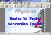 Software development kit for CAD/CAM/ GIS and graphic software developers. Converts from raster to vector and refines architect, mechanical, tech drawing, maps, math graphs, graphics for books and journals and more. ActiveX and Com Component are also available. Refines vector graphics, creates...
Platforms: Windows
| License: Freeware | Size: 2.67 MB | Download (527): Algolab Raster to Vector Conversion CAD/ Download |
Released: September 16, 2012
|
Added: September 16, 2012 | Visits: 457
 liblvls is actually a handy and useful collection of codes that lets the user store and use data on quantum levels.
Data can be used in a system such as an atom, molecule, or nucleus. Now you can make use of this code collection to store your data with ease.
liblvls is actually a handy and useful collection of codes that lets the user store and use data on quantum levels.
Data can be used in a system such as an atom, molecule, or nucleus. Now you can make use of this code collection to store your data with ease.
Platforms: Windows
| License: Freeware | Download (45): liblvls Download |
Released: September 09, 2012
|
Added: September 09, 2012 | Visits: 477
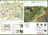
 A Microstation GIS to allow pipeline design and management
Platforms: Windows
| License: Freeware | Size: 7.58 MB | Download (446): RiliView Download |
Released: December 04, 2012
|
Added: December 04, 2012 | Visits: 315
An attempt to design minimum cost broadband networks with the use of a modified version of the Particle Swarm Optimization method. A GIS subsystem is used for the visualization of data and results.
Platforms: Windows, Mac, Linux
| License: Freeware | Size: 1.02 MB | Download (55): NetDesigner GIS Download |
Added: March 31, 2013 | Visits: 610
Easy to use Clebsch-Gordan coefficient solver for adding two angular momentums in Quantum Mechanics. This tool is created for my Quantum Mechanics II course offered by Dr. Thompson in Summer of 2007.[Instruction]Execute "GUI.m" script by invoking "GUI"
Platforms: Matlab
| License: Freeware | Size: 20.48 KB | Download (54): Clebsch Gordan Coefficient Solver GUI Download |
Added: June 24, 2013 | Visits: 350
This is a toolbox to compute the subband structure of the quantum cascade lasers without conduction band nonparapolicity effect.
Platforms: Matlab
| License: Freeware | Size: 102.4 KB | Download (44): QEBS Version Download |
Added: August 12, 2013 | Visits: 503
This script simulates the time evolution of a quantum mechanical wavepacket on the unit square with Dirichlet boundary conditions. Spatial discretization is with a Chebyshev-tau spectral method and time discretization is with a second order Crank-Nicholson method.
Platforms: Matlab
| License: Freeware | Size: 10 KB | Download (43): 2D Wavepacket Time Evolution Download |
Added: September 03, 2013 | Visits: 450
The tool box provides the procedure to calculate all band edge energies and corresponding wavefunctions in single quantum square well using Finite Element Method.
Platforms: Matlab
| License: Freeware | Size: 30.72 KB | Download (45): FEMQWEBS Download |
Added: September 15, 2013 | Visits: 418
The QM Spins program simulates the quantum-mechanical measurement of spin-1/2 and spin-1 particles. The default simulation shows the result of measuring the z component of spin on a beam of spin-1/2 particles with a random (or statistical) mixture of spin orientations. Additional initial states...
Platforms: Mac
| License: Freeware | Size: 487.42 KB | Download (35): QM Spins Download |
Added: August 18, 2008 | Visits: 1.360
 Genesis IV is a landscape database and graphics system particularly targeted at Professional GIS and Educational users. Create great graphics for your clients, enthuse and educate your students, or explore geographical data, GenesisIV is unique multifaceted software and much more than a simple...
Platforms: Windows
| License: Freeware | Size: 23.84 MB | Download (606): GenesisIV Download |
Added: August 12, 2008 | Visits: 955
NewCyber3D provides full source code CDs covering a wide range of topics relevant to OpenGL GIS, terrain, stereo display, image processing and visualization. Each CD includes the entire OpenGL program and demonstrations with full source codes (including library source codes), project files,...
Platforms: Windows
| License: Freeware | Download (549): NewCyber3D Download |
Added: August 07, 2008 | Visits: 2.160
QCADesigner is a CAD tool for quantum-dot cellular automata (QCA) circuits. The powerful CAD features and simulation engines allow for rapid design, layout, and simulation of QCA circuits and systems. QCADesigner has most of the standard computer aided design features required for the advanced...
Platforms: Windows, *nix
| License: Freeware | Size: 2.6 MB | Download (1031): QCADesigner Download |
Added: January 14, 2010 | Visits: 1.206
OGDI is the Open Geographic Datastore Interface. OGDI is an application programming interface (API) that uses a standardized access methods to work in conjunction with GIS software packages (the application) and various geospatial data products. OGDI uses a client/server architecture to...
Platforms: *nix
| License: Freeware | Size: 911.36 KB | Download (91): Open Geographic Datastore Interface Download |
Added: February 05, 2010 | Visits: 773
Geotools is an open source Java GIS toolkit for developing standards compliant solutions. GeoTools project provides an implementation of Open Geospatial Consortium (OGC) specifications as they are developed. Geotools maintains an open development process, with public collaboration on new ideas...
Platforms: *nix
| License: Freeware | Size: 26 MB | Download (113): GeoTools Download |
Released: November 16, 2012
|
Added: November 16, 2012 | Visits: 492
 The goal of VTP is to foster the creation of tools for easily constructing any part of the real world in interactive, 3D digital form.
This goal will require a synergetic convergence of the fields of CAD, GIS, visual simulation, surveying and remote sensing. VTP gathers information and tracks...
The goal of VTP is to foster the creation of tools for easily constructing any part of the real world in interactive, 3D digital form.
This goal will require a synergetic convergence of the fields of CAD, GIS, visual simulation, surveying and remote sensing. VTP gathers information and tracks...
Platforms: Mac, Linux
| License: Freeware | Size: 2.2 MB | Download (492): Virtual Terrain Project for Mac OS X and Linux Download |
Released: November 04, 2012
|
Added: November 04, 2012 | Visits: 556
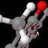
MOPlot is a handy visualization application specially designed for fast molecular orbitals plotting from the outputs of the Gaussian 03/98/94, Molcas, Gamess/US quantum chemical calculation packages. This Molecular Orbital Plotting Program will prove to be easy-to-use and very efficient.
MOPlot...
Platforms: Windows, XP
| License: Freeware | Download (478): MOPlot Download |
Released: October 22, 2012
|
Added: October 22, 2012 | Visits: 589
IrriPro is the only software that let you design an irrigation system only by drawing the elements: now it's possible, thanks to the INDO technology (Irrigation Network Data Object) developed by Irriworks, to draw the elements of a system (such as outlets, pipes, etc) and of a terrain, not only...
Platforms: Windows
| License: Freeware | Size: 161 MB | Download (467): IrriPro Download |
Released: July 14, 2012
|
Added: July 14, 2012 | Visits: 618
 Jmol is an applet and Java based application designed to display various 3D chemical information.
Jmol's features include reading a variety of file types and output from quantum chemistry programs, and animation of multi-frame files and computed normal modes from quantum programs....
Jmol is an applet and Java based application designed to display various 3D chemical information.
Jmol's features include reading a variety of file types and output from quantum chemistry programs, and animation of multi-frame files and computed normal modes from quantum programs....
Platforms: Windows
| License: Freeware | Size: 14.8 MB | Download (407): Jmol Download |
Released: June 18, 2012
|
Added: June 18, 2012 | Visits: 477
 The goal of VTP is to foster the creation of tools for easily constructing any part of the real world in interactive, 3D digital form.
This goal will require a synergetic convergence of the fields of CAD, GIS, visual simulation, surveying and remote sensing. VTP gathers information and tracks...
The goal of VTP is to foster the creation of tools for easily constructing any part of the real world in interactive, 3D digital form.
This goal will require a synergetic convergence of the fields of CAD, GIS, visual simulation, surveying and remote sensing. VTP gathers information and tracks...
Platforms: Windows
| License: Freeware | Size: 1024 KB | Download (420): Virtual Terrain Project for Windows Download |
Released: August 16, 2012
|
Added: August 16, 2012 | Visits: 529
uDig is a user-friendly desktop Internet GIS, a core element in an internet aware Geographic Information System.
The application is an open source spatial data viewer / editor, that comes with a special emphasis on the OpenGIS standards for internet GIS, the Web Map Server and Web Feature Server...
Platforms: Windows
| License: Freeware | Download (439): uDig Download |